Stay in the know on all smart updates of your favorite topics.
Herman van den Bosch,
professor in management development
,
posted
24 Participation
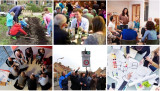
This is the 24st episode of a series 25 building blocks to create better streets, neighbourhoods, and cities. Its topic is how involving citizens in policy, beyond the elected representatives, will strengthen democracy and enhance the quality of the living environment, as experienced by citizens.
Strengthening local democracy
Democratization is a decision-making process that identifies the will of the people after which government implements the results. Voting once every few years and subsequently letting an unpredictable coalition of parties make and implement policy is the leanest form of democracy. Democracy can be given more substance along two lines: (1) greater involvement of citizens in policy-making and (2) more autonomy in the performance of tasks. The photos above illustrate these lines; they show citizens who at some stage contribute to policy development, citizens who work on its implementation and citizens who celebrate a success.
Citizen Forums
In Swiss, the desire of citizens for greater involvement in political decision-making at all levels is substantiated by referenda. However, they lack the opportunity to exchange views, let alone to discuss them.
In his book Against Elections (2013), the Flemish political scientist David van Reybrouck proposes appointing representatives based on a weighted lottery. There are several examples in the Netherlands. In most cases, the acceptance of the results by the established politicians, in particular the elected representatives of the people, was the biggest hurdle. A committee led by Alex Brenninkmeijer, who has sadly passed away, has expressed a positive opinion about the role of citizen forums in climate policy in some advice to the House of Representatives. Last year, a mini-citizen's forum was held in Amsterdam, also chaired by Alex Brenninkmeijer, on the concrete question of how Amsterdam can accelerate the energy transition.
Autonomy
The ultimate step towards democratization is autonomy: Residents then not only decide, for example, about playgrounds in their neighbourhood, they also ensure that these are provided, sometimes with financial support from the municipality. The right to do so is formally laid down in the 'right to challenge'. For example, a group of residents proves that they can perform a municipal task better and cheaper themselves. This represents a significant step on the participation ladder from participation to co-creation.
Commons
In Italy, this process has boomed. The city of Bologna is a stronghold of urban commons. Citizens become designers, managers, and users of part of municipal tasks. Ranging from creating green areas, converting an empty house into affordable units for students, the elderly or migrants, operating a minibus service, cleaning and maintaining the city walls, redesigning parts of the public space etcetera.
From 2011 on commons can be given a formal status. In cooperation pacts the city council and the parties involved (informal groups, NGOs, schools, companies) lay down agreements about their activities, responsibilities, and power. Hundreds of pacts have been signed since the regulation was adopted. The city makes available what the citizens need - money, materials, housing, advice - and the citizens donate their time and skills.
From executing together to deciding together
The following types of commons can be distinguished:
Collaboration: Citizens perform projects in their living environment, such as the management of a communal (vegetable) garden, the management of tools to be used jointly, a neighborhood party. The social impact of this kind of activities is large.
Taking over (municipal) tasks: Citizens take care of collective facilities, such as a community center or they manage a previously closed swimming pool. In Bologna, residents have set up a music center in an empty factory with financial support from the municipality.
Cooperation: This refers to a (commercial) activity, for example a group of entrepreneurs who revive a street under their own responsibility.
Self-government: The municipality delegates several administrative and management tasks to the residents of a neighborhood after they have drawn up a plan, for example for the maintenance of green areas, taking care of shared facilities, the operation of minibus transport.
<em>Budgetting</em>: In a growing number of cities, citizens jointly develop proposals to spend part of the municipal budget.
The role of the municipality in local initiatives
The success of commons in Italy and elsewhere in the world – think of the Dutch energy cooperatives – is based on people’s desire to perform a task of mutual benefit together, but also on the availability of resources and support.
The way support is organized is an important success factor. The placemaking model, developed in the United Kingdom, can be applied on a large scale. In this model, small independent support teams at neighbourhood level have proven to be necessary and effective.
Follow the link below to find an overview of all articles.
AMS Institute,
Re-inventing the city (urban innovation)
at AMS Institute,
posted
AMS Conference: Final call for submissions & keynote speaker announcement
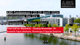
We're thrilled to share another round of exciting updates on the AMS Conference (April 23-24, 2024). As a quick reminder, the submission deadline has been extended to November 14th, providing you with an opportunity to be a contributor to this multi-dimensional event celebrating urban innovation and sustainability. Submit your abstract, workshop, or special session here 👉 https://reinventingthecity24.dryfta.com/call-for-abstracts
🎙️ Meet our keynote speaker: Charles Montgomery
We are honored to introduce Charles Montgomery, an award-winning author and urbanist, named one of the 100 most influential urbanists in the world by Planetizen magazine in 2023. Charles Montgomery leads transformative experiments, research, and interventions globally to enhance human well-being in cities.
His acclaimed book, Happy City, Transforming Our Lives Through Urban Design, explores the intersection between urban design and the emerging science of happiness. His presentation at the AMS Conference, "Your city should be a trust machine," delves into the critical role of trust in human happiness and societal success. As the world grapples with a trust deficit, Charles Montgomery shares insights drawn from over a decade of using lessons from behavioral science and psychology to turn cities into better social machines.
🚀 Don't miss your chance to contribute to the future of cities! For more details about submissions and to submit your abstract, workshop, and/or special session, visit our conference website 👉 https://reinventingthecity24.dryfta.com/call-for-abstracts
Herman van den Bosch,
professor in management development
,
posted
23. Governance

This is the 23st episode of a series 25 building blocks to create better streets, neighbourhoods, and cities. Its topic is the way how the quality of the living environment benefits from good governance.
In 1339 Ambrogio Lorenzetti completed his famous series of six paintings in the town hall of the Italian city of Siena: The Allegory of Good and Bad Government. The image above refers to the characteristics of governance: Putting the interests of citizens first, renouncing self-interest, helpfulness, and justice. These characteristics still apply.
Rooted in the community
The starting point of urban policy is a long-term vision on the development of the city that is tailored to the needs and wishes of citizens, as they become manifest within and beyond the institutional channels of representative democracy. In policies that are rooted in the community, knowledge, experiences, and actions of those involved are also addressed. Each city has a pool of experts in every field; many are prepared to commit themselves to the future of their hometown.
Participation
Governance goes beyond elections, representative bodies, following proper procedures and enforcing the law. An essential feature is that citizens can trust that the government protects their interests and that their voices are heard. The municipality of Amsterdam has access to a broad range of instruments: co-design, Initiating a referendum, subsiding local initiatives, neighbourhood law, including the 'right to challenge' and neighbourhood budgets. I will deal with participation in the next post.
Two-way communication
Barcelona and Madrid both use technical means to give citizens a voice and to make this voice heard in policy. Barcelona developed the platform Decidem (which means 'We decide' in Catalan) and Madrid made available Decide Madrid ('Madrid decides'). Both platforms provide citizens with information about the policy, allow them to put topics on the policy agenda, start discussions, change policy proposals, and issue voting recommendations for the city council.
Madrid has developed its participatory electronic environment together with CONSUL, a Madrid-based company. CONSUL enables cities to organize citizen participation on the internet. The package is very extensive. The software and its use is free. Consul is in use in 130 cities and organizations in 33 countries and has reached some 90 million citizens worldwide.
City management
Each city offers a range of services and facilities, varying from the fire brigade, police, health services, municipal cleaning services to 'Call and repair' lines, enabling residents to report defects, vandalism, damage, or neglect. Nuisance has many sources: non-functioning bridges, traffic lights, behavior of fellow citizens, young and old, traffic, aircraft noise and neighbours. In many cases, the police are called upon, but they are too often unable or unwilling to intervene because other work is considered more urgent. This is detrimental to citizens' confidence in 'politics' and seriously detracts from the quality of the living environment.
Resilience
Cities encounter disasters and chronic problems that can take decades to resolve. Resilience is needed to cope and includes measures that reduce the consequences of chronic stress (e.g., communal violence) and - if possible - acute shocks (e.g., floods) and eliminate their occurrence through measures 'at the source.'
For an adequate approach to disasters, the fire brigade, police, and ambulances work together and involve citizens. This cooperation must be learned and built up through practice, improvisation and trust and is not created through a hierarchical chain of command.
Follow the link below to find an overview of all articles.
Herman van den Bosch,
professor in management development
,
posted
22. Nature, never far away
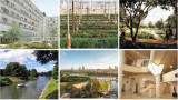
This is the 22st episode of a series 25 building blocks to create better streets, neighbourhoods, and cities. Its topic is the way how the quality of the living environment benefits from reducing the contrast between urban and rural areas.
Photos from space show a sharp contrast between city and countryside. Urban areas are predominantly gray; rural areas turn green, yellow, and brown, but sharp contrasts are also visible within cities between densely built-up neighborhoods and parks. Even between neighborhoods there are sometimes sharp transitions.
The division between city and country
Large and medium-sized cities on the one hand and rural areas on the other are worlds apart in many respects and local government in municipalities would like to keep it that way. For a balanced development of urban and rural areas, it is much better if mutual cohesion is emphasized, that their development takes place from a single spatial vision and (administrative) organization and that there are smooth transitions between both. The biggest mistake one can made is regarding the contrast between city and country as a contradiction between city and nature. Where large-scale agriculture predominates in the rural area, the remaining nature has a hard time. Where nature-inclusive construction takes place in cities, biodiversity is visibly increasing.
The idea that urban and rural areas should interpenetrate each other is not new. At the time, in Amsterdam it was decided to retain several wedges and to build garden villages. Some of the images in the above collage show such smooth transitions between urban and rural areas: Eko Park, Sweden (top right), Abuja, Nigeria (bottom left), and Xion'an, China (bottom center). The latter two are designs by SOM, an international urban design agency that focuses on biophilic designs.
Pulling nature into the city
Marian Stuiver is program leader Green Cities of Wageningen Environmental Research at WUR. In her just-released book The Symbiotic City, she describes the need to re-embed cities in soil, water and living organisms. An interesting example is a design by two of her students, Piels and Çiftçi, for the urban expansion of Lelystad. The surrounding nature continues into the built-up area: soil and existing waterways are leading; buildings have been adapted accordingly. Passages for animals run between and under the houses (see photo collage, top left). Others speak of rewilding. In this context, there is no objection to a small part of the countryside being given a residential destination. Nature benefits!
Restoration of the rural area
The threat to nature does not come from urban expansion in the first place, but mainly from the expansion of the agricultural area. Don't just think immediately of the clearing of tropical rain woods to produce palm oil. About half of the Dutch land area is intended for cows. Usually, most of them are stabled and the land is mainly used to produce animal feed.
The development of large-scale industrialized agriculture has led to the disappearance of most small landscape features, one of the causes of declining biodiversity. Part of the Climate Agreement on 28 June 2019 was the intention to draw up the Aanvalsplan landschapselementen . Many over-fertilized meadows and fields that are intended to produce animal feed in the Netherlands were once valuable nature reserves. Today they value from a biodiversity point of view is restricted and they are a source of greenhouse gases. Nature restoration is therefore not primarily focusses at increasing the wooded area. Most of the land can continue to be used for agricultural and livestock farming, provided that it is operated in a nature-inclusive manner. The number of farmers will then increase rather than decrease.
Pulling the city into nature
There are no objections against densification of the city as long this respects the green area within the city. So-called vertical forests by no means make up for the loss of greenery. Moreover, space is needed for urban agriculture and horticulture (photo collage, top center), offices, crafts, and clean industry as part of the pursuit of complete districts. Nature in the Netherlands benefits if one to two percent of the land that is currently used to produce animal feed is used for housing, embedded in a green-blue infrastructure. Some expansion and densification also apply to villages, which as a result are once again developing support for the facilities, they saw disappearing in recent decades.
Finally, I mentioned earlier that nature is more than water, soils, plants, and trees. Biophilic architects also draw nature into the built environment by incorporating analogies with natural forms into the design and using natural processes for cooling and healthy air. The 'Zandkasteel' in Amsterdam is still an iconic example (photo collage, bottom right).
Follow the link below to find an overview of all articles.
Sanne van Kempen,
Marketing & Communications Lead
at Spectral,
posted
Spectral Receives Investment from ABN AMRO Sustainable Impact Fund to Scale its Operations

Spectral, a pioneer in the integration of energy and information technologies and a highly impactful scale-up in the energy sphere, is excited to announce a major turning point in its expansion. Spectral has successfully secured an investment from ABN AMRO’s Sustainable Impact Fund (SIF). The fund invests in impact-driven companies seeking both social and financial returns. The investment will primarily be used to scale and professionalize operations.
Herman van den Bosch,
professor in management development
,
posted
21. Work, also in the neighbourhood
This is the 21th episode of a series 25 building blocks to create better streets, neighbourhoods, and cities. Its topic is the combination of living and working in the same neighbourhood. This idea is currently high on the agenda of many city councils.
Benefits for the quality of the living environment
If there is also employment in or near the place where people live, several residents might walk to work. That will only apply to relatively few people, but urban planners think that bringing living and working closer together will also increase the liveliness of the neighborhood. But more reasons are mentioned: including cross-fertilization, sharing of spaces, the shared use of infrastructure (over time), a greater sense of security and less crime. Whether all these reasons are substantiated is doubtful.
In any case, mixed neighbourhoods contributes to widening the range of residential environments and there is certainly a group that finds this an attractive idea. The illustrations above show places were living and work will be mixed (clockwise): Deventer (Havenkwartier), The Hague (Blinckhorst), Leiden (Bioscience Park), Amersfoort (Oliemolenterrein), Amsterdam (Ravel) and Hilversum (Wybertjesfabriek).
Break with the past
Le Corbusier detested the geographical nearness of work and living. In his vision, all the daily necessities of residents of the vertical villages he had in mind had to be close to home, but the distance to work locations could not be great enough. Incidentally, very understandable because of the polluting nature of the industry in the first half of the 20th century. Nowadays, the latter is less valid. An estimated 30% of companies located on industrial sites have no negative environmental impact whatsoever. A location in a residential area therefore does not have to encounter any objections. The choice for an industrial site was mainly dictated because the land there is much cheaper. And that's where the shoe pinches. The most important reason to look for housing locations on industrial estates is the scarcity of residential locations within the municipality and consequently their high prices. Moreover, in recent decades the surface of industrial estates has grown faster than that of residential locations, at least until a couple of years ago.
Companies are still hesitating
Companies are generally reserved about the development of housing in their immediate vicinity. Apart from the realistic expectation that the price of land will rise, they fear that this will be at the expense of space that they think they will need to grow in the future. This fear is justified: In the Netherlands 4600 hectares of potential commercial sites disappeared between 2016 and 2021. Another concern is that future 'neighbors' will protest against the 'nuisance' that is inherent to industrial sites, among others because of the traffic they attract. The degree of 'nuisance' will mainly depend on the scale on which the mixing will take place. If this happens at block level, the risk is higher than in case of the establishment of residential neighborhoods in a commercial environment. But as said, there is no need to fear substantial nuisance from offices, laboratories, call centers and the like. Companies also see the advantages of mixing living and working, such as more security.
Searching for attractive combinations of living and working
Project developers see demand for mixed-use spaces rising and so do prices, which is an incentive for the construction of compact multifunctional buildings, in which functions are combined. To create sufficient space for business activity in the future, they advocate reserving 30% for business space in all residential locations. The municipality of Rotterdam counters this with a 'no net loss' policy regarding gross floor surface for commercial spaces.
Gradually, attractive examples of mixed living and working areas emerge. Park More (from Thomas More), the entrance area of the Leiden Bioscience Park, which will consist of homes, university facilities and a hotel (photo top right). The idea is that in the future there will also be room for the storage of rainwater, the cultivation of food and the production of the estate's own energy.
Another example, which can probably be followed in more places, is the transformation of the Havenkwartier Deventer into a mixed residential and working area, although part of the commercial activity has left and the buildings are being repurposed as industrial heritage (photo above left). The starting point is that, despite hundreds of new homes, the area will retain its industrial and commercial character, although some residents complain about the 'smoothening' of the area'. Living and working remains a challenging combination, partly depending on where the emphasis lies. In this respect, many eyes are focused on the substantiation of the plans of Amsterdam Havenstad.
Follow the link below to find an overview of all articles.
Herman van den Bosch,
professor in management development
,
posted
Expeditie Muziek
Ik heb de laatste jaren honderden posts geschreven over stedelijke ontwikkeling, innovatie en organisatie. Vele daarvan hebben op deze website gestaan. Ik verschuif mijn schrijfactiviteiten geleidelijk naar het thema waarvan mijn hart sneller gaat kloppen, namelijk muziek. In mijn nieuwe Nederlandstalige blog 'Expeditie muziek' (zie de link hieronder) verken ik wekelijk een ander facet. Deze week is dat de geschiedenis van de blues, vorige week heb ik een top tien samengesteld van de in mijn ogen mooiste Nederlandstalige liedjes 'ooit'. Neem eens een kijkje.
Noor Veenhoven,
Program manager energy & circularity
at Amsterdam Smart City,
posted
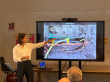
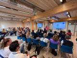
Highlights Data Dilemma's: Kijken onder de grond en samenwerken erboven
English version below
We zien het misschien niet, maar de ondergrond ligt vol met assets en is voortdurend in beweging. Er liggen elektriciteitskabels, gasleidingen, riolering, stadswarmte, glasvezel, en nog veel meer, die constant moeten worden onderhouden, verwijderd, of bijgelegd. De ambities van Nederland voor de energietransitie, snel dataverkeer, mobiliteitsoplossingen, circulaire economie en klimaatadaptie, leggen alleen nog maar meer druk op de schaarse ondergrond. Goed inzicht hebben in wat er precies onder de grond ligt en goede samenwerking tussen de verschillende partijen die de grond in moeten is daarom essentieel.
Tijdens de Data Dilemma’s evenementen van Amsterdam Smart City verkennen we de mogelijkheden voor het gebruik van data en nieuwe technologieën om stedelijke en maatschappelijke uitdagingen aan te pakken, met een focus op verantwoorde digitalisering. Het doel is om data te gebruiken om steden veiliger, schoner en toegankelijker te maken.
In deze editie van Data Dilemma’s, bespraken we het dilemma van de ondergrond: Hoe zorg je dat de data van de ondergrond klopt met de werkelijkheid en hoe kunnen de partijen die de grond in moeten beter samenwerken. De sprekers van dit evenement waren Ceciel Kempers (Alliander), Marco Scheffers (Gemeente Amsterdam) en Vincent van Mierlo (Eurofiber Nederland) die ieder hun tools en dilemma’s deelden als zij met hun organisatie de grond in gaan.
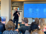
Het Scan de Sleuf project - Ceciel Kempers
Ceciel Kempers, bedrijfsontwikkelaar bij Alliander, vertelde over hun ‘Scan de sleuf’ project, waarbij ze een 3D scan maken van open werksleuven om inzichtelijk te maken waar alle assets precies liggen. Bij Alliander levert de huidige aanpak van schetsverwerkingen op dit moment nog veel problemen op. De doorlooptijd van assetregistratie is op het moment 550 dagen. Dit zorgt ervoor dat de data over de ondergrond soms flink achterloopt op de werkelijkheid wat weer kan leiden tot graafschade, gevaarlijke situaties en veel uren die gaan naar het zoeken van assets.
Volgens Ceciel moet de buitensituatie leidend gemaakt worden door middel van een 3D scan, een Scan de Sleuf, waar er letterlijk een scan gemaakt wordt van de werksleuf in de grond wanneer deze open ligt. Dit kan gewoon met een tablet of smartphone worden gedaan en de technologie zal beschikbaar zijn voor iedereen die de grond in moet. Als de grond dan ooit weer open moet, kan er op de 3D scan precies gezien worden waar de kabels zich bevinden. Dit zorgt er op de korte termijn voor dat er minder discussies ontstaan met aannemers over aangelegd werk en dat er minder liggingsregistraties worden afgekeurd. Later zal het ook de registratie versnellen en de kwaliteit van liggingsdata verbeteren. Op de lange termijn zullen ook graafschade en gevaarlijke situaties afnemen.
Een ander groot voordeel van 3D data is dat afstanden nauwkeurig ingemeten kunnen worden door middel van pixelafstanden. Daarnaast kan er een kaart laag, die de kabels en leidingen in de ondergrond weergeven, op de werkelijkheid gelegd worden aan de hand van geo-referentie.
De eindvisie van het Scan de Sleuf project is om een landelijke 3D-database van de ondergrondse situatie te maken: De ‘Understreetview’ van Nederland.
Data samenbrengen in de Digital Twin van de ondergrond - Marco Scheffers
Bij de Gemeente Amsterdam is er vanuit de ambtenaren een werkgroep ondergrond ontstaan, vertelde Marco Scheffers, data-adviseur ondergrond en geo-informatie bij de Gemeente Amsterdam. Volgens hen moest er meer gedaan worden aan de ondergrond in Amsterdam, de huidige kwaliteit van informatie over de ondergrond is onvoldoende om de huidige en toekomstige verdeling van ruimte inzichtelijk te maken. Daarom is er besloten te gaan werken met regie op de ondergrond.
De eerste stap is het vormen van het Datafundament ondergrond, een digitale basis binnen de Amsterdamse Digital Twin. Het bestaat uit relevante ondergrondgegevens van systemen en fenomenen die vitaal zijn voor de stad, denk hierbij aan kabels, leidingen, historische assets, funderingen van gebouwen en fysische eigenschappen van de bodem. Uiteindelijk is het plan om ook 3D informatie te verschaffen en te bouwen aan een Digital Twin van de ondergrond.
Er wordt nu gebouwd aan data over de ondergrond op het platform data.amsterdam.nl. Niet alle data over de ondergrond is openbaar, de KLIC data (Kabels en Leidingen Informatie Centrum) is alleen toegankelijk voor bevoegden. De Digital Twin van Amsterdam is te zien op 3d.amsterdam.nl.
Een dynamische ondergrond zonder z-coördinaat - Vincent van Mierlo
De laatste spreker was Vincent van Mierlo, strategisch adviseur bij Eurofiber Nederland. Eurofiber is gespecialiseerd in het aanleggen van glasvezelaansluitingen, ze werken dus met vitale infrastructuur. Dit betekent dat als deze processen uitvallen of verstoord worden, er snelle reparaties vereist zijn. Dit leidt met hun 60.000 kilometer aan glasvezelkabel tot 500 handelingen per week.
Bij 3D visualisaties van de bovengrond wordt het meteen duidelijk of de data klopt, maar bij 3D visualisaties van de ondergrond kun je niet makkelijk zien of de data correct is. Dit kan een risico op schade aan netwerken veroorzaken omdat er wordt uitgegaan van theoretische data. De leggegevens zijn niet per se hetzelfde zijn als de liggegevens (en dat die termen maar één letter van elkaar verschillen leidt ook tot verwarring). De ondergrond blijft dynamisch waardoor ook kabels en leidingen in de werkelijkheid anders gepositioneerd kunnen zijn dan verwacht. In principe liggen glasvezelkabels op 60 cm diepte maar dat is lang niet altijd het geval. Daarom zou 3D visualisaties kunnen helpen met het verschaffen van niet alleen de X en Y coördinaten, maar ook de Z-coördinaten (diepte).
Volgens Vincent is het belangrijk om een geharmoniseerde werkwijze van 3D inmeten in te stellen die op landelijk niveau wordt vastgelegd. Daarnaast moet er eenzelfde taal/jargon worden gekozen. Want als we niet dezelfde taal spreken, dan wordt het onmogelijk om samen te werken.
We willen graag onze sprekers bedanken voor de interessante presentaties en het publiek voor de waardevolle discussie. De dilemma’s in de ondergrond brengen een hoop vragen met zich mee waar we graag met het Amsterdam Smart City netwerk aan verder werken.
Vervolg: We gaan door met het vraagstuk: Hoe kijken we onder de grond zonder te graven? Waarbij we met partijen die de grond in moeten, en partijen met slimme technologische oplossingen bespreken wat er allemaal mogelijk is om te kijken onder de grond zonder te graven. Heb je ook te maken met de vraagstuk, of kun je helpen met het vinden van een oplossing? Neem dan contact op met noor@amsterdamsmartcity.com.
Data Dilemmas: Looking Below Ground and Collaborating Above
We may not see it, but the underground is filled with assets and is constantly in motion. It contains electricity cables, gas pipelines, sewage systems, district heating, fibre optics, and much more, all requiring regular maintenance, removal, or expansion. The ambitions of the Netherlands for the energy transition, fast data traffic, mobility solutions, circular economy, and climate adaptation only add more pressure to the already limited underground space. Having a clear understanding of what lies beneath the ground and fostering effective collaboration among the various stakeholders involved in underground activities is essential.
During Data Dilemma's, we explore the possibilities for using data and new technologies to address urban and societal challenges, with a focus on responsible digitalization. The goal is to use data to make cities more safe, clean and accessible.
In this edition of Data Dilemmas, we discussed the dilemma of the underground: How to ensure that underground data matches reality and how the parties involved in underground activities can collaborate more effectively. The speakers for this event were Ceciel Kempers (Alliander), Marco Scheffers (City of Amsterdam), and Vincent van Mierlo (Eurofiber Netherlands), each sharing their tools and dilemmas when working beneath the ground.
The Scan the Trench Project - Ceciel Kempers
Ceciel Kempers, a business developer at Alliander, shared insights into their "Scan the Trench" project, where they create a 3D scan of open work trenches to make the exact locations of all assets visible. Alliander's current approach to make a work sketch of the situation is causing significant problems. The asset registration process takes 550 days at present, resulting in outdated data about what's underground, which can lead to excavation damage, hazardous situations, and significant hours spent searching for assets.
According to Ceciel, the outdoor situation should be the guiding force through a 3D scan, a "Scan the Trench," where a scan is created of the open trench in the ground. This can be done with a tablet or smartphone and will be available to anyone who needs to work in the underground. If the ground ever needs to be reopened, the 3D scan can precisely show the location of the assets, reducing disputes with contractors over completed work and rejected location registrations in the short term. In the long term, it will also accelerate asset registration and enhance the quality of location data, reducing excavation damage and dangerous situations.
Another significant advantage of 3D data is the ability to measure distances accurately using pixel distances. Additionally, a map layer depicting underground cables and pipelines can be overlaid on reality through geo-referencing.
The vision for the future of the Scan the Trench project is to create a national 3D database of the underground situation: the "Understreetview" of the Netherlands.
Bringing Data Together in the Digital Twin of the Underground - Marco Scheffers
At the municipality of Amsterdam, a group dedicated to the underground was formed by civil servants, as explained by Marco Scheffers, a data advisor specializing in the underground and geoinformation at the City of Amsterdam. They believe that more attention should be given to the underground in Amsterdam, as the current quality of information about the underground is insufficient to make the current and future spatial distribution transparent. Therefore, a decision was made to work on managing the underground.
The first step involves establishing the Data Foundation for the underground, a digital base within Amsterdam's Digital Twin. It comprises relevant underground data from systems and phenomena vital to the city, such as cables, pipelines, historical assets, building foundations, and soil properties. The ultimate plan is to provide 3D information and build a Digital Twin of the underground. Data about the underground is currently being developed on the platform data.amsterdam.nl. Not all underground data is publicly accessible; the KLIC data (Cables and Pipelines Information Center) is only accessible to authorized personnel. The Digital Twin of Amsterdam can be viewed at 3d.amsterdam.nl.
A Dynamic Underground without Z-Coordinates - Vincent van Mierlo
The final speaker was Vincent van Mierlo, a strategic advisor at Eurofiber Netherlands. Eurofiber specializes in installing fiber optic connections, so they work with critical infrastructure. This means that when these processes fail or are disrupted, quick repairs are required, which results in around 500 actions per week with their network of 60,000 kilometres of fibre optic cables.
With 3D visualizations of the surface, it's immediately clear whether the data is accurate. However, with 3D visualizations of the underground, it's not easy to determine the correctness of the data. This can pose a risk of network damage because it relies on theoretical data. The laying data may not necessarily match the lying locations, and the similarity of the terms "laying" and "lying" also leads to confusion. The underground remains dynamic, and cables and pipelines can be positioned differently in reality than expected. In principle, fibre optic cables are supposed to be at a depth of 60 cm, but this is not always the case. Therefore, 3D visualizations could help provide not only X and Y coordinates but also Z-coordinates (depth).
According to Vincent, it is important to establish a harmonized approach to 3D mapping at a national level. Additionally, a common language/jargon should be adopted because if we don't speak the same language, collaboration becomes impossible.
We would like to thank our speakers for their informative presentations and the audience for their valuable discussions. The underground dilemmas bring forth numerous questions that we are eager to continue addressing with the Amsterdam Smart City network.
Next Steps: We will proceed with the question: How can we look beneath the ground without excavation? We will discuss with parties involved in underground activities and those with smart technological solutions to explore what is possible in investigating beneath the ground. If you are dealing with similar questions or can assist in finding a solution, please contact noor@amsterdamsmartcity.com.
Xander Bakker,
Community Manager
at Green Innovation Hub,
posted
Minecraft Almere Pampus Challenge: pushing the boundaries to build the city of the future
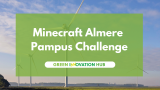
In today's dynamic landscape, the key to success lies in collaboration. The Green Innovation Hub firmly believe in the power of partnerships between companies, government and educational institutions to drive innovation, growth and positive change. In a world where technology connects us in unique ways, the Minecraft Almere Pampus Challenge exemplified the power of communities coming together to achieve remarkable feats.
It's inspiring to witness the incredible work of our young talents. They are the architects of the future and they're currently building virtual cities where companies can find their next digital solutions. Whether you represent a company, government department, or educational institution, we invite you to connect and explore how we can collaborate to make a meaningful impact on our shared goals.
1. Fresh Perspectives: young talent brings fresh and innovative perspectives to the table. They're unafraid to challenge the status quo and reimagine how things can be done.
2. Cutting-Edge Tech: these virtual cities are powered by the latest technologies from Microsoft and Iamprogrez. Companies can tap into this tech-savvy generation to incorporate cutting-edge solutions into their operations.
3. Collaboration Opportunities: collaborating with these digital pioneers can lead to mutually beneficial partnerships. Your company can gain a competitive edge while offering mentorship and growth opportunities to the next generation.
Find the Green Innovation Hub (NL Pavilion) at the Smart City Expo World Congres in Barcelona, and let's meet each other. Together, we'll keep pushing the boundaries of what's possible in the Minecraft universe and to build the house – or even the city of the future. Also stay tuned for upcoming advantures, events and challenges on our channels.
Watch the video: https://youtu.be/4F7CFGfb2HE
Herman van den Bosch,
professor in management development
,
posted
20. Facilities within walking and cycling distance
This is the 20th episode of a series 25 building blocks to create better streets, neighbourhoods, and cities. Its topic is to enable citizens having daily necessities in a walking and bicycling distance.
During the pandemic, lockdowns prevented people from leaving their homes or moving over a longer distance. Many citizens rediscovered their own neighbourhood. They visited the parks every day, the turnover of the local shops increased, and commuters suddenly had much more time. Despite all the concerns, the pandemic contributed to a revival of a village-like sociability.
Revival of the ‘whole neighbourhood’
Revival indeed, because until the 1960s, most residents of cities in Europe, the US, Canada, and Australia did not know better than their dally needs were available within a few minutes' walk. In the street where I was born, there were four butchers, four bakers, three greengrocers and four groceries, even though the street was not much longer than 500 meters. No single shop survived. My primary school was also on that street, and you had to be around the corner for the doctor. This type of quality of life went lost, in the USA in particular. However, urban planners never have forgotten this idea. In many cities, the pandemic has turned these memories into attainable goals, albeit still far removed from reality. Nevertheless, the idea of the 'whole neighborhood' gained traction in many cities. It fits into a more comprehensive planning concept, the 15-minute city.
Support for facilities
The idea is that residents can find all daily needs within an imaginary circle with an area of approximately 50 hectares. This implies a proportionate number of residents. A lower limit of 150 residents per hectare is often mentioned, considering a floor area of 40% for offices and small industry. The idea is further that most streets are car-free and provide plenty of opportunity for play and meeting.
Opportunity for social contacts
In a 'whole neighbourhood', residents find opportunity for shopping and meeting from morning to evening. There is a supermarket, a bakery, a butcher, a greengrocer's shop, a drugstore, a handful of cafes and restaurants, a fitness center, a primary school, a medical center, craft workshops, offices, green spaces and a wide variety of houses. Here, people who work at home drink their morning coffee, employees meet colleagues and freelancers work at a café table during the quiet hours. Housemen and women do their daily shopping or work out in the gym, have a chat, and drink a cup of tea. People meet for lunch, dinner and socializing on the terrace or in the cafes, until closing time. A good example is the Oostpoort in Amsterdam, albeit one of the larger ones with a station and a few tram lines.
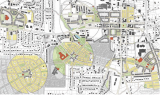
Planning model
On the map above, the boundaries of the neighborhoods with an area of approximately 50 hectares are shown in the form of circles. The circular neighborhood is a model. This principle can already play a role on the drawing board in new neighborhoods to be built. In existing neighbourhoods, drawing circles is mainly a matter of considering local data. The center of the circle will then often be placed where there are already some shops. Shops outside the intended central area can be helped to move to this area. Spaces between existing homes can be reserved for small-scale businesses, schools, small parks, communal gardens and play facilities. Once the contours have been established, densification can be implemented by choosing housing designs that align to the character of the neighbourhood. Towards the outside of the imaginary circle, the building density will decrease, except at public transport stops or where circles border the water, often an ideal place for higher buildings.
If a thoroughfare passes through the center of the circle, this street can be developed into a city street, including a public transport route. Facilities are then realized around a small square in the center of the circle and the surrounding streets.
Incidentally, space between the circles can be used for through traffic, parks, and facilities that transcend districts, for instance a swimming pool or a sports hall or an underground parking garage. Mostly, neighborhoods will merge seamlessly into each other.
It will take time before this dream comes true.
Follow the link below to find an overview of all articles.
Herman van den Bosch,
professor in management development
,
posted
19. Safe living environment
This is the 19th episode of a series 25 building blocks to create better streets, neighbourhoods, and cities. This post is about increasing the independent mobility of children and the elderly, which is limited due to the dangers that traffic entails.
For safety reasons, most urban children under the age of ten are taken to school. The same goes for most other destinations nearby. It hampers children’s independent mobility, which is important for their development.
Car-free routes for pedestrians and cyclists
For security reasons, car-free connections between homes and schools, community centers, bus stops and other facilities are mandatory (photo’s top left and bottom right). Car routes, in their turn, head to neighborhood parking spaces or underground parking garages. Except for a limited number of parking spaces for disabled people.
Design rules
Model-wise, the design of a residential area consists of quadrants of approximately 200 x 200 meters in which connections are primarily intended for pedestrians and cyclists. There are routes for motorized traffic between the quadrants and there are parking facilities and bus stops at the edges. Inhabitants might decide that cars may enter the pedestrian area at walking pace to load and unload to disappear immediately afterwards. The routes for pedestrians and cyclists connect directly with the shops and other destinations in the neighborhood, based on the idea of the 15-minute city. Shops 'ideally' serve 9 to 16 quadrants. In practice, this mode will have many variations because of terrain characteristics, building types and aesthetic considerations.
Examples
The number of neighborhoods where cars can only park on the outskirts is growing. A classic example is 'ecological paradise' Vauban were 50 'Baugruppen' (housing cooperatives) have provided affordable housing (photo bottom middle ). Car-free too is the former site of the Gemeentelijk waterleidingbedrijf municipal water supply company in Amsterdam - (photo bottom left). Here almost all homes have a garden, roof terrace or spacious balcony. The Merwede district in Utrecht (top middle) will have 12,000 inhabitants and for only 30% room for parking is available, and even then only on the edge of the district. Shared cars, on the other hand, will be widely available. The space between the houses is intended for pedestrians, cyclists and children playing.
More emphasis on collective green
Due to the separation of traffic types and the absence of nuisance caused by car, there are no obligatory streets, but wide foot- and cycle paths. Instead there are large lawns for playing and picnicking, vegetable gardens and playgrounds. Further space savings will be achieved by limiting the depth of the front and back gardens. Instead, large collective space appears between the residential blocks; remember the Rivierenwijk in Utrecht that I mentioned in the former post (top right). Behind the buildings, there is room for small backyards, storage sheds and possibly parking space.
Follow the link below to find an overview of all articles.
Amsterdam Smart City,
Connector of opportunities
at Amsterdam Smart City,
posted
Recap of Demoday #21
On Tuesday October 10th, Amsterdam Smart City partners gathered for an afternoon full of inspiration, exchange and connection with each other at our 21st Demoday! This time, we were invited by our partner Alliander to their brand-new circular office in Amsterdam Westpoort. In this article, we give you a quick overview of the Knowledge Session, pitches and work sessions. Interesting in learning more? Read the full reports by our Programme Managers Noor, Pelle and Sophie (linked below).
About our Demodays
The Demodays are one of the tools we use to stimulate innovation and encourage connection between our partners and community. The purpose of the Demodays is to present the progress of various innovation projects, ask for help, share dilemmas and involve more partners to take these projects to the next level. More information about the Demodays can be found here.
Knowledge Session: Systems Thinking for Beginners
We started the Demoday with a workshop Systems Thinking for Beginners, led by Nico Schouten from Metabolic. In this workshop, he explained why it is important to take a holistic approach to sustainability challenges. If we don’t see “solutions” in the context of the whole system it might have bad unintended consequences. Curious to learn more about Systems Thinking and how you can map a system for sustainability and societal challenges? Read the full report here.
Pitches
After the Knowledge Session, we continued with four inspiring pitches. Titus Venverloo (AMS Institute) told us all about the Senseable Amsterdam Lab (SAL), a new research collaboration between AMS Institute and MIT that introduces novel data and science-based methods to help the City of Amsterdam transition to a carbon-neutral city. Beth Massa (Ozarka) is on a mission to replace single-use and on-the-go food packaging with reusable alternatives. She explained how she uses empathy in her journey to get her partners to become more circular. Gilles Hommen (ZEnMO Simulations) presented the HOLON Tool, designed to help shape the energy system of the future. And last but not least, Christine Groothuis (municipality of Haarlemmermeer) and Jadine van Ooijen (Digital Society School) gave an update on their finalised human-centric design project, which once started as an Amsterdam Smart City challenge. Check out the aftermovie of the final showcase from the Digital Society School for the final results!
Work sessions
Circular | Bringing Circularity to Small and Medium-Sized Business by Mariska Joustra (municipality of Amsterdam) and Gabrielle Werkhoven (Versnellingshuis)
Amsterdam is striving to make a substantial reduction in resource usage by 2030 and transition to a fully circular economy by 2050. Engaging Small and Medium-sized Businesses (SMBs) in this transition is essential, but managing this is difficult. Key insights from the city's circular ambitions and strategies, along with challenges faced by SMBs and potential solutions, were discussed in this work session and are highlighted in this report.
Energy | How to share learnings of local energy systems and form a coalition | Omar Shafqat (HvA)
When thinking about the decarbonization of cities, Local Energy Systems (LES) are often mentioned as one of the key enablers in the future. While there is agreement that LES have a role to play in the energy system of the future, what exactly this role is and how to scale up and implement this solution remains unclear. In this work session, Omar Shafqat (HvA) presented a framework for sharing the learnings of LES and we discussed how we can further develop this framework and how to form a coalition between different parties that work on LES. You can read the full report here.
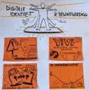
Digital | Digital Identity & Awareness
When using digital government services, we often leave more data behind than is actually necessary. The municipality of Amsterdam recently completed a pilot with Yivi (formerly IRMA), a safer and more reliable way of logging in that doesn't request or store unnecessary information. During the Transition Day in June, we identified that a lack of awareness and knowledge about digital identity and privacy risks is one of the main barriers for implementing new electronic identification methods. In this follow-up session, we continued with the theme of awareness and asked the Amsterdam Smart City network to come up with a change story and (start of) a campaign about digital identity. Read the full report here.
General | Value Mapping practice with CIRCOLLAB
CIRCOLLAB, a network in the Metropolitan Region of Amsterdam aimed at accelerating the circular transition, is developing a method to apply systems thinking and eco-centric approaches in organisations. While developing the right workshop methods, they are hosting meet-ups to discover what it takes for organisations to look beyond their organisational boundaries and feel part of the larger system. In this worksession, our Demoday participants were invited to apply value chain- and systems thinking within a Almere Pampus case, and articulate their feedback on the workshop methods. You can read the full report here.
Amsterdam Smart City,
Connector of opportunities
at Amsterdam Smart City,
posted
Knowledge Session: Systems Thinking for Beginners
We started the Demoday with a workshop Systems Thinking for Beginners, led by Nico Schouten from Metabolic. In this workshop, he explained why it is important to take a holistic approach to sustainability challenges. If we don’t see “solutions” in the context of the whole system, it might have bad unintended consequences. Airconditioning, for example, leads to a more comfortable temperature inside, but because of the high energy consumption, it also contributes to global warming.
What is a system?
To properly think in systems, you first need a clear definition of what a system is: A system is a collection of components that work together as a whole to achieve a common goal. For something to be a system it needs to have the following four attributes:
- A system needs to have a goal.
- All components of the system are functional.
- The order in which the components of the system are ordered matters.
- A system tries to stabilize via a feedback mechanism.
Using this definition you can conclude that a football team would be a system since it has the goal of winning, all players are functional, if you switch up the players it would matter for the effectiveness of the team, and as long as none of the players (components) fail they will continue to try to reach their goal of winning. On the other hand, a kitchen is not a system, since it has no goal (without a person in it), and the order of the components in a kitchen doesn’t matter that much.
How to map a system?
To map a system, we use four elements:
Nodes (O): These are the components of your system.
Polarity elements (+/-): These are arrows between the nodes that show how they influence each other. The positive polarity element shows that if one node increases, the other also increases, and if it decreases, the other also decreases. The negative polarity element shows that if one node increases, the other one decreases, and vice versa.
For example, the nodes birth rate and population size have a positive polarity between them, because if the birth rate increases, the population size also increases. For the mortality rate node and population size node, you would use a negative polarity element, because population size decreases if the mortality rate increases.Delay elements ( || ): These elements can be added to the arrow with the polarity if the effect is delayed. For instance, the node ‘number of fertilized eggs’ has a positive polarity with ‘birth rate’, but it has a delayed effect (of about 9 months) and therefore we add the delay element to the arrow.
Loops (R/B): If you map out your system completely you will find that there are probably one or multiple loops in your system. These loops can either be reinforcing (R) or Balancing (B).
- An example of a Reinforcing (R) loop is how a disease spreads: More sick people, lead to more people being infected, leading to more people being infected, leading to more people being sick, etc. You have the nodes “people being sick” and “people being infected” which both have a positive polarity with each other. This leads to exponential growth if no interventions are made. Of course, the system is more complicated than that in real life.
- An example of a Balancing (B) loop is how populations stay the same size: The larger the population, the higher the mortality rate (positive polarity). But the higher the mortality rate, the smaller the population (negative polarity). These positive and negative polarities keep each other in balance.
To fully understand how to map a system we looked at an example of a neighbourhood in Rotterdam. In this neighbourhood, a lot of maintenance was suddenly needed for public space. They are working on maintaining the neighbourhood, but problems keep propping up. Therefore, they mapped out the problem of this neighbourhood to get a better understanding of how to find a structural solution.
To properly make a system map, you need to look at three things:
- Context of the system: What are the social, economic and cultural components?
- Time: The time and duration of components need to be taken into account.
- Location: Where does this system take place?
After drawing out all the nodes of the system and connecting how they influence each other, you get a map (see attachment 1). Two feedback-reinforcing feedback loops can be discovered in this map (see attachment 2).
By unveiling these feedback loops it becomes easier to find the components for which an intervention would be most effective.
In the last 10 minutes of this workshop, we worked on making a system map ourselves by looking at the problem of airconditioners in warm places. Defining all the relevant nodes, and connecting them properly proved quite challenging, but also very enlightening.
Would you like to read more about Metabolic's approach, or work with them on driving systemic change? Visit their website via: https://www.metabolic.nl/about/our-approach/
Pelle Menke,
Communications and Programme officer Mobility
at Amsterdam Smart City,
posted
Demoday #21: Value Mapping practice with CIRCOLLAB
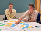
CIRCOLLAB, a network in the Metropolitan Region of Amsterdam aimed at accelerating the circular transition, is developing a method to apply systems thinking and eco-centric approaches in organisations. While developing the right workshop methods, they are hosting meet-ups to discover what it takes for organisations to look beyond their organisational boundaries and feel part of the larger system. In this worksession, our Demoday participants were invited to apply value chain- and systems thinking within a Almere Pampus case, and articulate their feedback on the workshop methods.
The case of Almere Pampus
The development of Pampus is a great example to use for experiments on circular value systems as there is a fresh clean sheet to start off with. Pampus can be used as a showcase and be a leading international example for sustainable area development by designing the area in a circular, climate-adaptive, nature-inclusive and energy-neutral way from the start, and by investing in necessary and smart above- and underground systems for energy, water, soil, food and waste early on. The two themes used during this exercise were the use of biobased building materials from hemp, and a transport system for local groceries.
Value Mapping
After an introduction by Melanie de Vries (Windesheim), Quirine Winkler (Windesheim) and Darina Huinck (HvA), the participants were split into two groups, each with their own Pampus Eiland topic. We were invited to make use of a ‘Value Mapping tool for sustainable business modelling (Bocken et al., 2012) to explore the value chain for our case. After the identification of the case its ‘purpose’, there were a few steps to walk through with the group and enrich the blank canvas:
- First of all, we identified some ‘values created’, in line with the purpose of the case. Think of; financial profits, healthier living conditions, sustainable building materials etc.
- Secondly, we identified all stakeholders concerned with the value chain. They could either be connected to the case because of their influence or because they’re affected by it. Think of; businesses, societal actors, nature, policy etc.
- Realizing the goal of the chain also has its negative side effects. Think of; the need for new knowledge and training, the abandonment of efficient production chains etc.
- The final two steps involved identifying the missed values and (the related) value opportunities. The group of stakeholders related to the value network could take on these value opportunities if they work together. For example; the need for new knowledge and training could create opportunities for new education business models, and; if the creating of new building materials requires more technical educated producers, they could be rewarded with discounts or financial help on housing in these newly created neighbourhoods.
- When all steps have been completed, you can actually look back at your input on the value map and make some adjustments if necessary. The initial purpose of the value chain for example, could be different now that all types of values and stakeholders have been identified.
Insights
Collaborating on an innovation case with the help of such methodology, made the participants aware of the complexities when considering a complete (eco)system. It emphasised the importance of considering the system and its stakeholders, and the variety of (surprising) ways in which value can be created within its network.
Identifying the ‘values destroyed’ and taking on the ‘value opportunities’ would be of importance in real-life scenarios. But who should be responsible for what? This made the group aware of the importance of independent- and network organizations to make networks and systems flourish.
During this exercise the groups were randomized. However, it became clear that each individual has their own expertise and interests and therefore has a personal perception or view of the system its analysing. The variety of values and stakeholders you could identify seem endless, and your personal perspective will determine what you focus on. It is therefore important to determine the composition of the group with which you will shape such a value map.
And last but not least, Melanie, Quirine and Darina received feedback on this workshop from the participants. They will use this feedback to further develop this method and workshop, before they invite regional parties to take part in their Learning Network Circular Collaboration.
Would you like to know more about CIRCOLLAB or their Systems / Value Mapping workshops? Get in contact with Melanie (m.h.devries@windesheim.nl) or CIRCOLLAB (circollab@hva.nl). Are you working at -or with- one of our partner organisations and would you like to organise a worksession at one of our Demodays? Get in touch with me! pelle@amsterdamsmartcity.com
Sophie van der Ploeg,
Community Manager & Program Lead Digital
at Amsterdam Smart City,
posted
Demoday #21: Digital Identity & Awareness
When using digital government services, we often leave more data behind than is actually necessary. The municipality of Amsterdam recently completed a pilot with Yivi (formerly IRMA), a safer and more reliable way of logging in that doesn't request or store unnecessary information. During the Transition Day in June, we identified barriers related to the implementation of new electronic identification methods (read the report here). A lack of awareness and knowledge about digital identity and privacy risks were identified as one of the major barriers. In this follow-up session, we continued with the theme of awareness and asked the Amsterdam Smart City network to come up with a “change story” and (start of) a campaign about digital identity.
Setting the scene: urgency for a digital identity in EU/NL
To seize the opportunities of digitisation, it is important that everyone in the Netherlands maintains control over their digital life while ensuring the protection of public values such as privacy, accessibility and security. The Digital Government Act (Wet Digitale Overheid) aims to improve digital government services while ensuring citizens' privacy. An important part of this law is safe and secure logging in to the government using new electronic identification methods (eIDs) such as Yivi. At European level, there are also ambitions to introduce personal EU identification wallets, that enables users to choose and keep track of their identity and data which they share with third parties.
Change story for Digital Identity
From a change management perspective, successful change requires both the technical and people sides. In the case of Digital Identity, the developments on a national and European level provide the Reason for Change. The Technical Side is already (mostly) there: Yivi. However, the People Side of the change is lacking behind. There is a growing group of citizens who feel discomfort with data collection by third parties, but many are not aware of the importance of protecting your own digital identity. Therefore, we started working on the change story around digital identity, with the People Side in mind:
Once upon a time….
We had SO MANY accounts and passwords for different public and private services. For governments services, we used DigiD, which often asks for more data than necessary. Once upon a time, our data was everywhere. We were not in control of our data anymore, with the risk of data misuse.
But then….
The risk of not changing is digital fraud. New European and national legislation is designed to protect citizens. This legislation will lead to less data misuse and freedom of choice. It gives citizens more control over their data.
That’s why…
Yivi gives citizens control over their own data. Based on the principles of simplicity, trust and convenience.
To a happy ending…
In our dream scenario, citizens are in control of their own data through one supported solution (by national government and Europe). We cooperate at an (inter)national level to put citizens’ privacy and convenience first.
And that starts today!
This session had a good mix of participants from both public and private organisations. Business parties, such as Deloitte and Eurofiber, highlighted the importance of continuing the conversation with the private sector and think of a business model. This is necessary to get large cooperations that handle a lot of data, such as bol.com, on board too.
On this Demo day, we made a start with the change story. To really start creating more awareness about digital identity, we need to create the story for the user instead of focusing on the technical aspects. What makes digital identity wallets so different than DigiD?
The participants ended the session with formulating a change slogan: your data is and remains yours now!
This question was introduced in the Amsterdam Smart City network by Mike Alders and Frank Willemsen from gemeente Amsterdam. Both sessions were prepared with and moderated by Coen Smit from Royal HaskoningDHV. Nick Rovroy and David Koop from Flatland supported this session with their drawings. Do you have any questions or input for us? Contact me via sophie@amsterdamsmartcity.com or leave a comment below.
Noor Veenhoven,
Program manager energy & circularity
at Amsterdam Smart City,
posted
Demoday #21: How to share the learnings of Local Energy Systems and form a coalition
When thinking about the decarbonization of cities, Local Energy Systems (LES) are often mentioned as one of the key enablers in the future. While there is agreement that LES have a role to play in the energy system of the future, what exactly is this role and how do we scale up implementation of this solution?
Cities are a major source of GHG emissions, with UN estimates suggesting that cities are responsible for ~75% of global emissions, mainly by means of transport and energy use in buildings. The decarbonization of buildings within urban areas can prove especially difficult, as space is limited, issues like grid congestion delay further electrification and there are a lot of stakeholders involved.
LES can be a solution in the decarbonisation of buildings in urban areas, like residential spaces, business parks and hybrid areas, creating positive energy districts that simultaneously reduce their impact on the grid. Preliminary LES pilot programs indicate that a LES can support decarbonization by integrating renewable generation and efficiently using energy by decreasing energy losses due to smart grids, communal energy management systems and by combining generation and use as locally as possible. We are however still in the early stages of building and growing LES around the globe, which is why we are focused on getting the right stakeholders together and learning about the requirements for scaling up such systems.
## Case & Set-up of the Session
During the latest Transition Day we hosted a work session on the topic of LES. In the past months, a number of partners in the Amsterdam Smart City network have expressed interest in the topic and would like to work together on the topic. Simultaneously the HvA, who is working on the ATELIER project with the aim to create Positive Energy Districts (PEDs), developed a framework to structurally categorize the various aspects involved in implemeting a LES. During the Demo Day, we considered two topics related to LES The first was a the framework created by the HvA, with the intention of capturing feedback and validating the approach. Secondly, we considered how we can move from an informal network around LES, to a structural coalition that can scale up the concept.
## Insights
A framework for structurally capturing aspects of a LES
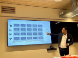
Omar Shafqat from the HvA / ATELIer project presented their framework for structurally capturing and monitoring aspects of LES. The framework categorizes various aspects into policy, market, technical and social considerations (from top to bottom). Next to that, it divides these aspects on a timeline along a planning horizon from longer term (planning) to shorter term (management). The framework is shown below in this image.
In response to the framework, the participants shared some the following feedback:
- Testing the framework is necessary to validate and improve it. This implies an inventorization of LES projects and working through a few specific cases to check how the framework can be applied, and how it can benefit project managers/owners.
- The framework should also be presented and validated by other key stakeholders such as Amsterdam’s “Task Force Congestion Management”.
- Participants raised the question of who exactly will use the framework, and how? Is this intended as an instrument to be used primarily by academics, and researchers, or also by practitioners?
Forming a coalition on the advancement of LES
The second part of the work session was moderated by Joost Schouten from Royal Haskoning DHV, who led the discussion on the need for building a coalition around LES. He argued that the further development of LES requires an ecosystem approach, since multiple parties with different interests are involved, but there is no clear ‘owner’ of the problem.
A ‘coalition of the willing’ could help to advance the development of LES. A discussion in breakouts led to the following insights:
- A coalition should be formed by the community itself, but it requires a party that coordinates during the kick-off phase. A discussion emerged around whose role should be to take on the coordination phase. Some participants were of the view that this should be led by a governmental party, others thought this should be organised by a network party like Amsterdam Smart City.
- To effectively build a coalition, the involved parties need to be interdependent. To make sure that it is clear that the parties in a LES are interdependent, the parties need to state their interests in developing a LES, to determine whether there is a common goal.
- Even when these interests are not fully aligned, communication between parties can help bridge gaps. Discussion leads to understanding and empathy.
- An ambassador can be a vital enabler in the beginning of building a coalition, as a clear face and point of contact for such a group.
- There are already many other communities and coalitions working on topics related to LES, including but not limited to 02025, New Amsterdam Climate platform, TET-ORAM, TopSector Energie, among others. A key question is whether a new coalition is necessary, or whether it should be possible to join forces with an existing coalition / initiative.
## Conclusions and next steps
Many work session participants indicated support and interest to further contribute to the development of the LES project. The HvA framework was viewed as a useful tool to capture learnings from LES projects to facilitate scaling up. Additionally, the question of how to facilitate collaboration and coalition forming requires further attention. There are many parties involved in the development of LES, and they don’t always have the same interests. However, this is not an issue that any party can ‘own’ or ‘solve’ on its own. It requires an ecosystem approach, which is something that will need to be further detailed.
For now, we will simultaneously work on further building the coalition and looking for LES projects that can be used to test and further develop the framework. If you would like to know more or get involved in the project, for example by contributing you own LES to be tested by the framework itself, let me know via noor@amsterdamsmartycity.com.
This challenge was introduced in the Amsterdam Smart City network by Lennart Zwols from gemeente Amsterdam and Omar Shafqat (HvA). The session was prepared with and moderated by Joost Schouten from Royal HaskoningDHV. Do you have any questions or input for us? Contact me via noor@amsterdamsmartcity.com or leave a comment below. Would you like to know more about the LES challenge? You can find the overview of the challenge with the reports of all the sessions here.
Herman van den Bosch,
professor in management development
,
posted
18. Space for sporting and playing in a green environment
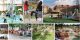
This is the 18th episode of a series 25 building blocks to create better streets, neighbourhoods, and cities. This message is about the limited possibilities for children to play in a green environment because of the sacrifices that are made to offer space for cars and private gardens
Almost all residential areas in the Netherlands offer too little opportunity for children to play. This post deals with this topic and also with changing the classic street pattern to make way for routes for pedestrians and cyclists.
Everything previously mentioned about the value of a green space applies to the living environment. The rule 3 : 30 : 300 is often used as an ideal: Three trees must be visible from every house, the canopy cover of the neighborhood is 30% and within an average distance of 300 meters there is a quarter of a hectare of green space, whether or not divided over a number of smaller parcels.
Functions of 'green' in neighbourhoods
The green space in the living environment must be more than a grass cover. Instead, it creates a park-like environment where people meet, it is accompanied by water features and can store water in case of superfluent rain, it limits the temperature and forms the basis for play areas for children.
Legally, communal, and private green areas are different entities; in practice, hybrid forms are becoming common. For example, a communal (inner) garden that can be closed off in the evening or public green that is cadastral property of the residents but intended for public use. In that case the residents live in a park-like environment which they might maintain and use together. Het Rivierdistrict in Utrecht is an example of this.
Play at the neighborhood level
Children want wide sidewalks and a place (at least 20 x 10 m2) close to home that is suitable for (fantasy) games and where there may also be attractive play equipment. The importance of playground equipment should not be overestimated. For many children, the ideal playground consists of heaps of coarse sand, water, climbing trees and pallets. To the local residents It undoubtedly looks messier than a field full of seesaw chickens. Good playground equipment is of course safe and encourages creative action. They can also be used for more than one purpose. You can climb on it, slide off it, play hide and seek and more. Of the simple devices, (saucer) swings and climbing frames are favorites.
A somewhat larger playground to play football and practice other sports is highly regarded. Such a space attracts many children from the surrounding streets and leads to the children playing with each other in varying combinations.
Squares
Most squares are large bare plains, which you prefer to walk around. Every neighborhood should have a square of considerable size as a place where various forms of play and exercise are concentrated. In the middle there is room for a multifunctional space - tastefully tiled or equipped with (artificial) grass - for ball games, events, music performances, markets and possibly movable benches. Ideally, the central part is somewhat lower, so that there is a slope to sit on, climb and slide down. On the edge there is room for countless activities, such as different forms of ball games, a rough part, with climbing trees, meeting places, spaces to hide, space to barbecue and walls to paint, but also catering and one or more terraces. Lighting is desirable in the evening, possibly (coloured) mood lighting. There is an opportunity for unexpected and unforeseen activities, such as a food car that comes by regularly, street musicians that come to visit, changing fairground attractions and a salsa band that comes to rehearse every week.
Such a square can possibly be integrated into a park that, apart from its value as a green space, already offers opportunities for children to play. Adding explicit game elements makes parks even more attractive.
Connecting car-free routes
Safe walking and cycling routes connect playgrounds, parks, and homes. They offer excellent opportunities to use bicycles, especially where they are connected to those of other neighbourhoods.
By seeing facilities for different age groups in conjunction, networks and nodes are created for distinctive target groups. The children's network mainly includes play areas close to home, connected via safe paths to playgrounds in the vicinity. Facilities especially for teenagers are best located somewhat secluded, but not isolated. Essentially, they want to fit in. The teenage network also includes places where there is something to eat, but also various facilities for sports and at a certain age it includes the entire municipality.
Follow the link below to find an overview of all articles.
Adriaan van Eck,
Implementing IoT & Smart Energy
,
posted
Smart Energy Community - Elaad Testlab - Arnhem
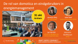
Op 31 oktober organiseren FAN en TKI Urban Energy de tweede fysieke netwerkbijeenkomst van de Smart Energy Community, in het testlab van ElaadNL, Arnhem, met als onderwerp:
Domotica en Home Energy Management Systems in de praktijk
Eindgebruikers aan het woord
Hoe weerbarstig is de praktijk? Sommige eindgebruikers zijn zelf al aan de slag gegaan met domotica om hun energiegebruik slim aan te sturen. Wij laten drie van deze enthousiastelingen aan het woord: Jan Kerdel, Michiel Damoiseaux & Harm van den Brink. Wat zijn hun ervaringen? Waar liepen ze tegenaan?
Setting the scene: HEMS & Domotica
Jasmijn Kleij van TKI Urban Energy gaat in op de vraag of Domotica ook kansen op voor slim energiemanagement biedt, of dat het nu nog vooral een oplossing voor de enthousiaste knutselaars.
Praktische lessen uit Belgie
Giovanni Oorthuizen van Xemex zal een presentatie geven over de nieuwe wet- en regelgeving in België, hoe zij daarop inspelen met energiediensten, en hun ervaringen met eindgebruikers.
En verder
* Paneldiscussie over Domotica, energiemanagement en de rol van de eindgebruiker
* Speeddaten & netwerken
Aanmelden
https://www.aanmelder.nl/smartenergyday/subscribe
Volledige programma ochtendsessie:
https://www.aanmelder.nl/smartenergyday/wiki/924116/ochtendprogramma
Volledige programma middagsessie: 'Smart Energy Day 2.0', georganiseerd door TKI Urban Energy, Dutch Power, Connectr, RVO en ElaadNL
https://www.aanmelder.nl/smartenergyday/part_program
Amsterdam Smart City,
Connector of opportunities
at Amsterdam Smart City,
posted
Amsterdam Smart City at the Smart City Expo World Congress in Barcelona!

It’s almost that time of the year again. From 7 till 9 November, The Smart City Expo World Congress (SCEWC) will take place in Barcelona. SCEWC is an important meeting place for smart city experts from all around the world. By promoting urban innovation and facilitating collaboration opportunities, the event is dedicated to creating a better future for cities and their citizens. The Amsterdam Smart City team will again be joining the Dutch delegation to SCEWC, where together with our partners we will host several keynotes, workshops and visits to other pavilions.
In collaboration with partners from the Amsterdam Smart City network, including Amsterdam Trade & Innovate (municipality of Amsterdam), the Green Innovation Hub (municipality of Almere), AMS Institute, the province of North-Holland, BTG, and the Amsterdam Economic Board, we are organizing various activities on and around the expo. Find an overview of the programme below and keep an eye on this post for further updates leading up to the event.
Sunday - 5 November
Welcome drinks (17:00 – 18:30) (invite only) with the Green Innovation Hub, Amsterdam Trade & Innovate and Amsterdam Smart City.
Official kick-off reception (from 18:30) by RVO for all Dutch participants in Barcelona.
Monday - 6 November
Innovation bike tour (10:00 – 14:30) (invite only) organised by Amsterdam Smart City and Green Innovation Hub. introducing Barcelona’s key approaches to urban planning. Followed by a tour of Tech Barcelona Hub and lunch.
Tuesday - 7 November
Official start of SCEWC and Tomorrow.Mobility.
Panel discussion ‘All Aboard! The Future of Transport of Public’ (10:30 – 12:00). Our colleague Chris de Veer is part of this panel at Tomorrow.Mobility and will be speaking about the Amsterdam Smart City “Emission-free Travel to Events” Mobility Challenge.
Outgoing delegation to Microsoft Pavilion (11:00 – 12:30) led by Cornelia Dinca, International Liaison for Amsterdam Smart City.
Keynote ‘Open Innovation for Liveable Cities: The Case of Amsterdam Smart City’ (13:00 – 13:15) by Leonie van den Beuken in the Green Room (Congress area).
Outgoing delegation to EIT Urban Mobility (13:30 – 14:30) led by Cornelia Dinca, International Liaison for Amsterdam Smart City.
Opening drinks at the Dutch Pavilion (17:00).
Wednesday - 8 November
Visit SCEWC
Outgoing delegation to European Commission Pavilion (timing TBA) led by Cornelia Dinca, International Liaison for Amsterdam Smart City.
Keynote by Danny Frietman, Green Innovation Hub, at the Microsoft Agora (17:00 – 17:20) about the Minecraft Challenge for Pampus District in Almere.
Network session for floating urban development (12:30-14:00) organised by AMS Institute, municipality of Amsterdam and Amsterdam Smart City (location: Microsoft Pavillion)
In this session, we are looking to connect with representatives from delta and waterfront cities that are looking at the water surface for new developments, as no city can or should be solving these challenges by themselves. As a networking event, we are looking to connect with cities that are interested in partnering up with Amsterdam for a floating future. Do you want to join this session? Contact Sophie via sophie@amsterdamsmartcity.com!
Market consultation mobility for floating urban development (14:00-15:30) organised by AMS Institute, municipality of Amsterdam and Amsterdam Smart City (location: Microsoft Pavillion)
Large scale, high density floating districts are a relatively new phenomenon in (Dutch) urban developments. As a new phenomenon, experience on mobility, accessibility and logistics for such developments is scarce. The session aims to map which solutions exist, who are their providers, what are their challenges and opportunities, and what interesting combinations of solution(provider)s can be made. It serves to collect insights on the (technological) developments and innovations for mobility solutions for floating urban developments. Do you want to join this session? Contact Sophie via sophie@amsterdamsmartcity.com!
Thursday - 9 November
Visit SCEWC
Keynote by Boen Groothoff, municipality of Amsterdam, at the Microsoft Agora (12:00 – 12:20) about the Modal Shift Monitor and AI for mobility in Amsterdam.
Amsterdam Smart City x SPIE roundtable session (invite only) about energy networks, technological market solutions and cooperation with society.
Are you also in Barcelona and do you want to join us for any of the above activities? Please contact Sophie at sophie@amsterdamsmartcity.com. Additional information about programming of Dutch partners can be found here. We’re looking forward to meet you there!
Noor Veenhoven,
Program manager energy & circularity
at Amsterdam Smart City,
posted
Demoday #21: Bringing Circularity to Small and Medium-Sized Businesses
Drawing by Govert van der Heijden from Flatland
The city of Amsterdam has ambitious circular goals, aiming to halve its resource usage by 2030. This corresponds to a yearly reduction in material use of the size of 15 Amsterdam Arenas. Collaboration amongst stakeholders, including small and medium-sized businesses (SMBs), is necessary to meet this target. In a work session, the focus was on engaging SMBs in the circular transition.
Ambitions and Strategy of the City of Amsterdam (Mariska Joustra):
The City of Amsterdam aims to reduce its use of new raw materials by 50% by 2023 and become fully circular by 2050. Using the Monitor Circular Economy, Amsterdam tracks its progress in the circular economy, enabling them to develop a strategy to achieve their ambitious objectives.
One of the key points of this strategy is to shift the focus from the city's organization to "Collaborating with the City" to better support entrepreneurs in the circular transition. Examples of how they try to achieve this are:
- Initiatives such as scaling up sustainable artificial turf fields through a significant procurement process.
- Using circular procurement as a means of encouraging companies to provide circular products.
- Mandating at least 20% of new construction to be timber-based.
- Offering a circular assessment to local manufacturers, allowing them to explore steps towards greater circularity.
“Rode Draden Raport” from the Versnellingshuis (Gabrielle Werkhoven):
The Versnellingshuis is an organisation that aids entrepreneurs in advancing circular business practices. Each year, they produce a Red Threads (Rode Draden) report that outlines the key issues in the circular economy. Their focus is on mobilizing the entire supply chain, which can be challenging. Process facilitators are vital for fostering circularity throughout the entire chain. Provinces like Noord-Holland and Zuid-Holland have lists of such facilitators to assist in making the entire chain more circular.
However, challenges persist, as the costs and benefits can vary significantly between different chain participants, making it difficult to implement systemic changes fairly.
Panel Discussion
Following the presentations, a discussion took place involving Jack Stuifbergen (MKB Nederland), Julius Heyning (Gekko), and Joanne Lucas (HvA), who represented the SMB sector. They highlighted the following key points regarding challenges and opportunities:
- Existing strategies, initiatives, and tools tend to benefit circular frontrunners within the SMB sector, often leaving the rest behind.
- Entrepreneurs often face legal obstacles in their sustainability efforts.
- Entrepreneurs need more financial incentives to transition to circular business models. The concept of "true price" could make a significant difference.
- Many entrepreneurs find it challenging to determine how to make their business more sustainable, particularly in sectors like software, where the environmental impact is not readily apparent.
- The Corporate Sustainability Reporting Directive (CSRD) offers significant opportunities for increasing circularity. It is crucial to ensure that SMBs are well-informed about the implications of this legislation.
Anne Schaap (MVO Nederland), Kornelis de Jong (municipality Haarlemmermeer), Gabrielle Werkhoven (Versnellingshuis), and Mariska Joustra (municipality of Amsterdam) discussed their efforts to support entrepreneurs:
- Simplifying the concept of circularity to emphasize resource savings and optimize logistics.
- Hosting events to educate SMBs about circularity, offering a platform for frontrunners in circularity.
- Collaborating with organisations like Triodos to assist entrepreneurs.
The consensus of the discussion was that more needs to be done to make circularity a pressing concern for the average SMB, their sense of urgency needs to be increased on this issue. More can be done for the front-runners as well because even though they receive considerable support, they still face legal and collaborative challenges.
This question was introduced in the Amsterdam Smart City network by Mariska Joustra from gemeente Amsterdam. The session was prepared with and moderated by Roos Kramer from Royal HaskoningDHV. Do you have any questions or input for us? Contact me via noor@amsterdamsmartcity.com or leave a comment below.
Stay up to date
Get notified about new updates, opportunities or events that match your interests.
Set up preferences


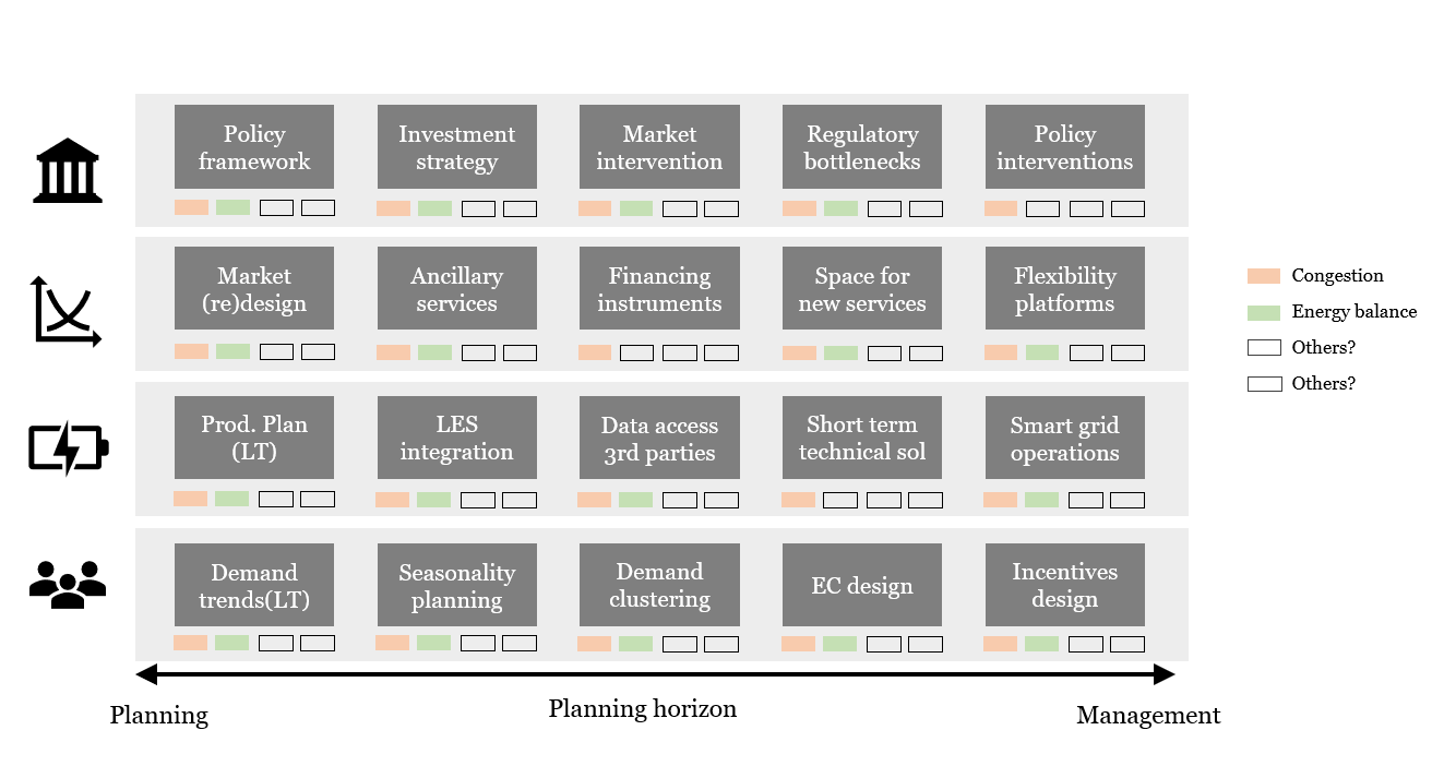