🚶♀️ How walkable is Amsterdam? 🚶♂️
🏘️ Ever wondered how pedestrian-friendly is your neighbourhood?
Do you feel encouraged and safe to walk in your surroundings?
Do the streets have too much traffic 🚦 and not enough trees 🌳?
I am thrilled to introduce to you the newest sibling of CTwalk: CTstreets Map!
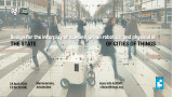
CTstreets is a web tool that highlights how walkable Amsterdam is 🚶♀️ 🚶♂️
It uses openly available data sources and provides information on how walkable neighborhoods, walksheds (5 and 15-minutes), and streets are.
CTstreets was developed through a participatory approach in three main steps:
📖 We studied the literature and made a list of all the factors that are most commonly found to impact walkability.
💬 We asked urban experts who work in Amsterdam to prioritize the identified walkability factors while considering the characteristics and citizens of Amsterdam.
💯 Based on our discussions with the experts we created overall walkability scores, and scores per theme (e.g., related to landscape or proximity) and visualized them.
👀 Explore the web tool here:
CTstreets Map
[currently does not support mobile phones or tablets]
🔍 Learn more about CTstreets Map:
Documentation
On a more personal note, it was wonderful collaborating with Matias Cardoso to develop this project. CTstreets draws significantly from Matia's MSc thesis "Amsterdam on foot," which is openly accessible and you can read here: https://lnkd.in/eyj3dpBZ
Disclaimer:
The estimated walkability scores are heavily based on the availability and quality of existing data sources. The reality is undoubtedly more complex. Walkability can be also personal and the presented scores might not reflect everyone’s point of view. Ctstreets is practically a tool aiming to enable the exploration of factors that impact walkability according to the experts in a simple, interactive, and fun way.