Stay in the know on all smart updates of your favorite topics.
Highlight from
Jill Vink,
Communication
at Amsterdam InChange,
posted
An Innovative Summer: Tips from Amsterdam InChange

Summer wouldn’t be complete without our annual Innovative Summer tips! This season, soak up the sunshine and get inspired by everything the city has to offer. From exploring the future of energy to dancing on a science museum rooftop, Amsterdam is bursting with opportunities to experience innovation, sustainability, and creativity. Here are six highlights from Amsterdam InChange to help make your summer not just memorable, but also meaningful.
1. Kwaku Festival x Innofest
Innofest is teaming up with Kwaku Festival to turn the festival atmosphere into a testing ground for sustainable innovations. For four weeks, Kwaku brings together music, dance, art, and food rooted in the Surinamese community and enriched by influences from the Caribbean, Africa, and beyond. This summer, Innofest will be testing two of its innovations live at the festival. Curious to find out which ones? Check them out on their website.
2. SAIL Amsterdam
Experience history and the future on open water. Every five years, the world’s largest tall ships dock in Amsterdam for SAIL: a celebration of maritime heritage and innovation. Due to COVID, it’s now been ten years since the last edition. In August 2025, SAIL returns not only with beautiful ships but also with important themes like the energy transition and green logistics.
3. Music on the Roof of NEMO
Spend your summer evenings on NEMO’s rooftop, where live music meets stunning city views and a dose of science. The rooftop becomes a spot for concerts, interactive exhibits, and inspiring ideas around energy and sustainability. A good mix of culture, curiosity, and summer vibes.
4. Climate festival at De Hortus
Get active in the climate conversation. Set in the lush botanical gardens of De Hortus, the Climate festival offers workshops, talks, and art installations focused on climate change and ecological resilience. It's a moment to reconnect with nature and find actionable hope.
5. Waag Open: Energy of the Future
Reimagine how we power our lives. Hosted by Waag Futurelab, this edition of Waag Open explores the future of energy. You'll go on an excursion to the Buiksloterham neighborhood, where all aspects of the energy transition come to life. Discover how deep the boreholes for thermal energy storage go, and learn exactly where the heat for the district heating system comes from.
6. The Digital Fabric of Political Violence
Discover how technology shapes conflict. At Pakhuis de Zwijger, this event explores how digital tools and social platforms contribute to modern political violence. Through research and open dialogue, you’ll learn more about the intersection of tech, power, and resistance.
Do you have any other interesting tips? Share them below!
Highlight from
Amsterdam InChange,
Connector of opportunities
at Amsterdam InChange,
posted
Jaarverslag Amsterdam InChange 2024
Met trots presenteren we het jaarverslag 2024 van Amsterdam InChange!
We kijken terug op een bijzonder jaar waarin we niet alleen onze programmaonderdelen verder hebben versterkt, maar ook succesvol de transitie hebben gemaakt naar onze nieuwe naam en branding. Daarnaast hebben we nieuwe vraagstukken opgepakt en onze Challenge-aanpak verder ontwikkeld — lerend door te doen, samen met onze partners.
Het samenstellen van dit verslag is elk jaar weer een feest. De verzamelde Challenges en bijgevoegde verslagen laten zien hoe we samen bouwen aan een rijke, diverse broedplaats: een tussenruimte waar innovatie tot bloei komt.
In dit jaarverslag lees je meer over de Challenges van afgelopen jaar, de events die we organiseerden, en de thema’s die we als netwerk verkenden tijdens kennissessies, werksessies, deepdives en Data Dilemma’s.
Hieronder vind je alvast de highlights. Wil je meer weten? Lees dan hier het volledige jaarverslag 2024.
Highlights
- Nieuwe naam en branding gelanceerd: De officiële introductie van onze nieuwe naam Amsterdam InChange, samen met vernieuwde branding en een frisse visie voor de toekomst.
- 15-jarig jubileum: Ons 15-jarig bestaan gevierd in Ruigoord, samen met ons partnernetwerk en community leden.
- ATELIER verbonden aan ons netwerk: Het Europese ATELIER-project is officieel opgenomen in het netwerk van Amsterdam InChange.
- Mentorstad op internationaal niveau: Een fysiek internationaal programma gehost als onderdeel van het ICC Programma, waarin we onze rol als mentorstad hebben versterkt.
- Challenges opgepakt: Naast diverse andere vraagstukken hebben we ons structureel gericht op belangrijke thema’s zoals mobiliteitsrechtvaardigheid, zero-emissiezones, laadpleinen, circulaire laadinfrastructuur, de coöperatieve metropool, de ondergrond en nutshubs.
- Europese aanvraag Nutshubs: Met een consortium een aanvraag ingediend om de ontwikkeling van Nutshubs mogelijk te maken.
- Data Dilemma’s: Eén van de Data Dilemma’s events in samenwerking met onze partner Hieroo georganiseerd en gehost.
- Interdisciplinaire afstudeerkring: Een primeur! De eerste interdisciplinaire afstudeerkring begeleid in samenwerking met de HvA en de Provincie Noord-Holland.
- 49 delegaties ontvangen: Ook dit jaar hebben we weer groepen van over de hele wereld verwelkomd om meer te vertellen over Amsterdam InChange, het netwerk, en innovatieprojecten uit de regio.
Tim van de Laar,
Project management, Scale Up, Innovation Partnerships, Sport
at City of Amsterdam: Ingenieursbureau Amsterdam,
posted
Amsterdam and Haarlem launch groundbreaking sustainable artificial turf pitch innovations
The pioneering innovations were presented of the Scale Up Future-proof artificial turf pitches project, a collaboration between Amsterdam and Haarlem focused on sustainable artificial turf pitches. Over the next few years, more than 250 sports pitches in both cities will be transformed into circular, energy-generating and climate-adaptive sports venues. These artificial turf pitches can not only generate and store energy, but also involve smart water management. An approach that is globally relevant for urban sports infrastructure.
Three consortia collaborate on the sport pitch of the future
The three selected consortia Antea Sport, EnergieVeld and GOO4iT together comprise more than 15 market players. They join forces within this innovation partnership, where there is room for long-term collaboration, co-creation and scalable innovation. The pioneering solutions will make it possible to cool down sport pitches on warm days, help dispose of and collect rainwater, make the pitches more pleasant for the users and possibly even generate energy for the surrounding area. Find out how these innovations are shaping the sport pitch of the future here.
Two municipalities: joint procurement
The Scale Up Future-proof artificial turf pitches project is a unique collaboration between two municipalities and market players. The municipalities jointly procure pooling their purchasing power and use an innovation partnership to challenge the market to test and scale up innovative and sustainable solutions. In doing so, the solutions are also scalable and transferable to other cities in the Netherlands and Europe.
From prototype to pilot fields
The first prototype fields will be constructed in Amsterdam and Haarlem in 2026, in different capacities and combining multiple innovations, where they will be extensively tested and monitored for a year. Successful concepts are then scaled up to full-scale pilot pitches and tested and monitored for another year. This will form the basis for the new standard of sustainable sports pitches, with potential for adoption in other cities around the world. At the same time, existing pitches are already being improved with the most sustainable solutions available, making an immediate impact from the start. The project thus shows how cooperation between municipalities and market players can lead to innovative, climate-proof sports infrastructure with international relevance.
Join us
This project provides cities worldwide a blueprint for sustainable, smart, and future-proof artificial turf pitches. Interested municipalities and industry partners can get in touch and subscribe to our news updates by sending an e-mail to: sportveldvandetoekomst@amsterdam.nl.
Make this your personal feed
Amsterdam InChange,
Connector of opportunities
at Amsterdam InChange,
posted
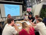
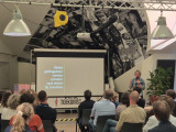
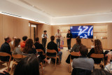
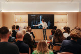
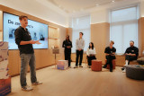
Recap of Demo Day #28
On June 5th, we were welcomed at the Huis van de Toekomst (House of the Future) in Amsterdam South-east for our 28th Knowledge and Demoday! Former Amsterdam Smart City director Leonie van den Beuken hosted the event. It was a day full of enthusiasm, positive energy, and fresh insights.
In this article, we’ll give you a quick overview of the Knowledge Session, Work Sessions, and Pitches. Want to dive deeper? Read the full reports by our team members Noor, Pelle and Jill (linked below).
About our Demo Days
Demo Days are one of the key tools we use to stimulate innovation and foster connections between our partners and the broader community. The purpose is to showcase the progress of various innovation projects, ask for support, share challenges, and engage more partners to help take these projects to the next level. More information about the Demo Days can be found here.
Knowledge Session: Behavioural Change
Behavioural scientist Reint Jan Renes (Amsterdam University of Applied Sciences) delivered an inspiring session on behavioural change. Why do people, despite good intentions and awareness, continue unsustainable practices? And what does it really take to achieve lasting behavioural change, especially among more affluent groups? Read Jill’s full report here.
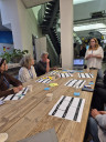
Work Sessions
Circular | Designing for Circularity in the Port of Amsterdam
This session addressed one of the key challenges of the circular transition: how can we make the Port of Amsterdam fully circular? The City of Amsterdam has set an ambitious goal to become fully circular by 2050. A transformation that includes the port. Achieving this will require deep collaboration and innovation. Read Noor’s full report here.
Mobility | From Policy to Practice: Inclusive Design Ambitions of the Amsterdam Transport Authority
Together with a diverse group of network partners, we explored inclusive design in mobility projects. Inclusive mobility is a key theme in regional policy, based on the idea that everyone — regardless of age, income, disability, gender, or background — should be able to travel safely and comfortably. This session aimed to co-create an initial action plan for implementing inclusive design principles in mobility. Read Pelle’s full report here.
Energy | How to Keep Our Mechanics on the Move?
This session focused on a major challenge in the energy transition: grid congestion, and specifically, how to ensure grid maintenance workers can continue operating effectively. Alliander’s Operation 2.0 team is exploring innovative ways to work smarter, faster, and more flexibly to keep up with the demands of the transition. Read Noor’s full report here.
Digital | Transformation Canvas
In the Digital work session, the spotlight was on the Transformation Canvas: a powerful tool to turn complex societal challenges into actionable strategies. Ocean Conijn from the Digital Society School guided participants through the framework, using the example of how data could support healthier eating habits among students. Read Jill’s full report here.
Pitches
We also featured a series of inspiring pitches from innovators within our network. Here's a quick look at the topics presented:
- Gocimo – Electric scooters with a smart battery-swapping system
- Amsterdam University of Applied Sciences – Design-based research into Civic Protocol Economies
- Interdisciplinary Graduation Group | Zero Emission Urban Logistics – Research outcomes
- VU Amsterdam Students – Living, Learning Networks in Motion
- Energy Lab Southeast | LIFE Project
Noor Veenhoven,
Program manager energy & circularity
at Amsterdam InChange,
posted
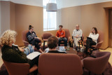
Demoday #28: Designing for Circularity in the Port of Amsterdam
During Demoday #28, we focused on one of the key challenges in the circular transition: how can we make the Port of Amsterdam fully circular?
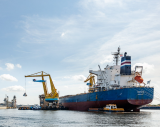
The Amsterdam port is one of the largest in Europe. It functions as a major energy hub, where fossil fuels still play a central role, and as an industrial hub, where massive flows of raw materials pass through. The City of Amsterdam has set the ambitious goal of becoming fully circular by 2050. This means the port must transform as well. This is a complex and far-reaching task that requires collaboration and innovation.
In this work session, we zoomed in on circular design: how can we make products and processes circular from start to finish?
A closer look at the port
James Hallworth, Commercial Manager at Port of Amsterdam, opened the session by taking the group on a tour through the world of the port. Located in the western harbour area, the port has two main responsibilities. First, it ensures the smooth and safe handling of all maritime traffic on behalf of the City of Amsterdam. Second, it manages and develops the land and industrial areas around the harbour.
To tackle circularity, Port of Amsterdam applies industrial ecosystem thinking. In nature, waste does not exist, and the same principle should apply here. The port aims to build collaborative networks between companies, where waste flows from one company becomes raw materials for another. There is already significant activity around recycling and recovery, but more can be done in higher-value strategies on the R-ladder, such as repurposing, remanufacturing, and refurbishment. Circular by design is a key concept in this shift.
The port is transitioning from measuring success in tons to measuring added value. This shift also means thinking differently about space: circular systems require space to receive, process, and recover valuable materials from waste streams.
Getting hands-on with circular design
Creating a fully circular production process is easier said than done. That’s why we worked through two real-world cases: construction materials and e-bikes. Participants split into groups and explored what a truly circular production process might look like. We also explored the potential role the port could play as an enabler of circular supply chains.
Some key takeaways from the session:
• Material passports: A digital document containing material properties and origin can greatly simplify recycling and reuse.
• Monomaterials: Products made from a single type of material are much easier to separate and recycle at the end of life.
• Smart synergies: Mapping which companies can use each other’s waste flows as input can unlock huge circular potential.
• Financial incentives: Right now, circular processes are often more expensive than linear ones. Smart financial mechanisms could help bridge that gap.
• E-bike challenges: In the case of e-bikes, batteries were flagged as a challenge. Recycling them is still very difficult, and since they are mostly produced outside of Europe, it’s hard to have control over the production process.
This session invited participants to take a step back and view products through a circular lens. The port has the potential to become a key player in the circular transition, but to get there, it will need ideas, insights, and input from across the network.
<strong>Do you have ideas on how the Port of Amsterdam can become more circular? Or would you like to contribute to future sessions? Get in touch with Noor at noor@amsterdaminchange.com. A big thank you to James Hallworth from Port of Amsterdam for bringing this challenge to the network, and Yanti Slaats (Amsterdam University of Applied Sciences) for moderating the session.</strong>
Pelle Menke,
Communications and Programme officer Mobility
at Amsterdam InChange,
posted
Demoday #28: From Policy to Practice: Inclusive Design Ambitions of the Amsterdam Transport Authority
On the 5th of June, during the 28th Knowledge and Demo Day, we explored the topic of Inclusive Design in the context of mobility projects together with a diverse group of network partners. Iris Ruysch introduced the theme on behalf of the Amsterdam Transport Authority (Vervoerregio), while David Koop and Lotte de Wolde from our knowledge partner Flatland facilitated the session format, moderation and visual notes.
The ambition of the Amsterdam Transport Authority
The Amsterdam Transport Authority is responsible for public transport across fourteen municipalities in the region and is working towards a mobility system that enables people to travel quickly, safely and comfortably by public transport, bicycle or car. In addition to organising and funding public transport and investing in infrastructure, the Authority actively contributes to broader societal goals such as sustainability, health and inclusivity.
Inclusive mobility is one of the key themes within the wider mobility policy. The central principle is that everyone – regardless of age, income, disability, gender or background – should be able to travel well and comfortably throughout the region. This calls for a mobility system that is accessible, affordable, appropriate, socially safe and welcoming.
The aim of the session on 5 June was to work with the network towards an initial action plan for applying inclusive design principles in mobility projects. Iris is keen to ensure that the ambitions around inclusivity are not only stated in policy and vision documents but are truly embedded in the organisation – from policymakers to implementation teams.
Session set-up
After an introduction by Iris on the context and ambitions within the Transport Authority, we got to work. In small groups, participants explored the profile of the implementing civil servant (using a persona canvas) and considered desirable changes in approach; in terms of attitude, skills and collaboration.
We then used the Inclusive Design Wheel to examine how existing programme components of the Authority could be made more inclusive. In pairs, we tackled themes such as accessible travel information, social safety at stations (specifically for women), and improving bicycle parking facilities.
The Inclusive Design Wheel is an iterative process model that supports the structural integration of inclusivity into design and policy projects. The model emphasises collaboration, repetition, and continuous learning. It consists of four phases:
- Explore: Gather insights about users, their needs, and potential exclusion.
- Create: Develop ideas, concepts, and prototypes that address inclusive needs.
- Evaluate: Test whether the designs are inclusive, collect feedback, and make improvements where necessary.
- Manage: Ensure shared understanding, set goals, engage stakeholders, and embed the process.
Outcomes and insights
While the persona profiles were being developed, I observed the group discussions and noted several important insights to take forward in the development of the action plan:
- Awareness and concrete translation: Implementation teams often already have an intrinsic motivation to contribute to inclusivity goals set in policy. However, they may not always realise how their day-to-day work can support those goals. It’s important to continuously ask the question ‘How, exactly?’. Tools like checklists, templates and practical examples can support this translation from policy to practice.
- Flexible guidelines and not ‘extra work’: Given the differences in scale, pace and content of projects, guidelines need to be flexible. There must also be sufficient room in terms of time and budget. Most importantly, these guidelines and action plans should feel supportive, not like extra rules or bureaucracy. Too many rigid frameworks can backfire.
- Interaction between policy and implementation: There is a need for more two-way communication. Implementation teams want to be involved early in policy development, especially when they will be the ones carrying it out. They also want opportunities to reflect with policymakers on whether policy is being implemented as intended. This allows for timely feedback and course-correction based on real-world experience.
- An Inclusive Design mindset: Beyond sharpened policy documents and a stronger focus on the end user, Inclusive Design also requires a mindset – one that is inquisitive and reflective. Embedding this within the organisational culture will require more than just an action plan.
What’s next
Iris collected valuable input to kick-start the development of the action plan, and participants gained a better understanding of the Amsterdam Transport Authority, the principles of Inclusive Design, and what it takes to move from policy to implementation. This summer, a trainee will start at the Transport Authority to further develop this topic and the action plan. The session, this report, and Flatland’s visual notes provide a strong foundation to build on. We’ll be meeting with Iris and David to explore how we can support this follow-up.
Would you like to learn more about any of the topics or developments mentioned in this report? Feel free to email pelle@amsterdaminchange.com.
Noor Veenhoven,
Program manager energy & circularity
at Amsterdam InChange,
posted
Demoday #28: How to keep our mechanics on the move?
On the 5th of July, during Demoday #28, we zoomed in on one of the pressing challenges facing the energy transition: grid congestion, and more specifically, how to keep the people who maintain the grid moving efficiently.
Grid congestion is a serious and growing concern for grid operator Alliander. It is therefore essential to speed up the grid reinforcement as much as possible. Alliander’s Operation 2.0 team is exploring innovative ways to work smarter, faster, and more flexibly to keep pace with these developments.
Their efforts focus on three tracks:
• Alleviating staff shortages by training office employees to occasionally support fieldwork.
• Exploring technologies like advanced ground radar to get better insights into underground assets.
• Improving the logistics of supplying mechanics to ensure they have the right tools, in the right place, at the right time.
This last track was the main focus of our work session.
Inefficient supply of mechanics
Logistics experiences show that mechanics collect materials inefficiently when supplying their vans and jobs, resulting in stock corrections, less control over stock, unnecessary work for logistics staff, and valuable mechanic hours being lost, which leads to less execution work. A few key problems stood out:
• Supplies are scanned inconsistently, so the system doesn’t reflect what is actually in stock.
• Every van is different, with a custom layout that suits the preferences of its mechanic.
• The work itself is unpredictable, which makes standardised restocking difficult.
• With a transition to smaller electric vans, space is becoming even more limited.
A simple optimisation of the process is not enough, especially without considering the human element. For many mechanics, a visit to the supply centre is more than just logistics. It is a moment of connection, a short break from the road, or simply a chance for a good coffee.
Ideas from the network
In groups of four, we brainstormed creative ideas to improve the supply of Alliander vans while keeping the needs and routines of mechanics in mind.
Some highlights:
• Peer-to-peer van inspiration: Let mechanics share the layout of their vans with colleagues. They can exchange best practices and take pride in an efficient setup. Adding a bit of gamification might boost motivation even more.
• A mobile supply service: A supply van could drive around to restock mechanic vans, reducing the need to visit the supply centre. However, this might remove the social element of taking a break with colleagues.
• Smarter routing: Track the location of mechanics only in relation to nearby grid faults. This way, the closest available mechanic can respond without feeling like their movements are constantly being monitored.
• Package-based resupply: Inspired by delivery service Picnic, mechanics could exchange complete “supply packages” instead of picking out materials individually. Collaborating with wholesale suppliers could reveal more useful insights.
• Automatic stock tracking: Tag all materials with RFID chips and use sensors installed in the door of the van to register what is removed from the van. This eliminates the need for manual scanning and reduces the chance of mistakes.
Do you have a bright idea to improve how mechanics work? Let us know in the comments or send a message to Noor at noor@amsterdaminchange.com.
A big thank you to Thomas Hoekstra and Iris van der Zanden from Alliander for bringing this challenge to the network, and to Chantal Inia from Royal HaskoningDHV for moderating the session.
Jill Vink,
Communication
at Amsterdam InChange,
posted
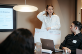
Demoday #28: Transformation Canvas
At the 28th Knowledge and Demo Day on July 5, the ‘Digital’ workshop focused on the Transformation Canvas: a powerful tool for translating complex societal challenges into actionable strategies for change. Ocean Conijn from the Digital Society School guided participants through the framework, using the question of how data can support healthier eating habits among students as a real-world case study.
What is the Transformation Canvas?
The Transformation Canvas helps teams and organisations break down societal or systemic issues into five essential components:
- Situation – What is the current context?
- Transformation – What does the desired change look like?
- Outcome – What are the best- and worst-case scenarios?
- Change – What shift do we want to see (from – to)?
- Research Question – What is the central question?
This structure provided a clear framework during the session, where participants worked on a self-selected case study.
From Supermarket Data to Behavioural Change
The session began with a participant's question: supermarkets hold valuable data on purchasing behaviour but don’t share it due to commercial interests. How can we shift this mindset?
As the discussion progressed, the focus shifted from “What do we want to know?” to a more fundamental question: “Why do we want to know it?” Students often eat unhealthy when they are at school. The central challenge became: how do we break this pattern using both data and behavioural insights?
What Did We See?
Current Situation:
• Supermarkets hold crucial data on eating behaviour.
• Municipalities want to use this data to shape health policies.
• But there are concerns around privacy, ownership, and commercial interests.
Desired Transformation:
• Not just access to data, but a shared sense of urgency among all stakeholders.
• Healthy eating becomes a natural part of daily life (for students and companies).
Scenarios: From Worst to Best Case
Worst case:
• No access to usable data
• Increasing resistance from businesses
• Poor representation among participants
• Data turns out to be unreliable or incomplete
Best case:
• Open and secure data sharing
• Real behavioural change among students
• Supermarkets adapt their product offerings
• Companies take the initiative in the food transition
From Idea to Action: Creative Solutions
Participants were challenged to imagine solutions they could start building tomorrow. Some ideas included:
• “Snack Rehab Clinic” – A playful but serious intervention where individuals gain awareness of their eating behaviour and voluntarily share data to break habits.
• Collaboration with supermarkets like Albert Heijn via the Bonus app – By using personal purchase data, users could be ‘nudged’ toward healthier choices, with transparency and rewards at the core.
There wasn’t enough time during the workshop to complete the entire canvas, but participants got a preview of how the tool works in practice. Are you curious about the Transformation Canvas or interested in using it in your own work? Send us a message, and we’ll connect you with Ocean from the Digital Society School.
Amsterdam InChange,
Connector of opportunities
at Amsterdam InChange,
posted
Knowledge and Demo Day #28: Behavioural Change
Why do people, despite good intentions and awareness, continue to engage in unsustainable behaviour? And what does it really take to bring about lasting behavioural change — especially among affluent groups? These questions were central to an inspiring session by behavioural scientist Reint Jan Renes (Amsterdam University of Applied Sciences) at our 28th Knowledge and Demo Day.
Record-breaking heat, floods, avalanches, and prolonged droughts — alarming news stories bombard us daily. The planet is in crisis. And yet, we continue with behaviours that harm the climate and increase our ecological footprint.
Why don’t we change?
Over 75% of Dutch citizens regularly express significant concern about climate change. Yet these concerns rarely translate into real, lasting behavioural shifts. The climate is changing—so why aren’t we?
“Many people agree that ‘something’ needs to be done about climate change,” says Reint Jan Renes. “But that willingness drops sharply the moment plans become concrete.” Few are prepared to take real responsibility. This leads to a growing gap between words and actions.
Who should act? We should!
The richest 10% of the global population is responsible for roughly half of all CO₂ emissions. Meanwhile, the poorest 50% contribute just 8%. So the responsibility falls squarely on us—to address the problems we have helped create.
Yet we don’t act. We feel entitled to behaviours that heavily burden the climate: eating meat daily, regularly buying new clothes or gadgets, taking frequent flights. We know it’s harmful to the planet—and we do it anyway. Why?
Coping strategies
We’re remarkably good at justifying our actions: “What difference does one time make?” Or: “Everyone else is doing it.” “My neighbour is much worse than I am.” “I already do some good things—don’t expect me to do more.” And: “Scientists keep changing their minds. I read somewhere it’s not that bad after all.”
Sound familiar? Then you’ve likely used some of these coping strategies too.
This lack of personal ownership leads to a “steady state”—a status quo in which everyone looks to someone else to take the first step. Many believe governments should lead, since they have the authority to initiate and enforce change. But research shows that governments often take a surprisingly passive role in social transitions.
Speak up and be visible
So what does help? People are more inclined to adopt sustainable behaviour when they hear about the concrete actions others are taking. Do you eat (less) meat? Take your bike or public transport? Talk about it positively. Start conversations about climate-harmful behaviours.
Make your actions visible. This has an even greater impact when individuals and organisations regularly appear in the media. It helps correct the false belief that few people care about the climate—or that you're among a rare few making an effort.
Talking openly about climate-positive behaviour is crucial for shifting social norms. Demonstrating it in everyday life is inspiring. Both can act as powerful drivers to accelerate the transition. And that’s vital. Especially in light of another research finding: Climate-friendly behaviour makes us happier.
Susanna Stroer,
Communication
,
posted
Nomineer jouw AI-toepassing voor de Dutch Applied AI Award 2025

Heb of ken jij een vernieuwend initiatief op het gebied van toegepaste Artificiële Intelligentie? Nomineer deze toepassing dan voor de Dutch Applied AI Award! Je hebt nog twee weken de tijd om jouw initiatief aan te melden.
Het is dit jaar voor de zesde keer dat deze juryprijs tijdens de jaarlijkse Computable Awards wordt uitgereikt. Sinds 2020 beloont het Centre of Expertise Applied AI van de Hogeschool van Amsterdam samen met ICT-platform Computable en podcast De Dataloog een innovatieve AI-toepassing.
Daarbij beoordeelt de jury - bestaande uit zes experts op het gebied van Applied AI - alle inzendingen op drie criteria:
· Applied AI - in hoeverre is de oplossing al geïmplementeerd, wordt het gebruikt door de beoogde doelgroep en hoe groot is het aantal (potentiële) klanten/het aantal mensen dat met deze innovatie direct of indirect wordt geholpen.
· Uniekheid - in hoeverre is de innovatie de enige in haar soort, is het nooit eerder op de markt gebracht en kan het doel van de innovatie niet op een andere manier worden behaald.
· Responsible AI (transparantie, privacy, fairness, etc.) - in hoeverre is het ontworpen of gebruikte AI-algoritme transparant. Stelt het de gebruiker in staat om verantwoording af te leggen en duidelijk te zijn over de factoren die de algoritmische beslissingen beïnvloeden.
Je kunt een initiatief tot maandag 16 juni 2025 voordragen via https://awards.computable.nl/nomineren/dutch-applied-ai.
Uit alle inzendingen maakt de jury een top 3. De winnaar wordt op dinsdag 18 november 2025 verkozen tijdens de uitreiking van de Computable Awards in de Jaarbeurs Utrecht.
Meer informatie
Eerdere winnaars:
· 2024 - Sturgeon | UMC Utrecht & Oncode Institute
· 2023 - KLM, Mainblades, KPN
· 2022 - WSK Medical | Zeno AI
· 2021 - BAM Infra Asset Management
· 2020 - DEARhealth
Frans-Anton Vermast,
Strategy Advisor & International Smart City Ambassador
at Amsterdam InChange,
posted
“We’re not just creating technology for cities—we’re creating better cities for people.” From Global Goals to Local Action: How Amsterdam Is Building a Smarter, Fairer City
As the world grapples with massive challenges—climate change, rapid urbanisation, digital disruption, and growing inequality—some cities are not waiting for top-down solutions. They are rolling up their sleeves and experimenting with new ways to improve life for everyone, block by block. Amsterdam is one of those cities.
That’s why I was proud to share Amsterdam InChanges approach to smart, inclusive urban innovation at the #CIPPCD2025 conference in Aveiro.
Through our open innovation platform, <strong>Amsterdam InChange</strong>, the city has become a global leader in turning lofty global ambitions into practical, local action. But Amsterdam’s model isn’t built around flashy tech or utopian blueprints. Instead, it’s grounded in an essential question: How can we use innovation to improve people’s everyday lives?
Local Action for Global Challenges
Amsterdam understands that the climate crisis, digital transition, and social inequality can’t be solved by government alone—or by technology alone. That’s why it launched Amsterdam Smart City in 2009 as a public-private partnership. What began as small-scale energy-saving pilots has grown into a community of over 8,500 members, coordinating more than 300 projects across the city and beyond.
The approach is rooted in co-creation. Citizens, companies, knowledge institutions, and government actors come together to design, test, and scale solutions that serve the public good. The values that guide the network are clear: people first, openness, transparency, learning by doing, and public value.
The Doughnut as a Compass
Amsterdam was the first city in the world to embrace Doughnut Economics as a guiding framework. The “City Doughnut,” developed with economist Kate Raworth, helps policymakers balance the city’s ecological footprint with the social foundations that all citizens need: housing, education, health, equity, and more. It’s a tool to align every local decision with both planetary boundaries and human dignity.
This framework has inspired circular construction strategies, neighbourhood energy co-ops, and more inclusive procurement policies. It shows that global concepts can become real when grounded in local practice.
Making Innovation Inclusive
One of Amsterdam’s core beliefs is that smart cities must be <strong>inclusive cities</strong>. That means tackling issues like <strong>mobility poverty</strong>, where rising transport costs and digital-only services make it harder for low-income or elderly residents to get around.
Through the <strong>Mobility Poverty Challenge</strong>, Amsterdam partnered with the Province of North Holland and researchers from DRIFT to understand where and how exclusion occurs—and to design better public mobility systems. Pilot ideas like a “Mobility Wallet” (a subsidy for essential travel) and more inclusive digital apps emerged from real conversations with affected residents.
The same inclusive mindset guides Amsterdam’s digital transformation. In the suburb of Haarlemmermeer, officials flipped the script on e-government. Instead of asking citizens to become “digitally skilled,” they asked how government systems could become more <strong>humane</strong>. This led to simplified interfaces, better access to services, and ultimately more trust.
Responsible Tech and Energy from the Ground Up
Tech transparency is another pillar of the Amsterdam model. The city runs the world’s first <strong>Algorithm Register</strong>, giving the public insight into how AI and automated systems are used in services—from traffic enforcement to housing applications. Anyone can access this register, offer feedback, and better understand how digital decisions are made.
In the energy space, the city supports both bold innovation and careful upscaling. At the <strong>Johan Cruijff ArenA</strong>, used electric vehicle batteries store solar energy, powering concerts and matches with clean backup power. At the same time, a coalition of partners led by Amsterdam InChange is working to scale up Local Energy Systems by collecting lessons learned and creating a toolkit for community-led energy.
What Makes It Work?
If there’s one secret to Amsterdam’s success, it’s the governance model: small, neutral facilitation teams guiding large multi-stakeholder coalitions, anchored by public trust and shared purpose. Regular Demo Days allow project teams to showcase progress, get feedback, and adapt. This culture of transparency and iteration helps avoid the so-called “innovation graveyard,” where pilot projects go to die.
The city also embraces failure—as long as it’s shared and learned from. Reports like “Organising Smart City Projects” openly list lessons, from the importance of strong leadership to the need for viable business models and continuous user involvement.
An Invitation to Other Cities
Amsterdam’s smart city is not a blueprint—it’s a mindset. Start with your biggest local challenge. Bring the right people together. Make space for experimentation. Build bridges between local and global. And, above all, put citizens at the centre.
As international smart city ambassador Frans-Anton Vermast puts it: “We’re not just creating technology for cities—we’re creating better cities for people.”
The III International Conference on Public Policies and Data Science
Amsterdam InChange,
Connector of opportunities
at Amsterdam InChange,
posted
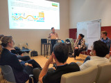
Programma voor Kennis- en Demodag #28
Op 5 juni komen we met het partnernetwerk bijeen voor een zomerse Kennis- en Demodag. We zijn dit keer te gast bij het Huis van de Toekomst in Amsterdam Zuid-Oost. Hieronder lichten we het programma toe.
Over onze Kennis- en Demodagen
De Amsterdam InChange Kennis- en Demodagen zijn regelmatig terugkerende middagen, georganiseerd door en voor ons partnernetwerk. Deze middagen zijn bedoeld om de voortgang van de verschillende innovatieprojecten aan elkaar te presenteren, hulpvragen op tafel te leggen, dilemma’s te delen en meer partners te betrekken bij een project en deze vraagstukken verder te brengen. We starten de middag met een Kennissessie waarin een kennispartner het netwerk verrijkt met specifieke onderwerpen die van belang zijn voor Amsterdam InChange en de transities waar wij aan werken. We sluiten af met een hapje en drankje. De middagen kenmerken zich door een zeer open en vrolijke sfeer.
Kennissessie
De mens in de machine: gedrag als sleutel tot duurzame transities – Reint Jan Renes (gedragswetenschapper Hogeschool van Amsterdam)
De Kennissessie wordt deze keer verzorgd door Gedragswetenschapper Reint Jan Renes. Hij belicht in een interactieve lezing de psychologische kant van duurzame transities. Hij legt uit waarom mensen, ondanks goede intenties en kennis, vast blijven houden aan niet-duurzaam gedrag en wat er nodig is om echte gedragsverandering te bereiken. Met inzichten uit zijn Noblesse Oblige-onderzoek richt hij zich op de rol van welvarende groepen in de klimaattransitie. Thema’s als motivatie, sociale normen en de kloof tussen weten en doen staan centraal. Deelnemers krijgen daarnaast praktische handvatten om duurzame keuzes aantrekkelijker en effectiever te maken in hun eigen werkpraktijk.
Werksessies
Energie | Versnelling van de operatie op het elektriciteitsnet | Thomas Hoekstra en Iris van der Zanden (Alliander)
De energietransitie vraagt van de netbeheerder een aanzienlijke versnelling in het verzwaren van het elektriciteitsnet. Dit vormt een omvangrijke uitdaging, waarbij alle vormen van samenwerking en innovatie noodzakelijk zijn. In deze werksessie richten Thomas Hoekstra en Iris van der Zanden zich tot het netwerk met de volgende vragen: Op welke innovatieve wijze kunnen wij onze operatie versnellen? Van welke innovaties zouden wij nog gebruik kunnen maken, en aan welke oplossingen is bij andere partners in het netwerk behoefte?
Mobiliteit | Inclusive Design | Irisch Ruysch (Vervoerregio Amsterdam) en David Koop (Flatland)
Inclusive design is een ontwerpbenadering die producten, diensten en omgevingen toegankelijk en bruikbaar maakt voor zo veel mogelijk mensen, ongeacht hun leeftijd, achtergrond of fysieke en mentale vermogens. De Vervoerregio onderzoekt hoe ze hier het best een rol in kunnen pakken. Iris van de Vervoerregio en David van Flatland gaan in deze sessie aan de slag met vragen als; Hoe neem je ‘iedereen’ mee in doelgroepenonderzoek? Hoe ga je van onderzoek en beleid over in actie en uitvoering? En wat zijn mooie Nederlandse voorbeelden van Inclusive Design in de praktijk?
Circulair | Circulair ontwerpen en kritieke grondstoffen | James Hallworth (Port of Amsterdam)
Voor veel kritieke grondstoffen zijn we afhankelijk van het buitenland, deze internationale ketens zijn kwetsbaar en vaak ook onwenselijk uit politieke oogpunt. Door ‘circular by design’ principes toe te passen, goed te recyclen en circulair met onze materialen om te gaan kunnen we als stad en regio zelf duurzaam gebruik van kritieke grondstoffen realiseren. Nu gaan er helaas nog een hoop grondstoffen verloren, of middels verbranding of middels export. Hoe zorgen we ervoor dat schaarse en waardevolle grondstoffen niet meer verloren gaan? Wat gebeurt er als we afval niet meer als eindproduct zien? Hoe ontwerpen we systemen, zowel voor productie als de noodzakelijk (retour)logistiek, voor een volledige circulaire stad en regio? In deze werksessie gaan we, samen met de Amsterdamse haven, met deze vraagstukken aan de slag.
Digitaal | TBA
Pitches
Gocimo | Elektrische scooters met een batterijwisselsysteem | Flavie Marie-Dabin
Flavie Marie-Dabin komt pitchen over GoCimo, een Zweeds mobiliteitsbedrijf dat elektrische stadsvervoeroplossingen biedt met een innovatief batterijwisselsysteem. Hun model stelt gebruikers in staat om binnen 10 seconden lege batterijen te vervangen door volle, wat zorgt voor minimale stilstand en ontlasting van het energienet. Met activiteiten in Stockholm, Göteborg, Malmö en Kopenhagen draagt GoCimo bij aan duurzame mobiliteit in de stad. Flavie is op zoek naar Amsterdamse locaties voor de oplaadstations en samenwerkingspartners.
Hogeschool van Amsterdam | Ontwerpend onderzoek Civic Protocol Economies | Iskander
Smit
Hoe kan digitale technologie bijdragen aan een sterke, rechtvaardige gemeenschapseconomie? Binnen de onderzoeksgroep Civic Interaction Design (HvA) verkent Iskander dit via het project Civic Protocol Economies. In dit ontwerpend onderzoek worden prototypes ontwikkeld en netwerken versterkt rondom initiatieven zoals energiecoöperaties, buurtdeelplatformen en wooncoöperaties. Doel is om te onderzoeken hoe digitale platformen en protocollen zulke gemeenschapseconomische initiatieven kunnen ondersteunen. Een driedaagse design-charette in september vormt een belangrijke volgende stap.
Interdisciplinaire afstudeerkring Zero Emissie Stadslogistiek | De onderzoeksresultaten! | Jay van den Boog, Chanel Pinas en Stan van der Meer (HvA)
De afgelopen maanden hebben drie HvA studenten een interdisciplinair onderzoek gedaan op de transitie naar uitstootvrije stadslogistiek. Ze liepen rond op Food Center Amsterdam en gingen in gesprek met kleine ondernemers in de food sector. Deze opdracht is een samenwerking tussen Vervoerregio Amsterdam, de HvA en een werkgroep vanuit Amsterdam InChange. Op 5 juni zullen ze ons in vogelvlucht meenemen in hun onderzoeksresultaten.
Levende Lerende Netwerken in beweging | VU Studenten
Hoe blijft een publiek-privaat netwerk duurzaam en relevant? In samenwerking met Amsterdam InChange en Royal HaskoningDHV onderzoeken wij, 4 studenten aan de Vrije Universiteit Amsterdam, hoe het concept van Levende Lerende Netwerken toegepast kan worden. Onze casus: het unieke netwerk van Amsterdam InChange. Een lerend netwerk waarin AIC als faciliterende partij publieke en private spelers samenbrengt rondom grootstedelijke transities. Samen verkennen we hoe dit netwerk in beweging blijft en blijvend waarde creëert.
Klinkt het programma interessant? Je bent welkom om aan te sluiten. Laat het ons weten en stuur een korte motivatie naar pelle@amsterdaminchange.com. De Kennis- en Demodag is van 12:30-17:00 met een borrel na afloop.
Jorden van der Hoogt,
Strategy and Innovation Lead
at Cenex NL,
posted
🚨 𝗪𝗲'𝗿𝗲 𝗮𝗹𝗿𝗲𝗮𝗱𝘆 𝗮𝘁 𝟱𝟬% – 𝗮𝗻𝗱 𝘄𝗲 𝗵𝗮𝘃𝗲𝗻'𝘁 𝗲𝘃𝗲𝗻 𝗸𝗶𝗰𝗸𝗲𝗱 𝗼𝗳𝗳 𝘆𝗲𝘁! 🚨
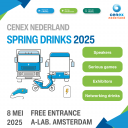
Wow! Half of the tickets for our Cenex Nederland Lenteborrel have already been ordered – and the event isn’t even happening until 8th of May 2025. 🎉
That means: lots of excitement, high expectations, and... an opportunity you don’t want to miss.
The event will be focusing on Transport & Mobility, Circular Mobility, Energy & Infrastructure, where you can expect the following.
📍 What to expect:
✅ Meet exhibitors and explore the latest innovations
🎮 Join or watch two exciting serious game sessions
🎤 Be inspired by four engaging keynotes (English)
🥂 End the day with our annual spring reception where you have the opportunity to network.
Want to join us? Don’t wait too long – the remaining 50% is likely to go even faster. 🎫
Please make sure to get your (free) ticket via Eventbrite
Noor Veenhoven,
Program manager energy & circularity
at Amsterdam InChange,
posted
Underground Challenges and Shared Solutions: Lessons from Amsterdam for District Heating in Haarlemmermeer
How do you install district heating in villages with narrow streets and limited underground space? This was the central question during a recent deepdive session hosted in the municipality of Haarlemmermeer. The session brought together experts from the City of Amsterdam, local officials and experts from Haarlemmermeer, and Arcadis to explore practical solutions to the physical challenges of implementing district heating in dense and complex infrastructure environments.
From complexity to coordination
Amsterdam has years of experience addressing similar challenges in dense urban areas where underground infrastructure is already under pressure. Experts from the City of Amsterdam were invited to share their approach, which combines long-term planning, integrated design processes, and flexibility in applying standards.
Some key principles they shared:
- Planning 15 years ahead: Amsterdam actively involves all utility providers to map out future plans and co-create underground infrastructure layouts.
- Using standard ways of working in the underground (WIOR) and a standardised scheme for subsurface infrastructure planning: These frameworks help assess available underground space and guide decisions when concessions are necessary.
- Embracing alternative methods: Stacking pipelines instead of placing them side-by-side, drilling under roads, or clustering transport cables in walls or consolidated zones are all viable options.
Sometimes, this requires deviating from standard spacing requirements. Such exceptions are only made with strong justification and agreement at the decision-making level.
A fresh look at Haarlemmermeer’s challenges
Participants from Haarlemmermeer acknowledged that they face several pressing issues. With limited space in the underground and a lack of an integrated planning framework, it is difficult to make informed, long-term decisions. Three villages in the municipality are particularly challenging due to their narrow streets and aging infrastructure.
Key challenges included:
- Underestimating the space needed for district heating infrastructure (including expansion loops, communication lines, and insulation).
- Rigid adherence to guidelines, which may not always be feasible locally.
- A missing coordinating role to oversee all the different parties operating in the underground to facilitate collaboration.
Shared lessons, shared responsibility
The session made clear that while every context is different, the challenges of underground infrastructure for district heating are shared across municipalities. The city of Amsterdam is a bit further ahead than Haarlemmermeer, and their expertise was already tremendously helpful. The Amsterdam case shows that smart, flexible planning—backed by clear coordination of all parties active in the underground —can lead to effective, long-term solutions.
Now the task for Haarlemmermeer is to translate these insights into concrete next steps. As one participant concluded, “We need to move from awareness to action.”
Would you like to learn more about this topic? Please contact Noor at noor@amsterdaminchange.com.
Amsterdam InChange,
Connector of opportunities
at Amsterdam InChange,
posted
Recap of Demoday #27
Last Thursday, we gathered with the network for the 27th Knowledge and Demo Day! This time, it took place in a special location: above the showroom of the electric car brand NIO. Our brand-new Interim Programme Director Saskia Bosnie hosted the day, guiding us smoothly through the agenda.
In this article, we’ll give you a quick overview of the Knowledge Session, Work Sessions and Pitches. Interested in learning more? Read the full reports by our team members Pelle, Noor, Ouassim and Jill (linked below).
About our Demodays
The Demodays are one of the tools we use to stimulate innovation and encourage connection between our partners and community. The purpose of the Demodays is to present the progress of various innovation projects, ask for help, share dilemmas and involve more partners to take these projects to the next level. More information about the Demodays can be found here.
Knowledge Session: Beyond Tech - Taking Control of Our Technology
Sander van der Waal took us through an insightful Knowledge Session on a relevant topic: Big Tech. How can we gain more control over our technology? That was the central question. What if we no longer viewed technology solely through the lens of big corporations but from a broader societal perspective instead? Together with Sander, we reflected on the role of technology in our society, which sparked thought-provoking and engaging discussions. Read Jill’s full report here.
Worksessions
Mobility | Zero Emission Urban Logistics: The Food Center Amsterdam Case
Amsterdam faces a major logistics challenge: from January 2025 onwards, polluting delivery vans will no longer be allowed in the city centre. How can entrepreneurs and suppliers in the food sector prepare for this and turn the transition into a success? Four fourth-year students from the Amsterdam University of Applied Sciences (HvA) are working together in an interdisciplinary graduation circle to find solutions. They used this working session as a focus group with stakeholders from the Amsterdam InChange network. Read Pelle’s full report here.
Energy | Resident Participation in District Heating Networks
The municipality of Haarlemmermeer is actively advancing the energy transition by prioritizing sustainable heating solutions. As part of this effort, a heat initiative has been launched in the village of Rijsenhout, east of Haarlemmermeer. During this work session, participants explored past successful processes in developing heat networks. The central questions were: What made these projects successful, and why? Read Ouassim’s full report here.
Digital | Combining Regional Strengths for a National AI Strategy
The Netherlands aims to strengthen its position in artificial intelligence (AI) through initiatives like the planned AI Factory in Groningen and recent European investments in AI infrastructure. To fully capitalize on these opportunities, collaboration between AI regions is essential. In this work session, we explored how Amsterdam can position itself within the national and international AI landscape and distinguish itself from other regions, such as Eindhoven and Groningen. Read Jill’s full report here.
General | Contribute to the Development of Ethical Mobile Innovation
We depend heavily on Big Tech companies like Google, Meta, Apple, Amazon, and more. And with your smartphone, there is no escaping them. Even if you don’t use social media, and use anti-tracking software, some of your data will still be shared and sold. In this session, we worked on the question: Is it possible to develop mobile software which is ethical and functional? Read Noor’s full report here.
Pitches
We also featured a series of inspiring pitches, highlighting ongoing projects within our network. Here’s an overview of the topics presented.
- Nutshubs - Willem van Heijningen (Gemeente Amsterdam)
- 27 Charging Hubs - Hugo Niesing (Resourcefully)
- Zero Emission Urban Logistics - Pelle Menke (Amsterdam InChange)
Our next Demoday will be on June 5.
Noor Veenhoven,
Program manager energy & circularity
at Amsterdam InChange,
posted
Demoday #27: What is ethical mobile software for your phone?
We depend heavily on Big Tech companies like Google, Meta, Apple, Amazon, and more. And with your smartphone, there is no escaping them. Even if you don’t use social media, and use anti-tracking software, some of your data will still be shared and sold. This can make you feel pretty uncomfortable. Especially, since most of these tech companies are in the USA and China. This is why, in this session, we worked on the question: Is it possible to develop mobile software which is ethical and functional?
Danny Lämmerhirt from Waag Futurelab works on the MOBIFREE project. This project aims to change the development and use of mobile software in Europe by citizens, businesses, non-profits and governments. In doing so, they want to support the emerging movement for ethical mobile software consisting of organisations that adhere to European values such as openness, privacy, digital sovereignty, fairness, collaboration, sustainability, and inclusivity.
In this session, Danny introduced us to the smartphone they are working on. This smartphone has its hardware from Fairphone (an ethically produced smartphone) and uses a privacy-friendly operating system: Murena. This operating system is an Android fork that doesn’t come with standard tracking software. On top of that, it has an app store with only ethical apps and is connected to an ethical European cloud.
Outcomes
We discussed with the group what values we found most important in an ethical mobile phone when using it for work. The values that were deemed most important by the group were:
- Autonomy: A smartphone allows working wherever and whenever you want. It is an incredibly powerful tool that you can use for so many different things, and it fits in your pocket.
- Independency: We’ve become incredibly dependent on our smartphones. When you lose your phone, you no longer have your money, your public transport card, a map to find the way, etc. On the other hand, this also means that you don’t need to travel with a bag full of tools every time you leave the house.
- Privacy: Constantly being tracked has become normal, but that doesn't mean we’re happy with it. Right now, you don’t have a choice. It would be nice to have a choice, to either pay with your data, or with money.
- User-friendliness: An ethical and privacy-friendly smartphone sounds great, but it also means that you can no longer use many of the apps that you’re used to. Will it still be practical to use? And will it be intuitive? We are all used to a certain way of working and are hesitant to change.
This discussion was definitely food for thought. We all want a more ethical phone, but are not willing to sacrifice much in return…
Are you interested in trying out this ethical smartphone? The MOBIFREE project is currently looking for people who can test this smartphone. They are looking for young adults, civil servants, mobile software developers, and professionals working in humanitarian organisations.
<strong>Would you like to participate, or do you have any questions about this project? Please contact Noor at noor@amsterdaminchange.com. Special thanks to Danny Lämmerhirt for this interesting session.</strong>
Ouassim Khatraoui,
Program Manager Energy & Circularity
,
posted
Demoday 27# District heating and resident participation in the municipality of Haarlemmermeer
The municipality of Haarlemmermeer is actively working on the realisation of the energy transition in the municipality by, among other things, focusing on sustainable heat supplies. As part of this, a heat initiative has been started in the village of Rijsenhout (east of Haarlemmermeer). This initiative has not been taken up by the market in the past. This has led the municipality to want to take a more active role in the development of District heating in which resident participation is a crucial factor.
During the Knowledge- and Demodag on 13th of March (2025), Kelly Winters and Sophie Keijzer (Hieroo) led a session with the participants that looked at similar successful processes in the past of realising a heat network. The central questions were: What was the success and why was it a success?
Session structure and focus
During the session, the participants split into two groups. Similar processes were then discussed in the two groups in which the success factors of the realisation of energy transition projects were examined. An important example that was discussed in the session was the Schoonschip project in Amsterdam North. This project is a sustainable initiative in which residents have researched how they can live on the water in a circular and sustainable way. This resulted in a community of 46 houseboats that share energy with each other via a Smart Grid that’s cheaper and more efficient.
Outcomes and insights
During the session, various strategies were discussed to strengthen resident participation and make heat network initiatives successful. The most important points from the discussions are:
1. Composition of the initiator group: A diverse and enthusiastic group is crucial. In the Schoonschip project, the core of the success was a group of pioneers who complemented each other in creativity and expertise. Such a group can also be formed in Rijsenhout if they are properly guided and supported.
2. The role of the municipality: The municipality must be aware of the distrust that residents often have towards government institutions. Using an external intermediary or an independent entity can help to reduce this mistrust.
3. Reward and inspire: One way to involve residents in a low-interest topic such as energy is to reward them. Examples are setting up competitions, the use of ambassadors or energy coaches and the organisation of events. Linking opportunities, for example by combining energy transition with social goals such as combating energy poverty, can also play an important role.
4. Using the right moment: An important lesson from the Schoonschip project is to use external circumstances to arouse interest. A crisis, such as rising energy costs or limited energy production, can turn a low interest topic into a high interest topic for people.
5. Governance and structure: A solid Governance structure is essential. The municipality can play a role as a project manager by setting clear deadlines and formulating requirements. This helps both initiators and residents to keep focus and take steps towards concrete results.
Follow up
Do you have a tip to help the municipality of Haarlemmermeer with their district heating plans? Or do you have a question about this project? Contact Ouassim at Ouassim@amsterdaminchange.com or Noor at Noor@amsterdaminchange.com. Later this week on 27th of march, we'll dive into the technical problems that district heating poses, when there just isn't enough space in the underground to build it. If you would like to know more about this, let us know.
Jill Vink,
Communication
at Amsterdam InChange,
posted
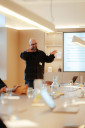
Knowledge Session: Beyond Tech - Taking Control of Our Technology
‘Technology is not neutral. We're inside of what we make, and it's inside of us. We're living in a world of connections — and it matters which ones get made and unmade.’ — Donna Haraway, Cyborg Manifesto
With this powerful quote from feminist science philosopher Donna Haraway, Sander van der Waal opened the knowledge session at the 27th Knowledge and Demo Day. What if we no longer viewed technology solely through the lens of big corporations but instead from a broader societal perspective? This question took centre stage in the session, where we, together with Sander, reflected on the role of technology in our society.
From pioneering to big tech
The internet originally started as a decentralised network where everyone could connect with one another. The Digital City, a freenet initiative by cultural centre De Balie and Hack-Tic, was one of the first projects to experiment with data sharing in Amsterdam. It was the first online internet community to come to existence. However, in the early 2000s, big tech gradually took control of the internet. What was once a free and open platform transformed into a space where a handful of companies dictated the rules. Shoshana Zuboff wrote about this in her book The Age of Surveillance Capitalism. “Forget the cliché that if it’s free ‘you are the product’. You are not the product. You are the abandoned carcass,” Zuboff states in her book.
Today, we navigate a digital landscape shaped by platforms like Facebook and Google, which dictate how we communicate. We’re all familiar with the well-known image from Donald Trump's swearing-in ceremony, where a noticeable shift in protocol placed top CEOs in the front row — traditionally reserved for the President’s family, key political figures, and former Presidents. The internet is now dominated by a handful of conglomerates, which are increasingly influencing decision-making in the United States.
According to Sander, the choice is limited: give up your privacy or remain outside the digital society. But how does this align with European legislation? More importantly, how does this impact our mental health? Recent figures from Amsterdam show that 36 per cent of young people experience mental health issues, with social media cited as one of the contributing factors.
What happens to our data?
Sander illustrated this using a graph on the screen, showing how we unknowingly transmit our personal data hundreds of times each day to unknown entities, which then use it to target us with personalised ads. In the Netherlands, this happens an average of 380 times per day — a relatively low number compared to U.S. states. Colorado leads the way with 987 instances per day. This continues despite the implementation of the GDPR in Europe, which was meant to curb such practices. Lawsuits against data misuse are ongoing, but in the meantime, these processes persist — or even expand.
According to Sander, this highlights a deeper issue: technology is not neutral. Human biases are embedded in it, and AI only amplifies them. Artificial intelligence is already being used in job interviews and to shape personal preferences. This also raises another question: how sustainable is our use of AI? The art project Anatomy of an AI System by Kate Crawford and Vladan Joler vividly illustrates what happens behind the scenes when we ask an AI a question — from the extraction of raw materials to the energy required to generate a response.
Is there another way?
Waag Futurelab champions a new technological foundation. One that prioritizes people over profit. In collaboration with various organizations, they have developed a manifesto (PublicSpaces) that defines how technology should serve society, not the other way around. Here are its core values:
- Accountable
- User centric
- Transparant
- Open
- Sovereign
Sander also highlights alternatives such as GPT-NL (an open AI model from the Netherlands), Fairbnb.coop (a fairer alternative to Airbnb), and Fairphone, which offers a more sustainable smartphone option that breaks away from the traditional tech industry. These applications work differently from Big Tech, focusing on giving users more control over technology.
But how do we transition to more transparent, privacy-friendly, and sustainable technology? A thought-provoking question from the audience: Can we still go back? One attendee admitted they don’t use Signal because all their friends are still on WhatsApp, sparking a discussion on ethics and peer pressure. Should change start at the individual level, or does it require collective action?
Seeking digital independence
The dependence on American tech companies is increasingly being questioned. A recent ICC report in The Guardian warned of the influence of major US corporations on geopolitical institutions. Meanwhile, Dutch media have raised concerns about how the country can become independent of big tech. Professors from Radboud University have also recently called for action.
This all leads to Sander’s crucial conclusion: the internet belongs to all of us. As a society, we decide what our digital future looks like. Under the hashtag #MakeSocialsSocialAgain, a campaign led by Bits of Freedom, DeGoedeZaak, Noorderlicht, PublicSpaces, and Waag Futurelab is now urging public organisations to take the first step by adopting alternatives to big tech social media platforms. These platforms are built on public values such as transparency, privacy, and sustainability — and there are plenty of alternatives available. See the screenshot from Sander’s presentation here.
We’re curious: do you already use alternative social media platforms? Or maybe you have some great other recommendations? Leave a comment below, and let’s share our tips with each other.
Pelle Menke,
Communications and Programme officer Mobility
at Amsterdam InChange,
posted
Demoday #27: Zero Emission City Logistics - The Food Center Amsterdam Case. Hosted by the Interdisciplinary Graduation Circle (HvA)
Amsterdam faces a major logistics challenge: from January 2025 onwards, polluting delivery vans will no longer be allowed in the city centre. How can entrepreneurs and suppliers in the food sector prepare for this and turn the transition into a success? Four fourth-year students from the Amsterdam University of Applied Sciences (HvA) are working together in an interdisciplinary graduation circle to find solutions. They are addressing both the technical aspects of this issue and the communication side. Drawing on their different fields of study, they analyse the problem and develop a joint recommendation for the Amsterdam Transport Region (Vervoerregio Amsterdam). As part of their research, they used this working session as a focus group with stakeholders from the Amsterdam InChange network.
Opening of the session
Stan van der Meer (Logistics Management), Chanel Pinas (Digital Marketing), Jay van den Boog (Digital Marketing), and Vanessa Man (Logistics Engineering) opened the session with a few questions to get a sense of the participants in the room. The attendees rated their own level of expertise on the topic and wrote down a word they associated with the issue.
The room was filled with expertise: policymakers from the Municipality of Amsterdam directly involved in the issue, as well as researchers and advisors from Arcadis and Cenex who are actively working on zero-emission logistics. Representatives from the Port of Amsterdam and EIT Urban Mobility (a European network) were also present, each bringing their own perspective on the challenge.
Statements and discussion
The students facilitated the discussion by presenting a number of statements, and moderating the group discussions that followed. Below are a few observations.
Statements 1 and 2 (summarized): Amsterdam entrepreneurs are aware of the new zero-emission policy, and it is clearly presented to them.
There was broad consensus within the group regarding the city’s policy. Communication from the Municipality of Amsterdam has been extensive over the past ten years — first targeting larger logistics partners in the city, and more recently also via letters to local entrepreneurs. In addition, physical signs throughout the city communicate the new regulations. However, what can cause confusion among entrepreneurs are the mixed signals coming from national politics and policies. This can create the impression that there is a lack of determination or vision behind the transition, making entrepreneurs hesitant to invest in new electric vehicles.
Statement 3: There is sufficient support for entrepreneurs to switch to zero-emission transport.
The group also agreed that the municipality is doing a good job offering financial support where needed. Advisors, for example, are available to guide entrepreneurs through the rules and support options. However, it was noted that the target audience still does not always have a clear overview of all the possibilities. While the municipality communicates well and “presents” the available opportunities, confusion and uncertainty remain among entrepreneurs on the streets. This represents an important communication challenge that the students will further explore.
Also, regarding this statement and the ones before, it was noted that the (micro)entrepreneurs and stakeholders we were talking about weren't present in the room. It would have been good to have more of the target group in the room, but for this session specifically the policymakers and specialists from our network were the ones the students focussed on. In the following months of their research, their focus will be on the specialists and (micro)entrepreneurs in the food sector.
Statement 4: Logistics hubs play an important role in reducing transport movements in the city.
This part of the discussion became more technical. The group agreed that a new logistics system with greater use of hubs throughout the city is, in theory, a logical and effective step in this transition. In practice, however, it is not as simple as it sounds. For example, consider the Port of Amsterdam — an existing large hub at the edge of the city for water-based transport. While goods can be transferred there to smaller vehicles for distribution within the city, docking on the busy canals poses a significant challenge. Additionally, water transport was the first sector required to become fully electric, and this system is currently somewhat reduced in scale
Road transport is also complex. Hubs are locations where goods from different suppliers can be combined and delivered with fewer transport movements. But who holds responsibility for these goods if something goes wrong? And how can this be managed without adding too much delivery time?
One of the participants summarized it well: we are shifting from logistics as a chain, where each party is responsible for a small part, to an ecosystem where all actors and the physical infrastructure depend on one another, share collective responsibility, and need to exchange information and services to keep the system running.
In-depth interviews
The second part of the session consisted of two breakout groups in which the students could ask targeted questions for the research they are conducting. Jay and Chanel spoke with several participants about the research side of the project, delving deeper into successful research methods that involve entrepreneurs. Stan and Vanessa spoke with another group of participants about potential solutions for this issue, gathering knowledge about existing innovations and solutions or what might still be needed for this logistical transition.
Follow-up
Through this focus group, the students in this interdisciplinary graduation circle have engaged in dialogue with experts on this topic from various organizations. They also made many new contacts and actively shared their project with the network. During our upcoming Knowledge and Demo Day on June 5, they will once again be part of the program and present their results and potential conclusions.
Would you like to know more about the graduation circle, the research topic, or do you have tips or questions for the students? Feel free to reach out via pelle@amsterdaminchange.com
Jill Vink,
Communication
at Amsterdam InChange,
posted
Demoday #27: AI Strategy Amsterdam Economic Board - Positioning Amsterdam and the Netherlands
The Netherlands aims to strengthen its position in artificial intelligence (AI) with initiatives such as the planned AI Factory in Groningen and recent European investments in AI infrastructure. To fully leverage these opportunities, collaboration between AI regions is essential. During the Knowledge- and Demoday on March 13 Laetitia Stuijt and Bart Krull from Amsterdam Economic Board led a work session that explored how Amsterdam can position itself within the national and international AI landscape and how the region can distinguish itself from other regions like Eindhoven and Groningen. The session was moderated by Remco Marinus and Jannes Boon from Havas Lemz.
What’s happening? Trends and initiatives
Several trends influencing the development of AI in Amsterdam were discussed. The city is already familiar with AI initiatives, particularly within the social sciences and civil society organisations. This makes it an attractive location for AI research and development. The tech sector is growing rapidly, with a wide range of startups and a young, talented student body actively engaged in AI.
A key theme that emerged during the session was 'inclusive prosperity'. This concept, which aims to create not only economic but also social and ecological value, was seen as a potential differentiating factor for Amsterdam. AI’s potential to help achieve broader societal goals, such as sustainability, inclusivity, and social innovation, was highlighted as a key strength.
The Transport Region of Amsterdam (Vervoerregio Amsterdam), who were also present at the session, indicated the need for a clear framework for AI applications, with specific guidelines on how data should be collected and used. They expressed a need for support in making the right decisions and asking the right questions around AI policy. This is a broader issue likely relevant to several regions across the Netherlands.
From the perspective of the City of Amsterdam, the question arose whether we should start with AI technology itself or focus on the societal challenges we aim to solve. It became clear that the preference lies with the latter: rather than simply exploring what AI can do, the emphasis was on using AI to tackle major societal challenges. This calls for an approach where AI is not just viewed as a technology, but as a tool to solve pressing social issues.
Collaboration with other European countries
Another key point of discussion was how Amsterdam compares to other European cities and countries in the context of AI. It was noted that the Netherlands, like other European nations, is too small to play a leading role in AI on its own. The challenge is to create a shared narrative as a region that is both powerful and attractive for European partnerships.
Positioning Amsterdam in AI: what makes the region unique?
The participants in the workshop then worked on formulating Amsterdam’s unique positioning in the AI sector. They worked on an exercise to create an "Onliness statement" that would set Amsterdam apart from other regions. Different groups proposed interesting ideas:
- Group 1: Focused on placing people at the centre, emphasising the societal impact that Amsterdam can make. This could be a distinguishing factor.
- Group 2: Highlighted Amsterdam as a software development hub, leveraging the open-source community already present in the city.
- Group 3: Positioned Amsterdam as an innovative software cluster, a place where new technologies can be rapidly developed.
- Group 4: Emphasised the importance of smaller, specialised niches in the AI industry, where Amsterdam can have a strong profile.
- Group 5: Stressed the importance of safe innovation and accelerating best practices in AI, with a focus on the responsible use of technology.
Next steps
The work session was a productive gathering where various ideas were shared about Amsterdam’s position in the AI landscape. It became clear that there is significant potential for the city to differentiate itself through its societal approach to AI, its innovative ecosystem, and its strong educational and research institutions. However, it was also noted that the business sector was underrepresented in the discussion. Their perspective on the deployment of AI, especially regarding commercial applications, would be valuable to get a fuller picture of Amsterdam’s potential in this field.
The next step will be for Amsterdam Economic Board to further develop a clear vision and narrative that highlights both the technological and societal benefits of AI in Amsterdam. They will be working intensively on this in the coming period, among others during the Kick-Off meeting they are organising on March 26.
Do you have interesting input on this issue? Leave a comment below, and we’ll connect you with Laetitia and Bart from Amsterdam Economic Board, who are the leads on this topic.
Stay up to date
Get notified about new updates, opportunities or events that match your interests.
Set up preferences

