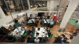
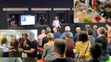
On September 26th, our community gathered in the AHK Culture Club at Marineterrein Amsterdam for our Datadilemma’s series. This edition focused on the use of Data and AI to create a more accessible Amsterdam. This article presents some of the key highlights and insights from the afternoon.
Together with the three speakers, Vishruth Krishnan, Hans Voerknecht, Michiel Bontenbal, and our audience we discussed how data and AI can help make our city more accessible for all. Which dilemma’s do we encounter when we use new technologies for an accessible city? How can data help to get more understanding of unequal access to mobility in the country? And what about sounds and noise pollution; how can data help make te city more livable?
What the three speakers had in common; a personal motivation to get away from the surface and dive deeper into the data, attempting to get closer to people’s experiences and perceptions. From an ordinary routeplanner, to one paying specific attention to challenges for people in weelchairs. From generic accesibility data for the region, to data highlighting the unequal distribution of access to mobility. And from recording noise levels, to measuring and classifying all different sounds in urban settings. In the paragraphs below, I will delve deeper into the different speakers and their topics.
Visruth Krishnan – Personalized Route Planner for People in a Wheelchair
To help individuals with limited mobility navigate the city more easily, the city’s innovation department has developed a prototype route planning tool. This route planner maps out the most accessible routes based on personal needs, considering preferences like maximum curb height at crossings, minimum sidewalk width, and whether to prioritize sidewalks or bike paths.
Visruth Krishnan, Data Scientist at the Innovation Department of the Municipality of Amsterdam, explained how data helps facilitate travel from point A to point B. However, to ensure route planning tools address the challenges faced by wheelchair users, we must feed these systems with data drawn from real-world experiences. A person’s journey might present specific challenges, such as detours, improperly parked bicycles, slopes, and narrow footpaths.
Working with a group of wheelchair users, Visruth studied the obstacles and experiences they encountered on their routes. This research generated precise data to feed the route planner, enabling it to provide personalized route suggestions that account for each individual’s freedom of movement.
Visruth presented several dilemmas encountered during the project:
- Subjectivity in the data: How busy is a sidewalk or intersection perceived to be? Are cyclists at a certain point fast and aggressive, or is that just a feeling?
- Minimal vs. comprehensive data collection: How much data should be gathered? While more data might provide deeper insights, it could also increase privacy risks.
- Accurate vs. timely data: Timely data may not always be accurate, and accurate data may not always be available in time for critical decision-making. Consider issues like illegally parked bikes, construction work, and terraces that vary in size and location depending on the season.
- Transparency vs. complexity: How transparent should data-driven processes be, especially when the algorithms or analytics behind them are complex? AI is often seen as a "black box"—people don’t understand how it works or how data is processed, which can lead to less trust from the start.
To address these challenges, Visruth and his team maintain an ongoing dialogue with the target audience. It’s an iterative process, and they keep the ‘human in the loop.’ The prototype is now ready, and hopefully, it can be further developed!
Hans Voerknecht – Unequal Accesibility and Data to Support The Narrative
Hans Voerknecht, strategist for sustainable accessibility at Een Nieuwe Kijk, presented the Integrated Perspective on Accessibility method, which he developed to get a deeper understanding of people’s accessibility. This method assists in collecting data and analyzing the severity of current inequalities and the effects of policy measures. The method has already been applied in nearly twenty projects, including four in the Amsterdam region, such as the Multimodal Future Vision of the Metropoolregio Amsterdam (MRA).
IKOB stands for "Integrale Kijk Op Bereikbaarheid" (Integrated Perspective/view on Accessibility). IKOB examines the travel time and costs that people face to reach their workplace by bike, car, or public transport and it visualizes how many jobs people can access from a specific area.
IKOB uses 'distance decay curves<strong>,'</strong> meaning that jobs located closer are given more weight than those further away. Travel time and costs are adjusted depending on the target group. Factors considered include income, access to a car, travel cost reimbursement, public transport options, and preference for a mode of transport (car, public transport, or bike). For people with a lower income, costs weigh more heavily than for those with higher incomes.
Throughout his talk, Hans discussed how data can be used to support a narrative, either consciously or unconsciously. Regional research on the state of mobility can quickly paint a positive picture if you're working with averages and fail to examine differences between people. There are groups that experience less access to mobility, and for whom this issue carries more weight due to financial constraints. The way data is researched and how deeply you investigate determines to what extent this group and their challenges are brought into focus.
One of the dilemmas Hans mentioned was the fact that poor accessibility is a personal experience. It’s subjective, and there can be a lot behind it. Regardless of the detail and quality of your data, you can never be completely sure if it truly reflects the human experience it’s supposed to represent.
Michiel Bontenbal – The Urban Sounds Sensor
Our third and final speaker discussed sounds and noise pollution in an urban environment. It may not seem to immediately fit with the rest of the speakers, but urban sound is also important to consider when creating an accessible and liveable city. Michiel Bontenbal, lecturer in business and IT courses at the Amsterdam University of Applied Sciences, told us more about the Urban Sounds sensor, developed in collaboration with the volunteer organization Sensemakers. He explained us more about the challenges they face with this AI-driven solution and raised some dilemmas in his work.
The Urban Sounds Sensor project was developed in response to the need for evidence of nighttime noise disturbances. It was crucial to be able to distinguish between different types of sounds, such as music, mopeds, alarms, doors, car noises, and honking.
Together with the volunteers from Sensemakers, Michiel designed the sensor in such a way that the recorded sounds are neither stored nor released. The microphone registers the sound, and the algorithm in the sensor immediately categorizes it within the device. This approach ensures privacy by design.
Training the sensor is still an ongoing process. Achieving high accuracy is challenging, as even humans sometimes have trouble identifying certain sounds. And, while measuring noise disturbances is definitely getting more attention in the city now. However, this specific method of distinguishing between sound categories is still lagging behind in both development and interest from government authorities.
Michiel concluded his presentation by discussing his dilemmas with the audience. One of his dilemmas, as expected, was about placing microphones in public spaces; how desirable is that, really? It's important to talk about ethics and privacy when measuring in public spaces, especially with a sound sensor that isn’t visible. His second point focused on the experience of city sounds. How you perceive sounds depends on personal experiences and preferences. Some people enjoy urban sounds, like the noise of a tram or ringing bike bells. People may have associations with certain sounds that determine whether they find them annoying, don't even notice them, or actually enjoy them. This is a factor that a sound sensor and the data it collects have difficulty accounting for.
Panel Discussion
After the presentations, we brought the speakers together for a panel discussion. Led by Chris de Veer, programme manager Mobility at Amsterdam InChange, there was an engaging conversation with the audience. To wrap things up, I’d like to highlight three key statements made by the speakers in response to some critical questions from the audience:
- "We often try to objectify the world with data, but there is no objective truth. However, diving deep into data can give you a better and more diverse understanding of an issue or region." – Hans
- "Data is always messy. If the data we input is messy, the outcome will also be messy. Garbage in, garbage out." – Michiel
- “The Route Planner method and platform could be of great use in gaining a better overview of building accessibility throughout the city.” - Visruth
Thanks to the speakers for their stories and to the audience for the lively discussions afterwards. Want to join us for our next Data Dilemmas event? The next edition of this series of open events will be announced soon. We’re also always open to new themes and topics for this series; we’re curious to hear about the data dilemmas you encounter in your work!