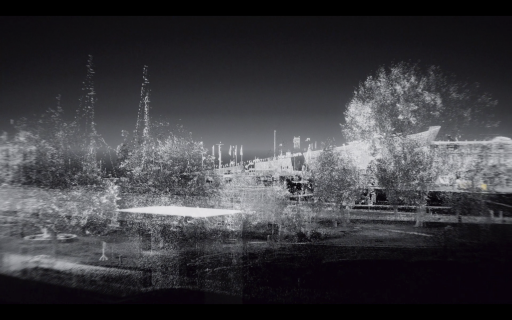
Lidar is what robots use to read and navigate our built environment. Also known as point cloud or 3D scanning, Lidar becomes a wonderful 'black canvas' to paint a new portrait of our digital surroundings. We created a point cloud scan animation of the Marineterrein in the heart of Amsterdam that revealed the many data sets being collecting in our living lab. Like Bob Ross, we used the data and points to paint to a new landscape explaining our 21st century city.
Check out how we created this animation here: http://tapp.nl/point-cloud-scan-animation
I'll be giving alking about the point cloud animation and process at the upcoming Sensemakers AMS talk “DigitalTwins - cities, neighborhoods and infra” 19 February 2020. Signup here: http://meetu.ps/e/Hwyjq/8dXgR/a


'Ever make mistakes in life? Let's make them birds'
Just like Bob Ross indeed! ;-)