Stay in the know on all smart updates of your favorite topics.
People get more connected and technology becomes part of our daily life. Between 2014 and 2015 there was a 27% growth of internet traffic in Amsterdam. Eleven out of fifteen Trans-Atlantic data cables are connected with or go through Amsterdam and the AMS-IX is the second largest internet exchange point in the world. In 2016 Amsterdam was ranked second in the European Digital City Index. Do you work on a smarter city? Share your technologies here!
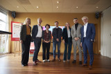
Tim van de Laar,
Project management, Scale Up, Innovation Partnerships, Sport
at City of Amsterdam: Ingenieursbureau Amsterdam,
posted
Amsterdam and Haarlem launch groundbreaking sustainable artificial turf pitch innovations
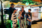
The pioneering innovations were presented of the Scale Up Future-proof artificial turf pitches project, a collaboration between Amsterdam and Haarlem focused on sustainable artificial turf pitches. Over the next few years, more than 250 sports pitches in both cities will be transformed into circular, energy-generating and climate-adaptive sports venues. These artificial turf pitches can not only generate and store energy, but also involve smart water management. An approach that is globally relevant for urban sports infrastructure.
Three consortia collaborate on the sport pitch of the future
The three selected consortia Antea Sport, EnergieVeld and GOO4iT together comprise more than 15 market players. They join forces within this innovation partnership, where there is room for long-term collaboration, co-creation and scalable innovation. The pioneering solutions will make it possible to cool down sport pitches on warm days, help dispose of and collect rainwater, make the pitches more pleasant for the users and possibly even generate energy for the surrounding area. Find out how these innovations are shaping the sport pitch of the future here.
Two municipalities: joint procurement
The Scale Up Future-proof artificial turf pitches project is a unique collaboration between two municipalities and market players. The municipalities jointly procure pooling their purchasing power and use an innovation partnership to challenge the market to test and scale up innovative and sustainable solutions. In doing so, the solutions are also scalable and transferable to other cities in the Netherlands and Europe.
From prototype to pilot fields
The first prototype fields will be constructed in Amsterdam and Haarlem in 2026, in different capacities and combining multiple innovations, where they will be extensively tested and monitored for a year. Successful concepts are then scaled up to full-scale pilot pitches and tested and monitored for another year. This will form the basis for the new standard of sustainable sports pitches, with potential for adoption in other cities around the world. At the same time, existing pitches are already being improved with the most sustainable solutions available, making an immediate impact from the start. The project thus shows how cooperation between municipalities and market players can lead to innovative, climate-proof sports infrastructure with international relevance.
Join us
This project provides cities worldwide a blueprint for sustainable, smart, and future-proof artificial turf pitches. Interested municipalities and industry partners can get in touch and subscribe to our news updates by sending an e-mail to: sportveldvandetoekomst@amsterdam.nl.
Susanna Stroer,
Communication
,
posted
Nomineer jouw AI-toepassing voor de Dutch Applied AI Award 2025

Heb of ken jij een vernieuwend initiatief op het gebied van toegepaste Artificiële Intelligentie? Nomineer deze toepassing dan voor de Dutch Applied AI Award! Je hebt nog twee weken de tijd om jouw initiatief aan te melden.
Het is dit jaar voor de zesde keer dat deze juryprijs tijdens de jaarlijkse Computable Awards wordt uitgereikt. Sinds 2020 beloont het Centre of Expertise Applied AI van de Hogeschool van Amsterdam samen met ICT-platform Computable en podcast De Dataloog een innovatieve AI-toepassing.
Daarbij beoordeelt de jury - bestaande uit zes experts op het gebied van Applied AI - alle inzendingen op drie criteria:
· Applied AI - in hoeverre is de oplossing al geïmplementeerd, wordt het gebruikt door de beoogde doelgroep en hoe groot is het aantal (potentiële) klanten/het aantal mensen dat met deze innovatie direct of indirect wordt geholpen.
· Uniekheid - in hoeverre is de innovatie de enige in haar soort, is het nooit eerder op de markt gebracht en kan het doel van de innovatie niet op een andere manier worden behaald.
· Responsible AI (transparantie, privacy, fairness, etc.) - in hoeverre is het ontworpen of gebruikte AI-algoritme transparant. Stelt het de gebruiker in staat om verantwoording af te leggen en duidelijk te zijn over de factoren die de algoritmische beslissingen beïnvloeden.
Je kunt een initiatief tot maandag 16 juni 2025 voordragen via https://awards.computable.nl/nomineren/dutch-applied-ai.
Uit alle inzendingen maakt de jury een top 3. De winnaar wordt op dinsdag 18 november 2025 verkozen tijdens de uitreiking van de Computable Awards in de Jaarbeurs Utrecht.
Meer informatie
Eerdere winnaars:
· 2024 - Sturgeon | UMC Utrecht & Oncode Institute
· 2023 - KLM, Mainblades, KPN
· 2022 - WSK Medical | Zeno AI
· 2021 - BAM Infra Asset Management
· 2020 - DEARhealth
Noor Veenhoven,
Program manager energy & circularity
at Amsterdam InChange,
posted
Demoday #27: What is ethical mobile software for your phone?
We depend heavily on Big Tech companies like Google, Meta, Apple, Amazon, and more. And with your smartphone, there is no escaping them. Even if you don’t use social media, and use anti-tracking software, some of your data will still be shared and sold. This can make you feel pretty uncomfortable. Especially, since most of these tech companies are in the USA and China. This is why, in this session, we worked on the question: Is it possible to develop mobile software which is ethical and functional?
Danny Lämmerhirt from Waag Futurelab works on the MOBIFREE project. This project aims to change the development and use of mobile software in Europe by citizens, businesses, non-profits and governments. In doing so, they want to support the emerging movement for ethical mobile software consisting of organisations that adhere to European values such as openness, privacy, digital sovereignty, fairness, collaboration, sustainability, and inclusivity.
In this session, Danny introduced us to the smartphone they are working on. This smartphone has its hardware from Fairphone (an ethically produced smartphone) and uses a privacy-friendly operating system: Murena. This operating system is an Android fork that doesn’t come with standard tracking software. On top of that, it has an app store with only ethical apps and is connected to an ethical European cloud.
Outcomes
We discussed with the group what values we found most important in an ethical mobile phone when using it for work. The values that were deemed most important by the group were:
- Autonomy: A smartphone allows working wherever and whenever you want. It is an incredibly powerful tool that you can use for so many different things, and it fits in your pocket.
- Independency: We’ve become incredibly dependent on our smartphones. When you lose your phone, you no longer have your money, your public transport card, a map to find the way, etc. On the other hand, this also means that you don’t need to travel with a bag full of tools every time you leave the house.
- Privacy: Constantly being tracked has become normal, but that doesn't mean we’re happy with it. Right now, you don’t have a choice. It would be nice to have a choice, to either pay with your data, or with money.
- User-friendliness: An ethical and privacy-friendly smartphone sounds great, but it also means that you can no longer use many of the apps that you’re used to. Will it still be practical to use? And will it be intuitive? We are all used to a certain way of working and are hesitant to change.
This discussion was definitely food for thought. We all want a more ethical phone, but are not willing to sacrifice much in return…
Are you interested in trying out this ethical smartphone? The MOBIFREE project is currently looking for people who can test this smartphone. They are looking for young adults, civil servants, mobile software developers, and professionals working in humanitarian organisations.
<strong>Would you like to participate, or do you have any questions about this project? Please contact Noor at noor@amsterdaminchange.com. Special thanks to Danny Lämmerhirt for this interesting session.</strong>
Make this your personal feed
Pelle Menke,
Communications and Programme officer Mobility
at Amsterdam InChange,
posted
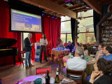
Smart City Expo World Congress | Barcelona 2024 | Personal highlights
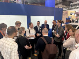
In early November, I travelled to Barcelona for the third time to attend the Smart City Expo World Congress. Together with the Amsterdam InChange Team, some of our network partners, and the Dutch delegation, we put together a strong content-focused programme, gained inspiration, and strengthened both international and national connections. In this article, I’ll briefly share some of my personal highlights from this trip.
International Delegations: Building International Connections and Knowledge Exchange at the Expo
During the congress, I organised several guided visits from the Dutch Pavilion in collaboration with the DMI-Ecosystem. The aim of these visits was to connect the Dutch delegation with international colleagues and facilitate knowledge exchange. At the busy expo, full of companies, cities, regions, and conference stages, it’s really appreciated to join planned meetings on specific themes. It’s also a great chance to meet many international representatives in just a few days, since everyone is in the same place at the same time.
We visited and connected with the pavilions of EIT Urban Mobility, Forum Virium (Helsinki), the European Commission, and Catalonian innovations. Topics such as The Future of Mobility, Digital Twins, and Net Zero Cities were central to the discussions. It was a good opportunity to strengthen existing networks and establish new connections. For myself, for Amsterdam InChange, and for the participants joining the meetings.
A few aspects of the visits particularly stood out to me. At Forum Virium Helsinki we met with Timo Sillander and Jaana Halonen. I was impressed by their work with Digital Twins. They focus not only on the technology itself and the efficiency of urban systems, but also on the social dimensions a digital simulation can play into. Think of; unequal distributions of risks related to climate change and extreme weather conditions.
I also appreciated the efforts of the European Commission. They are working to make it easier to navigate research topics, funding opportunities, and findings related to themes like energy-neutral cities. With their new marketplace, there is more focus on small and medium-sized cities across Europe, helping them to benefit from innovations that are often developed in larger urban areas.
Collaborating Internationally on a Regional Challenge: Zero-Emission Zones and City Logistics
On Tuesday, my colleague Chris and I organised a session on zero-emission city logistics. We brought together representatives from Oslo, Helsinki, Stockholm, Munich, and EIT Urban Mobility, as well as the Dutch municipalities of Haarlemmermeer and Amsterdam.
The session built on connections we made during other events on Sunday and Monday, bringing together an international group of stakeholders interested in this topic. During the discussion, we compared how different cities are approaching zero-emission zones and identified shared challenges, particularly in policymaking and working with logistics companies and local entrepreneurs.
It was interesting to see how this topic lends itself so well to international comparison and exchange. For instance, while Amsterdam will be one of the first to implement a strict ZE zone in the city centre, other cities are already ahead in areas like charging infrastructure and the transition to cargo bikes. The group was eager to keep the discussion going, and we’re already planning a follow-up online meeting to continue learning from one another.
Future-Proof Sports Fields, International Dinners, and Bicycles
Finally, a few other topics worth mentioning: I joined an international session hosted by the City of Amsterdam about future-proof sports fields. It was inspiring to reflect on the value and potential of sports fields for neighbourhoods, as well as their use as testing grounds for sustainable innovations. For me, the session reinforced how important these spaces are for local communities in cities, and sparked a new personal interest in this subject.
I also really enjoyed both our own international changemakers’ dinner and another international dinner hosted by Drees & Sommer (thanks for the invitation!). Bringing together an international network — whether as individuals or in small groups — and mixing them at the table sparked meaningful conversations that felt different from those during the formal congress sessions or workshops.
Lastly, it’s great to see more Superblocks and bicycles in the city every year! Go Barcelona!
Susanna Stroer,
Communication
,
posted
Dutch Applied AI Award 2024 naar Sturgeon, UMC Utrecht en Oncode Institute
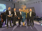
Sturgeon, het AI-initiatief van UMC Utrecht en Oncode Institute is dit jaar de winnaar van de Dutch Applied AI Award 2024. Naast deze award heeft de AI-toepassing ook de Computable Award in de categorie ‘Zorgproject’ gewonnen.
In verkorte tijd het type hersentumor bepalen met behulp van AI
Dankzij de inzet van AI kunnen neurochirurgen sneller bepalen met welk type hersentumor zij te maken hebben. De technologie vermindert de tijd die nodig is voor het stellen van een diagnose, van dagen naar ongeveer drie kwartier. Een behandelplan kan hierdoor sneller worden opgesteld. De technologie is ontwikkeld door de onderzoeksgroep van biomedicus Jeroen de Ridder van UMC Utrecht en Oncode Institute. Het algoritme dat het type hersentumor moet bepalen is getraind op miljoenen onvolledige datavoorbeelden van verschillende typen tumoren. Sturgeon is publiek beschikbaar en het wordt inmiddels ook ingezet in het Máxima Kinderziekenhuis voor het diagnosticeren van kinderkanker.
Jury prijst complexiteit van de technologie
De jury van de Dutch Applied AI Award heeft bewondering voor de toepassing. “Dit jaar een AI-toepassing in de medische sector, in het bijzonder voor de snelle herkenning van hersentumoren, wat voor zowel patiënt als chirurg een enorme impact heeft. Ze waren met de technologie van Sturgeon in staat om een model te ontwikkelen dat uit een minimale hoeveelheid pixels een accurate diagnose kan stellen, en dat in ongeveer drie kwartier tijd”. Aldus Nanda Piersma, jurylid van de Dutch Applied AI Award.
Het is de vijfde keer dat de Dutch Applied AI Award werd uitgereikt. Dit jaar in de jury:
· Nanda Piersma (Hogeschool van Amsterdam)
· Anouk Dutreé (De Dataloog & UbiOps)
· Omar Niamut (Hogeschool van Amsterdam & TNO)
· Maaike Harbers (Hogeschool Rotterdam)
· Jann de Waal (Topsector Creatieve Industrie)
· Sander Hulsman (Jaarbeurs Utrecht)
Over de Dutch Applied AI Award
Beth Njeri,
Communications & Events Manager
at Metabolic,
posted
𝗛𝗼𝘄 𝗰𝗮𝗻 𝗖𝗦𝗥𝗗 𝗯𝗲 𝘁𝗵𝗲 𝗹𝗮𝘂𝗻𝗰𝗵𝗽𝗮𝗱 for 𝘆𝗼𝘂𝗿 𝘀𝘂𝘀𝘁𝗮𝗶𝗻𝗮𝗯𝗶𝗹𝗶𝘁𝘆 𝗷𝗼𝘂𝗿𝗻𝗲𝘆?
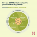
A systems approach is key.
Climate transition plans that lack a systemic perspective can unintentionally shift risks, disrupt supply chains, harm human rights, or even contribute to biodiversity loss. For example, switching to a low-carbon product that requires three times more land may address your carbon goals, but jeopardize your biodiversity targets.
Without considering these interdependencies, your climate strategy may become inefficient and require reworking as new issues arise.
𝗧𝗵𝗲 𝘀𝘆𝘀𝘁𝗲𝗺𝗶𝗰 𝘀𝗰𝗲𝗻𝗮𝗿𝗶𝗼👇
By addressing root causes and considering the ripple effects of climate decision-making in other areas, a systems lens ensures your plan goes beyond regulatory box-ticking.
Together, we can co-create effective action plans with your stakeholders and develop customized decision-making frameworks, accounting for material impacts on climate, nature, and people across your operations and value chain.
How? Learn how our Systemic Transition Suite can unlock your business’s full potential ⬇️
#BeyondCompliance #climatetransition #sustainabilityreporting #CSRD #ESG #circulareconomy
Rihards Dzelme,
Inclusive Cities & AI / Trained Architect and Urbanist
,
posted
Red Light District Relocation: What do you think? 🤷🤦♀️
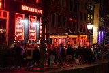
Amsterdam is set to relocate its iconic Red Light District from De Wallen to Europaboulevard, marking a significant shift in the city's approach to sex work and urban development.
This move aims to create a more structured and safe environment for sex workers while addressing concerns about over-tourism and its impact on local communities. We analyzed available data online to understand the hottest topics from affected groups.
<strong>See data insights on Playground Journal. Or listen to a short 5-minute podcast on this here.</strong>
This is your opportunity to engage in the conversation. Your insights and opinions matter in shaping a future that respects the city’s rich history while addressing the challenges and hopes of its diverse inhabitants.
The significance of this relocation lies in its potential to reshape Amsterdam's cultural and social landscape. It reflects the city's commitment to balancing the needs of residents, tourists, and sex workers, ensuring that the new Erotic Centre aligns with contemporary values while preserving the district's historical essence.
As this transformation unfolds, community input is vital. Residents, business owners, and other stakeholders are encouraged to contribute their thoughts and ideas to help shape the future of the new Red Light District. Your insights can influence the new facility's design, amenities, and safety features.
While communities can influence many aspects—such as building design, types of amenities, and community engagement processes—certain elements are fixed. The location of the new RLD has already been determined, as are existing laws and regulations governing sex work. Additionally, the core concept of the Erotic Centre and project timelines remain unchanged.
Let’s ensure that the new Red Light District reflects the values and aspirations of all who call Amsterdam home. Your voice matters!
Pelle Menke,
Communications and Programme officer Mobility
at Amsterdam InChange,
posted
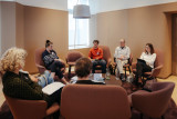
Data Dilemmas Recap: Using Data and AI for an Accessible Amsterdam
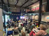
On September 26th, our community gathered in the AHK Culture Club at Marineterrein Amsterdam for our Datadilemma’s series. This edition focused on the use of Data and AI to create a more accessible Amsterdam. This article presents some of the key highlights and insights from the afternoon.
Together with the three speakers, Vishruth Krishnan, Hans Voerknecht, Michiel Bontenbal, and our audience we discussed how data and AI can help make our city more accessible for all. Which dilemma’s do we encounter when we use new technologies for an accessible city? How can data help to get more understanding of unequal access to mobility in the country? And what about sounds and noise pollution; how can data help make te city more livable?
What the three speakers had in common; a personal motivation to get away from the surface and dive deeper into the data, attempting to get closer to people’s experiences and perceptions. From an ordinary routeplanner, to one paying specific attention to challenges for people in weelchairs. From generic accesibility data for the region, to data highlighting the unequal distribution of access to mobility. And from recording noise levels, to measuring and classifying all different sounds in urban settings. In the paragraphs below, I will delve deeper into the different speakers and their topics.
Visruth Krishnan – Personalized Route Planner for People in a Wheelchair
To help individuals with limited mobility navigate the city more easily, the city’s innovation department has developed a prototype route planning tool. This route planner maps out the most accessible routes based on personal needs, considering preferences like maximum curb height at crossings, minimum sidewalk width, and whether to prioritize sidewalks or bike paths.
Visruth Krishnan, Data Scientist at the Innovation Department of the Municipality of Amsterdam, explained how data helps facilitate travel from point A to point B. However, to ensure route planning tools address the challenges faced by wheelchair users, we must feed these systems with data drawn from real-world experiences. A person’s journey might present specific challenges, such as detours, improperly parked bicycles, slopes, and narrow footpaths.
Working with a group of wheelchair users, Visruth studied the obstacles and experiences they encountered on their routes. This research generated precise data to feed the route planner, enabling it to provide personalized route suggestions that account for each individual’s freedom of movement.
Visruth presented several dilemmas encountered during the project:
- Subjectivity in the data: How busy is a sidewalk or intersection perceived to be? Are cyclists at a certain point fast and aggressive, or is that just a feeling?
- Minimal vs. comprehensive data collection: How much data should be gathered? While more data might provide deeper insights, it could also increase privacy risks.
- Accurate vs. timely data: Timely data may not always be accurate, and accurate data may not always be available in time for critical decision-making. Consider issues like illegally parked bikes, construction work, and terraces that vary in size and location depending on the season.
- Transparency vs. complexity: How transparent should data-driven processes be, especially when the algorithms or analytics behind them are complex? AI is often seen as a "black box"—people don’t understand how it works or how data is processed, which can lead to less trust from the start.
To address these challenges, Visruth and his team maintain an ongoing dialogue with the target audience. It’s an iterative process, and they keep the ‘human in the loop.’ The prototype is now ready, and hopefully, it can be further developed!
Hans Voerknecht – Unequal Accesibility and Data to Support The Narrative
Hans Voerknecht, strategist for sustainable accessibility at Een Nieuwe Kijk, presented the Integrated Perspective on Accessibility method, which he developed to get a deeper understanding of people’s accessibility. This method assists in collecting data and analyzing the severity of current inequalities and the effects of policy measures. The method has already been applied in nearly twenty projects, including four in the Amsterdam region, such as the Multimodal Future Vision of the Metropoolregio Amsterdam (MRA).
IKOB stands for "Integrale Kijk Op Bereikbaarheid" (Integrated Perspective/view on Accessibility). IKOB examines the travel time and costs that people face to reach their workplace by bike, car, or public transport and it visualizes how many jobs people can access from a specific area.
IKOB uses 'distance decay curves<strong>,'</strong> meaning that jobs located closer are given more weight than those further away. Travel time and costs are adjusted depending on the target group. Factors considered include income, access to a car, travel cost reimbursement, public transport options, and preference for a mode of transport (car, public transport, or bike). For people with a lower income, costs weigh more heavily than for those with higher incomes.
Throughout his talk, Hans discussed how data can be used to support a narrative, either consciously or unconsciously. Regional research on the state of mobility can quickly paint a positive picture if you're working with averages and fail to examine differences between people. There are groups that experience less access to mobility, and for whom this issue carries more weight due to financial constraints. The way data is researched and how deeply you investigate determines to what extent this group and their challenges are brought into focus.
One of the dilemmas Hans mentioned was the fact that poor accessibility is a personal experience. It’s subjective, and there can be a lot behind it. Regardless of the detail and quality of your data, you can never be completely sure if it truly reflects the human experience it’s supposed to represent.
Michiel Bontenbal – The Urban Sounds Sensor
Our third and final speaker discussed sounds and noise pollution in an urban environment. It may not seem to immediately fit with the rest of the speakers, but urban sound is also important to consider when creating an accessible and liveable city. Michiel Bontenbal, lecturer in business and IT courses at the Amsterdam University of Applied Sciences, told us more about the Urban Sounds sensor, developed in collaboration with the volunteer organization Sensemakers. He explained us more about the challenges they face with this AI-driven solution and raised some dilemmas in his work.
The Urban Sounds Sensor project was developed in response to the need for evidence of nighttime noise disturbances. It was crucial to be able to distinguish between different types of sounds, such as music, mopeds, alarms, doors, car noises, and honking.
Together with the volunteers from Sensemakers, Michiel designed the sensor in such a way that the recorded sounds are neither stored nor released. The microphone registers the sound, and the algorithm in the sensor immediately categorizes it within the device. This approach ensures privacy by design.
Training the sensor is still an ongoing process. Achieving high accuracy is challenging, as even humans sometimes have trouble identifying certain sounds. And, while measuring noise disturbances is definitely getting more attention in the city now. However, this specific method of distinguishing between sound categories is still lagging behind in both development and interest from government authorities.
Michiel concluded his presentation by discussing his dilemmas with the audience. One of his dilemmas, as expected, was about placing microphones in public spaces; how desirable is that, really? It's important to talk about ethics and privacy when measuring in public spaces, especially with a sound sensor that isn’t visible. His second point focused on the experience of city sounds. How you perceive sounds depends on personal experiences and preferences. Some people enjoy urban sounds, like the noise of a tram or ringing bike bells. People may have associations with certain sounds that determine whether they find them annoying, don't even notice them, or actually enjoy them. This is a factor that a sound sensor and the data it collects have difficulty accounting for.
Panel Discussion
After the presentations, we brought the speakers together for a panel discussion. Led by Chris de Veer, programme manager Mobility at Amsterdam InChange, there was an engaging conversation with the audience. To wrap things up, I’d like to highlight three key statements made by the speakers in response to some critical questions from the audience:
- "We often try to objectify the world with data, but there is no objective truth. However, diving deep into data can give you a better and more diverse understanding of an issue or region." – Hans
- "Data is always messy. If the data we input is messy, the outcome will also be messy. Garbage in, garbage out." – Michiel
- “The Route Planner method and platform could be of great use in gaining a better overview of building accessibility throughout the city.” - Visruth
Thanks to the speakers for their stories and to the audience for the lively discussions afterwards. Want to join us for our next Data Dilemmas event? The next edition of this series of open events will be announced soon. We’re also always open to new themes and topics for this series; we’re curious to hear about the data dilemmas you encounter in your work!
Susanna Stroer,
Communication
,
posted
Wie maakt kans op de Dutch Applied AI Award 2024?

Na topoverleg van de jury maken drie initiatieven kans op de Dutch Applied AI Award. Het is voor de vijfde keer op rij dat deze prijs tijdens de Computable Awards in november wordt uitgereikt. Met de award belonen het Centre of Expertise Applied AI van de Hogeschool van Amsterdam, ICT-platform Computable en podcast De Dataloog een vernieuwend initiatief op het gebied van toegepaste Artificiële Intelligentie.
We feliciteren de volgende genomineerden:
Wie er uiteindelijk met de award vandoor gaat, wordt bekend op woensdagavond 27 november 2024 tijdens de uitreiking van de Computable Awards in Utrecht. De jury - bestaande uit zes experts op het gebied van Applied AI - heeft de genomineerden geselecteerd op drie criteria:
Applied AI - in hoeverre is de oplossing al geïmplementeerd, wordt het gebruikt door de beoogde doelgroep en hoe groot is het aantal (potentiële) klanten/het aantal mensen dat met deze innovatie direct of indirect wordt geholpen.
Uniekheid - in hoeverre is de innovatie de enige in haar soort, is het nooit eerder op de markt gebracht en kan het doel van de innovatie niet op een andere manier worden behaald.
Responsible AI (transparantie, privacy, fairness, etc.) - in hoeverre is het ontworpen of gebruikte AI-algoritme transparant. Stelt het de gebruiker in staat om verantwoording af te leggen en duidelijk te zijn over de factoren die de algoritmische beslissingen beïnvloeden.
Dit jaar in de jury:
Nanda Piersma | Hogeschool van Amsterdam | Wetenschappelijk directeur Centre of Expertise Applied AI
Jurjen Helmus | Hogeschool van Amsterdam | Coördinator Smart Asset Management Lab | Eigenaar De Dataloog
Omar Niamut | TNO | Director of Science
Maaike Harbers | Hogeschool Rotterdam | Lector AI & Society
Jann de Waal | Topsector Creatieve Industrie | Voorzitter | Oprichter INFO
Sander Hulsman | Jaarbeurs Utrecht | Chief Digital Content
Pelle Menke,
Communications and Programme officer Mobility
at Amsterdam InChange,
posted
Data Dilemma's verslag: De Voedseltransitie

Op 30 mei nodigden we onze community uit bij AMS Institute op het Marineterrein voor een Data Dilemma’s event over de Voedseltransitie. Het ging deze middag over technische dilemma’s rond data en de verduurzaming van voedselketens, en; wat is nou echt lokaal voedsel?
Data Commons: Een digitaal gemeenschapsgoed met een gezamenlijk doel
Jan Wester, directeur van Big Data Value Center, vertelde ons meer over het project ‘Data Value Center Agri & Food Korte Keten’. Aanleiding voor dit project is de transitie naar een duurzamer voedselsysteem waarbij digitalisering en data een belangrijke rol spelen. Er is de wens dat relatief meer voeding uit de regio komt (in plaats van langere ketens), dat er meer transparantie en efficiëntie is in ketensamenwerking en dat er meer informatie wordt vastgelegd over productie en herkomst (denk aan True Pricing). Dit vraagt om een neutraal precompetitief platform. Dit platform kan je zien als een zogenaamde Data Commons: een digitaal gemeenschapsgoed waarin je samen afspraken maakt over het delen van data; wat deel je, met wie, en wat is het gezamenlijke doel ermee?
De Agrifood Data Common is een veilige data-deel omgeving/marktplaats/dashboard, met verschillende gebruikersgroepen. Ondernemers kunnen hiermee bijvoorbeeld markten transparanter maken, ketensamenwerking verbeteren en meervoudige verdienmodellen creëren. Overheden kunnen gebruik maken van de omgeving voor meer evidence-based beleid en het monitoren van impact. Ten slotte kunnen kennisinstellingen gebruik maken van het platform voor de opbouw van referentiedata en het delen van data uit experimenten en fieldlabs. Belangrijk is dat de verschillende partijen vertrouwen met- en in elkaar opbouwen om dit samen te laten werken.
De cateringketen van de Hogeschool van Amsterdam als case
DVC Agri & Food is samen met partners cases aan het bouwen die het nut en belang van dit digitale gemeenschapsgoed in de praktijk tonen. Kees Willem Rademakers van de Hogeschool van Amsterdam vertelde ons meer over het ‘Food Governance 2.0’ project met betrekking op hun eigen cateringketen.
De HvA wilt zich actiever afvragen wat ze van (hun) voedsel vinden en hoe ze een nieuwe rol kunnen spelen in hun eigen lokale voedselsysteem. Ze kijken naar factoren als gezondheid, biodiversiteit, betaalbaarheid en energiegebruik. Als je hier kritisch naar wilt kijken blijkt hoe moeilijk het is om te onderzoeken waar kantineproducten precies vandaan komen. De precieze oorsprong, de reizen die het afgelegd heeft, de arbeidsomstandigheden; het zijn onderdelen waar je als afnemer grip op- of in ieder geval een beeld van wilt hebben. Er is nu een ongelijke machtsverdeling waarbij de leverancier meer data over de keten bezit en dit gebruikt als verdienmodel.
Binnen een keten die digitaal en transparant is georganiseerd, kan de HvA zien wat er nu gebeurt, kan er onderhandeld worden, en kunnen ze samen gaan hervormen waar ze naartoe willen. Het is belangrijk om daarom de governance structuren over voedselketens en de informatiestructuren daarbinnen opnieuw vorm te geven met elkaar. Jan Wester en Kees Willem Rademakers concluderen samen dat deze hervorming vooral zit in wederkerigheid en bereidheid om meer data met elkaar te delen, en de digitale platformen die dit mogelijk maken.
Flevo Campus: Samen werken aan het stedelijk voedselsysteem van de toekomst
Lenno Munnikes vertelde ons meer over lopende initiatieven bij de Flevo Campus. Een organisatie waar onderzoek, onderwijs, ondernemerschap en overheden samenkomen om samen te werken aan het stedelijke voedselsysteem van de toekomst. Hier verbinden ze economische, maatschappelijke en kennis-vraagstukken op het gebied van een duurzame voedseleconomie en een gezonde voedselomgeving.
In een project rond ‘de supermarkt van de toekomst’ zijn ze aan het experimenteren met het verbreden van het assortiment van lokale producten in de schappen. Als je een deel van een supermarkt bijvoorbeeld reserveert voor lokale ondernemers, ontstaat er al sneller een match tussen lokale consumenten en lokale producenten. Ook wordt er gekeken hoe je stadstuinderijen kan ontwikkelen met een mix van verschillende functies. Naast voedselzekerheid, kan zo’n plek ook een belangrijke educatiefunctie vervullen voor kinderen en jongeren in de buurt, kan er onderzoek plaatsvinden, kunnen er nieuwe verdienmodellen worden uitgeprobeerd, en kan de tuin gekoppeld worden aan een zorgcentrum in de buurt.
Ten slotte vertelde Lenno over hun projecten in de zogenaamde Labs. Hier experimenteren ze op kleine schaal om ons aan het denken te zetten over ons voedselsysteem. Een bekend voorbeeld is het hergebruiken van de ‘reststromen’ van de kip. Na slachting wordt zo’n 70% van het dier als reststroom verscheept naar andere continenten. Maar wat als je nou alles van de kip verwerkt? Hoe kan je omgaan met onderdelen van een dier dat je niet opeet? Met deze vragen gingen ze aan de slag en creëerden ze bijvoorbeeld een tasje van de huid, zeep van het vet en keramiek van de botten. Een experiment als dit kan op kleine schaal worden uitgevoerd, maar via nieuwskanalen veel mensen bereiken en aan het denken zetten over ons voedselsysteem.
Onderzoek naar de klimaatimpact van een voedselketen; van verantwoording naar nieuwsgierigheid
Leen Felix, adviseur Agrifood en Biodiversiteit bij Metabolic, nam ons mee in het proces waarmee ze bedrijven adviseert over de duurzaamheid van hun voedselketen. Het begint simpel, bij de ingrediëntenlijst van een product. In plaats van de locatie van de leverancier, moet je echt op zoek naar de productielocatie; het land van herkomst per ingrediënt. De impact van voedselproductie hangt namelijk af van de combinatie van het productieproces en de productielocatie. Maten van landgebruik, bodemtransformatie en uitstoot van broeikasgassen, bijvoorbeeld, hebben ieder een effect op de natuurlijke omgeving. De ruimtelijke context bepaald hoe schadelijk deze processen zijn voor de aarde en het klimaat. Je kan hierbij denken aan de volgende voorbeelden: Het verbouwen van soja, waarbij veel land voor nodig is, is schadelijker als er regenwoud in Brazilië voor wordt gekapt. Het transformeren en homogeniseren van de bodem is schadelijker voor het klimaat, als dit gebeurt op een plek waar voorheen een relatief hoge mate van biodiversiteit aanwezig is. Water-intensieve productieprocessen hebben meer impact op mens en natuur als het plaatsvind op locaties waar water schaars is.
Metabolic koppelt daarom ruimtelijke context aan productieprocessen. Via scores is te zien hoe de negatieve impact van productieprocessen nog sterker is in ‘gebieden met een gevoeligheid’. Dit legt de complexiteit vast waar je in mondiaal voedselsysteem mee te maken hebt. Hoe meer ingrediënten in een product, hoe meer productielocaties, hoe meer factoren die de klimaatimpact beïnvloeden. Het is voor Leen als analist en adviseur de balans zoeken tussen het weergeven van álle data en de complexiteit van de keten, en het adviseren met een platgeslagen verhaal waar de opdrachtgever soms naar op zoek is. Je wilt een bedrijf niet verlammen met de data, maar ze ook wel gericht handvatten geven om bijvoorbeeld risicolocaties en ingrediënten te vermijden.
Leen sluit af met een drietal lessen voor het publiek:
- Perfecte data bestaat niet, en dat is niet eens zo erg: focus op het verhaal wat je ermee kan en wilt overbrengen.
- Van verantwoording naar nieuwsgierigheid: Je kan dus niet 100% verantwoorden en berekenen, maar je moet wel een nieuwsgierige houding tonen over bijvoorbeeld alle bijkomende milieulasten en context risico’s.
- Geen top 10 maar systeemdenken: Duurzaamheid als een simpel thema laten vallen, het is geen top 10 maar denk in systeem met contrasten, schaal, complexiteit, ruilfuncties. ‘One size fits all’ oplossingen werken niet.
Dank aan de sprekers voor hun verhalen en het publiek voor de levendige discussies na afloop. Wil je bij onze volgende Data Dilemma's zijn? De volgende editie van deze serie open events vindt plaats op 16 juli. Ook staan we altijd open voor nieuwe thema’s en onderwerpen voor deze serie; we zijn benieuwd wat voor data dilemma’s jij mee in aanraking komt bij je werk!
Herman van den Bosch,
professor in management development
,
posted
Citizen's preferences and the 15-minutes city
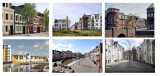
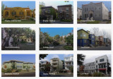
For decades, the behaviour of urban planners and politicians, but also of residents, has been determined by images of the ideal living environment, especially for those who can afford it. The single-family home, a private garden and the car in front of the door were more prominent parts of those images than living in an inclusive and complete neighbourhood. Nevertheless, such a neighbourhood, including a 'house from the 30s', is still sought after. Attempts to revive the idea of 'trese 'traditional' neighbourhoods' have been made in several places in the Netherlands by architects inspired by the principles of 'new urbanism' (see photo collage above). In these neighbourhoods, adding a variety of functions was and is one of the starting points. But whether residents of such a neighbourhood will indeed behave more 'locally' and leave their cars at home more often does not depend on a planning concept, but on long-term behavioural change.
An important question is what changes in the living environment residents themselves prefer. Principles for the (re)design of space that are in line with this have the greatest chance of being put into practice. It would be good to take stock of these preferences, confront (future) residents conflicting ideas en preconditions, for instance with regard to the necessary density. Below is a number of options, in line with commonly expressed preferences.
1. Playing space for children
Especially parents with children want more playing space for their children. For the youngest children directly near the house, for older children on larger playgrounds. A desire that is in easy reach in new neighbourhoods, but more difficult in older ones that are already full of cars. Some parents have long been happy with the possibility of occasionally turning a street into a play street. A careful inventory often reveals the existence of surprisingly many unused spaces. Furthermore, some widening of the pavements is almost always necessary, even if it costs parking space.
2. Safety
High on the agenda of many parents are pedestrian and cycle paths that cross car routes unevenly. Such connections substantially widen children's radius. In existing neighbourhoods, this too remains daydreaming. What can be done here is to reduce the speed of traffic, ban through traffic and make cars 'guests' in the remaining streets.
3. Green
A green-blue infrastructure, penetrating deep into the immediate surroundings is not only desired by almost everyone, but also has many health benefits. The presence of (safe) water buffering (wadis and overflow ponds) extends children's play opportunities, but does take up space. In old housing estates, not much more is possible in this area than façade gardens on (widened) pavements and vegetation against walls.
4. Limiting space for cars
Even in older neighbourhoods, opportunities to play safely and to create more green space are increased by closing (parts of) streets to cars. A pain point for some residents. One option for this is to make the middle part of a street car-free and design it as an attractive green residential area with play opportunities for children of different age groups. In new housing estates, much more is possible and it hurts to see how conventionally and car-centred these are often still laid out. (Paid) parking at the edge of the neighbourhood helps create a level playing field for car and public transport use.
5. Public space and (shopping) facilities
Sometimes it is possible to turn an intersection, where for instance a café or one or more shops are already located, into a cosy little square. Neighbourhood shops tend to struggle. Many people are used to taking the car to a supermarket once a week to stock up on daily necessities for the whole week. However, some neighbourhoods are big enough for a supermarket. In some cities, where car ownership is no longer taken for granted, a viable range of shops can develop in such a square and along adjacent streets. Greater density also contributes to this.
6. Mix of people and functions
A diverse range of housing types and forms is appreciated. Mixing residential and commercial properties can also contribute to the liveliness of a neighbourhood. For new housing estates, this is increasingly becoming a starting point. For business properties, accessibility remains an important precondition.
7. Public transport
The desirability of good public transport is widely supported, but in practice many people still often choose the car, even if there are good connections. Good public transport benefits from the ease and speed with which other parts of the city can be reached. This usually requires more than one line. Free bus and tram lanes are an absolute prerequisite. In the (distant) future, autonomous shuttles could significantly lower the threshold for using public transport. Company car plus free petrol is the worst way to encourage sensible car use.
8. Centres in plural
The presence of a city centre is less important for a medium-sized city, say the size of a 15-minute cycle zone, than the presence of a few smaller centres, each with its own charm, close to where people live. These can be neighbourhood (shopping) centres, where you are sure to meet acquaintances. Some of these will also attract residents from other neighbourhoods, who walk or cycle to enjoy the wider range of amenities. The presence of attractive alternatives to the 'traditional' city centre will greatly reduce the need to travel long distances.
The above measures are not a roadmap for the development of a 15-minute city; rather, they are conditions for the growth of a liveable city in general. In practice, its characteristics certainly correspond to what proponents envisage with a 15-minute city. The man behind the transformation of Paris into a 15-minute city, Carlos Moreno, has formulated a series of pointers based on all the practical examples to date, which can help citizens and administrators realise the merits of the 15-minute city in their own environments. This book will be available from mid-June 2024 and can be reserved HERE.
For now, this is the last of the hundreds of posts on education, organisation and environment I have published over the past decade. If I report again, it will be in response to special events and circumstances and developments, which I will certainly continue to follow. Meanwhile, I have started a new series of posts on music, an old love of mine. Check out the 'Expedition music' website at hermanvandenbosch.online. Versions in English of the posts on this website will be available at hermanvandenbosch.com.
Pelle Menke,
Communications and Programme officer Mobility
at Amsterdam InChange,
posted
Samenwerken aan transitievraagstukken; wat is er nodig? - Opbrengsten van het Amsterdam Smart City partnerdiner 2024
Als Amsterdam Smart City netwerk bijten we ons vast in complexe stedelijke transitievraagstukken. Ze zijn complex omdat doorbraken nodig zijn; van kleine doorbraakjes, tot grotere systeem doorbraken. Denk aan bewegingen rond; organisatie-overstijgend werken, domein-overstijgend werken, en van competitief naar coöperatief. Als netwerk zetten we samenwerkingsprojecten op waarin we gaandeweg ondervinden met wat voor barrières we te maken hebben en wat voor doorbraken er nodig zijn.
Tijdens ons jaarlijkse Partnerdiner op 2 april, hadden we het samen met eindverantwoordelijken van onze partnerorganisaties over de strategische dilemma’s die spelen bij transitievraagstukken. Als gespreksstarters gebruikten we onze lopende onderwerpen van 2024: De coöperatieve metropool, de ondergrond, de circulaire metropool en drijvende wijken. De gesprekken aan tafel gingen echter over wat er aan de basis staat van het werken aan transitievraagstukken. Zo ging het bijvoorbeeld over; het samenwerken aan visies en scenario’s, leiderschap, burgerlijke ongehoorzaamheid en de kracht van coöperaties. In dit artikel bespreek ik beknopt een aantal onderwerpen die onder de aandacht werden gebracht door onze gasten.
Belangen en visie organiseren
Bij een vraagstuk of onderwerp als de ondergrond, gaan we het al snel hebben over de data en de oplossingen. Dat is ‘te makkelijk’. Technisch gaat het allemaal wel kunnen, maar als we daar te snel beginnen met de oplossing lopen we over een aantal jaar weer vast. Het is belangrijk om eerst een stapje terug te doen en een gedeeld belang en gedeelde visie te organiseren.
Hoe je belanghebbenden verzamelt, en de methode om tot een gedeelde visie te komen, dat is wat meer aandacht verdient. Neem het ondergrond vraagstuk als voorbeeld. Op welke schaal organiseer je daarvoor de belanghebbenden? Aan de oppervlakte hebben we Gemeentelijke en Provinciale grenzen, maar in de ondergrond liggen netwerken van kabels en leidingen die op andere schaal zijn geïnstalleerd en hebben we te maken met bodemtypologieën met verschillende behoeften.
Samen voorstellen en voorspellen
Dat waar je naartoe wilt werken, dat moet van iedereen voelen. Het is belangrijk om een setting te creëren van gedeeld eigenaarschap, waarin iedereen zich ook gehoord voelt, en dat je voelt dat de mensen met wie je gaat samenwerken ook voor jouw belangen op zullen komen. Om samen tot een visie te komen, is het belangrijk om te werken aan scenario’s en die samen te doorleven. Je moet het dan niet alleen hebben over waar je heen wilt, maar ook uitwerken wat er gebeurt als je niets doet of als het helemaal verkeerd uitpakt.
De scenario’s zouden op waarden moeten rusten. Het beeld wat bij de scenario’s hoort is veranderlijk, maar de waarden niet. Samen ben je continu in samenspraak over wat de waarden betekenen voor het verhaal dat je creëert.
Leiderschap en een interdisciplinaire werkwijze
Transitievraagstukken en bovenstaande aanpakken verdienen een bepaald soort leiderschap. Zo zou een leidinggevende bijvoorbeeld een veranderlijke en faciliterende houding moeten tonen, en moet hij/zij vanuit waarden werken die inspireren en verbinden. Het zou meer moeten gaan over het faciliteren van doeners, het stimuleren van doelgericht samenwerken in plaats van taakgericht en ruimte bieden voor menszijn en persoonlijke expertises. Met dit laatste wordt verwezen naar een stukje burgerlijke ongehoorzaamheid. Om dingen die we belangrijk vinden in gang te zetten moeten we soms even los kunnen denken van onze organisatiestructuren en functies. We zouden wel wat vaker mogen appelleren aan ons menszijn.
Meer faciliteren en minder hiërarchie helpt ons om beleid en praktijk dichter bij elkaar te brengen, en om van competitief naar meer coöperatief te bewegen. Als je naar de uitvoering gaat mag de kracht verplaatsen naar de uitvoerders. De machtsverschuivingen tussen leidinggevenden en de doeners, met specifieke rollen en expertises, mag in een constante wisselwerking rond gaan.
Ook interdisciplinair samenwerken aan transitievraagstukken zal nog meer moeten worden gestimuleerd, en misschien wel de norm moeten worden. Bij overheden en bestuurders bijvoorbeeld, zijn transitie thema’s verdeeld over domeinen als energie, mobiliteit, etc. maar de vraagstukken zelf zijn domein overstijgend. Als voorwaarde zou je kunnen stellen dat je altijd twee transities aan elkaar moet koppelen. We zouden meer inspirerende voorbeelden moeten laten zien waarbij verschillende domeinen en transities aan elkaar worden gekoppeld, door bijvoorbeeld overheden.
Publiek-privaat-civiel
Publieke, private en civiele partijen zouden nog meer naast elkaar aan tafel mogen, in plaats van tegenover elkaar. Bedrijven kunnen verzuild zijn, of zich zo voelen, en zouden nog meer om zich heen kunnen kijken en samenwerken. Niet alleen met overheden, maar ook met civiele organisaties. Er zijn vaak meer gezamenlijke belangen dan we denken.
In een beweging naar niet-competitief samenwerken kunnen coöperaties een belangrijke factor zijn. Wanneer je meer autoriteit bij coöperaties neerlegt, weet je zeker dat er in de basis voor een wijk, een stad, haar inwoners, een publiek belang wordt gewerkt. Er liggen dan ook veel kansen bij een faciliterende houding vanuit de overheid naar coöperaties toe, en in de samenwerking tussen bedrijven en coöperaties.
Er zijn tijdens dit diner veel onderwerpen aan bod gekomen waar we met het netwerk mee aan de slag kunnen in onze programmering. De input wordt gebruikt voor onze lopende vraagstukken en we gaan de komende tijd in gesprek met partners om te kijken of we van start kunnen met verdiepende sessies of het ontwikkelen van methoden op (enkele van) deze onderwerpen.
<em>Wil je doorpraten over deze onderwerpen, met ons - of een van onze partners? Mailen kan naar pelle@amsterdamsmartcity.com*</em>
Herman van den Bosch,
professor in management development
,
posted
Will the 15-minute city cause the US suburbs to disappear? 6/7
Urbanisation in the US is undergoing major changes. The image of a central city surrounded by sprawling suburbs therefore needs to be updated. The question is what place does the 15-minute city have in it? That is what this somewhat longer post is about
From the 1950s, residents of US cities began moving en masse to the suburbs. A detached house in the green came within reach for the middle and upper classes, and the car made it possible to commute daily to factories and offices. These were initially still located in and around the cities. The government stimulated this development by investing billions in the road network.
From the 1980s, offices also started to move away from the big cities. They moved to attractive locations, often near motorway junctions. Sometimes large shopping and entertainment centres also settled there, and flats were built on a small scale for supporting staff. Garreau called such cities 'edge cities'.
Investors built new suburbs called 'urban villages' in the vicinity of the new office locations, significantly reducing the distance to the offices. This did not reduce congestion on congested highways.
However, more and more younger workers had no desire to live in suburbs. The progressive board of Arlington, near Washington DC, took the decision in the 1980s to develop a total of seven walkable, inclusive, attractive and densely built-up cores in circles of up to 800 metres around metro stations. In each was a wide range of employment, flats, shops and other amenities . In the process, the Rosslyn-Balston Corridor emerged and experienced rapid growth. The population of the seven cores now stands at 71,000 out of a total of 136,000 jobs. 36% of all residents use the metro or bus for commuting, which is unprecedentedly high for the US. The Rosslyn-Balston Corridor is a model for many other medium-sized cities in the US, such as New Rochelle near new York.
Moreover, to meet the desire to live within walking distance of all daily amenities, there is a strong movement to also regenerate the suburbs themselves. This is done by building new centres in the suburbs and densifying part of the suburbs.
The new centres have a wide range of flats, shopping facilities, restaurants and entertainment centres. Dublin Bridge Park, 30 minutes from Columbus (Ohio) is one of many examples.
It is a walkable residential and commercial area and an easily accessible centre for residents from the surrounding suburbs. It is located on the site of a former mall.
Densification of the suburbs is necessary because of the high demand for (affordable) housing, but also to create sufficient support for the new centres.
Space is plentiful. In the suburbs, there are thousands of (semi-)detached houses that are too large for the mostly older couples who occupy them. An obvious solution is to split the houses, make them energy-positive and turn them into two or three starter homes. There are many examples how this can be done in a way that does not affect the identity of the suburbs (image).
New construction in suburbs
This kind of solution is difficult to realise because the municipal authorities concerned are bound by decades-old zoning plans, which prescribe in detail what can be built somewhere. Some of the residents fiercely oppose changing the laws. Especially in California, the NIMBYs (not in my backyard) and the YIMBYs (yes in my backyard) have a stranglehold on each other and housing construction is completely stalled.
But even without changing zoning laws, there are incremental changes. Here and there, for instance, garages, usually intended for two or three cars, are being converted into 'assessor flats' for grandma and grandpa or for children who cannot buy a house of their own. But garden houses are also being added and souterrains constructed. Along the path of gradualness, this adds thousands of housing units, without causing much fuss.
It is also worth noting that small, sometimes sleepy towns seem to be at the beginning of a period of boom. They are particularly popular with millennials. These towns are eminently 'walkable' , the houses are not expensive and there is a wide range of amenities. The distance to the city is long, but you can work well from home and that is increasingly the pattern. The pandemic and the homeworking it has initiated has greatly increased the popularity of this kind of residential location.
All in all, urbanisation in the US can be typified by the creation of giant metropolitan areas, across old municipal boundaries. These areas are a conglomeration of new cities, rivalling the old mostly shrinking and poverty-stricken cities in terms of amenities, and where much of employment is in offices and laboratories. In between are the suburbs, with a growing variety of housing. The aim is to create higher densities around railway stations. Besides the older suburbs, 'urban villages' have emerged in attractive locations. More and more suburbs are getting their own walkable centres, with a wide range of flats and facilities. Green space has been severely restricted by these developments.
According to Christopher Leinberger, professor of real estate and urban analysis at George Washington University, there is no doubt that in the US, walkable, attractive cores with a mixed population and a varied housing supply following the example of the Rosslyn-Ballston corridor are the future. In addition, walkable car-free neighbourhoods, with attractive housing and ample amenities are in high demand in the US. Some of the 'urban villages' are developing as such. The objection is that these are 'walkable islands', rising in an environment that is anything but walkable. So residents always have one or two cars in the car park for when they leave the neighbourhood, as good metro or train connections are scarce. Nor are these kinds of neighbourhoods paragons of a mixed population; rents tend to be well above the already unaffordable average.
The answer of the question in the header therefore is: locally and slowly
Rihards Dzelme,
Inclusive Cities & AI / Trained Architect and Urbanist
,
posted
😀Resultaten - Is betrokkenheid van de gemeenschap de moeite waard? 😀

We hebben uiteenlopende en interessante reacties ontvangen van stedenbouwkundigen, architecten en gemeenten. Als u wilt weten wat andere professionals denken, vul dan deze enquête in met uw e-mailadres en wij delen de inzichten met u.
Bedankt! 😀
Follow Playground on LinkedIn
We've received varied and interesting responses from urban developers, architects, and municipalities. If you want to know what other professionals think, please fill out this survey with your email, and we will share the insights with you.
Thank you! 😀
Herman van den Bosch,
professor in management development
,
posted
The global distribution of the 15-minute city idea 5/7
A previous post made it clear that a 15-minute city ideally consists of a 5-minute walking zone, a 15-minute walking zone, also a 5-minute cycling zone and a the 15-minute cycling zone. These three types of neighbourhoods and districts should be developed in conjunction, with employment accessibility also playing an important role.
In the plans for 15-minute cities in many places around the world, these types of zones intertwine, and often it is not even clear which type of zone is meant. In Paris too, I miss clear choices in this regard.
The city of Melbourne aims to give a local lifestyle a dominant place among all residents. Therefore, everyone should live within at most 10 minutes' walking distance to and from all daily amenities. For this reason, it is referred to as a 20-minute city, whereas in most examples of a 15-minute city, such as Paris, it is only about <strong>the round trip</strong>. The policy in Melbourne has received strong support from the health sector, which highlights the negative effects of traffic and air pollution.
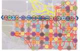
In Vancouver, there is talk of a 5-minute city. The idea is for neighbourhoods to become more distinct parts of the city. Each neighbourhood should have several locally owned shops as well as public facilities such as parks, schools, community centres, childcare and libraries. High on the agenda is the push for greater diversity of residents and housing types. Especially in inner-city neighbourhoods, this is accompanied by high densities and high-rise buildings. Confronting this idea with reality yields a pattern of about 120 such geographical units (see map above).
Many other cities picked up the idea of the 15-minute city. Among them: Barcelona, London, Milan, Ottawa, Detroit and Portland. The organisation of world cities C40 (now consisting of 96 cities) elevated the idea to the main policy goal in the post-Covid period.
All these cities advocate a reversal of mainstream urbanisation policies. In recent decades, many billions have been invested in building roads with the aim of improving accessibility. This means increasing the distance you can travel in a given time. As a result, facilities were scaled up and concentrated in increasingly distant places. This in turn led to increased congestion that negated improvements in accessibility. The response was further expansion of the road network. This phenomenon is known as the 'mobility trap' or the Marchetti constant.
Instead of increasing accessibility, the 15-minute city aims to expand the number of urban functions you can access within a certain amount of time. This includes employment opportunities. The possibility of working from home has reduced the relevance of the distance between home and workplace. In contrast, the importance of a pleasant living environment has increased. A modified version of the 15-minute city, the 'walkable city' then throws high hopes. That, among other things, is the subject of my next post.
Herman van den Bosch,
professor in management development
,
posted
The '15-minute principle' also applies to rural areas (4/7)
Due to a long stay in the hospital, I was unable to post my columns. I also cannot guarantee their continuity in the near future, but I will do my best...
In my previous post, I emphasised that urban densification should be coordinated with other claims on space. These are: expanding blue-green infrastructure and the desire to combine living and working. I am also thinking of urban horticulture. It is therefore unlikely that all the necessary housing in the Netherlands - mentioned is a number of one million housing units - can be realised in the existing built-up area. Expansion into rural areas is then inevitable and makes it possible to improve the quality of these rural areas. Densification of the many villages and small towns in our country enable to approach them from the '15-minute principle' as well. Villages should thereby become large enough to support at least a small supermarket, primary school and health centre, but also to accommodate small businesses. A fast and frequent public transport-connection to a city, to other villages and to a railway station in the vicinity is important.
A thorny issue is the quality of nature in the rural area. Unfortunately, it is in bad shape. A considerable part of the rural area consists of grass plots with large-scale agro-industrial use and arable land on which cattle feed is grown. Half of the Netherlands is for cows, which, incidentally, are mostly in stalls. Restoring nature in the area that is predominantly characterised by large-scale livestock farming, is an essential task for the coming decades.
The development of sufficiently dense built-up areas both in cities and villages and the development of new nature around and within those cities and villages is a beckoning prospect. This can be done by applying the idea of 'scheggen' in and around medium-sized and large cities. These are green zones that penetrate deep into the urban area. New residential and work locations can then join the already built-up area, preferably along existing railway lines and (fast) bus connections. These neighbourhoods can be built in their entirety with movement on foot and by bicycle as a starting point. The centre is a small densely built-up central part, where the desired amenities can be found.
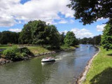
In terms of nature development, depending on the possibilities of the soil, I am thinking of the development of forest and heath areas and lush grasslands, combined with extensive livestock farming, small-scale cultivation of agricultural and horticultural products for the benefit of nearby city, water features with a sponge function with partly recreational use, and a network of footpaths and cycle paths. Picture above: nature development and stream restoration (Photo: Bob Luijks)
Below you can link to my free downloadable e-book: 25 Building blocks to create better streets, neighborhoods and cities
Amsterdam Economic Board,
posted
Amsterdamse ziekenhuizen gaan data delen
Amsterdam UMC, OLVG en het Antoni van Leeuwenhoek (AVL) gaan elkaars medische data gepseudonimiseerd hergebruiken in Health Data Space Amsterdam.
HDSA is een geheel nieuwe, regionale zorgdata-infrastructuur. Deze ondersteunt patiëntenzorg en medisch wetenschappelijk onderzoek naar gezondheid en preventie. Met als doel: gezondheidsverschillen in de regio te verkleinen en de gezondheidszorg toegankelijk te houden.
Het initiatief van de drie Amsterdamse ziekenhuizen komt voort uit een bredere samenwerking met de Universiteit van Amsterdam, Vrije Universiteit Amsterdam, Gemeente Amsterdam, Amsterdam Economic Board en Philips. Verder trekken de ziekenhuizen nauw op met Amsterdam AI, het Amsterdamse samenwerkingsverband voor kunstmatige intelligentie, en Health-RI, dat zich inzet voor een landelijke geïntegreerde gezondheidsdata-infrastructuur voor onderzoek, beleid en innovatie.
HDSA faciliteert met deze betere en snellere uitwisseling van zorgdata wetenschappelijk onderzoek naar gezondheid, beter medisch inzicht in hoe mensen langdurig gezond kunnen blijven, gepersonaliseerde preventie en behandeling van ziekten. De samenwerking is een eerste stap in de aansluiting op (een nog te bouwen) nationale infrastructuur vanuit het Integraal Zorgakkoord (IZA) en een Europese samenwerking via het European Health Data Space (EHDS).
Lees het complete bericht via
Rihards Dzelme,
Inclusive Cities & AI / Trained Architect and Urbanist
,
posted
Community Engagement & AI: Free few-click participation framework based on data and science.🎈

Happy Thursday, all 🎈
👯While Playground 🛝 is busy building the product, we actively talk with architects, developers, and governments. One topic that keeps surfacing is that there isn’t a clear and simple framework for starting community engagement and even convincing internal stakeholders to embark on this adventure without knowing the associated costs and best practices.
For that reason, we are releasing the Playground Framework 🪄. With five simple clicks, you can generate an actionable strategy to help you navigate the complexities of making our cities more inclusive.
✨Play with the framework and share your thoughts with us. Link to public demo video 🔗
💌<strong>Our inbox is open;</strong> let’s build the future of our cities together. 🏙️🍃
Susanna Stroer,
Communication
,
posted
Nomineer jouw AI-toepassing voor de Dutch Applied AI Award

Heb of ken jij een vernieuwend initiatief op het gebied van toegepaste Artificiële Intelligentie? Nomineer deze toepassing dan voor de Dutch Applied AI Award!
Het is dit jaar voor de vijfde keer dat deze juryprijs tijdens de jaarlijkse Computable Awards wordt uitgereikt. Sinds 2020 beloont het Centre of Expertise Applied AI van de Hogeschool van Amsterdam samen met ICT-platform Computable en podcast De Dataloog een innovatieve AI-toepassing.
Daarbij beoordeelt de jury - bestaande uit vijf experts op het gebied van Applied AI - alle inzendingen op drie criteria:
- Applied AI - in hoeverre is de oplossing al geïmplementeerd, wordt het gebruikt door de beoogde doelgroep en hoe groot is het aantal (potentiële) klanten/het aantal mensen dat met deze innovatie direct of indirect wordt geholpen.
- Uniekheid - in hoeverre is de innovatie de enige in haar soort, is het nooit eerder op de markt gebracht en kan het doel van de innovatie niet op een andere manier worden behaald.
- Responsible AI (transparantie, privacy, fairness, etc.) - in hoeverre is het ontworpen of gebruikte AI-algoritme transparant. Stelt het de gebruiker in staat om verantwoording af te leggen en duidelijk te zijn over de factoren die de algoritmische beslissingen beïnvloeden.
Je kunt een initiatief tot maandag 1 juli voordragen via deze link .
Uit alle inzendingen maakt de jury een top 3. De top 3 wordt op dinsdag 12 november uitgenodigd op de Hogeschool van Amsterdam om zijn innovatieve AI-toepassing te pitchen. De winnaar wordt op donderdag 28 november verkozen tijdens de uitreiking van de Computable Awards in de Jaarbeurs Utrecht.
Eerdere winnaars:
Susanna Stroer,
Communication
,
posted
Impact Magazine over AI

De Hogeschool van Amsterdam (HvA) heeft de derde editie van het Impact Magazine uitgebracht, waarin het Centre of Expertise Applied AI centraal staat. In deze editie draait het om AI en digitalisering, en gaat het magazine dieper in op wat de razendsnelle ontwikkeling van deze technologie voor onze maatschappij kan betekenen.
Daarnaast zoomt het Impact Magazine in op de verantwoorde ontwikkeling van AI en geeft het impactmakers een podium. Zo spreken Ivar Timmer (onderzoekscoördinator van het Legal Tech Lab, HvA) en Wilco Verdoold (docent-onderzoeker bij de opleiding Commerciële Economie, HvA) over het nieuwe AI-landschap waar studenten, docenten en beroepsprofessionals doorheen moeten navigeren. Maar hoe doe je dat en welke middelen kun je hiervoor inzetten?
Ook geeft het Impact Magazine lezers een diepgaande kijk op de snel veranderende en complexe wereld van generatieve AI. Hoe maak je studenten bijvoorbeeld AI-ready en voorkom je dat ze na hun afstuderen weer terug de schoolbanken in moeten? Lees deze editie hier
Stay up to date
Get notified about new updates, opportunities or events that match your interests.
Set up preferences

