Stay in the know on all smart updates of your favorite topics.
Mobility and transport are crucial for a city to function properly. Amsterdam is considered the world capital of cycling; 32% of traffic movement in Amsterdam is by bike and 63% of its inhabitants use their bike on daily basis. The number of registered electrical car owners in the Netherlands increased with 53% to 28.889 in 2016. Since 2008 car sharing increased with 376%. However, this is less than 1% of the total car use. Innovative ideas and concepts can help to improve the city’s accessibility, so share your ideas and concepts here.
Iskander Smit,
Futures researcher, curator, strategizer
at Cities of Things,
posted
State of Cities of Things: design for the interplay of humans, urban robotics, and physical AI
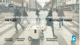
In 2018, the first paper on the Near Future in Cities of Things was published. Seven years later, we took the initiative to conduct exploratory research to reflect on the state of cities of things. Or, put differently: how should we assess the current state of urban robotics and physical AI?
In this interactive event, Iskander Smit will present the learnings from the research, and a panel of four of the approximately 25 interviewed experts will share their perspectives to kick off a discussion led by moderator Monique van Dusseldorp.
The central question is how the developments might impact and inspire the design of future cities, things, intelligent systems, and the interplay between these.
The panelists
- <strong>Maria Luce Lupetti</strong>; Assistant Professor in Design at Politecnico di Torino. She is co-director of POEL – Possible Entanglements Lab, a research group dedicated to investigating how people and technologies co-shape one another, and how design can help envision desirable configurations. She was the leading author of the first paper on Cities of Things in 2018. Maria Luce will reflect on the changes in human entanglement with the artificial world, particularly in complex technologies such as AI and robotics.
- <strong>Sen Lin</strong>; Senior Product Designer and AI Design Consultant. Sen was among the first students graduating in the Delft Design Lab Cities of Things. Sen just returned from a 2-month stay in China and will share his impressions from urban robotics there.
- <strong>Tomasz Jaskiewicz</strong> is a professor of civic prototyping at Rotterdam University of Applied Sciences. Tomasz is a founding partner in the creation of the Wijkbot platform for research through prototyping into urban robotics. He will share the learnings between experiments.
- <strong>Vera van der Burg</strong> is a designer, researcher, and Ph.D. candidate at TU Delft's Designing Intelligence Lab. Her research investigates how training AI models can become a reflective practice. With her research, she was awarded as Dutch Design Emerging Talent and FD Talent. She will reflect on the relations we build while applying (physical) AI.
- <strong>Iskander Smit</strong> is the founder of the Cities of Things, an expertise center for urban robotics and physical AI. Applying research through (speculative) design, connecting experts in knowledge events, and publishing via his weekly newsletter.
Monique will involve other interviewed experts and participants in the event to reflect on the impact of urban robotics and physical AI on the practice of creative industries, design methods, and on relations between humans and AI.
Before and after, there will be space to connect with other participants and explore the current Wijkbots.
Schedule:
15h00 - Doors open, mingle, explore Wijkbots
16h00 - Welcome and introduction to the results of the research by Iskander Smit
16h30 - Introductions of the positions by the panelists
17h00 - Interactive discussion with panel, participants
18h00 - Wrap up and drinks with bites
20h00 - End
If you can only join part of the event, you are welcome to join later.
Find more details about the program on the <strong>Cities of Things website</strong>.
The event is powered by CLICKNL, and registration is free, including drinks.
Manon den Dunnen,
Strategisch specialist digitaal
,
posted
Unmanned systems & sustainability @Formula 1
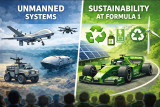
Unmanned systems; Developments & challenges
<strong>Pieter Elands,</strong> Program Manager Unmanned Systems at TNO, is an experienced manager of people and complex research programs. Pieter will share insights into the latest developments and key challenges in the field of unmanned systems. With a strong background in Aerospace and Defence, responsibility for coordinating research on unmanned systems and extensive knowledge of how unmanned systems are deployed in today’s military operations, the talk will explore technological, organizational, and strategic challenges.
Sustainability at the F1 Heineken Dutch Grand Prix
Dimitri Bonthuis is director Media & Sports Development at SportVibes and currently involved in major events like ABN AMRO Open and F1 Heineken Dutch Grand Prix. At the Dutch GP he is responsible for sustainability. This evening, Dimitri will talk about his experiences with sustainability at the Grand Prix, exploring how he approaches the topic, which innovations have been key, the challenges of driving sustainable initiatives, and how these efforts fit into a broader strategic vision.
21.00 Networking with coffee/tea
Manon den Dunnen,
Strategisch specialist digitaal
,
posted
Sensemakers Workshop DIY Smart Glasses
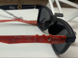
During this evening Paul Stefaan Mooij will introduce the DIY Smart Glasses he developed, he is bringing several 'arms'. The PMSG kit lets you swap out those boring old arms from your (sun)glasses for a custom-made PCBA that looks and functions like something a hacker MacGyver would dream up. It fits just like the original—using the same hinges, screws, and probably duct tape somewhere—but now you’ve got space for sensors, connectors, and all the IoT magic you can pack onto your temples.
Join us to experiment, learn and envision new sensors and possibilities.
https://www.hackster.io/psmooij/pmsg-prototype-modular-smart-glasses-8bd4e6
https://github.com/Control-C/PMSG
For more info and rsvp: https://sensemakersams.org/events/
The workshop is from 19-21h in the Makerspace of the OBA and you can also just walk in!
OBA: Oosterdokskade 143, 1011DL Amsterdam
Make this your personal feed
Jorden van der Hoogt,
Strategy and Innovation Lead
at Cenex NL,
posted
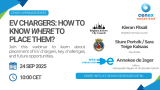
Cenex Webinar #2 - EV Chargers: How to know where to place them?
Join us for an exclusive webinar featuring three leading European cities sharing their proven strategies for EV charging infrastructure placement. Learn from real-world experiences and discover data-driven approaches that are transforming urban mobility across Europe.
𝗪𝗵𝗮𝘁 𝗬𝗼𝘂'𝗹𝗹 𝗟𝗲𝗮𝗿𝗻
🏙️ 𝗦𝘁𝗿𝗮𝘁𝗲𝗴𝗶𝗰 𝗣𝗹𝗮𝗰𝗲𝗺𝗲𝗻𝘁 𝗔𝗽𝗽𝗿𝗼𝗮𝗰𝗵𝗲𝘀 - Discover how Brighton & Hove, Oslo, and Metropolitan Region of Amsterdam Electric have developed their EV charging strategies
📊 𝗗𝗮𝘁𝗮-𝗗𝗿𝗶𝘃𝗲𝗻 𝗗𝗲𝗰𝗶𝘀𝗶𝗼𝗻 𝗠𝗮𝗸𝗶𝗻𝗴 - Learn about the tools and methodologies these cities use to optimize charging point locations
🚗 𝗦𝗲𝗿𝘃𝗶𝗻𝗴 𝗔𝗹𝗹 𝗥𝗲𝘀𝗶𝗱𝗲𝗻𝘁𝘀 - Understand how to address the needs of residents without private parking spaces
🌍 𝗜𝗻𝘁𝗲𝗿𝗻𝗮𝘁𝗶𝗼𝗻𝗮𝗹 𝗕𝗲𝘀𝘁 𝗣𝗿𝗮𝗰𝘁𝗶𝗰𝗲𝘀 - Gain insights from three different countries and municipal perspectives
💡 𝗟𝗲𝘀𝘀𝗼𝗻𝘀 𝗟𝗲𝗮𝗿𝗻𝗲𝗱 - Avoid common pitfalls and learn from real implementation experiences
𝗙𝗲𝗮𝘁𝘂𝗿𝗲𝗱 𝗦𝗽𝗲𝗮𝗸𝗲𝗿𝘀
Kieran Fitsall - Brighton & Hove Council
Sture Portvik & Sara Teige Kalsaas - City of Oslo
Annekee de Jager - MRA-e (Amsterdam Metropolitan Region)
Hosted by Sanne van Breukelen - Cenex Nederland
𝗪𝗵𝘆 𝗔𝘁𝘁𝗲𝗻𝗱?
With Europe requiring 6.8 million public charging points by 2030, municipalities face unprecedented challenges in planning and implementing EV infrastructure. This webinar brings together three cities that have successfully navigated these challenges, offering practical insights for:
- Municipal planning departments
- Urban mobility professionals
- EV infrastructure developers
- Policy makers and city officials
- Transport consultants
𝗞𝗲𝘆 𝗧𝗼𝗽𝗶𝗰𝘀 𝗖𝗼𝘃𝗲𝗿𝗲𝗱
- Historical approaches vs. modern data-driven strategies
- Stakeholder engagement
- Grid capacity considerations and smart charging integration
- On-street charging solutions for urban residents
𝗪𝗵𝗼 𝗦𝗵𝗼𝘂𝗹𝗱 𝗔𝘁𝘁𝗲𝗻𝗱
This webinar is essential for anyone involved in:
- Urban planning and development
- Sustainable transport initiatives
- EV infrastructure deployment
- Municipal policy development
- European mobility strategy
𝗥𝗲𝗴𝗶𝘀𝘁𝗿𝗮𝘁𝗶𝗼𝗻
Don't miss this opportunity to learn from Europe's leading cities in EV infrastructure planning. Register now to secure your spot and gain access to exclusive insights that could transform your city's approach to EV charging.
---
This webinar is part of Cenex's ongoing commitment to accelerating the transition to sustainable transport through knowledge sharing and best practice dissemination across European cities.
Anoop Kumar Jha,
Architect Planner, MSc. (Infrastructure & Smart Cities)
,
posted
Everything Urban 001_Interactive Talk for students and young professionals
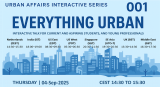
Everything Urban 001 (LinkedIn Event) is the first in the Interactive Talk series for students and young professionals interested in Urban Affairs i.e. urban planning, urban management, architecture, sustainability, smart cities, to name some. Feel Free to attend it on September 4, 2025. More details in the link.
Jorden van der Hoogt,
Strategy and Innovation Lead
at Cenex NL,
posted
E-Trucks: Is Trucking Still Hard to Electrify?
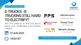
𝟭𝟬 𝘆𝗲𝗮𝗿𝘀 𝗮𝗴𝗼, 𝗵𝗲𝗮𝘃𝘆 𝘁𝗿𝘂𝗰𝗸𝘀 𝘄𝗲𝗿𝗲 “𝘁𝗼𝗼 𝗵𝗮𝗿𝗱 𝘁𝗼 𝗲𝗹𝗲𝗰𝘁𝗿𝗶𝗳𝘆.”
𝗡𝗼𝘄? 𝗙𝗹𝗲𝗲𝘁𝘀 𝗮𝗿𝗲 𝗽𝗿𝗼𝘃𝗶𝗻𝗴 𝘁𝗵𝗲𝘆 𝗰𝗮𝗻 𝘄𝗼𝗿𝗸 — 𝗯𝘂𝘁 𝗼𝗻𝗹𝘆 𝘄𝗵𝗲𝗻 𝗿𝗼𝘂𝘁𝗲𝘀, 𝗰𝗵𝗮𝗿𝗴𝗶𝗻𝗴, 𝗮𝗻𝗱 𝗼𝗽𝗲𝗿𝗮𝘁𝗶𝗼𝗻𝘀 𝗮𝗿𝗲 𝗶𝗻 𝘀𝘆𝗻𝗰.
On 𝟮𝟳 𝗔𝘂𝗴 2025 at 𝟭𝟬:𝟬𝟬 𝗖𝗘𝗦𝗧, we’ll break down exactly what works today, where the pain points still hurt, and how to electrify your fleet without disrupting your operations.
You’ll get:
• The biggest shifts in electric truck technology and adoption over the last decade
• Which fleets are running e-trucks successfully today — and where they still don’t fit
• The toughest operational and infrastructure hurdles (and why they persist)
• When e-trucks hit profitability based on TCO, range, and duty cycle
• A practical roadmap to start electrifying your fleet without disrupting operations
Speakers:
Tharsis Teoh, Smart Freight Centre — Perspective of the freight sector
Michael Ayres, Flexible Power Systems — Experience from live projects on depot charging
Rishabh Ghotge, Cenex Nederland — Live demo of KITE, a free tool for electrifying your truck fleets
Hosted by our favourite Sanne van Breukelen
Join us to cut through the noise and address the real barriers European fleets face.
Cenex, NextETRUCK, MACBETH Project, ALICE, Alliance for Logistics Innovation through Collaboration in Europe (ETP LOGISTICS), 2Zero , Connekt, Connectr - Energy innovation, ERTICO - ITS Europe, POLIS network, Niklas Schmalholz, Holly Nakatomi, Megan de Langen
Pelle Menke,
Communications and Programme officer Mobility
at Amsterdam InChange,
posted
Demoday #28: From Policy to Practice: Inclusive Design Ambitions of the Amsterdam Transport Authority
On the 5th of June, during the 28th Knowledge and Demo Day, we explored the topic of Inclusive Design in the context of mobility projects together with a diverse group of network partners. Iris Ruysch introduced the theme on behalf of the Amsterdam Transport Authority (Vervoerregio), while David Koop and Lotte de Wolde from our knowledge partner Flatland facilitated the session format, moderation and visual notes.
The ambition of the Amsterdam Transport Authority
The Amsterdam Transport Authority is responsible for public transport across fourteen municipalities in the region and is working towards a mobility system that enables people to travel quickly, safely and comfortably by public transport, bicycle or car. In addition to organising and funding public transport and investing in infrastructure, the Authority actively contributes to broader societal goals such as sustainability, health and inclusivity.
Inclusive mobility is one of the key themes within the wider mobility policy. The central principle is that everyone – regardless of age, income, disability, gender or background – should be able to travel well and comfortably throughout the region. This calls for a mobility system that is accessible, affordable, appropriate, socially safe and welcoming.
The aim of the session on 5 June was to work with the network towards an initial action plan for applying inclusive design principles in mobility projects. Iris is keen to ensure that the ambitions around inclusivity are not only stated in policy and vision documents but are truly embedded in the organisation – from policymakers to implementation teams.
Session set-up
After an introduction by Iris on the context and ambitions within the Transport Authority, we got to work. In small groups, participants explored the profile of the implementing civil servant (using a persona canvas) and considered desirable changes in approach; in terms of attitude, skills and collaboration.
We then used the Inclusive Design Wheel to examine how existing programme components of the Authority could be made more inclusive. In pairs, we tackled themes such as accessible travel information, social safety at stations (specifically for women), and improving bicycle parking facilities.
The Inclusive Design Wheel is an iterative process model that supports the structural integration of inclusivity into design and policy projects. The model emphasises collaboration, repetition, and continuous learning. It consists of four phases:
- Explore: Gather insights about users, their needs, and potential exclusion.
- Create: Develop ideas, concepts, and prototypes that address inclusive needs.
- Evaluate: Test whether the designs are inclusive, collect feedback, and make improvements where necessary.
- Manage: Ensure shared understanding, set goals, engage stakeholders, and embed the process.
Outcomes and insights
While the persona profiles were being developed, I observed the group discussions and noted several important insights to take forward in the development of the action plan:
- Awareness and concrete translation: Implementation teams often already have an intrinsic motivation to contribute to inclusivity goals set in policy. However, they may not always realise how their day-to-day work can support those goals. It’s important to continuously ask the question ‘How, exactly?’. Tools like checklists, templates and practical examples can support this translation from policy to practice.
- Flexible guidelines and not ‘extra work’: Given the differences in scale, pace and content of projects, guidelines need to be flexible. There must also be sufficient room in terms of time and budget. Most importantly, these guidelines and action plans should feel supportive, not like extra rules or bureaucracy. Too many rigid frameworks can backfire.
- Interaction between policy and implementation: There is a need for more two-way communication. Implementation teams want to be involved early in policy development, especially when they will be the ones carrying it out. They also want opportunities to reflect with policymakers on whether policy is being implemented as intended. This allows for timely feedback and course-correction based on real-world experience.
- An Inclusive Design mindset: Beyond sharpened policy documents and a stronger focus on the end user, Inclusive Design also requires a mindset – one that is inquisitive and reflective. Embedding this within the organisational culture will require more than just an action plan.
What’s next
Iris collected valuable input to kick-start the development of the action plan, and participants gained a better understanding of the Amsterdam Transport Authority, the principles of Inclusive Design, and what it takes to move from policy to implementation. This summer, a trainee will start at the Transport Authority to further develop this topic and the action plan. The session, this report, and Flatland’s visual notes provide a strong foundation to build on. We’ll be meeting with Iris and David to explore how we can support this follow-up.
Would you like to learn more about any of the topics or developments mentioned in this report? Feel free to email pelle@amsterdaminchange.com.
Noor Veenhoven,
Program manager energy & circularity
at Amsterdam InChange,
posted
Demoday #28: How to keep our mechanics on the move?
On the 5th of July, during Demoday #28, we zoomed in on one of the pressing challenges facing the energy transition: grid congestion, and more specifically, how to keep the people who maintain the grid moving efficiently.
Grid congestion is a serious and growing concern for grid operator Alliander. It is therefore essential to speed up the grid reinforcement as much as possible. Alliander’s Operation 2.0 team is exploring innovative ways to work smarter, faster, and more flexibly to keep pace with these developments.
Their efforts focus on three tracks:
• Alleviating staff shortages by training office employees to occasionally support fieldwork.
• Exploring technologies like advanced ground radar to get better insights into underground assets.
• Improving the logistics of supplying mechanics to ensure they have the right tools, in the right place, at the right time.
This last track was the main focus of our work session.
Inefficient supply of mechanics
Logistics experiences show that mechanics collect materials inefficiently when supplying their vans and jobs, resulting in stock corrections, less control over stock, unnecessary work for logistics staff, and valuable mechanic hours being lost, which leads to less execution work. A few key problems stood out:
• Supplies are scanned inconsistently, so the system doesn’t reflect what is actually in stock.
• Every van is different, with a custom layout that suits the preferences of its mechanic.
• The work itself is unpredictable, which makes standardised restocking difficult.
• With a transition to smaller electric vans, space is becoming even more limited.
A simple optimisation of the process is not enough, especially without considering the human element. For many mechanics, a visit to the supply centre is more than just logistics. It is a moment of connection, a short break from the road, or simply a chance for a good coffee.
Ideas from the network
In groups of four, we brainstormed creative ideas to improve the supply of Alliander vans while keeping the needs and routines of mechanics in mind.
Some highlights:
• Peer-to-peer van inspiration: Let mechanics share the layout of their vans with colleagues. They can exchange best practices and take pride in an efficient setup. Adding a bit of gamification might boost motivation even more.
• A mobile supply service: A supply van could drive around to restock mechanic vans, reducing the need to visit the supply centre. However, this might remove the social element of taking a break with colleagues.
• Smarter routing: Track the location of mechanics only in relation to nearby grid faults. This way, the closest available mechanic can respond without feeling like their movements are constantly being monitored.
• Package-based resupply: Inspired by delivery service Picnic, mechanics could exchange complete “supply packages” instead of picking out materials individually. Collaborating with wholesale suppliers could reveal more useful insights.
• Automatic stock tracking: Tag all materials with RFID chips and use sensors installed in the door of the van to register what is removed from the van. This eliminates the need for manual scanning and reduces the chance of mistakes.
Do you have a bright idea to improve how mechanics work? Let us know in the comments or send a message to Noor at noor@amsterdaminchange.com.
A big thank you to Thomas Hoekstra and Iris van der Zanden from Alliander for bringing this challenge to the network, and to Chantal Inia from Royal HaskoningDHV for moderating the session.
A Lab,
Where Curious Works
at A Lab Amsterdam,
posted
A Lab Open Huis. Met exposities, pitches voor een positieve toekomst, live muziek, dans en theater, workshops en meer!
Laat je nieuwsgierigheid de vrije loop tijdens het <strong>A Lab Open Huis</strong>. Een creatief en innovatief festival voor alle nieuwsgierige Amsterdammers die in deze turbulente tijden waarde hechten aan kunst & cultuur, duurzaamheid en sociale innovatie.
Kom kijken hoe meer dan 350 members in onze broedplaats werken aan een positieve toekomst. Met een programma vol exposities, live muziek, kunst, pitches, theater, fotoreportages, workshops, interessante ontmoetingen en meer! Kinderen? Neem ze vooral mee, het is voor iedereen een feestje!
Ontdek nieuwe ideeën, ontmoet makers en verken het live programma. Dwaal rond en laat je verrassen door wat je tegenkomt, of volg een van de inspirerende routes die speciaal zijn samengesteld langs de thema’s waar A Lab members aan werken. Er is een (digitale) kunst & cultuurroute, een duurzaamheidsroute, een sociaal maatschappelijke innovatieroute en ga voor een mix van activiteiten in de kidsroute.
Bekijk het volledige programma met timetables komende tijd op de website, maar een sneak peek is natuurlijk altijd leuk. Laat je meevoeren door livemuziek – van opkomend raptalent tot jazzy klanken – en ontdek unieke ervaringen zoals een levende algenexpo, verticale dans op de binnentuinmuur en interactieve datavisualisatie. Luister naar korte, inspirerende talks over een zelfredzame toekomst, stap in een Kanta vol verhalen over Amsterdam Noord, of scoor iets moois in de A Lab pop-up store. Geniet van wereldse smaken van de restaurants van het nieuwe Maritim Hotel, bewonder kunst van o.a. jonge makers, draai aan een meteorologisch rad of ga zelf aan de slag in een escape room of met je eigen digitale kunst. En voor filmliefhebbers: struin door Izzy’s Videotheek voor verborgen parels die je nergens kunt streamen.
Het event is gratis, maar reserveer wel je gratis ticket via deze link.
arjen groeneveld,
Data designer
,
posted
Amsterdam Data Design Den- Beyond the Graph
Amsterdam Data Design Den is the city's newest community meetup celebrating the intersection of data, design, and storytelling. In an era where information surrounds us, we believe in the power of creative visualization to transform complex data into compelling narratives that inspire and inform.
Every couple of months, we bring together professional designers, creative studios, and emerging talents in an informal setting to share groundbreaking projects and foster meaningful connections. Our speakers range from established design studios showcasing large-scale data visualization projects to independent designers experimenting with novel approaches to information design.
What makes our meetup unique is its commitment to accessibility and community. There's no entry fee, no membership requirements—just a gathering of curious minds passionate about using design to make sense of our data-driven world. Whether you're a seasoned information designer, a student exploring data visualization, or simply intrigued by the creative possibilities of data storytelling, you'll find your place here.
Join us for an evening of inspiration, networking, and casual conversations over drinks. Each session features thought-provoking presentations followed by open discussions, creating an environment where ideas flow freely and collaborations naturally emerge.
Amsterdam Data Design Den meets in the heart of Amsterdam, bringing together the city's vibrant creative community to explore the future of data visualization and information design.
Jorden van der Hoogt,
Strategy and Innovation Lead
at Cenex NL,
posted
🚨 𝗪𝗲'𝗿𝗲 𝗮𝗹𝗿𝗲𝗮𝗱𝘆 𝗮𝘁 𝟱𝟬% – 𝗮𝗻𝗱 𝘄𝗲 𝗵𝗮𝘃𝗲𝗻'𝘁 𝗲𝘃𝗲𝗻 𝗸𝗶𝗰𝗸𝗲𝗱 𝗼𝗳𝗳 𝘆𝗲𝘁! 🚨
Wow! Half of the tickets for our Cenex Nederland Lenteborrel have already been ordered – and the event isn’t even happening until 8th of May 2025. 🎉
That means: lots of excitement, high expectations, and... an opportunity you don’t want to miss.
The event will be focusing on Transport & Mobility, Circular Mobility, Energy & Infrastructure, where you can expect the following.
📍 What to expect:
✅ Meet exhibitors and explore the latest innovations
🎮 Join or watch two exciting serious game sessions
🎤 Be inspired by four engaging keynotes (English)
🥂 End the day with our annual spring reception where you have the opportunity to network.
Want to join us? Don’t wait too long – the remaining 50% is likely to go even faster. 🎫
Please make sure to get your (free) ticket via Eventbrite
Yeni Joseph,
Head of Public Policy and Government Affairs
at TNW,
posted
Apply for The Next 750 and attend TNW Conference

Your talent, recognized
LET'S CELEBRATE YOU!
The Next 750 builds upon the legacy of our renowned T500 program, expanding our recognition platform in honor of <strong>Amsterdam's 750th anniversary</strong>.
This is a celebration of exceptional talent in tech and entrepreneurship, showcasing individuals who are shaping the future across three categories:
- <strong>Rising Stars</strong>: Talents under 30 redefining innovation
- <strong>Inclusion Champions</strong>: Diverse individuals driving change through unique perspectives
- <strong>Amsterdam Changemakers</strong>: Local pioneers making an impact in the Amsterdam community
TNW Conference is proud to use its platform to honor and empower these 750 incredible talents.
Tech moves fast, but it’s powered by people. That’s why we’re giving The Next 750 access to TNW Conference 2025 — to connect them with the visibility, tools, and networks they need to thrive.
We’re shining a spotlight on the movers, makers, and game-changers shaping what’s next. Their contributions deserve to be celebrated, their potential amplified. Together, we’re not just building the future of Amsterdam—we’re shaping the future of the world.
A panel of judges will carefully review applications based on the following criteria: relevant (work) experience, side projects, and personal accomplishments to find the best candidates.
Applications are <strong>now open.</strong> This program is a great opportunity to connect with some of the most talented individuals in the digital tech industry, and you don't wanna miss it!
Pelle Menke,
Communications and Programme officer Mobility
at Amsterdam InChange,
posted
Demoday #27: Zero Emission City Logistics - The Food Center Amsterdam Case. Hosted by the Interdisciplinary Graduation Circle (HvA)
Amsterdam faces a major logistics challenge: from January 2025 onwards, polluting delivery vans will no longer be allowed in the city centre. How can entrepreneurs and suppliers in the food sector prepare for this and turn the transition into a success? Four fourth-year students from the Amsterdam University of Applied Sciences (HvA) are working together in an interdisciplinary graduation circle to find solutions. They are addressing both the technical aspects of this issue and the communication side. Drawing on their different fields of study, they analyse the problem and develop a joint recommendation for the Amsterdam Transport Region (Vervoerregio Amsterdam). As part of their research, they used this working session as a focus group with stakeholders from the Amsterdam InChange network.
Opening of the session
Stan van der Meer (Logistics Management), Chanel Pinas (Digital Marketing), Jay van den Boog (Digital Marketing), and Vanessa Man (Logistics Engineering) opened the session with a few questions to get a sense of the participants in the room. The attendees rated their own level of expertise on the topic and wrote down a word they associated with the issue.
The room was filled with expertise: policymakers from the Municipality of Amsterdam directly involved in the issue, as well as researchers and advisors from Arcadis and Cenex who are actively working on zero-emission logistics. Representatives from the Port of Amsterdam and EIT Urban Mobility (a European network) were also present, each bringing their own perspective on the challenge.
Statements and discussion
The students facilitated the discussion by presenting a number of statements, and moderating the group discussions that followed. Below are a few observations.
Statements 1 and 2 (summarized): Amsterdam entrepreneurs are aware of the new zero-emission policy, and it is clearly presented to them.
There was broad consensus within the group regarding the city’s policy. Communication from the Municipality of Amsterdam has been extensive over the past ten years — first targeting larger logistics partners in the city, and more recently also via letters to local entrepreneurs. In addition, physical signs throughout the city communicate the new regulations. However, what can cause confusion among entrepreneurs are the mixed signals coming from national politics and policies. This can create the impression that there is a lack of determination or vision behind the transition, making entrepreneurs hesitant to invest in new electric vehicles.
Statement 3: There is sufficient support for entrepreneurs to switch to zero-emission transport.
The group also agreed that the municipality is doing a good job offering financial support where needed. Advisors, for example, are available to guide entrepreneurs through the rules and support options. However, it was noted that the target audience still does not always have a clear overview of all the possibilities. While the municipality communicates well and “presents” the available opportunities, confusion and uncertainty remain among entrepreneurs on the streets. This represents an important communication challenge that the students will further explore.
Also, regarding this statement and the ones before, it was noted that the (micro)entrepreneurs and stakeholders we were talking about weren't present in the room. It would have been good to have more of the target group in the room, but for this session specifically the policymakers and specialists from our network were the ones the students focussed on. In the following months of their research, their focus will be on the specialists and (micro)entrepreneurs in the food sector.
Statement 4: Logistics hubs play an important role in reducing transport movements in the city.
This part of the discussion became more technical. The group agreed that a new logistics system with greater use of hubs throughout the city is, in theory, a logical and effective step in this transition. In practice, however, it is not as simple as it sounds. For example, consider the Port of Amsterdam — an existing large hub at the edge of the city for water-based transport. While goods can be transferred there to smaller vehicles for distribution within the city, docking on the busy canals poses a significant challenge. Additionally, water transport was the first sector required to become fully electric, and this system is currently somewhat reduced in scale
Road transport is also complex. Hubs are locations where goods from different suppliers can be combined and delivered with fewer transport movements. But who holds responsibility for these goods if something goes wrong? And how can this be managed without adding too much delivery time?
One of the participants summarized it well: we are shifting from logistics as a chain, where each party is responsible for a small part, to an ecosystem where all actors and the physical infrastructure depend on one another, share collective responsibility, and need to exchange information and services to keep the system running.
In-depth interviews
The second part of the session consisted of two breakout groups in which the students could ask targeted questions for the research they are conducting. Jay and Chanel spoke with several participants about the research side of the project, delving deeper into successful research methods that involve entrepreneurs. Stan and Vanessa spoke with another group of participants about potential solutions for this issue, gathering knowledge about existing innovations and solutions or what might still be needed for this logistical transition.
Follow-up
Through this focus group, the students in this interdisciplinary graduation circle have engaged in dialogue with experts on this topic from various organizations. They also made many new contacts and actively shared their project with the network. During our upcoming Knowledge and Demo Day on June 5, they will once again be part of the program and present their results and potential conclusions.
Would you like to know more about the graduation circle, the research topic, or do you have tips or questions for the students? Feel free to reach out via pelle@amsterdaminchange.com
Jorden van der Hoogt,
Strategy and Innovation Lead
at Cenex NL,
posted
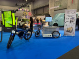
Cenex Nederland Lenteborrel 2025 - 8 mei
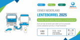
🌿 Vier de lente met ons tijdens de Cenex Nederland Lenteborrel 2025! 🌸
[English below]
Op 8 mei 2025 organiseren we weer een nieuwe editie van de Cenex Lenteborrel! Dit jaar is de editie open voor iedereen, het wordt een inspirerende middag vol innovatie, samenwerking en netwerkmogelijkheden.
📍 Locatie: A-lab, Overhoeksplein 2, 1031 KS Amsterdam
🕒 Tijd: 13:30 - 18:30
✨ Wat kun je verwachten?
🔹 13:30 - 15:30 – Inloop & exposanten
Ontmoet onze exposanten en ontdek de nieuwste innovaties op het gebied van mobiliteit en circulariteit.
🔹 13:30 - 15:00 – Twee serious games
Doe mee aan een interactieve sessie en verken de uitdagingen en kansen in de sector op een speelse manier. Liever toeschouwer? Dat kan ook! (Kies één sessie)
🔹 15:30 - 16:45 – Vijf inspirerende keynotes (Engels)
We verwelkomen sprekers van onder andere:
⚡ Coding the Curbs
⚡ Kempower
⚡ Ministerie van Infrastructuur en Waterstaat
⚡ Circular Campus
⚡ Cenex Nederland
🔹 16:45 - 18:30 – Gezellige Lenteborrel
Sluit de dag af met een hapje en een drankje, terwijl je nieuwe connecties legt met andere professionals.
Houd onze Eventbrite-pagina en LinkedIn in de gaten voor updates over sprekers en exposanten!
📢 Bevestig je aanwezigheid en mis het niet! (Beperkt aantal tickets beschikbaar)
Registreer hier: https://cenex-lenteborrel-2025.eventbrite.nl
-------English
🌿 Join us for the Cenex Spring Reception 2025! 🌸
On May 8, 2025, we’re hosting the latest edition of the Cenex Lenteborrel (Spring Drinks)—and this year, it’s open to all! Expect an inspiring and engaging afternoon filled with innovation, collaboration, and networking.
📍 Location: A-lab, Overhoeksplein 2, 1031 KS Amsterdam
🕒 Time: 13:30 - 18:30
✨ What’s in store?
🔹 13:30 - 15:30 – Walk-in & exhibitor showcase
Meet our exhibitors and explore the latest advancements in mobility and circularity.
🔹 13:30 - 15:00 – Two serious games
Join an interactive session tackling industry challenges in a fun, engaging way. Prefer to observe? That’s possible too! (Choose one session.)
🔹 15:30 - 16:45 – Five inspiring keynotes (English)
Industry leaders will share their insights, including:
⚡ Coding the Curbs
⚡ Kempower
⚡ Ministry of Infrastructure and Water Management
⚡ Circular Campus Delft
⚡ Cenex Netherlands
🔹 16:45 - 18:30 – Spring Networking Reception
Wrap up the day with drinks, bites, and great conversations with fellow professionals.
Stay tuned via our Eventbrite page and LinkedIn for speaker and exhibitor updates!
📢 Confirm your attendance and don’t miss out! (Limited tickets available)
Register here: https://cenex-lenteborrel-2025.eventbrite.nl
Luka de Koe,
Technical Specialist Circular Mobility
at Cenex NL,
posted
Life Cycle Analysis serious game
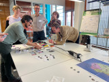
🎲♻️ Doe mee aan onze Life Cycle Analysis Serious Game!
Aanstaande dinsdag organiseren we onze Cyclum Vitae-serious game tijdens de Week van de Circulaire Economie!
Bij Cenex Nederland geloven we in het vertalen van kennis naar impact—en dat is precies waar Cyclum Vitae om draait. Dit boeiende bordspel neemt spelers mee op reis om de principes van een Life Cycle Analysis en de milieueffecten van product productie, gebruik en afvalverwerking te begrijpen.
🌱 Wat is de uitdaging? Spelers navigeren door realistische afwegingen, van het kiezen van materialen en productiemethoden tot het beheren van productgebruik en einde-levensduur. Het doel? Het meest duurzame product ontwerpen terwijl je concurrerend blijft in de markt.
📅 Wanneer: 18 maart, 14:00 - 16:00
📍 Waar: A-Lab, Overhoeksplein 2 (Lab 207)
Voor Engels- en Nederlandstaligen
🔗 Meld je aan via e-mail
Mariam Jessajan,
Intern Collection Presentation
at Eye Filmmuseum,
posted
Stream the Amsterdam Forever Young Programme on Eye Film Player

Discover the Amsterdam Forever Young program on the Eye Film Player, a diverse programme that explores the dynamic, ever-evolving spirit of Amsterdam. This collection of films highlights how the city’s unique identity has been shaped by its past, present, and future. Hence, we place a special focus on the intersection of urban development and planning, offering a look at how the city’s architectural and cultural transformations have intertwined in, both, historical films, as well as more contemporary filmic undertakings. Thus, our collection of films, such as Where the Rats are King, A Photographer Films Amsterdam and Amsterdam Global Village, shed light on the living conditions in Amsterdam, the urban communities witihin Amsterdam and, even, films as Jenny and Amsterdam on Film that shed light on how the canals have shaped Amsterdam more than aesthetically e.g., with its focus on ecology and care for our climate. Through, both, monetized and free to watch films, we aim to share the rich history of our city, whilst aiming for a dynamic space for creativity, inclusivity, and sustainability in the future, too that we hope this knowledge and collection will inspire.
All in all, Amsterdam Forever Young invites you to reflect on the city's evolution and its commitment to being a centre of modernity, without losing the essence of its heritage. Available on the Eye Film Player, to watch from your bedroom, this "digital" exhibition celebrates Amsterdam as the city of urban transformation that, at the same time, stay true to its historical roots.
Rosalie Post,
Applied Anthropologist
at Namla,
posted
Dissemination conference of our EU funded project AnthroAction: increasing employability and societal impact of action researchers.
Namla and Univerzita Pardubice Anthropology Department are hosting a one time mini conference next week on the results of our project in Erasmus Plus called AnthroAction: increasing employability and societal impact of action researchers. (https://erasmus-plus.ec.europa.eu/projects/search/details/2023-2-NL01-KA210-ADU-000180400)
We have been running the project since March 2024 and just wrapped up our pilot course for graduates of anthropology in Czech Republic and Netherlands; where the graduates learned to combine rapid ethnography and design thinking to tackle a real-world problem, suggested by real NGOs.
The NGOs that contributed to the project were:
-Czech Blind United (https://www.sons.cz/) with the question: how can we attract more younger members to our organisation?
-Junak - Czech Scouts (https://www.skaut.cz/) with the question: what do today’s teenagers want in leadership training?
-De Meevaart Community Centre (https://meevaart.nl/) with the question: how can we start a blue zone in Indische Buurt in Amsterdam?
-The Really Healthy School (https://www.skutecnezdravaskola.cz/) with the question: how can we reach more primary schools with our programme?
The participants in the course were coming from all over Czech Republic, and Amsterdam.
In the conference, we will discuss what happened in the course, how it went, what we can learn from the pilot. Also a number of professors in Anthropology from different parts of Europe (such as Laurens Bakker, Ana-Isabel Afonso), applied anthropologists from Czech Republic (such as Karolina Kania, PhD, Socionaut, z.s.), as well as organisations in our network will share reflections on how what we did here fits into a wider context.
Please register here before January 22nd: https://docs.google.com/forms/d/e/1FAIpQLSfGfI-vtCTk3XdaGpZvlK37y2VKqZqIV1LUfUiJhsD0OqFlxg/viewform
and join the conference at this Zoom link:
Zoom link: https://us02web.zoom.us/j/89954251812?pwd=78KpFxVY3rXY682mEbErjDl7woYVnR.1#success
Meeting ID: 899 5425 1812
Password: 514987
Sem Rudolph,
Fieldlab voor de bouwsector en industrie
at BouwLab,
posted
Innovation Dinner Digitale Fitheid

Vanuit het programma van de EDIH Digital Hub Noordwest organiseren BouwLab R&Do en 3D Makers Zone weer een Innovation Dinner.
In een wereld waar we allemaal werken met een scherm, is het belangrijk om stil te staan bij ‘hoe’ we daarmee werken. Hoe verwerken we informatie? Hoe slaan we informatie op? Hoe voorkomen we een overload aan mails en data? En hoe zorgen we ervoor dat we efficiënt blijven in een steeds digitaler landschap?
Om organisaties en hun medewerkers hierin te ondersteunen, heeft de overheid samen met verschillende partners de Maand van de Digitale Fitheid gelanceerd. Deze jaarlijkse campagne in maart richt zich op de digitale vaardigheden van de 4 miljoen keniswerkers in Nederland.
Samen met Martijn Aslander, een van de initiatiefnemers van deze campagne en auteur van onder andere ‘Ons werk is Stuk’, nemen we je mee in de wereld van digitale fitheid en de vijf essentiële pijlers:
- Digitaal bewustzijn
- Digitale Hygiëne
- Digitale vaardigheden
- Persoonlijk kennismanagement
- Persoonlijke groei met hulp van technologie
Suzanne Hansen,
Head of Partnerships
at University of Amsterdam (UvA),
posted
Last spots available for "Prototype for Change" project. Pitching your digital challenge february 4 and receive a prototype of a new website in june 2025 by talented, datadriven students UvA!
Do you work on innovative new ideas and are in for a project where talented students develop digital prototypes of websites aiming for Change? Do you want work with students from the most innovative datascience programme of the University of Amsterdam? Please reach out to me and drop me an email at: s.a.hansen@uva.nl or call me.
Students Computational Social Science are tasked with designing a website aimed at driving behavioral change in the contexts of climate change, surveillance, renewable energy, Circular economy or health. The project involves iterative prototyping and testing phases, which include conducting focus groups and experiments to refine users’ experience and impact.
The final deliverables include:
- A website (in python)
- A written report, investing divergent stakeholder perspectives and emphasizing effective opportunities for digital interventions
Students will also prepare and deliver a presentation of the study’s major findings to the partner, stakeholders, and their peers.
In 16 weeks from a challenge and idea into a prototype.
The only commitment we ask is your time, for at least 1 hour a week.
Please let us know if you have interesting project ideas!
greetings, Suzanne Hansen, head of partnerships Computational Social Science
M: 06- 482 72 193 | s.a.hansen@uva.nl
--
De opleiding Computational Social Science, is een innovatieve datascience opleiding van de UvA gericht op de publieke sector. Onze internationale en gepassioneerde studenten werken 2x per jaar, in februari en september in teams aan digitale producten zoals websites, data analyses, infographics en meer.
Wat wij zoeken zijn ambitieuze opdrachtgevers en innovators, die 1 uur per week willen investeren en boeiende challenges kunnen aandragen gericht op gedragsverandering en systeemverandering.
Bel gerust als je meer informatie wilt. Mijn nummer is 06- 482 72 193 en mail is s.a.hansen@uva.nl
Onze studenten werken op de Roeterseiland campus in Adam Oost, waar we voor onze partners ook een fijne werkplek kunnen bieden op de momenten dat zij online of fysiek studenten coachen en inspireren.
Pelle Menke,
Communications and Programme officer Mobility
at Amsterdam InChange,
posted
Zero Emission Urban Logistics Challenge
From January 1 2025, a zero-emission zone will be introduced in the centre of Amsterdam, with the aim of improving air quality and making the city healthier and more liveable. This policy helps achieve climate goals and supports the ambition of becoming climate neutral by 2050. It encourages zero-emission urban logistics, which contributes to reduced pollution, noise, and traffic congestion. And cleaner air also has positive effects on the health and well-being of residents. With this initiative, Amsterdam - and other Dutch cities implementing such zones this year - aim to set an example for other cities and stimulate innovation in sustainable mobility. The so-called "zero-emission zone" is therefore an essential measure in the transition to a cleaner and more sustainable city.
This transition will only succeed through collaboration. Therefore, considerable attention is being paid to the experiences and needs of small business owners in the city. Think of; market vendors, house painters, and local greengrocers. What kind of support do they need to transition to zero-emission vehicles, and how do entrepreneurs creatively adapt to the transition and new rules? Other cities and municipalities are closely observing and there is a strong need for knowledge sharing. It is important that the experiences and lessons learned from Amsterdam, as one of the pioneers, are well-documented and shared on a national and international scale.
Stay up to date
Get notified about new updates, opportunities or events that match your interests.
Set up preferences

