Stay in the know on all smart updates of your favorite topics.
Sensemakers Workshop DIY Smart Glasses
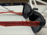
During this evening Paul Stefaan Mooij will introduce the DIY Smart Glasses he developed, he is bringing several 'arms'. The PMSG kit lets you swap out those boring old arms from your (sun)glasses for a custom-made PCBA that looks and functions like something a hacker MacGyver would dream up. It fits just like the original—using the same hinges, screws, and probably duct tape somewhere—but now you’ve got space for sensors, connectors, and all the IoT magic you can pack onto your temples.
Join us to experiment, learn and envision new sensors and possibilities.
https://www.hackster.io/psmooij/pmsg-prototype-modular-smart-glasses-8bd4e6
https://github.com/Control-C/PMSG
For more info and rsvp: https://sensemakersams.org/events/
The workshop is from 19-21h in the Makerspace of the OBA and you can also just walk in!
OBA: Oosterdokskade 143, 1011DL Amsterdam
Sensemakers Workshop MeshCore, configure your own node

Join us to learn to understand the concept of MeshCore, an open source, off grid, decentralized, mesh network build to run on affordable low-power devices!
Prepare and configure your own device as to contribute to Amsterdam wide coverage, or just for fun / to chat:-)
The workshop is based on this device: https://nl.aliexpress.com/item/1005007752194012.html Of course you may bring a different device, it only might take a little extra effort on your part if the settings are different. We will try to help of course!
For more info and rsvp: https://sensemakersams.org/events/
The workshop is from 19-21h in the Makerspace of the OBA and you can just walk in!
OBA: Oosterdokskade 143, 1011DL Amsterdam
Sensemakers X-Mas Workshop

For our end-of-the year event we have some extra opportunities to build, create and even program your own souvenir to take home!
Please if you want to make and take home the Xmas lights you see in the picture, the kit costs 25,- (we also have 2 Pay-It-Forward kits). Of course you can also work in other small projects or 3D print a small Xmas tree or make (for children!) a self designed wooden lamps!
You don't have to rsvp via meetup, the workshop is from 19-21h in the Makerspace of the OBA and you can just walk in!
OBA: Oosterdokskade 143 1011DL Amsterdam
Sousveillance: Civic Surveillance of Surveillance Cameras

How can citizens reclaim transparency in a world increasingly shaped by networked safety and enforcement cameras? Join our ThingsCon workshop to explore the power of sousveillance—using the tools of surveillance to scrutinize the systems that watch us.
Networked safety and enforcement cameras increasingly shape urban life, yet their presence and function often remain opaque. This workshop explores how citizens can turn the tools of surveillance back onto the systems that watch them: Redirecting object recognition to identify street camera's for civic scrutiny. Building on several camera spotting tours supported with various versions of a “mobile transparency app”, we introduce a new prototype that uses object recognition to detect street cameras and log them through a civic annotation workflow.
The workshop is for anyone interested in civic tech, democratic oversight, and human-scale alternatives to opaque “smart city” systems. Together, we explore how civic sousveillance might evolve into a deeper practice of scrutinizing—and reshaping—the technologies embedded in our streets.
More info and tickets: https://thingscon.org/events/things-2025
More info on the Human Values for Smarter Cities research project we are conducting: https://humanvaluesforsmartercities.nl/
Workshop Meshtastic, configure your own node (for Amsterdam-wide coverage)

Join us to learn to understand the concept of Meshtastic, an open source, off grid, decentralized, mesh network build to run on affordable low-power devices!
Prepare and configure your own device as to contribute to Amsterdam wide coverage, or just for fun / to chat:-)
It starts at 19h in the OBA in the Makerspace on level minus 1 (Junior department). You can rsvp via meetup or by sending an email to sensemakersams@protonmail.com. But our meetings are open to all so feel also free to just walk in.
https://www.meetup.com/sensemakersams/events/305263631/
Cenex Webinar #2 - EV Chargers: How to know where to place them?

Join us for an exclusive webinar featuring three leading European cities sharing their proven strategies for EV charging infrastructure placement. Learn from real-world experiences and discover data-driven approaches that are transforming urban mobility across Europe.
𝗪𝗵𝗮𝘁 𝗬𝗼𝘂'𝗹𝗹 𝗟𝗲𝗮𝗿𝗻
🏙️ 𝗦𝘁𝗿𝗮𝘁𝗲𝗴𝗶𝗰 𝗣𝗹𝗮𝗰𝗲𝗺𝗲𝗻𝘁 𝗔𝗽𝗽𝗿𝗼𝗮𝗰𝗵𝗲𝘀 - Discover how Brighton & Hove, Oslo, and Metropolitan Region of Amsterdam Electric have developed their EV charging strategies
📊 𝗗𝗮𝘁𝗮-𝗗𝗿𝗶𝘃𝗲𝗻 𝗗𝗲𝗰𝗶𝘀𝗶𝗼𝗻 𝗠𝗮𝗸𝗶𝗻𝗴 - Learn about the tools and methodologies these cities use to optimize charging point locations
🚗 𝗦𝗲𝗿𝘃𝗶𝗻𝗴 𝗔𝗹𝗹 𝗥𝗲𝘀𝗶𝗱𝗲𝗻𝘁𝘀 - Understand how to address the needs of residents without private parking spaces
🌍 𝗜𝗻𝘁𝗲𝗿𝗻𝗮𝘁𝗶𝗼𝗻𝗮𝗹 𝗕𝗲𝘀𝘁 𝗣𝗿𝗮𝗰𝘁𝗶𝗰𝗲𝘀 - Gain insights from three different countries and municipal perspectives
💡 𝗟𝗲𝘀𝘀𝗼𝗻𝘀 𝗟𝗲𝗮𝗿𝗻𝗲𝗱 - Avoid common pitfalls and learn from real implementation experiences
𝗙𝗲𝗮𝘁𝘂𝗿𝗲𝗱 𝗦𝗽𝗲𝗮𝗸𝗲𝗿𝘀
Kieran Fitsall - Brighton & Hove Council
Sture Portvik & Sara Teige Kalsaas - City of Oslo
Annekee de Jager - MRA-e (Amsterdam Metropolitan Region)
Hosted by Sanne van Breukelen - Cenex Nederland
𝗪𝗵𝘆 𝗔𝘁𝘁𝗲𝗻𝗱?
With Europe requiring 6.8 million public charging points by 2030, municipalities face unprecedented challenges in planning and implementing EV infrastructure. This webinar brings together three cities that have successfully navigated these challenges, offering practical insights for:
- Municipal planning departments
- Urban mobility professionals
- EV infrastructure developers
- Policy makers and city officials
- Transport consultants
𝗞𝗲𝘆 𝗧𝗼𝗽𝗶𝗰𝘀 𝗖𝗼𝘃𝗲𝗿𝗲𝗱
- Historical approaches vs. modern data-driven strategies
- Stakeholder engagement
- Grid capacity considerations and smart charging integration
- On-street charging solutions for urban residents
𝗪𝗵𝗼 𝗦𝗵𝗼𝘂𝗹𝗱 𝗔𝘁𝘁𝗲𝗻𝗱
This webinar is essential for anyone involved in:
- Urban planning and development
- Sustainable transport initiatives
- EV infrastructure deployment
- Municipal policy development
- European mobility strategy
𝗥𝗲𝗴𝗶𝘀𝘁𝗿𝗮𝘁𝗶𝗼𝗻
Don't miss this opportunity to learn from Europe's leading cities in EV infrastructure planning. Register now to secure your spot and gain access to exclusive insights that could transform your city's approach to EV charging.
---
This webinar is part of Cenex's ongoing commitment to accelerating the transition to sustainable transport through knowledge sharing and best practice dissemination across European cities.
How to maintain good intentions in the smart city?

During this ThingsCon Salon, we explore how to give good intentions a lasting place in smart city projects. Join us!
On October 29th from 16:00-19:00 we will be at the stunning Scheveningen Pier for a workshop and talks on how to give good intentions a lasting place in government digital projects. Sign up here!
What is the Thingscon Salon about?
When you interact with the municipality, you often first encounter a digital tool: a website, a menu system, an algorithm, or a parking scan car. There are important reasons behind such digital systems: they're convenient and often efficient.
But if things go wrong, citizens shouldn't get lost in the digital reality. That's why the municipality promises its residents, for example in a coalition agreement, the human dimension in the digital city. And according to project plans, a digital tool should be fair, accessible, transparent, and just.
These kinds of good intentions are formulated before or at the beginning of development processes, but can sometimes slip out of view along the way. During procurement, development and implementation, choices are made that later seem to clash with the original intentions.
How do we design so that good intentions remain leading not just at the beginning, but also during execution?
During this ThingsCon Salon, we explore how to give good intentions a lasting place in government digital projects. Using one or two case studies, we'll develop concrete methods in a workshop to make intentions tangible and maintain them throughout the entire process – from administrative agenda to technical implementation and practical, daily use.
This Salon is co-organized by the 'Human Values for Smarter Cities' project from the Amsterdam University of Applied Sciences and Smart City The Hague. The program consists of a workshop and several speakers.
Tessa Steenkamp and Mike de Kreek will host the workshop.
Date: Wednesday October 29th
Time: 16:00-19:00
Location: Infopunt Scheveningen
The Ins and Outs of Employment Background Screening in the Netherlands, Sweden (and Europe)

The Swedish Chamber of Commerce, in collaboration with our esteemed Patron member Validata, cordially invites you to an exclusive networking event on The Ins and Outs of Employment Background Screening in the Netherlands, Sweden, and Europe.
Join us as Harm Voogt, Managing Director of Validata Group, shares insights into the company’s journey, its expansion into Sweden, and strategies for navigating an undeveloped market. He will also discuss key industry trends shaping the future of employment screening. Following this, we will explore the latest developments, challenges, and best practices in employment background screening across Europe, providing valuable insights for businesses and professionals alike.
De Staat van het Internet 2025
Tijdens de Staat van het Internet steekt Waag Futurelab jaarlijks de peilstok in het internet. In dit 30-jarige jubileumjaar van Waag wordt de lezing gegeven door oprichter en directeur Marleen Stikker.
Nu techmiljardairs toegang tot het Witte Huis hebben, dringt het besef (eindelijk) door dat we extreem afhankelijk zijn van big tech. Met één decreet van Trump of een druk op de knop van Musk is onze samenleving volledig ontwricht. Volgens Rutte, secretaris-generaal van de NAVO, moeten we ons voorbereiden op oorlog. De vraag is of we die oorlog in het digitale domein niet al verloren hebben. Kunnen we onze grip terugwinnen?
Marleen Stikker heeft hierop het antwoord. Tijdens de zevende editie van de Staat van het Internet zet Stikker uiteen hoe we terug kunnen naar een internet waar we zelf controle hebben over de technologie en onze data. Niet het aandeelhoudersbelang of het verdienvermogen van ‘de BV Nederland’ moet centraal staan, maar de weerbaarheid en het handelingsperspectief van Europese burgers, organisaties en democratische instituties.
Dat betekent niet alleen de rug recht houden in het handhaven van de noodzakelijke Europese wetten, maar ook het investeren in kennis en technologie op basis van publieke en democratische waarden, de zogenaamde EuroStack. Er is al een eerste stap gezet door maatschappelijke en culturele organisaties en mensen om minder afhankelijk te worden van grote technologiebedrijven. Welke alternatieven voor big tech zijn er al, hoe maken we deze alternatieven samen tot een succes? En welke rol kunnen sociale en maatschappelijke bewegingen én individuen hier in spelen?
Na de lezing vindt een panelgesprek plaats. Het panel wordt gemodereerd door Dymphie Braun, programmamaker & facilitator die gedreven wordt door de principes van gelijkheid en inclusie. Haar missie is om creativiteit te promoten als middel voor sociale rechtvaardigheid.
Programma
| Inloop | 15:30 - 16:00 uur |
|---|---|
| Lezing | 16:00 - 17:00 uur |
| Panel | 17:00 -18:00 uur |
| Borrel | 18:00 - 19:00 uur |
Panel
Bert Hubert is de oprichter van PowerDNS, software waar een groot deel van het Internet in Europa op draait. Daarnaast werkte hij voor de AIVD. Tegenwoordig doet Bert DNA onderzoek en was hij tot voor kort lid van de Toetsingscommissie Inzet Bevoegdheden Inlichtingen- en Veiligheidsdiensten. Tegenwoordig is hij part-time technisch adviseur bij de Kiesraad, en lid van de commissie van advies van de Autoriteit online Terroristisch en Kinderpornografisch Materiaal.
Savriël Dillingh is marktfilosoof en bedrijfsethicus aan de Erasmus Universiteit Rotterdam. Hij doet onderzoek naar hoe politieke keuzes de vrije markt sturen, en naar hoe een nieuwe, eerlijkere economie er concreet uit kan zien. Savriël publiceerde o.a. in NRC, De Volkskrant, Trouw, Het Parool en De Groene Amsterdammer, en schrijft momenteel over de tirannie van de aandeelhouder.
Tessel Renzenbrink is Communication Officer bij NLnet, een stichting die zich inzet voor een vrij, robuust en open internet voor iedereen. Samen met Ronny Lam maakt ze de NGI Zero podcast waarin ze in gesprek gaan met mensen die bouwen aan het Next Generation Internet. In 2021 werd ze co-directeur van Netwerk Democratie en zette ze zich in voor een vitale democratie in een digitale samenleving. Tessel heeft een master filosofie en maakte in 2020 een post-collapse mesh netwerkapparaat als eindproject voor de FabAcademy.
Over Marleen Stikker
Marleen Stikker is oprichter en directeur-bestuurder van Waag Futurelab. In 1993 stond zij aan de wieg van het internet als 'burgemeester' van De Digitale Stad. Waag is sinds de oprichting in 1994 uitgegroeid tot een leidend Europees onderzoeksinstituut voor technologie en samenleving. Marleen was betrokken bij de oprichting van o.a. PICNIC, Creative Commons Nederland, Fairphone, Public Spaces en Meentcoop.
Ze is Professor of Practice aan de Hogeschool van Amsterdam, lid van de Adviesraad Wetenschap, Technologie en Innovatie en board-lid van de Amsterdam Economic Board en een van de voorzitters van het Overlegorgaan Fysieke Leefomgeving. Ze is auteur van het boek 'Het internet is stuk, maar we kunnen het repareren'. En heeft een eredoctoraat van de Vrije universiteit en is winnaar van de Felipe Rodriguez Award.
Toegankelijkheid
Mocht je krap bij kas zitten en wel graag aan dit evenement willen deelnemen, neem dan contact op met thieu [@] waag [punt] org.
Voor meer informatie over de toegankelijkheid van de locatie zie de toegankelijkheidspagina van Vlaams Cultuurhuis de Brakke Grond.
Over 30 jaar Waag
Dit jaar bestaat Waag Futurelab 30 jaar. Van het eerste ‘sociale medium’ De Digitale Stad, toegankelijk voor een breed publiek, via het ontwerpen van een duurzame modulaire Fairphone, of de eerste opleiding voor Biohackers in Europa, tot aan een advies aan de staatsecretaris voor Digitale Zaken en een burgermeetnetwerk in Noord-Holland: al 30 jaar werkt Waag aan grip op technologie voor iedereen. Die grip op technologie staat dit jubileumjaar centraal, in onze verhalen en in onze programmering.
Bekijk de eerdere edities van de Staat van het Internet.
<strong>Tickets: https://waag.org/nl/event/de-staat-van-het-internet-2025/</strong>
Waag Open: Wat zou de ideale internetroute zijn voor jouw data?

Wat is jouw dagelijkse schermtijd? Heb je wel eens nagedacht over de routes die jouw gegevens afleggen, wanneer je een email verstuurt, gebruik maakt van een zoekmachine of iets plaatst op sociale media? Het maakt niet uit of we het over apps hebben, online streaming, of simpele webpagina’s bekijken – data over ons reizen door de hele wereld.
Ontdek tijdens Waag Open hoe jouw gegevens via internet reizen en ontwerp je mee aan de meest wenselijke routes. Je gebruikt Packet Run, een software-tool waarmee je kunt zien hoe het internet data routeert. Het nemen van deze ideale route doen we al spelenderwijs. We bespreken wat een ideale route voor jou betekent, wat voor inzicht in internet routing wenselijk is, en hoeveel controle over internet routing nodig is.
Meld je aan: https://waag.org/nl/event/waag-open-internetroutes/
Wanneer: 6 maart 2025
Tijd: 19:30 - 22:00 uur
Waar: Waag Futurelab, Nieuwmarkt 4, Amsterdam
Programma
| 19:30 - 19:45 uur | welkom & introductie |
| 19:45 - 20:45 uur | interactief spel: jouw ideale route op het internet |
| 20:45 - 21:30 uur | afsluitende discussie |
| 21:30 - 22:00 uur | borrel |
Meld je aan:
Samenwerken met een burgerpanel aan smart city technology: de scanfiets in Amsterdam
Het Human Values for Smarter Cities onderzoeksproject nodigt je uit voor een interessante middag over samenwerking met burgers en smart city tech.
📅 Dinsdag 11 februari
⏰ 15:30-17:30
📍 HvA Wibauthuis | Wibautstraat 3b, 1091 GH Amsterdam | Kamer: 10A18
Programma:
• 15:30 Inloop
• 15:45 Sessie
• 17:00 Borrel
• 17:30 Einde
🔍 Waar gaat het over?
Door het Machine Vision team van de gemeente Amsterdam is er het afgelopen jaar samengewerkt met een groep burgers in een onderzoeks- en ontwikkelproject rondom de inzet van een scanfiets: "Samen werken aan verantwoord scannen en herkennen voor een leefbare, schone en veilige stad".
We zijn met het burgerpanel ongeveer 14 keer bij elkaar geweest en hebben bijna net zo veel voorbereidingsbijeenkomsten gehad. Op vier momenten hebben we het project geëvalueerd, twee keer met het burgerpanel en twee keer zonder. Op 12 februari 2025 komt de samenwerking ten einde en sluiten we dit project af.
Het project was een uniek experiment voor de gemeente om in samenwerking met burgers te bepalen hoe dat ‘verantwoord’ eruit zou kunnen zien door daarbij de rechten, belangen en wensen van deze inwoners te borgen in het proces. We deden allerlei interessante ervaringen op en kwamen verschillende do's en don'ts tegen, maar ook aandachtsgebieden waar geen eenduidig antwoord op is. Veel van de do's en don'ts worden door de gemeente Amsterdam beschreven in het document "Burgerparticipatie - Whitepaper verantwoord scannen en herkennen".
Tijdens de bijeenkomst op 11 februari willen we de do's/don'ts en aandachtsgebieden delen met geinteresseerden. Doe mee aan het gesprek!
Reserveer je plek door je hier in te schrijven. Tot 11 februari!
👇 💜 🤩 Co-Creation Opportunity 👇 💜 🤩

Calling all community engagement specialists shaping the future of our urban spaces! 📢
At Playground City🛝, we believe real impact happens when we build solutions together. The insights we’ve gained from incredible conversations at Placemaking Europe, World Summit AI, and soon at Smart City Expo World Congress are already shaping our roadmap—and now, we’re ready to bring in those who can help take it to the next level.
We’re building an ambassador community for dedicated community engagement professionals to join us in pioneering a platform created for (and with!) the people driving change in our cities.
As an ambassador, you’ll have early access to shape and use Playground City🛝 as it evolves, guiding its development with your insights. We’re also preparing exclusive perks just for you, like discounted pilot projects, early access to new features, and more exciting benefits (yes, also our amazing merch.. 😎).
If you’re a community engagement specialist, urban strategist, or resident leader ready to make an impact, comment “I’m in!” below, and we’ll follow up with details. We can't wait to meet you all!
Passionate about co-creation in urban spaces? Join Playground and make an impact! 🌍
#CommunityEngagement #UrbanInnovation #Placemaking #PlaygroundCity #CoCreation #AmbassadorProgram #SmartCities #UrbanImpact #PlaygroundCity
🔍 CIIIC zoekt een Communicatie & Community Lead!

Ben jij een ervaren communicatieprofessional met een hart voor de creatieve sector? Samen met het Ministerie van OCW, CLICKNL en vier uitvoeringspartners stelt CIIIC de creatieve industrie en contentmakers in staat om de potentie van immersive experiences te benutten.
Als Communicatie en Community Lead ben je verantwoordelijk voor het (door)ontwikkelen en implementeren van de communicatiestrategie van het CIIIC-programma. Daarnaast heb je een sleutelrol in het opbouwen en onderhouden van een betrokken en actieve community, waaronder IX-makers, kennisinstellingen, bedrijven die IX toepassen en andere relevante partijen.
📑 Lees de volledige vacature hier: https://lnkd.in/eBusnR6p
👋 Interesse? Stuur je motivatie en werkervaring naar info@clicknl.nl voor 16 september 23:59 uur.
🔗 Ken jij de perfecte kandidaat? Deel deze post!
🔍 CIIIC is looking for a Communications & Community Lead!
Are you an experienced communications professional with a love for the creative industry? Together with the Ministry of OCW, CLICKNL and four implementing partners, CIIIC enables the creative industry and content creators to harness the potential of immersive experiences.
As Communication and Community Lead, you are responsible for (further) developing and implementing the communication strategy of the CIIIC programme. You also have a key role in building and maintaining an engaged and active community, including IX makers, knowledge institutions, companies applying IX and other relevant parties.
📑 Read the full vacancy here: https://lnkd.in/eq_fE5WU
👋 Interested? Send your motivation and work experience to info@clicknl.nl before 16 September 23:59.
🔗 Do you know the perfect candidate? Share this post!
Society 5.0 Festival

How can we shape the society we want amidst rapid technological advancements? At the Society 5.0 Festival, we believe this demands a radical new way of thinking: a shift from transactions to relations. As creatives, researchers, citizens, technologists, teachers, designers, students, and policymakers, we must actively shape the fabric of our future society. Join us as we listen, nurture, and repair the ties that bind us.
Scanfiets experiment van vandaag geannuleerd vanwege weer
CORRECTIE: Experiment van vandaag is geannuleerd vanwege de harde wind. Ik laat weten wat de nieuwe datum wordt.
Toeschouwers gezocht voor een rijdend experiment vandaag!
Gemeente Amsterdam ontwikkelt een nieuwe technologie. Het gaat om een fiets met camera’s, die over een paar maanden waarschijnlijk door de stad gaat rondrijden. Er wordt veel moeite gestoken in blurring algoritmes, en andere privacymaatregelen. Maar op straat zie je vooral een camera langsrijden. Hoe communiceer je wat er achter de schermen van zo’n systeem gebeurd? Hoe zorg je voor genoeg ruimte voor feedback, vanuit de stadsbewoners?
De afgelopen maanden dachten het projectteam, een bewonerspanel en de onderzoekers van Civic Interaction Design van de HvA daar samen over na. Naast inhoudelijk meedenken (en tegendenken), werden verschillende versies van de fiets gezamenlijk ontworpen.
Op vrijdag 5 juli rijden we een testrondje. De fiets rijdt dan door 3 straten in Amsterdam. En daar zoeken we toeschouwers voor! Komen jullie de scan-fiets ontmoeten? Er is ruimte de fiets te bekijken, en om in gesprek te gaan met de fietsbestuurder en projectleider. Ook stellen de onderzoekers een paar vragen. Ik hoop jullie te zien!
Scanfiets bekijken?
13:30 - 14:00 Lou Jansenplein (Geuzenveld)
Verzamelpunt: Bij de ingang van het Lou Jansenplein (kruising met de Slotermeerlaan)
14:30 - 15:00 Sierplein (Nieuw-West)
Verzamelpunt: Tegenover Van Ollefenstraat; bij de Esso (tankstation)
15:45 - 16:15 Roetersstraat (Centrum)
Verzamelpunt: Ter hoogte van de brug bij de Nieuwe Achtergracht/Roetersstraat kruising
Waag Open: Blijf je AR-bril de baas

Ontwerp je eigen voorwaarden voor Augmented Reality tijdens deze workshop door AR-kunstenaar Sander Veenhof.
Nog niet zo lang geleden hoorden brillen met Virtual of Augmented Reality-technologie enkel thuis in sciencefictionfilms. Brillen die je iets extra’s laten zien wanneer je naar de wereld kijkt, of die zelfs een compleet andere wereld tonen. Sinds de lancering van de Quest3 en de Apple Vision Pro is deze technologie realiteit geworden en lopen onze fysieke en virtuele wereld steeds meer in elkaar over. Hoe kunnen we onze eigen voorwaarden creëren voor Augmented Reality (AR)?
Een AR-bril bepaalt letterlijk hoe jij als gebruiker naar de wereld kijkt. In de bril zit een camera die voortdurend registreert wat er zich in onze omgeving afspeelt. Dit zijn geen video-opnames, maar beelden die middels kunstmatige intelligentie worden geïnterpreteerd. Op basis van deze data, samen met jouw persoonlijk profiel en agenda-data uit de cloud worden vervolgens meldingen, notificaties, suggesties en taken aan je getoond. Maar hoe wordt bepaald wat wanneer relevant is?
Deze inschatting kunnen we beter niet aan kunstmatige intelligentie overlaten. In deze interactieve workshop, gegeven door AR-kunstenaar Sander Veenhof, ontwerp je zelf de voorwaarden voor verschillende scenario’s waarin een AR-bril wordt gebruikt. Aan de hand van een reeks concrete praktijksituaties ontrafelen we wanneer een AR-bril mag ingrijpen of initiatief mag tonen. ‘Als < X > mits < Y > behalve < Z > tenzij < W > of < U >’.
Kom naar Waag Open op donderdag 6 juni en verwerk jouw voorkeuren, eisen, wensen en uitzonderingen in een bestand met configuratie-instellingen over jezelf. Als het tijdperk van de 24/7 AR-brillen ooit écht aanbreekt, weet jij vast waar je jouw bril op moet wijzen!
Programma
| 19:15 uur | Deur open |
|---|---|
| 19:30 - 19:40 uur | Welkom & introductie door Waag |
| 19:45 - 20:30 uur | Lezing door Sander Veenhof |
| 20:30 - 21:30 uur | Workshop Ontwerp je eigen voorwaarden voor Augmented Reality |
| 21:30 - 22:00 uur | Borrel |
Over Sander Veenhof
Sander Veenhof brengt graag tijd door in semi-digitale werelden. Programmeerbare omgevingen in het bijzonder. Hoewel zijn nieuwsgierigheid betrekking heeft op een verre toekomstige samenleving waarin we allemaal in een mixed reality universum leven, is zijn kunstpraktijk hands-on en gesitueerd in het heden. Zijn heden. Dankzij AR kan hij zijn eigen speculatieve levensechte versies van een denkbeeldig universum ensceneren en erin leven. Op die manier kan hij nieuwe (technische) domeinen van binnenuit verkennen, met een focus op hoe het is om een semi-digitaal wezen te worden, versterkt met nieuwe superkrachten maar ook beperkt door nieuwe grenzen. Veenhof begon tien jaar geleden met het creëren van cross-reality projecten in de avatarwereld Second Life, ging toen verder met AR en later was zijn speeltuin onze Zoom-realiteit.
Waag Open
Elke eerste donderdagavond van de maand opent Waag haar deuren! Kom langs om te discussiëren en te doen. Want we gaan niet alleen in discussie over maatschappelijke thema's en de toekomst – je leert daarnaast ook altijd iets praktisch. Iets dat je altijd al hebt willen uitproberen, zoals de 3D-printer in het FabLab, of juist iets dat je nooit had verwacht, zoals uitpluizen hoe DNA in elkaar zit in ons biotech-lab. Waag Open vindt plaats in de maakplaatsen op de eerste en tweede verdieping van het historische Waaggebouw op de Nieuwmarkt.
Toegankelijkheid
Omdat het Waag-gebouw een beschermd monumentaal pand is, is het helaas niet voorzien van een lift. Dit evenement vindt plaats in de Makersguild op de eerste verdieping van het Waag-gebouw.
Mocht je krap bij kas zitten en wel graag aan dit evenement willen deelnemen, neem dan contact op met tanja [@] waag [punt] org.
Will the 15-minute city cause the US suburbs to disappear? 6/7
Urbanisation in the US is undergoing major changes. The image of a central city surrounded by sprawling suburbs therefore needs to be updated. The question is what place does the 15-minute city have in it? That is what this somewhat longer post is about
From the 1950s, residents of US cities began moving en masse to the suburbs. A detached house in the green came within reach for the middle and upper classes, and the car made it possible to commute daily to factories and offices. These were initially still located in and around the cities. The government stimulated this development by investing billions in the road network.
From the 1980s, offices also started to move away from the big cities. They moved to attractive locations, often near motorway junctions. Sometimes large shopping and entertainment centres also settled there, and flats were built on a small scale for supporting staff. Garreau called such cities 'edge cities'.
Investors built new suburbs called 'urban villages' in the vicinity of the new office locations, significantly reducing the distance to the offices. This did not reduce congestion on congested highways.
However, more and more younger workers had no desire to live in suburbs. The progressive board of Arlington, near Washington DC, took the decision in the 1980s to develop a total of seven walkable, inclusive, attractive and densely built-up cores in circles of up to 800 metres around metro stations. In each was a wide range of employment, flats, shops and other amenities . In the process, the Rosslyn-Balston Corridor emerged and experienced rapid growth. The population of the seven cores now stands at 71,000 out of a total of 136,000 jobs. 36% of all residents use the metro or bus for commuting, which is unprecedentedly high for the US. The Rosslyn-Balston Corridor is a model for many other medium-sized cities in the US, such as New Rochelle near new York.
Moreover, to meet the desire to live within walking distance of all daily amenities, there is a strong movement to also regenerate the suburbs themselves. This is done by building new centres in the suburbs and densifying part of the suburbs.
The new centres have a wide range of flats, shopping facilities, restaurants and entertainment centres. Dublin Bridge Park, 30 minutes from Columbus (Ohio) is one of many examples.
It is a walkable residential and commercial area and an easily accessible centre for residents from the surrounding suburbs. It is located on the site of a former mall.
Densification of the suburbs is necessary because of the high demand for (affordable) housing, but also to create sufficient support for the new centres.
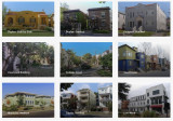
Space is plentiful. In the suburbs, there are thousands of (semi-)detached houses that are too large for the mostly older couples who occupy them. An obvious solution is to split the houses, make them energy-positive and turn them into two or three starter homes. There are many examples how this can be done in a way that does not affect the identity of the suburbs (image).
New construction in suburbs
This kind of solution is difficult to realise because the municipal authorities concerned are bound by decades-old zoning plans, which prescribe in detail what can be built somewhere. Some of the residents fiercely oppose changing the laws. Especially in California, the NIMBYs (not in my backyard) and the YIMBYs (yes in my backyard) have a stranglehold on each other and housing construction is completely stalled.
But even without changing zoning laws, there are incremental changes. Here and there, for instance, garages, usually intended for two or three cars, are being converted into 'assessor flats' for grandma and grandpa or for children who cannot buy a house of their own. But garden houses are also being added and souterrains constructed. Along the path of gradualness, this adds thousands of housing units, without causing much fuss.
It is also worth noting that small, sometimes sleepy towns seem to be at the beginning of a period of boom. They are particularly popular with millennials. These towns are eminently 'walkable' , the houses are not expensive and there is a wide range of amenities. The distance to the city is long, but you can work well from home and that is increasingly the pattern. The pandemic and the homeworking it has initiated has greatly increased the popularity of this kind of residential location.
All in all, urbanisation in the US can be typified by the creation of giant metropolitan areas, across old municipal boundaries. These areas are a conglomeration of new cities, rivalling the old mostly shrinking and poverty-stricken cities in terms of amenities, and where much of employment is in offices and laboratories. In between are the suburbs, with a growing variety of housing. The aim is to create higher densities around railway stations. Besides the older suburbs, 'urban villages' have emerged in attractive locations. More and more suburbs are getting their own walkable centres, with a wide range of flats and facilities. Green space has been severely restricted by these developments.
According to Christopher Leinberger, professor of real estate and urban analysis at George Washington University, there is no doubt that in the US, walkable, attractive cores with a mixed population and a varied housing supply following the example of the Rosslyn-Ballston corridor are the future. In addition, walkable car-free neighbourhoods, with attractive housing and ample amenities are in high demand in the US. Some of the 'urban villages' are developing as such. The objection is that these are 'walkable islands', rising in an environment that is anything but walkable. So residents always have one or two cars in the car park for when they leave the neighbourhood, as good metro or train connections are scarce. Nor are these kinds of neighbourhoods paragons of a mixed population; rents tend to be well above the already unaffordable average.
The answer of the question in the header therefore is: locally and slowly
😀Resultaten - Is betrokkenheid van de gemeenschap de moeite waard? 😀

We hebben uiteenlopende en interessante reacties ontvangen van stedenbouwkundigen, architecten en gemeenten. Als u wilt weten wat andere professionals denken, vul dan deze enquête in met uw e-mailadres en wij delen de inzichten met u.
Bedankt! 😀
Follow Playground on LinkedIn
We've received varied and interesting responses from urban developers, architects, and municipalities. If you want to know what other professionals think, please fill out this survey with your email, and we will share the insights with you.
Thank you! 😀
Mobiliteit als schaars goed - Denk mee: Hoe regelen we het recht om te reizen?
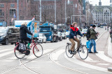
Mobiliteit staat voor vrijheid, maar zorgt ook voor ongelijke lasten. Tijdens deze sessie onderzoeken we samen in een interactieve simulatie een systeem dat met 'mobiliteitskrediet' werkt. Wat zijn de effecten voor de samenleving? Biedt het kansen voor een eerlijkere verdeling om maakt het de ongelijkheid alleen maar groter?
Deze avond is onderdeel van een studie van de TU Delft, in samenwerking met AMS Institute en gemeente Amsterdam. Let op: Om deel te nemen aan deze avond in Pakhuis de Zwijger, heb je een werkende smartphone nodig.
NB. Deelname aan de sessie wordt beloond met een VVV-bon ter waarde van 10-euro.
Aanmelden kan via de website van Pakhuis de Zwijger https://dezwijger.nl/programma/mobiliteit-als-schaars-goed
Wanneer: Dinsdag 23 april
Hoe laat: 19:30-21:30
Waar: Pakhuis de Zwijger, IJzaal (Piet Heinkade 179, 1019 HC Amsterdam)
The '15-minute principle' also applies to rural areas (4/7)
Due to a long stay in the hospital, I was unable to post my columns. I also cannot guarantee their continuity in the near future, but I will do my best...
In my previous post, I emphasised that urban densification should be coordinated with other claims on space. These are: expanding blue-green infrastructure and the desire to combine living and working. I am also thinking of urban horticulture. It is therefore unlikely that all the necessary housing in the Netherlands - mentioned is a number of one million housing units - can be realised in the existing built-up area. Expansion into rural areas is then inevitable and makes it possible to improve the quality of these rural areas. Densification of the many villages and small towns in our country enable to approach them from the '15-minute principle' as well. Villages should thereby become large enough to support at least a small supermarket, primary school and health centre, but also to accommodate small businesses. A fast and frequent public transport-connection to a city, to other villages and to a railway station in the vicinity is important.
A thorny issue is the quality of nature in the rural area. Unfortunately, it is in bad shape. A considerable part of the rural area consists of grass plots with large-scale agro-industrial use and arable land on which cattle feed is grown. Half of the Netherlands is for cows, which, incidentally, are mostly in stalls. Restoring nature in the area that is predominantly characterised by large-scale livestock farming, is an essential task for the coming decades.
The development of sufficiently dense built-up areas both in cities and villages and the development of new nature around and within those cities and villages is a beckoning prospect. This can be done by applying the idea of 'scheggen' in and around medium-sized and large cities. These are green zones that penetrate deep into the urban area. New residential and work locations can then join the already built-up area, preferably along existing railway lines and (fast) bus connections. These neighbourhoods can be built in their entirety with movement on foot and by bicycle as a starting point. The centre is a small densely built-up central part, where the desired amenities can be found.
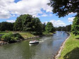
In terms of nature development, depending on the possibilities of the soil, I am thinking of the development of forest and heath areas and lush grasslands, combined with extensive livestock farming, small-scale cultivation of agricultural and horticultural products for the benefit of nearby city, water features with a sponge function with partly recreational use, and a network of footpaths and cycle paths. Picture above: nature development and stream restoration (Photo: Bob Luijks)
Below you can link to my free downloadable e-book: 25 Building blocks to create better streets, neighborhoods and cities
Stay up to date
Get notified about new updates, opportunities or events that match your interests.

