Herman van den Bosch

Activity

  • 87
    Updates
  • 2
    Thumbs up
  • 12
    Comments
Herman van den Bosch, professor in management development , posted

11. Nature inclusivity

Featured image

This is the 11th episode of a series 25 building blocks to create better streets, neighbourhoods, and cities. In this post, I wonder whether nature itself can tackle the environmental problems that humans have caused.

Ecosystem services

According to environmental scientists, ecosystems are providers of services. They are divided into production services (such as clean drinking water, wood, and biomass), regulating services (such as pollination, soil fertility, water storage, cooling, and stress reduction) and cultural services (such as recreation, and natural beauty). In case of nature-inclusive solutions ecosystems are co-managed to restore the quality of life on the earth in the short term and to maintain it in the long term, insofar as that is still possible.

The green-blue infrastructure

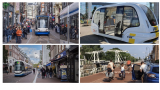
The meaning of urban green can best be seen in conjunction with that of water, hence the term green-blue infrastructure. Its importance is at least fourfold: (1) it is the source of all life, (2) it contributes substantially to the capture and storage of CO2, (3) 'green' has a positive impact on well-being and health; (4) it improves water management. This post is mainly about the third aspect. The fourth will be discussed in the next post. 'Green' has many forms, from sidewalk gardens to trees in the street or vegetated facades to small and large parks (see collage above).

Improving air quality

Trees and plants help to filter the water itself. They have a significant role to play in managing water and air pollution. Conifers capture particulate matter. However, the extent to which this occurs is less than is necessary to have a significant impact on health. Particulate matter contributes to a wide range of ailments. Like infections of the respiratory system and cardiovascular disease, but also cancer and possibly diabetes.

Countering heat stress

Heat stress arises because of high temperature and humidity. The wind speed and the radiation temperature also play a role. When the crowns of trees cover 20% of the surface of an area, the air temperature decreases by 0.3oC during the day. However, this relatively small decrease already leads to a 10% reduction in deaths. Often 40% crown area over a larger area is considered as an optimum.

Reduce mental stress and improve mood

According to Arbo Nederland, 21% of the number of absenteeism days is stress-related, which means approximately a €3 billion damage. A short-term effect of contact with nature on stress, concentration and internal tranquility has been conclusively demonstrated. The impact of distributing greenery within the residential environment is larger than a concentrated facility, such as a park, has.

Strengthening immune function via microbiome

The total amount of greenery in and around the house influences the nature and quantity of the bacteria present. This green would have a positive effect on the intestinal flora of those who are in its vicinity and therefore also on their immune function. The empirical support for this mechanism is still rather limited.

Stimulate physical activity

The impact of physical activity on health has been widely demonstrated. The Health Council therefore advises adults to exercise at least 2½ hours a week. The presence of a green area of at least ¼ hectare at 300 meters from the home is resulting more physical activity of adults in such areas, but not to more activity as a whole.

Promoting social contact

Well-designed green areas near the living environment invite social contacts. For instance, placement of benches, overview of the surroundings and absence of traffic noise. The state of maintenance are important: people tend to avoid neglected and polluted areas of public space, no matter how green.

Noise reduction

Vegetation dampens noise to some extent, but it is more important that residents of houses with a green environment experience noise as less of a nuisance. It is assumed that this is due to a mechanism already discussed, namely the improvement of stress resistance because of the greenery present.

Biophilic construction

For years buildings made people sic. A growing number of architects want to enhance the effect of 'green' on human health by integrating it into the design of houses and buildings and the materials used. This is the case if it is ensured that trees and plants can be observed permanently. But also, analogies with natural forms in the design of a building
The 'Zandkasteel', the former headquarters of the Nederlandse Middenstandsbank in Amsterdam, designed by the architects Ton Alberts and Max van Huut, is organically designed both inside and outside, inspired by the anthroposophical ideas of Rudolf Steiner. The (internal) water features are storage for rainwater and the climate control is completely natural. The building has been repurposed for apartments, offices and restaurants.

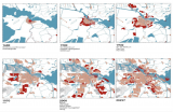
Green gentrification

Worldwide, there is a direct correlation between the amount of greenery in a neighborhood and the income of its residents. Conversely, we see that poorer neighborhoods where new green elements are added fall victim to green gentrification over time and that wealthier housing seekers displace the original residents.
The challenge facing city councils is to develop green and fair districts where gentrification is halted and where poorer residents can stay. Greening in poor communities must therefore be accompanied by measures that respect the residential rights and aim at improving the socio-economic position of the residents.

Follow the link below to find an overview of all articles.  

Herman van den Bosch's picture #Citizens&Living
Herman van den Bosch, professor in management development , posted

10. Health

Featured image

Most important causes of death worldwide (Source: The Lancelet, le Monde)
 
This is the 10th episode of a series 25 building blocks to create better streets, neighbourhoods, and cities. In this post, I mainly focus on health problems which are directly related to the quality of the living environment  

Are cities healthy places?

According to the WHO's Global Burden of Diseases Study, 4.2 million deaths worldwide each year are caused by particulate matter. The regional differences are significant. Urban health depends on the part of the world and the part of the city where you are living. More than 26 million people in the United States have asthma and breathing problems as a result. African-American residents in the US die of asthma three times as often as whites. They live in segregated communities with poor housing, close to heavy industry, transportation centers and other sources of air pollution.
Globally, the increasing prosperity of city dwellers is causing more and more lifestyle-related health problems. Heart disease, and violence (often drug-related) has overtaken infectious diseases as the first cause of death in wealthy parts of the world.  

The Netherlands

Very recently, Arcadis published a report on 'the healthy city'. This report compares 20 Dutch cities based on many criteria, divided over five domains. The four major cities score negatively on many aspects. In particular: healthy outdoor space, greenery, air quality, noise nuisance, heat stress and safety. Medium-sized cities such as Groningen, Emmen, Almere, Amersfoort, Nijmegen, and Apeldoorn, on the other hand, are among the healthiest cities.
In Amsterdam, the level of particulate matter and nitrogen dioxide (NO2) in 2018 exceeded World Health Organization standards in many streets. The GGD of Amsterdam estimates that 4.5% of the loss of healthy years is the result of exposure to dirty air.  

Collaborative measuring air quality

In various cities, groups of concerned citizens have started measuring the quality of the air themselves. A professional example is the AiREAS project in Eindhoven. An innovative measuring system has been developed together with knowledge institutions and the government. Sensors are distributed over the area of the city and the system provides real-time information. The AiREAS group regularly discusses the results with other citizens and with the city government. The measurement of the quality of the air is supplemented by medical examination. This research has confirmed that citizens in the vicinity of the main roads and the airport have an increased risk of mortality, reduced lung function and asthma.
The AiREAS project is linked to similar initiatives in other European cities. Occasionally the data is exchanged. That resulted in, among other things, this shocking video.  

Future?

Could the future not be that we are busy doing the obvious things for our health, such as walking, cycling, eating good food and having fun and that thanks to wearables, symptoms of diseases are watched early and permanently in the background, without us being aware of it? The local health center will monitor and analyze the data of all patients using artificial intelligence and advise to consult the doctor if necessary. An easily accessible health center in one's own neighborhood remains indispensable.
 
Follow the link below to find an overview of all articles.  

Herman van den Bosch's picture #DigitalCity
Herman van den Bosch, professor in management development , posted

9. Road safety

Featured image

This is the 9th episode of a series 25 building blocks to create better streets, neighbourhoods, and cities. Casualties in traffic are main threats to the quality of the living environment. ‘Vision zero’ might change this.
Any human activity that annually causes 1.35 million deaths worldwide, more than 20 million serious injuries, damage of $1,600 billion and is a major cause of global warming would be banned immediately. Except for the use of the car. This post describes how changes in road design will improve safety.

The more public transport, the safer the traffic

Researchers from various universities in the US, Australia and Europe have studied the relationship between road pattern, other infrastructure features and road safety or its lack. They compared the road pattern in nearly 1,700 cities around the world with data on the number of accidents, injuries, and fatalities. Lead researcher Jason Thompsonconcluded: <em>It is quite clear that places with more public transport, especially rail, have fewer accidents</em>. Therefore, on roads too public transport must prioritized.

The growing risk of pedestrians and cyclists

Most accidents occur in developing and emerging countries. Road deaths in developed countries are declining. In the US from 55,000 in 1970 to 40,000 in 2017. The main reason is that cars always better protect their passengers. This decrease in fatalities does not apply to collisions between cars and pedestrians and cyclists, many of which are children. Their numbers are increasing significantly, in the US more than in any other developed country. In this country, the number of bicycle lanes has increased, but adjustments to the layout of the rest of the roads and to the speed of motorized traffic have lagged, exposing cyclists to the proximity of speeding or parking cars. SUVs appear to be 'killers'and their number is growing rapidly.

Safe cycling routes

In many American cities, paint is the primary material for the construction of bike lanes. Due to the proximity of car traffic, this type of cycle routes contributes to the increasing number of road deaths rather than increasing safety. The Canadian city of Vancouver, which doubled the number of bicycle lanes in five years to 11.9% of all downtown streets, has the ambition to upgrade 100% of its cycling infrastructure to an AAA level, which means safe and comfortable for all ages and abilities. Cycle paths must technically safe: at least 3 meters wide for two-way traffic; separated from other traffic, which would otherwise have to reduce speed to less than 30 km/h).  In addition, users also need to feel safe.

Street design

Vision Zero Cities such as Oslo and Helsinki are committed to reducing road fatalities to zero over the next ten years. They are successful already now: There were no fatalities in either city in 2019. These and other cities use the Vision Zero Street Design Standard, a guide to planning, designing, and building streets that save lives.
Accidents are often the result of fast driving but are facilized by roads that allow and encourage fast driving. Therefore, a Vision Zero design meets three conditions:
• Discouraging speed through design.
• Stimulating walking, cycling and use of public transport.
• Ensure accessibility for all, regardless of age and physical ability (AAA).
The image above shows a street that meets these requirements. Here is an explanation of the numbers: (1) accessible sidewalks, (2) opportunity to rest, (3) protected cycle routes, (4) single lane roads, (5) lanes between road halves, (6) wide sidewalks, (7) public transport facilities, (8) protected pedestrian crossings, (9) loading and unloading bays, (10) adaptive traffic lights.

Enforcement

Strict rules regarding speed limits require compliance and law enforcement and neither are obvious. The Netherlands is a forerunner with respect to the infrastructure for bikes and pedestrians, but with respect to enforcement the country is negligent: on average, a driver of a passenger car is fined once every 20,000 kilometers for a speeding offense (2017 data). In addition, drivers use apps that warn of approaching speed traps. Given the risks of speeding and the frequency with which it happens, this remissing law enforcement approach is unacceptable.
Follow the link below to find an overview of all articles.

Herman van den Bosch's picture #Mobility
Herman van den Bosch, professor in management development , posted

8. Polycentricity

Featured image

This is the 8th episode of a series 25 building blocks to create better streets, neighbourhoods, and cities. The question is whether a distribution of services over the whole area contributes to the quality of the urban environment.
 
The central parts of cities like Siena, Amsterdam and Barcelona are overrun by visitors and tourists. Partly because Airbnb has increased its overnight capacity by withdrawing homes from their actual destination. As a result, these cities see their real estate prices rise ans residents leave, making room for expensive apartments, boutique hotels and corporate headquarters. Eventually, old city centers will become amusement parks that offer twenty-four hours of entertainment.

The need for distributed centers

There are no objections against visiting nice cities. The underlying problem is that many of these cities have few other places of interest left, partly due to destruction in the Second World War and their rapid expansion afterwards. Therefore, some cities are in urgent need to create additional attractive places and become polycentric. This aligns with the intention of cities to become a 15-minute city. The figure above is a model developed for this purpose by the council of Portland (USA).
Because of this policy, the prospect is that residents can buy their daily necessities close to home. At the other hand, tourists will be spread. What attractive neighborhood centers look like will be discussed in a subsequent post.

Ancillary centers

Cities without an inordinate number of tourists and visitors also observe a steady grow in the number of events, all competing for the same locations. For this reason, it is advisable that cities have a few ancillary centers each with one or two crowd pullers that divide the stream of visitors. An example is the Guggenheim Museum in Bilbao and its newly developed public space around. In world cities such as London and New York, such centers have existed for years, but they are sometimes difficult to find because they are spread over a large area.
Amsterdam too urgently needs one or more ancillary centers. The area between Leidseplein and the Rijksmuseum has potential but lacks unity due to the chaotic intersections of roads and tram lines. The presence of a train or metro station is an advantage, that is why the area near Station Zuid also has potential.

Peripheral centers

Next decade, many visitors will still arrive by car and the best policy is to seduce them to leave their cars at safe transfer points to continue their journey by public transport. For visitors who intend to stay longer, this solution is not optimal. Many will dismiss the perspective of carrying their luggage to the hotel by public transport, although taking a cab is an alternative, albeit expensive. The alternative is the presence of a couple of affordable hotels next to the car park and the development of these areas into attractive public space, with shops, cafes, and restaurants, as a starting point to visit places of interest in the city. These centers can also accommodate major events, such as a football stadium, a music hall, cinemas and open-air festivities, because of the presence of large scale parking facilities. The Amsterdam Arena district is developing in this direction. It used to be a desolate place, but it's getting better. There are excellent train and metro links.

And what about the old 'old' city center?

The public spaces in the old city centers must meet the same requirements as the whole city to prevent becoming an amusement park for tourists. Aside from its carefully maintained and functionally integrated cultural legacy, centers should provide a mix of functions, including housing, offices, spaces for craft and light industry and plenty of greenery dedicated to its inhabitants. The number of hotels should be limited and renting out by Airbnb prohibited. There will be shops for both residents and tourists, rents must be frozen, and the speculative sale of houses curbed. Space over shops must be repurposed for apartments.
 
Follow the link below to find an overview of all articles.
https://www.dropbox.com/scl/fi/x39qvzkw687rxsjvhsrzn/overzicht-blogposts-Eng.docx?rlkey=vpf7pwlfxkildpr9r062t5gf2&dl=0

Herman van den Bosch's picture #Mobility
Herman van den Bosch, professor in management development , posted

7. Accessibility

Featured image

This is the 7th episode of a series 25 building blocks to create better streets, neighbourhoods, and cities. The question is whether motorized traffic must be banned from central parts of the city to improve the quality of the urban environment.
Most cities face a choice when it comes to accessibility of their central parts: Whether they renovate the road infrastructure or they face a growing and lasting conflict between car traffic and visitors, whose numbers will decrease further as a result of prioritizing cars. This post deals with the first option.

Changing priorities in the use of road space

The starting point for this renovation is choosing the best experience for both residents and visitors. Therefore, the use of road space in all parts of cities must be under scrutiny. This also applies the connecting roads between centers and the other parts of the city. The distribution of space between pedestrians, cyclists, cars, and public transport has to be reconsidered. A good example is the Ferdinand Bolstraat in Amsterdam. Cars have been banned, the sidewalks are widened, cyclists have their own lanes and the tram uses a switch track (photo below left), just as in Leidsestraat (photo above left).

Accessibility

The rule of thumb is that the larger a city and the better public transport is functioning, the more the accessibility by car of the central parts and the residential areas as well can be reduced. Visitors who rely on the use of a car then store their vehicle in a parking on the edge of the center, preferably near supermarkets or other places where voluminous purchases can be made. From these parking spaces they enter the central area on foot. Incidentally, it is worth considering opening the entire center to cars until 11 a.m. to pick up orders.
Cyclists can be allowed deeper penetration in the central urban area, but not unlimited. They leave their bicycles in (guarded) parking facilities too.
Public transport never stops more than 300 meters from the middle of the center, where comfortable waiting areas are offered, and information is available.

Separation of traffic flows

A separation of traffic flows is required for the entire urban area. The most central streets will be exclusively intended for pedestrians, emergency services and occasionally the tram. Bicycles are allowed in streets in the center, depending on their wideness.
Public transport has always priority at traffic lights. It ensures not only transfer-free accessibility of the urban center, but also connects the most important residential and work areas with a minimum number of transfer. The possible arrival of autonomous minibuses will radically improve the flexibility of public transport (photo above right).
Intra-urban walking and cycling routes
Pedestrians’ and cyclists’ safety and amenity are improved if the connections between the central and outlying parts of the city are accessible by separate routes too. In a city whose green space penetrates deep into the central area, these routes can partly run through nature. A good example is the cycle route from the center of Utrecht to Leidsche Rijn (photo bottom right). Pedestrians need an attractive route through the built-up area for reasons of social safety.
 
Follow the link below to find an overview of all articles.

Herman van den Bosch's picture #Mobility
Herman van den Bosch, professor in management development , posted

6. Appropriate density

Featured image

This article is part of the series 25 building blocks to create better streets, neighbourhoods, and cities. Read whether Increasing density of cities complies with the quality of the urban environment.

There is widespread agreement to use the available space more thoughtful than during the last decades. In the Nationale Omgevingsvisie (NOVI), the Dutch government has unambiguously expressed its preference for housing locations within existing built-up areas or in the vicinity of stations.

The need for density

Frequently, references are made to ‘urban sprawl' in the USA to illustrate the disadvantages of low density. However, but The Netherlands is also familiar with extensive growth of the urban area. The maps above show the growth of the Amsterdam area. Between 1900 and 2000, the population of Amsterdam grew from 317,000 to 727,000 inhabitants. Its surface from 560 to 11,500 hectares.
The spread of urban activities over an ever-increasing surface and the associated traffic movements have led to vast monotonous areas, car dependence, expansion of the road network, increasing congestion, impoverishment of social life, air pollution, emissions of greenhouse gases and decline of nature.
A summary of 300 OECD research projects shows that compactness results in more efficient use of facilities, but that there are also disadvantages in terms of health and well-being, usually as results of air pollution and traffic.

Advantages of density

Denser development is generally associated with the availability of amenities within walking distance, creating support for better public transport accessibility, and leading to more efficient use of utilities. Moreover - corrected for the composition of the population - CO2 emissions in urban areas are at least 30% lower than in the suburbs. An advantage that disappears in case of high-rises.

No necessity to expand building outside urban areas

According to many urban planners, there is no reason to divert to locations outside the existing built-up area. They claim that there is sufficient space in every city for new residential locations, for instance disused office buildings and factory locations. Many new homes can also come available through the division of oversized single-family homes and the renovation and raising of older (porch) homes.
These arguments only hold if at the same time the nuisance by densification is limited. For example, by reducing car useto prevent the roads from becoming even more crowded and the streets even more filled with parked cars. I don't see that happening yet.

Competing claims on urban land use

There is another important objection to further densification and that is the fact that other forms of land use also appeal to available land within the urban space. For example, the expansion of industry, trade, research etcetera. preferably in the vicinity of living areas to reduce the length of trips.
The most important claim on the available space is the need to expand the city’s greenery. Research into the development of 'green' in Amsterdam and Brussels since 2010 shows that the open space ratio (OSR) in both cities has decreased. In Amsterdam this was 3.68 km2 (4.7%) and in Brussels 9.17 km2 (11.9%). This is in line with a recent study by Arcadis, which shows that the four major cities in the Netherlands score very poorly on healthy outdoor space, greenery, air quality, noise nuisance, heat stress and safety.

Inner- and outer-urban development revisited

The report therefore concludes that extension of the use of urban space for housing must be weighed up against other claims for the use of space, such as urban greening, urban agriculture, and the maintenance and expansion of business activities. At the same time, the objections to ecologically responsive building activities outside the already urbanized areas must be reconsidered. Three-quarters of the agricultural land is used for intensive livestock farming, not exactly creating valuable nature. I will come back to it later.
 
In the 'Dossier leefbaar wonen' (in Dutch)' I wrote extensively about the subject of providing affordable housing. You can download this e-book using the link below:

Herman van den Bosch's picture #Citizens&Living