Stay in the know on all smart updates of your favorite topics.
Sensemakers workshop on open source LLM's

Michiel Bontenbal will give a practical update on running open source LLM’s locally
De workshop is in het Engels maar we spreken ook Nederlands!
How can we, as citizens, designers, and policymakers, regain control over the technologies that shape our cities?

Join us for the workshop: Civic Sousveillance & Democratic Oversight of Sensor Technology.
In this interactive workshop, we explore democratic oversight of camera detection and other urban sensors: from citizen initiatives such as the On Camera pocket guide and smart city camera-spotting tours to current policies on data collection in public space.
With contributions by Tom van Arman & Mike de Kreek from the Human Values for Smarter Cities research project, Inge Janse & Arthur De Jaeger from Centre for BOLD Cities, and council member Elisabeth IJmker from GroenLinks-PvdA. Next to talks we will also go outside for a joint camera-spotting tour around Arcam.
Date: Thursday, January 29, 2026
Time: 4:00 p.m. – 6:00 p.m.
Location: Arcam
Address: Prins Hendrikkade 600
Language: Dutch
Registration: free, but mandatory via the registration form which is here
More info on the Human Values for Smarter Cities research project is here
Waag Open: nepnieuws, no thanks

Trollen, nepprofielen en Russische desinformatiecampagnges. Het is helaas de realiteit van het internet vandaag de dag. In Nederland zijn we het er gelukkig over eens dat het van belang is om de geloofwaardigheid en betrouwbaarheid van bronnen, informatie en digitale content te kunnen analyseren.
Mediawijsheid en kritisch nadenken krijgen dan ook sinds een aantal jaren meer aandacht op scholen, maar eigenlijk kan iedereen wel een crash course fake news gebruiken. Want met de komst van generatieve AI is het makkelijker dan ooit om content te genereren. Teksten en beelden worden aan de lopende band geproduceerd en kunnen betrouwbaar nieuws vertroebelen. Hoe kan je tegenwoordig desinformatie herkennen? En wat moeten we met de hoeveelheid fake news?
Tijdens deze Waag Open leer je in een workshop hoe je misinformatie kunt maken, herkennen en ontdek je waar je op kunt letten om nepnieuws te ontkrachten. We starten de avond met een presentatie van Sophie Morosoli en Teresa Weikmann van het AI, Media & Democracy Lab van de UvA. Aan het einde van de avond beschik jij over de tips & tricks om mis- en desinformatie te herkennen én te duiden
Programma
| 19:30 - 19:45 uur | Welkom & introductie |
|---|---|
| 19:45 - 20:15 uur | Presentatie door Sophie Morosoli en Teresa Weikmann |
| 20:15 - 21:30 uur | Workshop digitale weerbaarheid |
Waag Open
Elke eerste donderdagavond van de maand opent Waag haar deuren! Kom langs om te discussiëren en te doen. Want we gaan niet alleen in discussie over maatschappelijke thema's en de toekomst – je leert daarnaast ook altijd iets praktisch. Iets dat je altijd al hebt willen uitproberen, zoals de 3D-printer in het FabLab, of juist iets dat je nooit had verwacht, zoals uitpluizen hoe DNA in elkaar zit in ons biotech-lab. Waag Open vindt plaats in de maakplaatsen op de eerste en tweede verdieping van het historische Waaggebouw op de Nieuwmarkt.
Toegankelijkheid
Mocht je krap bij kas zitten en wel graag aan dit evenement willen deelnemen, neem dan contact op met sanna [@] waag [punt] org.
Hackathon Power of Europe @ Amsterdam/Oosterpark

Join 100 builders to fine-tune LLMs, build RAG and agentic systems — all using powerful, emerging European AI tech.
<em>This hackathon is brought to you by Tech Makers, Build Europe, and</em> AI for Good<em>.</em>
Power of Europe Hackathon
From fine-tuning LLMs to building next-gen RAG pipelines and agentic systems, this hackathon is your launchpad to experiment with the latest AI patterns using Europe's rich and often underexplored tech ecosystem.
<strong>Goal</strong>: build a working "AI demo" using European-made tech as much as possible, whether that’s RAG, smart agents, fine-tuned LLMs, or fresh AI ideas.
<strong>Demo</strong>: at the end of the day you will be given the opportunity to share what you built, what you learned, and your ASK: feedback, help, or just encouragement to keep you going!
Whether you're playing with open models, exploring modular architecture, or rethinking how AI tools are built and deployed, this is the place to connect with others shaping the future.
Let’s build the next wave: locally grown, globally relevant.
A Lab Open Huis. Met exposities, pitches voor een positieve toekomst, live muziek, dans en theater, workshops en meer!

Laat je nieuwsgierigheid de vrije loop tijdens het <strong>A Lab Open Huis</strong>. Een creatief en innovatief festival voor alle nieuwsgierige Amsterdammers die in deze turbulente tijden waarde hechten aan kunst & cultuur, duurzaamheid en sociale innovatie.
Kom kijken hoe meer dan 350 members in onze broedplaats werken aan een positieve toekomst. Met een programma vol exposities, live muziek, kunst, pitches, theater, fotoreportages, workshops, interessante ontmoetingen en meer! Kinderen? Neem ze vooral mee, het is voor iedereen een feestje!
Ontdek nieuwe ideeën, ontmoet makers en verken het live programma. Dwaal rond en laat je verrassen door wat je tegenkomt, of volg een van de inspirerende routes die speciaal zijn samengesteld langs de thema’s waar A Lab members aan werken. Er is een (digitale) kunst & cultuurroute, een duurzaamheidsroute, een sociaal maatschappelijke innovatieroute en ga voor een mix van activiteiten in de kidsroute.
Bekijk het volledige programma met timetables komende tijd op de website, maar een sneak peek is natuurlijk altijd leuk. Laat je meevoeren door livemuziek – van opkomend raptalent tot jazzy klanken – en ontdek unieke ervaringen zoals een levende algenexpo, verticale dans op de binnentuinmuur en interactieve datavisualisatie. Luister naar korte, inspirerende talks over een zelfredzame toekomst, stap in een Kanta vol verhalen over Amsterdam Noord, of scoor iets moois in de A Lab pop-up store. Geniet van wereldse smaken van de restaurants van het nieuwe Maritim Hotel, bewonder kunst van o.a. jonge makers, draai aan een meteorologisch rad of ga zelf aan de slag in een escape room of met je eigen digitale kunst. En voor filmliefhebbers: struin door Izzy’s Videotheek voor verborgen parels die je nergens kunt streamen.
Het event is gratis, maar reserveer wel je gratis ticket via deze link.
Amsterdam Data Design Den- Beyond the Graph
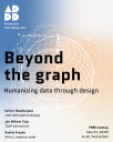
Amsterdam Data Design Den is the city's newest community meetup celebrating the intersection of data, design, and storytelling. In an era where information surrounds us, we believe in the power of creative visualization to transform complex data into compelling narratives that inspire and inform.
Every couple of months, we bring together professional designers, creative studios, and emerging talents in an informal setting to share groundbreaking projects and foster meaningful connections. Our speakers range from established design studios showcasing large-scale data visualization projects to independent designers experimenting with novel approaches to information design.
What makes our meetup unique is its commitment to accessibility and community. There's no entry fee, no membership requirements—just a gathering of curious minds passionate about using design to make sense of our data-driven world. Whether you're a seasoned information designer, a student exploring data visualization, or simply intrigued by the creative possibilities of data storytelling, you'll find your place here.
Join us for an evening of inspiration, networking, and casual conversations over drinks. Each session features thought-provoking presentations followed by open discussions, creating an environment where ideas flow freely and collaborations naturally emerge.
Amsterdam Data Design Den meets in the heart of Amsterdam, bringing together the city's vibrant creative community to explore the future of data visualization and information design.
Enabling the Future with High Tech

Societal challenges such as climate change, geopolitical security issues, and an ageing population are widely recognised. However, the fact that photonic, nano, and quantum technology can provide solutions to these global problems remains largely unknown to many.
Addressing these major dilemmas requires an approach in which technology plays a central role. Key enabling technologies in general – and photonics, nano, and quantum technology in particular – are therefore in the spotlight when it comes to the strategic plans of businesses and governments.
These technologies enable, for instance, secure communication, the development of smarter and more cost-effective sensors, and the creation of highly targeted medicines.
Who is it for?
This symposium is intended for professionals working in industry, public institutions, and knowledge organisations. Potential attendees include:
🔹 Scientists and researchers – Academics and researchers in physics, electrical engineering, materials science, and nanotechnology
🔹 Engineers and technologists – Professionals working on optical systems, semiconductors, quantum computing, and nanotechnology
🔹 Students and PhD candidates – Master's and PhD students in physics, computer science, and engineering
🔹 Industry experts and entrepreneurs – Companies and startups in high-tech sectors such as photonics, quantum computing, telecoms, and sensor technology
🔹 Government and policymakers – Organisations driving innovation, such as ministries, EU programmes, and investment funds
🔹 Investors and venture capitalists – Investors interested in deep-tech startups and the commercial applications of these technologies
Sign up right now - admission is free!
Edge AI Handson Special @SensemakersAMS

This Wednesday we'll be tinkering in the Makerspace of the OBA again, you can work on your own projects but you can also join the free workshop where you can learn to run an AI model locally on your smartphone or microcontroller and teach it to do keyword spotting or object recognition.
Looking forward to seeing you! We spreken trouwens ook Nederlands!
The Ins and Outs of Employment Background Screening in the Netherlands, Sweden (and Europe)

The Swedish Chamber of Commerce, in collaboration with our esteemed Patron member Validata, cordially invites you to an exclusive networking event on The Ins and Outs of Employment Background Screening in the Netherlands, Sweden, and Europe.
Join us as Harm Voogt, Managing Director of Validata Group, shares insights into the company’s journey, its expansion into Sweden, and strategies for navigating an undeveloped market. He will also discuss key industry trends shaping the future of employment screening. Following this, we will explore the latest developments, challenges, and best practices in employment background screening across Europe, providing valuable insights for businesses and professionals alike.
Innovation Dinner Robotica
𝗥𝗼𝗯𝗼𝘁𝗶𝗰𝗮 𝗯𝗶𝗲𝗱𝘁 𝗸𝗮𝗻𝘀𝗲𝗻. 𝗠𝗮𝗮𝗿 𝗮𝗹𝗹𝗲𝗲𝗻 𝗮𝗹𝘀 𝗷𝗲 𝘄𝗲𝗲𝘁 𝘄𝗮𝗮𝗿 𝗷𝗲 𝗺𝗼𝗲𝘁 𝗯𝗲𝗴𝗶𝗻𝗻𝗲𝗻.
Welke taken kun je automatiseren zonder je hele proces om te gooien?
Hoe weet je of cobots geschikt zijn voor jouw productieomgeving?
En wat kost het – in tijd, geld én kennis – om echt aan de slag te gaan?
Op woensdag 23 april organiseren we een Innovation Dinner over robotica, samen met BouwLab R&Do – speciaal voor professionals in de maak- en bouwsector die serieus werk willen maken van slimme productie.
Franc Mouwen (European Innovation Council) deelt zijn inzichten over technologische doorbraken en de stappen die bedrijven écht verder helpen – van technische kennis opbouwen tot financiering en samenwerking.
Na het dinner kun je kiezen voor een tweedelige workshopreeks waarin we samen de praktijk induiken: wat werkt, waar begin je en hoe zorg je dat het blijft werken?
📅 Workshops: 7 & 14 mei | 13.00-17.00 uur
🆓 Deelname is kosteloos
𝗩𝗿𝗮𝗴𝗲𝗻? Mail Sem via sem@3dmz.nl.
Demoday #27: What is ethical mobile software for your phone?
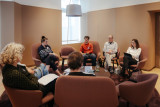
We depend heavily on Big Tech companies like Google, Meta, Apple, Amazon, and more. And with your smartphone, there is no escaping them. Even if you don’t use social media, and use anti-tracking software, some of your data will still be shared and sold. This can make you feel pretty uncomfortable. Especially, since most of these tech companies are in the USA and China. This is why, in this session, we worked on the question: Is it possible to develop mobile software which is ethical and functional?
Danny Lämmerhirt from Waag Futurelab works on the MOBIFREE project. This project aims to change the development and use of mobile software in Europe by citizens, businesses, non-profits and governments. In doing so, they want to support the emerging movement for ethical mobile software consisting of organisations that adhere to European values such as openness, privacy, digital sovereignty, fairness, collaboration, sustainability, and inclusivity.
In this session, Danny introduced us to the smartphone they are working on. This smartphone has its hardware from Fairphone (an ethically produced smartphone) and uses a privacy-friendly operating system: Murena. This operating system is an Android fork that doesn’t come with standard tracking software. On top of that, it has an app store with only ethical apps and is connected to an ethical European cloud.
Outcomes
We discussed with the group what values we found most important in an ethical mobile phone when using it for work. The values that were deemed most important by the group were:
- Autonomy: A smartphone allows working wherever and whenever you want. It is an incredibly powerful tool that you can use for so many different things, and it fits in your pocket.
- Independency: We’ve become incredibly dependent on our smartphones. When you lose your phone, you no longer have your money, your public transport card, a map to find the way, etc. On the other hand, this also means that you don’t need to travel with a bag full of tools every time you leave the house.
- Privacy: Constantly being tracked has become normal, but that doesn't mean we’re happy with it. Right now, you don’t have a choice. It would be nice to have a choice, to either pay with your data, or with money.
- User-friendliness: An ethical and privacy-friendly smartphone sounds great, but it also means that you can no longer use many of the apps that you’re used to. Will it still be practical to use? And will it be intuitive? We are all used to a certain way of working and are hesitant to change.
This discussion was definitely food for thought. We all want a more ethical phone, but are not willing to sacrifice much in return…
Are you interested in trying out this ethical smartphone? The MOBIFREE project is currently looking for people who can test this smartphone. They are looking for young adults, civil servants, mobile software developers, and professionals working in humanitarian organisations.
<strong>Would you like to participate, or do you have any questions about this project? Please contact Noor at noor@amsterdaminchange.com. Special thanks to Danny Lämmerhirt for this interesting session.</strong>
De Staat van het Internet 2025
Tijdens de Staat van het Internet steekt Waag Futurelab jaarlijks de peilstok in het internet. In dit 30-jarige jubileumjaar van Waag wordt de lezing gegeven door oprichter en directeur Marleen Stikker.
Nu techmiljardairs toegang tot het Witte Huis hebben, dringt het besef (eindelijk) door dat we extreem afhankelijk zijn van big tech. Met één decreet van Trump of een druk op de knop van Musk is onze samenleving volledig ontwricht. Volgens Rutte, secretaris-generaal van de NAVO, moeten we ons voorbereiden op oorlog. De vraag is of we die oorlog in het digitale domein niet al verloren hebben. Kunnen we onze grip terugwinnen?
Marleen Stikker heeft hierop het antwoord. Tijdens de zevende editie van de Staat van het Internet zet Stikker uiteen hoe we terug kunnen naar een internet waar we zelf controle hebben over de technologie en onze data. Niet het aandeelhoudersbelang of het verdienvermogen van ‘de BV Nederland’ moet centraal staan, maar de weerbaarheid en het handelingsperspectief van Europese burgers, organisaties en democratische instituties.
Dat betekent niet alleen de rug recht houden in het handhaven van de noodzakelijke Europese wetten, maar ook het investeren in kennis en technologie op basis van publieke en democratische waarden, de zogenaamde EuroStack. Er is al een eerste stap gezet door maatschappelijke en culturele organisaties en mensen om minder afhankelijk te worden van grote technologiebedrijven. Welke alternatieven voor big tech zijn er al, hoe maken we deze alternatieven samen tot een succes? En welke rol kunnen sociale en maatschappelijke bewegingen én individuen hier in spelen?
Na de lezing vindt een panelgesprek plaats. Het panel wordt gemodereerd door Dymphie Braun, programmamaker & facilitator die gedreven wordt door de principes van gelijkheid en inclusie. Haar missie is om creativiteit te promoten als middel voor sociale rechtvaardigheid.
Programma
| Inloop | 15:30 - 16:00 uur |
|---|---|
| Lezing | 16:00 - 17:00 uur |
| Panel | 17:00 -18:00 uur |
| Borrel | 18:00 - 19:00 uur |
Panel
Bert Hubert is de oprichter van PowerDNS, software waar een groot deel van het Internet in Europa op draait. Daarnaast werkte hij voor de AIVD. Tegenwoordig doet Bert DNA onderzoek en was hij tot voor kort lid van de Toetsingscommissie Inzet Bevoegdheden Inlichtingen- en Veiligheidsdiensten. Tegenwoordig is hij part-time technisch adviseur bij de Kiesraad, en lid van de commissie van advies van de Autoriteit online Terroristisch en Kinderpornografisch Materiaal.
Savriël Dillingh is marktfilosoof en bedrijfsethicus aan de Erasmus Universiteit Rotterdam. Hij doet onderzoek naar hoe politieke keuzes de vrije markt sturen, en naar hoe een nieuwe, eerlijkere economie er concreet uit kan zien. Savriël publiceerde o.a. in NRC, De Volkskrant, Trouw, Het Parool en De Groene Amsterdammer, en schrijft momenteel over de tirannie van de aandeelhouder.
Tessel Renzenbrink is Communication Officer bij NLnet, een stichting die zich inzet voor een vrij, robuust en open internet voor iedereen. Samen met Ronny Lam maakt ze de NGI Zero podcast waarin ze in gesprek gaan met mensen die bouwen aan het Next Generation Internet. In 2021 werd ze co-directeur van Netwerk Democratie en zette ze zich in voor een vitale democratie in een digitale samenleving. Tessel heeft een master filosofie en maakte in 2020 een post-collapse mesh netwerkapparaat als eindproject voor de FabAcademy.
Over Marleen Stikker
Marleen Stikker is oprichter en directeur-bestuurder van Waag Futurelab. In 1993 stond zij aan de wieg van het internet als 'burgemeester' van De Digitale Stad. Waag is sinds de oprichting in 1994 uitgegroeid tot een leidend Europees onderzoeksinstituut voor technologie en samenleving. Marleen was betrokken bij de oprichting van o.a. PICNIC, Creative Commons Nederland, Fairphone, Public Spaces en Meentcoop.
Ze is Professor of Practice aan de Hogeschool van Amsterdam, lid van de Adviesraad Wetenschap, Technologie en Innovatie en board-lid van de Amsterdam Economic Board en een van de voorzitters van het Overlegorgaan Fysieke Leefomgeving. Ze is auteur van het boek 'Het internet is stuk, maar we kunnen het repareren'. En heeft een eredoctoraat van de Vrije universiteit en is winnaar van de Felipe Rodriguez Award.
Toegankelijkheid
Mocht je krap bij kas zitten en wel graag aan dit evenement willen deelnemen, neem dan contact op met thieu [@] waag [punt] org.
Voor meer informatie over de toegankelijkheid van de locatie zie de toegankelijkheidspagina van Vlaams Cultuurhuis de Brakke Grond.
Over 30 jaar Waag
Dit jaar bestaat Waag Futurelab 30 jaar. Van het eerste ‘sociale medium’ De Digitale Stad, toegankelijk voor een breed publiek, via het ontwerpen van een duurzame modulaire Fairphone, of de eerste opleiding voor Biohackers in Europa, tot aan een advies aan de staatsecretaris voor Digitale Zaken en een burgermeetnetwerk in Noord-Holland: al 30 jaar werkt Waag aan grip op technologie voor iedereen. Die grip op technologie staat dit jubileumjaar centraal, in onze verhalen en in onze programmering.
Bekijk de eerdere edities van de Staat van het Internet.
<strong>Tickets: https://waag.org/nl/event/de-staat-van-het-internet-2025/</strong>
BouwLab Software Summit

Op 22 mei 2025 organiseert Smart Tech fieldlab BouwLab R&Do de BouwLab Software Summit 2025 in Haarlem. Het thema van dit jaar is "Beyond BIM", waarbij de focus ligt op de volgende fase in de digitalisering van de bouwsector. Het evenement brengt experts, softwareontwikkelaars, opdrachtgevers, ontwerpers en beleidsmakers samen om de digitale toekomst van de bouw vorm te geven.
Het programma bevat diverse sessies, waaronder:
✅ Studio Talks over AI, standaardisering versus parametrisering, datamodellen en ketensamenwerking.
✅ Software Stand-up Sessions met innovatieve softwareontwikkelingen.
✅ BouwBoosts en table-top presentaties om inzichten te delen en samenwerkingen te stimuleren.
✅ Netwerkborrel om in contact te komen met professionals uit de sector.
Tickets
🎟 Softwaregebruikers: €99 (excl. btw)
🎟 Softwareaanbieders: €499 (excl. btw)
Tickets zijn inclusief lunch, toegang tot alle sessies, de netwerkborrel en gratis parkeren.
Wil je meer informatie? Bekijk de details en bestel je ticket op: softwaresummit.nl
Responsible AI Congres
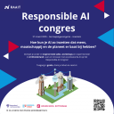
Hoe kun je kunstmatige intelligentie (vaak afgekort tot AI) zo inzetten dat mens, maatschappij en de planeet er baat bij hebben? Binnen het programma Responsible Applied Artificial InTelligence (kort: RAAIT) staat deze vraag centraal. Met drie hogescholen (Amsterdam, Rotterdam en Utrecht) en een hoop praktijkpartners ontwerpen en ontwikkelen we samen verantwoorde AI-oplossingen.
Wat er allemaal mogelijk is, laten we je graag zien op ons congres op donderdag 27 maart 2025! Je bent hiervoor van harte uitgenodigd.
📆 Donderdag 27 maart 2025
⏲ 09:30 - 17:00 uur
📍 De Koepel | Koepelplein 1 | 2031 WH, Haarlem
Dompel je onder in inspirerende talks, workshops en experimenteer in AI Wonderland. Leer en innoveer met verantwoorde AI, en dat op een heel bijzondere locatie: de oude koepelgevangenis van Haarlem. Na deze dag ga je naar huis met een goodiebag vol nieuwe inzichten/tools die je meteen kunt inzetten!
Benieuwd wat er zoal te doen is op 27 maart? Graag lichten we een paar onderdelen voor je uit:
· Keynote Noëlle Cicilia - Responsible AI leader ‘24 & AI Person of the Year '25
o Responsible AI voor iedereen?
Responsible AI krijgt steeds meer aandacht, en terecht. Maar terwijl grote bedrijven hier volop in investeren, blijft het voor kleinere organisaties vaak een uitdaging. De complexiteit en kosten kunnen een drempel vormen, terwijl verantwoord AI-gebruik juist voor iedereen toegankelijk zou moeten zijn. In deze keynote neemt Noëlle, oprichter van Brush AI, je mee in hoe zij Responsible AI toepasbaar maakt voor kleinere projecten en organisaties met beperkte budgetten.
· Workshop Wilco Verdoold - Hogeschool van Amsterdam
o Van idee tot AI: leer je eigen GPT bouwen en inzetten
Wil jij leren hoe je generatieve AI praktisch en verantwoord kunt inzetten in jouw organisatie? Heb je al ervaring met generatieve AI, maar nog nooit zelf een AI-assistent gemaakt? Tijdens deze hands-on workshop neemt Wilco je mee in het proces van het bouwen van je eigen GPT.
Geen theoretische verhalen, maar praktische kennis die je de volgende dag al kunt toepassen!
Meer dan de helft van het aantal beschikbare tickets is inmiddels geclaimd, dus mocht je collega’s of relaties kennen voor wie dit event interessant kan zijn: stuur deze mail vooral door en claim je ticket:
Waag Open: Wat zou de ideale internetroute zijn voor jouw data?

Wat is jouw dagelijkse schermtijd? Heb je wel eens nagedacht over de routes die jouw gegevens afleggen, wanneer je een email verstuurt, gebruik maakt van een zoekmachine of iets plaatst op sociale media? Het maakt niet uit of we het over apps hebben, online streaming, of simpele webpagina’s bekijken – data over ons reizen door de hele wereld.
Ontdek tijdens Waag Open hoe jouw gegevens via internet reizen en ontwerp je mee aan de meest wenselijke routes. Je gebruikt Packet Run, een software-tool waarmee je kunt zien hoe het internet data routeert. Het nemen van deze ideale route doen we al spelenderwijs. We bespreken wat een ideale route voor jou betekent, wat voor inzicht in internet routing wenselijk is, en hoeveel controle over internet routing nodig is.
Meld je aan: https://waag.org/nl/event/waag-open-internetroutes/
Wanneer: 6 maart 2025
Tijd: 19:30 - 22:00 uur
Waar: Waag Futurelab, Nieuwmarkt 4, Amsterdam
Programma
| 19:30 - 19:45 uur | welkom & introductie |
| 19:45 - 20:45 uur | interactief spel: jouw ideale route op het internet |
| 20:45 - 21:30 uur | afsluitende discussie |
| 21:30 - 22:00 uur | borrel |
Meld je aan:
Samenwerken met een burgerpanel aan smart city technology: de scanfiets in Amsterdam
Het Human Values for Smarter Cities onderzoeksproject nodigt je uit voor een interessante middag over samenwerking met burgers en smart city tech.
📅 Dinsdag 11 februari
⏰ 15:30-17:30
📍 HvA Wibauthuis | Wibautstraat 3b, 1091 GH Amsterdam | Kamer: 10A18
Programma:
• 15:30 Inloop
• 15:45 Sessie
• 17:00 Borrel
• 17:30 Einde
🔍 Waar gaat het over?
Door het Machine Vision team van de gemeente Amsterdam is er het afgelopen jaar samengewerkt met een groep burgers in een onderzoeks- en ontwikkelproject rondom de inzet van een scanfiets: "Samen werken aan verantwoord scannen en herkennen voor een leefbare, schone en veilige stad".
We zijn met het burgerpanel ongeveer 14 keer bij elkaar geweest en hebben bijna net zo veel voorbereidingsbijeenkomsten gehad. Op vier momenten hebben we het project geëvalueerd, twee keer met het burgerpanel en twee keer zonder. Op 12 februari 2025 komt de samenwerking ten einde en sluiten we dit project af.
Het project was een uniek experiment voor de gemeente om in samenwerking met burgers te bepalen hoe dat ‘verantwoord’ eruit zou kunnen zien door daarbij de rechten, belangen en wensen van deze inwoners te borgen in het proces. We deden allerlei interessante ervaringen op en kwamen verschillende do's en don'ts tegen, maar ook aandachtsgebieden waar geen eenduidig antwoord op is. Veel van de do's en don'ts worden door de gemeente Amsterdam beschreven in het document "Burgerparticipatie - Whitepaper verantwoord scannen en herkennen".
Tijdens de bijeenkomst op 11 februari willen we de do's/don'ts en aandachtsgebieden delen met geinteresseerden. Doe mee aan het gesprek!
Reserveer je plek door je hier in te schrijven. Tot 11 februari!
Innovation Dinner Digitale Fitheid

Vanuit het programma van de EDIH Digital Hub Noordwest organiseren BouwLab R&Do en 3D Makers Zone weer een Innovation Dinner.
In een wereld waar we allemaal werken met een scherm, is het belangrijk om stil te staan bij ‘hoe’ we daarmee werken. Hoe verwerken we informatie? Hoe slaan we informatie op? Hoe voorkomen we een overload aan mails en data? En hoe zorgen we ervoor dat we efficiënt blijven in een steeds digitaler landschap?
Om organisaties en hun medewerkers hierin te ondersteunen, heeft de overheid samen met verschillende partners de Maand van de Digitale Fitheid gelanceerd. Deze jaarlijkse campagne in maart richt zich op de digitale vaardigheden van de 4 miljoen keniswerkers in Nederland.
Samen met Martijn Aslander, een van de initiatiefnemers van deze campagne en auteur van onder andere ‘Ons werk is Stuk’, nemen we je mee in de wereld van digitale fitheid en de vijf essentiële pijlers:
- Digitaal bewustzijn
- Digitale Hygiëne
- Digitale vaardigheden
- Persoonlijk kennismanagement
- Persoonlijke groei met hulp van technologie
🚀 Oproep voor organisaties in de publieke sector! Draag bij aan de ontwikkeling van ethische mobiele innovatie! 🌍
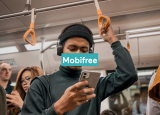
Wil jij de status quo uitdagen en bijdragen aan een mobiel ecosysteem dat privacy, duurzaamheid en ethische technologie vooropstelt?
💡 Bij Waag Futurelab zijn we vastbesloten om alternatieven te verkennen voor de datahongerige apps en apparaten die momenteel de techwereld domineren. Via ons onderzoeksproject Mobifree nodigen we organisaties in de publieke sector uit om een open-source Murena-smartphone te testen en samen met ons de toekomst van ethische, open-source mobiele technologie in Europa vorm te geven.
Dit is jouw kans om:
✅ Als organisatie Murena-smartphones te testen, voorzien van open-source apps.
✅ Feedback te geven die direct invloed heeft op de volgende generatie mobiele oplossingen.
✅ Bij te dragen aan een duurzaam, veilig en inclusief alternatief voor Big Tech.
🔍 Wat kun je verwachten?
- Doe mee aan een pilot van twee maanden (februari–oktober 2025) en verken hoe open-source tools jouw werk- en persoonlijke behoeften kunnen ondersteunen.
- Test baanbrekende technologie terwijl je pleit voor ethische en duurzame softwareontwikkeling.
- Maakt deel uit van een community die een privacy gerichte en Big Tech-vrije toekomst vormgeeft!
🙌 Wie kan deelnemen?
We een groep van maximaal 30 deelnemers om de volgende kerngebieden te verkennen:
- Besturingssystemen
- Messaging-apps
- Appstores
- Cloudservices
📩 Hoe kun je je aanmelden?
Stuur een e-mail naar bente[at]waag[dot]org met de naam van je organisatie, het aantal deelnemers, gekozen categorieën en een korte motivatie om mee te doen. Vervolgens zullen wij contact met je opnemen!
Doe met ons mee om mobiele technologie opnieuw vorm te geven voor een betere, privacy-respecterende Europa 🌟
Dutch Applied AI Award 2024 naar Sturgeon, UMC Utrecht en Oncode Institute
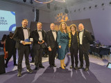
Sturgeon, het AI-initiatief van UMC Utrecht en Oncode Institute is dit jaar de winnaar van de Dutch Applied AI Award 2024. Naast deze award heeft de AI-toepassing ook de Computable Award in de categorie ‘Zorgproject’ gewonnen.
In verkorte tijd het type hersentumor bepalen met behulp van AI
Dankzij de inzet van AI kunnen neurochirurgen sneller bepalen met welk type hersentumor zij te maken hebben. De technologie vermindert de tijd die nodig is voor het stellen van een diagnose, van dagen naar ongeveer drie kwartier. Een behandelplan kan hierdoor sneller worden opgesteld. De technologie is ontwikkeld door de onderzoeksgroep van biomedicus Jeroen de Ridder van UMC Utrecht en Oncode Institute. Het algoritme dat het type hersentumor moet bepalen is getraind op miljoenen onvolledige datavoorbeelden van verschillende typen tumoren. Sturgeon is publiek beschikbaar en het wordt inmiddels ook ingezet in het Máxima Kinderziekenhuis voor het diagnosticeren van kinderkanker.
Jury prijst complexiteit van de technologie
De jury van de Dutch Applied AI Award heeft bewondering voor de toepassing. “Dit jaar een AI-toepassing in de medische sector, in het bijzonder voor de snelle herkenning van hersentumoren, wat voor zowel patiënt als chirurg een enorme impact heeft. Ze waren met de technologie van Sturgeon in staat om een model te ontwikkelen dat uit een minimale hoeveelheid pixels een accurate diagnose kan stellen, en dat in ongeveer drie kwartier tijd”. Aldus Nanda Piersma, jurylid van de Dutch Applied AI Award.
Het is de vijfde keer dat de Dutch Applied AI Award werd uitgereikt. Dit jaar in de jury:
· Nanda Piersma (Hogeschool van Amsterdam)
· Anouk Dutreé (De Dataloog & UbiOps)
· Omar Niamut (Hogeschool van Amsterdam & TNO)
· Maaike Harbers (Hogeschool Rotterdam)
· Jann de Waal (Topsector Creatieve Industrie)
· Sander Hulsman (Jaarbeurs Utrecht)
Over de Dutch Applied AI Award
Slotevent City Deal 'Een Slimme Stad, Zo Doe Je Dat'
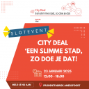
(Er zijn slechts 100 plekken beschikbaar, waarbij City Deal-partners voorrang krijgen) Aan alles komt een eind, dus ook aan zoiets leuks als de City Deal ‘Een slimme stad, zo doe je dat.’
We stoppen ermee
De City Deal ‘Een slimme stad, zo doe je dat’ loopt formeel af op 31 december en de stuurgroep heeft besloten de City Deal niet te verlengen. Dat is omdat we vinden dat de smartcitymarkt in een volgende fase is gekomen. Van innovatie naar opschaling . Het DMI-ecosysteem is daar het mooiste voorbeeld van. De City Deal stopt dus wegens succes.
Er zijn slechts 100 plekken beschikbaar, waarbij City Deal-partners voorrang krijgen. Meld je snel aan om verzekerd te zijn van een plek op dit inspirerende event. Meld je hier aan
Slotevent City Deal ‘Een slimme stad, zo doe je dat’ – Vier samen met ons de toekomst van slimme steden
Kom naar het feestelijke slotevent van de City Deal ‘Een slimme stad, zo doe je dat’, waarin we in een talkshow-setting terugblikken op alles wat we samen hebben bereikt én een blik vooruit werpen op wat er nog in het verschiet ligt. Dit event markeert het einde van een bijzondere samenwerking, en biedt jou de kans om inspiratie op te doen en waardevolle inzichten te delen.
Wat kun je verwachten (concept)?
Lessen en Visies – Samen verkennen we wat we hebben geleerd: van de kracht van samenwerken in een ecosysteem tot het belang van visie en doorzettingsvermogen. We delen onze inzichten over de uitdagingen en successen die we tijdens corona hebben doorstaan en hoe die ons sterker hebben gemaakt.
Lancering van ons nieuwe boek – Dit boek wordt een onmisbare bron voor iedereen die zich inzet voor slimme steden. Ontdek hoe de City Deal ook jou kan inspireren en ondersteunen.
Initiatieven als ‘AI in de Stad’ en DMI – Samen met de zaal gaan we in gesprek over belangrijke nieuwe initiatieven zoals DMI en ‘AI in de Stad’. Waar liggen kansen en wie kunnen we nog verbinden om verder te groeien?
Resultaten en Toekomstige Thema’s – We delen enkele hoogtepunten en resultaten van onze City Deal en belichten thema’s die klaar zijn voor verdere verdieping en groei.
Let op: Beperkte plekken beschikbaar! – Er zijn slechts 100 plekken beschikbaar, waarbij City Deal-partners voorrang krijgen. Meld je snel aan om verzekerd te zijn van een plek op dit inspirerende event. Meld je hier aan
Mis deze unieke gelegenheid niet om met gelijkgestemden te praten, jouw ideeën te delen en geïnspireerd te raken door de resultaten en toekomstvisies van slimme steden. Samen maken we van deze afsluiting een startpunt voor iets nieuws.
Dit jaar ronden we de City Deal af en borgen we de resultaten. Dat laten we zien in dit slotevenement. Zorg dat je erbij bent!
__________________________________
Datum: 23 januari 2025
Tijd: 12:00 – 18:00
Locatie: Prodentfabriek Amersfoort
Meld je hier aan
Stay up to date
Get notified about new updates, opportunities or events that match your interests.

