Stay in the know on all smart updates of your favorite topics.
Pelle Menke,
Communications and Programme officer Mobility
at Amsterdam InChange,
posted
Demoday #28: From Policy to Practice: Inclusive Design Ambitions of the Amsterdam Transport Authority
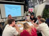
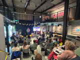
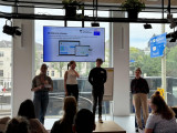
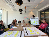
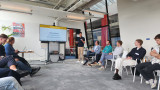
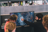
On the 5th of June, during the 28th Knowledge and Demo Day, we explored the topic of Inclusive Design in the context of mobility projects together with a diverse group of network partners. Iris Ruysch introduced the theme on behalf of the Amsterdam Transport Authority (Vervoerregio), while David Koop and Lotte de Wolde from our knowledge partner Flatland facilitated the session format, moderation and visual notes.
The ambition of the Amsterdam Transport Authority
The Amsterdam Transport Authority is responsible for public transport across fourteen municipalities in the region and is working towards a mobility system that enables people to travel quickly, safely and comfortably by public transport, bicycle or car. In addition to organising and funding public transport and investing in infrastructure, the Authority actively contributes to broader societal goals such as sustainability, health and inclusivity.
Inclusive mobility is one of the key themes within the wider mobility policy. The central principle is that everyone – regardless of age, income, disability, gender or background – should be able to travel well and comfortably throughout the region. This calls for a mobility system that is accessible, affordable, appropriate, socially safe and welcoming.
The aim of the session on 5 June was to work with the network towards an initial action plan for applying inclusive design principles in mobility projects. Iris is keen to ensure that the ambitions around inclusivity are not only stated in policy and vision documents but are truly embedded in the organisation – from policymakers to implementation teams.
Session set-up
After an introduction by Iris on the context and ambitions within the Transport Authority, we got to work. In small groups, participants explored the profile of the implementing civil servant (using a persona canvas) and considered desirable changes in approach; in terms of attitude, skills and collaboration.
We then used the Inclusive Design Wheel to examine how existing programme components of the Authority could be made more inclusive. In pairs, we tackled themes such as accessible travel information, social safety at stations (specifically for women), and improving bicycle parking facilities.
The Inclusive Design Wheel is an iterative process model that supports the structural integration of inclusivity into design and policy projects. The model emphasises collaboration, repetition, and continuous learning. It consists of four phases:
- Explore: Gather insights about users, their needs, and potential exclusion.
- Create: Develop ideas, concepts, and prototypes that address inclusive needs.
- Evaluate: Test whether the designs are inclusive, collect feedback, and make improvements where necessary.
- Manage: Ensure shared understanding, set goals, engage stakeholders, and embed the process.
Outcomes and insights
While the persona profiles were being developed, I observed the group discussions and noted several important insights to take forward in the development of the action plan:
- Awareness and concrete translation: Implementation teams often already have an intrinsic motivation to contribute to inclusivity goals set in policy. However, they may not always realise how their day-to-day work can support those goals. It’s important to continuously ask the question ‘How, exactly?’. Tools like checklists, templates and practical examples can support this translation from policy to practice.
- Flexible guidelines and not ‘extra work’: Given the differences in scale, pace and content of projects, guidelines need to be flexible. There must also be sufficient room in terms of time and budget. Most importantly, these guidelines and action plans should feel supportive, not like extra rules or bureaucracy. Too many rigid frameworks can backfire.
- Interaction between policy and implementation: There is a need for more two-way communication. Implementation teams want to be involved early in policy development, especially when they will be the ones carrying it out. They also want opportunities to reflect with policymakers on whether policy is being implemented as intended. This allows for timely feedback and course-correction based on real-world experience.
- An Inclusive Design mindset: Beyond sharpened policy documents and a stronger focus on the end user, Inclusive Design also requires a mindset – one that is inquisitive and reflective. Embedding this within the organisational culture will require more than just an action plan.
What’s next
Iris collected valuable input to kick-start the development of the action plan, and participants gained a better understanding of the Amsterdam Transport Authority, the principles of Inclusive Design, and what it takes to move from policy to implementation. This summer, a trainee will start at the Transport Authority to further develop this topic and the action plan. The session, this report, and Flatland’s visual notes provide a strong foundation to build on. We’ll be meeting with Iris and David to explore how we can support this follow-up.
Would you like to learn more about any of the topics or developments mentioned in this report? Feel free to email pelle@amsterdaminchange.com.
Mariam Jessajan,
Intern Collection Presentation
at Eye Filmmuseum,
posted
Stream the Amsterdam Forever Young Programme on Eye Film Player

Discover the Amsterdam Forever Young program on the Eye Film Player, a diverse programme that explores the dynamic, ever-evolving spirit of Amsterdam. This collection of films highlights how the city’s unique identity has been shaped by its past, present, and future. Hence, we place a special focus on the intersection of urban development and planning, offering a look at how the city’s architectural and cultural transformations have intertwined in, both, historical films, as well as more contemporary filmic undertakings. Thus, our collection of films, such as Where the Rats are King, A Photographer Films Amsterdam and Amsterdam Global Village, shed light on the living conditions in Amsterdam, the urban communities witihin Amsterdam and, even, films as Jenny and Amsterdam on Film that shed light on how the canals have shaped Amsterdam more than aesthetically e.g., with its focus on ecology and care for our climate. Through, both, monetized and free to watch films, we aim to share the rich history of our city, whilst aiming for a dynamic space for creativity, inclusivity, and sustainability in the future, too that we hope this knowledge and collection will inspire.
All in all, Amsterdam Forever Young invites you to reflect on the city's evolution and its commitment to being a centre of modernity, without losing the essence of its heritage. Available on the Eye Film Player, to watch from your bedroom, this "digital" exhibition celebrates Amsterdam as the city of urban transformation that, at the same time, stay true to its historical roots.
Pelle Menke,
Communications and Programme officer Mobility
at Amsterdam InChange,
posted
Data Dilemmas Recap: Using Data and AI for an Accessible Amsterdam
On September 26th, our community gathered in the AHK Culture Club at Marineterrein Amsterdam for our Datadilemma’s series. This edition focused on the use of Data and AI to create a more accessible Amsterdam. This article presents some of the key highlights and insights from the afternoon.
Together with the three speakers, Vishruth Krishnan, Hans Voerknecht, Michiel Bontenbal, and our audience we discussed how data and AI can help make our city more accessible for all. Which dilemma’s do we encounter when we use new technologies for an accessible city? How can data help to get more understanding of unequal access to mobility in the country? And what about sounds and noise pollution; how can data help make te city more livable?
What the three speakers had in common; a personal motivation to get away from the surface and dive deeper into the data, attempting to get closer to people’s experiences and perceptions. From an ordinary routeplanner, to one paying specific attention to challenges for people in weelchairs. From generic accesibility data for the region, to data highlighting the unequal distribution of access to mobility. And from recording noise levels, to measuring and classifying all different sounds in urban settings. In the paragraphs below, I will delve deeper into the different speakers and their topics.
Visruth Krishnan – Personalized Route Planner for People in a Wheelchair
To help individuals with limited mobility navigate the city more easily, the city’s innovation department has developed a prototype route planning tool. This route planner maps out the most accessible routes based on personal needs, considering preferences like maximum curb height at crossings, minimum sidewalk width, and whether to prioritize sidewalks or bike paths.
Visruth Krishnan, Data Scientist at the Innovation Department of the Municipality of Amsterdam, explained how data helps facilitate travel from point A to point B. However, to ensure route planning tools address the challenges faced by wheelchair users, we must feed these systems with data drawn from real-world experiences. A person’s journey might present specific challenges, such as detours, improperly parked bicycles, slopes, and narrow footpaths.
Working with a group of wheelchair users, Visruth studied the obstacles and experiences they encountered on their routes. This research generated precise data to feed the route planner, enabling it to provide personalized route suggestions that account for each individual’s freedom of movement.
Visruth presented several dilemmas encountered during the project:
- Subjectivity in the data: How busy is a sidewalk or intersection perceived to be? Are cyclists at a certain point fast and aggressive, or is that just a feeling?
- Minimal vs. comprehensive data collection: How much data should be gathered? While more data might provide deeper insights, it could also increase privacy risks.
- Accurate vs. timely data: Timely data may not always be accurate, and accurate data may not always be available in time for critical decision-making. Consider issues like illegally parked bikes, construction work, and terraces that vary in size and location depending on the season.
- Transparency vs. complexity: How transparent should data-driven processes be, especially when the algorithms or analytics behind them are complex? AI is often seen as a "black box"—people don’t understand how it works or how data is processed, which can lead to less trust from the start.
To address these challenges, Visruth and his team maintain an ongoing dialogue with the target audience. It’s an iterative process, and they keep the ‘human in the loop.’ The prototype is now ready, and hopefully, it can be further developed!
Hans Voerknecht – Unequal Accesibility and Data to Support The Narrative
Hans Voerknecht, strategist for sustainable accessibility at Een Nieuwe Kijk, presented the Integrated Perspective on Accessibility method, which he developed to get a deeper understanding of people’s accessibility. This method assists in collecting data and analyzing the severity of current inequalities and the effects of policy measures. The method has already been applied in nearly twenty projects, including four in the Amsterdam region, such as the Multimodal Future Vision of the Metropoolregio Amsterdam (MRA).
IKOB stands for "Integrale Kijk Op Bereikbaarheid" (Integrated Perspective/view on Accessibility). IKOB examines the travel time and costs that people face to reach their workplace by bike, car, or public transport and it visualizes how many jobs people can access from a specific area.
IKOB uses 'distance decay curves<strong>,'</strong> meaning that jobs located closer are given more weight than those further away. Travel time and costs are adjusted depending on the target group. Factors considered include income, access to a car, travel cost reimbursement, public transport options, and preference for a mode of transport (car, public transport, or bike). For people with a lower income, costs weigh more heavily than for those with higher incomes.
Throughout his talk, Hans discussed how data can be used to support a narrative, either consciously or unconsciously. Regional research on the state of mobility can quickly paint a positive picture if you're working with averages and fail to examine differences between people. There are groups that experience less access to mobility, and for whom this issue carries more weight due to financial constraints. The way data is researched and how deeply you investigate determines to what extent this group and their challenges are brought into focus.
One of the dilemmas Hans mentioned was the fact that poor accessibility is a personal experience. It’s subjective, and there can be a lot behind it. Regardless of the detail and quality of your data, you can never be completely sure if it truly reflects the human experience it’s supposed to represent.
Michiel Bontenbal – The Urban Sounds Sensor
Our third and final speaker discussed sounds and noise pollution in an urban environment. It may not seem to immediately fit with the rest of the speakers, but urban sound is also important to consider when creating an accessible and liveable city. Michiel Bontenbal, lecturer in business and IT courses at the Amsterdam University of Applied Sciences, told us more about the Urban Sounds sensor, developed in collaboration with the volunteer organization Sensemakers. He explained us more about the challenges they face with this AI-driven solution and raised some dilemmas in his work.
The Urban Sounds Sensor project was developed in response to the need for evidence of nighttime noise disturbances. It was crucial to be able to distinguish between different types of sounds, such as music, mopeds, alarms, doors, car noises, and honking.
Together with the volunteers from Sensemakers, Michiel designed the sensor in such a way that the recorded sounds are neither stored nor released. The microphone registers the sound, and the algorithm in the sensor immediately categorizes it within the device. This approach ensures privacy by design.
Training the sensor is still an ongoing process. Achieving high accuracy is challenging, as even humans sometimes have trouble identifying certain sounds. And, while measuring noise disturbances is definitely getting more attention in the city now. However, this specific method of distinguishing between sound categories is still lagging behind in both development and interest from government authorities.
Michiel concluded his presentation by discussing his dilemmas with the audience. One of his dilemmas, as expected, was about placing microphones in public spaces; how desirable is that, really? It's important to talk about ethics and privacy when measuring in public spaces, especially with a sound sensor that isn’t visible. His second point focused on the experience of city sounds. How you perceive sounds depends on personal experiences and preferences. Some people enjoy urban sounds, like the noise of a tram or ringing bike bells. People may have associations with certain sounds that determine whether they find them annoying, don't even notice them, or actually enjoy them. This is a factor that a sound sensor and the data it collects have difficulty accounting for.
Panel Discussion
After the presentations, we brought the speakers together for a panel discussion. Led by Chris de Veer, programme manager Mobility at Amsterdam InChange, there was an engaging conversation with the audience. To wrap things up, I’d like to highlight three key statements made by the speakers in response to some critical questions from the audience:
- "We often try to objectify the world with data, but there is no objective truth. However, diving deep into data can give you a better and more diverse understanding of an issue or region." – Hans
- "Data is always messy. If the data we input is messy, the outcome will also be messy. Garbage in, garbage out." – Michiel
- “The Route Planner method and platform could be of great use in gaining a better overview of building accessibility throughout the city.” - Visruth
Thanks to the speakers for their stories and to the audience for the lively discussions afterwards. Want to join us for our next Data Dilemmas event? The next edition of this series of open events will be announced soon. We’re also always open to new themes and topics for this series; we’re curious to hear about the data dilemmas you encounter in your work!
Make this your personal feed
Pelle Menke,
Communications and Programme officer Mobility
at Amsterdam InChange,
posted
De Interdisciplinaire Afstudeerkring - Mobiliteitsrechtvaardigheid. HvA x PNH x ASC
ENGLISH BELOW
Gedurende de eerste helft van 2024 werkten we samen met vier studenten van de Hogeschool van Amsterdam (HvA) op het thema Mobiliteitsrechtvaardigheid. Samen met de provincie Noord-Holland waren we als opdrachtgevers onderdeel van een primeur: De eerste interdisciplinaire afstudeerkring van de Hogeschool van Amsterdam. De afstudeerders kwamen vanuit verschillende opleidingen. De groep van vier bestond uit twee Bestuurskunde studenten (Jade Salomons en Timo van Elst), een student Toegepaste Psychologie (Jackie Ippel), en een student Communicatie en Multimedia Design (Merel Thuis).
De HvA wilt haar studenten al vroeg bekend maken met interdisciplinair samenwerken en onderzoeken. Een domein-overstijgend en complex vraagstuk als Mobiliteitsrechtvaardigheid, wat al langere tijd binnen het Amsterdam Smart City netwerk wordt behandeld, bleek een mooi onderwerp voor hun eerste afstudeerkring. Voor zowel de HvA en de opdrachtgevers was er veel nieuw aan dit project en waren er veel onzekerheden, maar vanuit onze waarde ‘leren door te doen’ gingen we samen aan de slag!
Resultaten
Na een kick-off met de leden van de Mobiliteitsrechtvaardigheid werkgroep en verkennende interviews met specialisten van Provincie Noord-Holland vormden de studenten concrete onderzoeksvragen. Na een brede introductie en vraagstelling hebben de studenten een deelonderwerp eigen gemaakt en hun afstudeeropdracht daarop ingericht. Bij deze licht ik kort toe wat de verschillende onderwerpen en resultaten waren. Bij vervolgvragen kunnen jullie mij of Bas Gerbrandy (PNH) een berichtje sturen.
- Timo keek naar het grotere plaatje en bestudeerde hoe het mobiliteitsbeleid in Noord-Holland nu is ingericht, met name met betrekking tot Mobiliteitsarmoede. Ook keek hij hoe participatiemethoden hier nu een rol in had. Hij schreef een advies waarin hij bijvoorbeeld pleit voor het installeren van participatie experts per domein/sector, in plaats van het als een apart team beschouwen.
- Jackie verdiepte zich nog meer in hoe ambtenaren zich verhouden tot de doelgroep die mobiliteitsarmoede kan ervaren. Zij onderzocht de bereidheid van ambtenaren om in gesprek te gaan met de doelgroep. Een belangrijk onderdeel wat velen nog een spannend idee vinden. Ook hielp Jackie mee met Jade’s focusgroep en kwalitatieve onderzoek.
- Jade ging namelijk het veld in. Ze sprak ouderen in Purmerend over hun reiservaringen en wat voor belemmeringen ze ervaren. Haar onderzoek bewees hoe belangrijk dit onderdeel is. Ze lichtten bijvoorbeeld uit dat ouderenvervoer goed geregeld is, maar dat ze angstig kunnen zijn tijdens hun reisbewegingen. Slechte kwaliteit van voetpaden en het snelle optrekken van een bus is waar ze het veel over wilden hebben.
- Ten slotte ging Merel aan de slag met een multidevice ontwerp. Ze creëerde een tool waarmee belevingen van inwoners op persoonlijk niveau uitgevraagd kunnen worden. Vervolgens wordt hierin inzichtelijk en tastbaar gemaakt wat beleidsrisico’s en -kansen zijn voor de sector Mobiliteit van de provincie. Het dient zo als gesprekstool en brug tussen de persoonlijke ervaringen van inwoners en de abstractere en strategische niveau van de beleidsmedewerkers.
Interdisciplinair en organisatie-overstijgend samenwerken
Het is een intensieve periode geweest waarin we het de studenten, en hun afstudeerbegeleiders, niet altijd makkelijk hebben gemaakt. Het project stelde namelijk bloot hoe de afstudeertrajecten en -eisen verschillen per studie en faculteit binnen de HvA. De studenten en docenten gingen hier uiteindelijk soepel mee om, maar dit was zeker wennen voor ze tijdens de start van de afstudeerkring. Ook voor de opdrachtgevers en begeleiders was het een leerproces waarin we samen in een iteratief proces onze werkwijze en opdrachten moesten aanpassen.
Bij veel van de vraagstukken die langskomen in het Amsterdam Smart City netwerk gaat het over het belang van domein overstijgend werken en hoe veel moeite grote (overheids)organisaties hier mee hebben. Juist daarom kijken we tevreden en trots terug op dit proces. Op deze manier hebben we de studenten voor de start van hun carrière al laten kennismaken met het samenwerken op maatschappelijke vraagstukken, met anderen, die vanuit hun eigen expertise, achtergrond en creativiteit naar problemen en oplossingen kijken.
Hogeschool van Amsterdam is op zoek naar een nieuw vraagstuk!
Ook komend jaar (start 2025) gaan we weer met veel enthousiasme aan de slag met een vraagstuk voor een nieuwe lichting afstudeerders. Om het onderwerp verder te brengen en om samen nog meer te leren over interdisciplinair samenwerken aan maatschappelijke vraagstukken. Samen met de HvA zijn we daarom op zoek naar een nieuw maatschappelijk vraagstuk voor de volgende groep afstudeerders. We zijn op zoek naar een onderwerp, maar ook een organisatie die, in combinatie met een ASC collega, als mede-opdrachtgever en begeleider zal optreden. Dit kan uiteraard in samenwerking met andere ASC partners.
Het onderwerp zal eind september bekend moeten zijn. In de weken die daarop volgen, zal de (groeps)opdracht gefinetuned worden en start de werving van geschikte studenten die in 2025 afstuderen.
Voor meer informatie kun je contact opnemen met Marije Poel (m.h.poel@hva.nl), Nora Rodenburg (n.m.rodenburg@hva.nl) of mij (pelle@amsterdamsmartcity.com)
________________________________________
ENGLISH:
During the first half of 2024, we collaborated with four students from the Amsterdam University of Applied Sciences (HvA) on the theme of Mobility Justice. Together with the Province of North Holland, we had the privilege of being part of a pioneering project: the first interdisciplinary graduation circle at the HvA. The graduates came from different programmes, and the group of four included two Public Administration students (Jade Salomons and Timo van Elst), a student Applied Psychology (Jackie Ippel), and a Communication and Multimedia Design student (Merel Thuis).
The HvA aims to familiarise its students early on with interdisciplinary collaboration and research. A complex, cross-domain issue like Mobility Justice, which has been a topic of focus within the Amsterdam Smart City network for some time (LINK), proved to be an excellent subject for their first graduation circle. For both the HvA and the commissioners of the topic, this project was new and presented many uncertainties, but driven by our value of ‘learning by doing,’ we embarked on this journey together!
Results
Following a kick-off with members of the Mobility Justice working group and exploratory interviews with specialists from the Province of North Holland, the students began to formulate concrete research questions. After a broad introduction and question formulation, each student chose a specific sub-topic to focus on for their graduation project. Below, I briefly outline the different topics and results. For further questions, feel free to contact me or Bas Gerbrandy (PNH, bas.gerbrandy@noord-holland.nl).
- Timo looked at the bigger picture, studying how mobility policy is currently structured in North Holland, particularly concerning Mobility Poverty. He also examined the role of participation methods in this context. In his advisory report, he advocates, for example, the installation of participation experts per domain/sector, rather than considering it as a separate team.
- Jackie delved deeper into how civil servants relate to the target group that may experience mobility poverty. She investigated the willingness of civil servants to engage in dialogue with this group, an essential aspect that many still find daunting. Jackie also assisted with Jade's focus group and qualitative research.
- Jade took to the field, speaking with the elderly in Purmerend about their travel experiences and the barriers they face. Her research highlighted the importance of this issue. For instance, she found that while transport services for the elderly are well-organised, they often feel anxious during their journeys. Poor pavement conditions and the sudden acceleration of buses were frequent topics of concern.
- Finally, Merel worked on a multi-device design. She created a tool that can be used to gather personal experiences from residents. This tool then makes the policy risks and opportunities for the Mobility sector in the province more visible and tangible. It serves as a discussion tool and a bridge between the personal experiences of residents and the more abstract, strategic level of policy officers.
Interdisciplinary and Cross-Organisational Collaboration
It has been an intensive period in which we didn’t always make it easy for the students and their graduation supervisors. The project revealed how graduation trajectories and requirements vary across programmes and faculties within the HvA. The students and lecturers eventually handled this smoothly, but it was certainly an adjustment for them at the start of the graduation circle. It was also a learning process for the supervisors, where we had to iteratively adapt our working methods and assignments together.
Many of the issues that arise in the Amsterdam Smart City network relate to the importance of cross-domain collaboration and the difficulties that large (government) organisations often face with this. That’s why we look back on this process with satisfaction and pride. We have introduced the students to the practice of working on social issues, with others who bring their own expertise, background, and creativity to the table, before the start of their careers.
Amsterdam University of Applied Sciences is Looking for a New Topic!
Next year (start of 2025), we will again enthusiastically tackle a new topic with a fresh group of graduates, to further advance the subject and learn even more about interdisciplinary collaboration on social issues. Together with the HvA, we are therefore looking for a new social issue for the next group of graduates. We are searching for a topic, as well as an organisation that, in combination with an ASC colleague, will act as a co-client and supervisor. This can, of course, be in collaboration with other ASC partners.
The topic should be finalised by the end of September. In the weeks after, the (group) assignment will be fine-tuned, and the recruitment of suitable students graduating in 2025 will begin.
For more information, you can contact Marije Poel (m.h.poel@hva.nl), Nora Rodenburg (n.m.rodenburg@hva.nl), or me (pelle@amsterdamsmartcity.com).
Pelle Menke,
Communications and Programme officer Mobility
at Amsterdam InChange,
posted
Demoday #24: Exploring the public transport of the future with Amsterdam’s Mobility Radar (2024)
Yuki Tol and Joaquim Moody, trend watchers for Smart Mobility at the Innovation Department of the Municipality of Amsterdam, delivered the Mobility Radar on future public Transport.Twee 'moonshots' geven je een,van zo'n 11 jaar) this March. In this first edition, the Amsterdam Smart Mobility program delves deeper into the city's mobility challenges. Will staff and funding shortages, the energy transition, and a growing demand for (accessible) transport options continue to impact the city's future public Transport system? Two 'moonshots' give us a glimpse into the future, showing what public Transport might look like in 2050.
The new concession for public Transport in Amsterdam is nearly ready and will commence in 2025 for a period of approximately 11 years. This is a good time to engage in discussions about the steps that need to be taken to achieve the goals and ambitions set for 2050. It is also crucial to determine what measures are necessary to address the developments that public Transport will face in the future. If the current system is continued, we are only one or two concessions away from 2050. Therefore, now is the time to start working on developments, innovations, and concepts that we want to include in the concessions for the 2030s and 2040s.
Exploring the future together
The Radar team has developed a workshop to engage with various organizations, experts, residents, and enthusiasts to discuss the Mobility Radar. In this workshop, participants jointly explore the trends and developments that can influence the future of mobility. It is a great way for participants to practice this way of thinking, and such a session also brings up topics and discussion points that the Municipality of Amsterdam can incorporate into its future explorations and concessions.
During our 24th Knowledge and Demo Day, Joaquim Moody hosted a work session for a diverse group of participants various organizations and domains. In three groups, we analysed an emerging public Transport challenge using the Mobility Radar approach and creatively thought about solutions. In the following paragraphs, I summarize what we discussed with the group.
Method
The starting point is a number of current challenges in public Transport: staff shortages, funding shortages, accessibility, the energy transition, and the growing demand for public Transport.
Each group selects one of the challenges and then 'dissects' it. Using a worksheet, you look at the following topics: What basic need underlies this challenge? What are examples of how or where you see this challenge currently? What macro changes play a role in the emergence of this challenge – in the long and short term? And how do these macro changes affect which basic needs are important and how they are fulfilled?
Next, you start creating a solution for this challenge and trend. Examples of solutions are: a service, a product, a regulatory adjustment, or an informative campaign. You also need to consider how you would deploy it and who exactly the target audience is.
Results
Accessibility
One of the groups analysed the challenge of public transport accessibility. This needs to be adequate for everyone, now and in the future. Accessibility involves affordability, the digital skills required, travel costs, and physical accessibility. This challenge mainly revolves around the basic needs of connectedness, independence, and control. The macro changes playing a role are migration (increasing number of people to be transported) and aging (more people wanting to travel independently but requiring extra assistance – particularly in digital and physical aspects). Therefore, more space and special assistance will be needed for a growing group of travellers.
The group proposed focusing more on 'micro public transport' and 'on-demand public transport' and making bus and train compartments more flexible. This would make people less dependent on a rigid system and travel environment. The group argued that air travel can serve as an example, where you can specify exactly where you want to sit, whether you need extra space, and if you require extra assistance. These needs deserve more attention in public transport as well. This can be tested with prototypes in train cars and buses and is intended for the target groups: the elderly, people with disabilities, and parents with young children.
Staff Shortages in Public transport
The challenge of 'staff shortages in public transport' is reflected in developments such as cancelled schedules, high work pressure, high absenteeism, strikes, and less social control in public transport (due to less staff). The basic needs affected by this challenge are the need for social status, financial security (for the driver), and a pleasant, healthy workplace. Macro changes playing a role include the large number of job opportunities in other sectors, increasing aggression and hardening in society, worsening public perception of public transport, and aging. As a result, working in public transport has become less prestigious, less safe, relatively less well-paid, and there is little influx of new, young employees.
The group proposed a campaign to improve the image of working in public transport. Currently, too few people choose this profession. However, with campaigns similar to those by the Defense Department, it could be made trendy and attractive again. Influencers or famous Dutch people could also play a role in this. The target audience to be enthused includes young starters and people considering a career switch.
The Growing Demand for public transport
Finally, the third group presented their worksheet regarding the challenge of the growing demand for public transport (and the decline in public transport investments). This is reflected in the decline in service quality, travel options, and the fact that less equipment is available. This affects the basic needs of comfort, connection, and being able to be oneself). Macro changes exacerbating these challenges include the decreasing space for mobility, individualization as a societal development, and increasing travel costs. This leads to a kind of public transport anxiety, aversion, and aggression, which is already happening and is only getting worse, the group noted.
The group proposed recognizing the societal role of public transport more, which would lead to more respect and funding. We should also further 'de-peak' travel times by better aligning telecommuting days or departure times for employees. This can be tested with pilots in specific (travel) areas or with large employers. The target audience can be seen as all travellers together.
Follow-Up
Joaquim will use the presented analyses and solutions as inspiration for further research and use the feedback on the method and workshop to improve such sessions in the future. Enthusiastic participants also wanted to use this method for sessions with students and international delegations, illustrating its success!
During the upcoming Knowledge- and Demo Day, we will have another session on mobility with a similar approach, but this time we will work with the scenario studies made by the Province of North Holland. Thinking about the future using trends, scenarios, and moonshots is essential in every domain, especially when done with a diverse group and maintaining connection.
Jessie Horsman,
Trainee
at Amsterdam InChange,
posted
Trainee Event Slimme en Schone Mobiliteit
Intro
Op woensdag 19 juni 2024 vond het trainee event Smart Mobility plaats bij AMS. Verschillende prominente organisaties waren aanwezig, waaronder de provincies Noord-Holland en Utrecht, de Metropoolregio Amsterdam (MRA), het MRA platform Smart Mobility, de Vervoerregio Amsterdam (VRA), en de gemeente Utrecht. Het evenement richtte zich op verschillende thema’s binnen de slimme en schone mobiliteit.
Doelen van het Evenement
Het evenement had drie hoofddoelen:
· Kennis vergaren: Inzicht krijgen in de nieuwste ontwikkelingen en uitdagingen op het gebied van slimme mobiliteit.
· Netwerken: Verbinding maken met professionals uit verschillende regio’s en sectoren.
· Teamwork: Samenwerken aan oplossingen voor actuele mobiliteitsvraagstukken.
Sprekers
Daniël van Motman (VRA en MRA-platform Smart Mobility)
Daniël van Motman gaf een uitgebreide presentatie over de huidige stand van zaken in de woningbouw, de schaarste aan mensen en grondstoffen, en het belang van duurzame samenwerking. Hij benadrukte dat, ondanks technologische vooruitgang, de mens nog steeds de slimste factor blijft in slimme mobiliteit.
Sander Oudbier (AMS)
Sander Oudbier presenteerde verschillende projecten die momenteel lopen binnen AMS, zoals City Flows, Smart Hubs en Code the Streets. Hij besprak ook educatieve initiatieven zoals MaaS for Elderly en het autovrije marine terrein. Een bijzonder project dat werd uitgelicht was de ontwikkeling van Roboat, dat zal worden ingezet tijdens de Olympische Spelen in Parijs. Daarnaast werd het project Digitale Regie op de Openbare Ruimte (DRO) besproken, dat de komende vijf jaar zal lopen vanuit DMI.
Pelle Menke (Amsterdam Smart City)
Pelle Menke presenteerde de thema’s mobiliteitsrechtvaardigheid en CO2-vrij reizen naar de JC ArenA. Hij benadrukte dat mobiliteit voor veel mensen moeilijker wordt en specifieke subgroepen unieke wensen hebben. Een werkgroep onderzoekt mogelijke oplossingen door kennisdeling en samenwerking met overheden. Ook werd een challenge besproken om CO2-vrij naar de JC ArenA te reizen door fiets, openbaar vervoer en deelvervoer te promoten. Samenwerking met vervoerders, evenementenorganisaties zoals Ajax, en gebiedsontwikkelaars is essentieel, evenals gedragsverandering en aanpassing van reisgewoontes.
Workshop: Crowdmanagement voor Sail 2025
De workshop werd verzorgd door Wouter en Maarten van het MRA-platform Smart Mobility.
“Hoe verzorgen we een goed crowdmanagement tijdens Sail 2025?”
De eerste stap in dit proces was het nadenken over ons eigen reisgedrag. We kregen per persoon een modaliteit aangewezen. De vraag was: als je om 12:00 op een bepaalde plek hebt afgesproken met je groep vrienden, wat heb je dan nodig om daar te komen?
Dit zorgde ervoor dat we nadachten over alle voorzieningen zoals (fiets)parkeerplekken en openbaar vervoer. Voor deze voorzieningen heb je data nodig, zoals inzicht in de beschikbaarheid van parkeerplekken en de status van het openbaar vervoer. Ook vanzelfsprekende dingen, zoals het checken van het weer met bijvoorbeeld Buienradar, zijn belangrijk omdat het weer een grote impact heeft op ons reisgedrag.
Daarna stapten wij in de rol van verkeersmanager. We bedachten welke middelen we konden inzetten om bezoekers zo goed en gemakkelijk mogelijk op hun bestemming te krijgen. We dachten aan elementen zoals éénrichtingsverkeer en het aantrekkelijker maken van het openbaar vervoer en de fiets. Dit konden we bewerkstelligen door bijvoorbeeld entertainment in het OV of het verzamelen van tokens op fietsroutes naar het evenement, die je kon inwisselen voor een gratis drankje. Ook kwamen er vragen naar voren zoals: hoe zorg je dat alles toegankelijk is voor iedereen? Hoe zorg je ervoor dat mensen met een beperking ook gemakkelijk naar het event kunnen komen? Hoe zorg je ervoor dat mensen die niet digitaal vaardig zijn, ook alle informatie kunnen krijgen?
Wat vond ik ervan?
Al met al was ik zeer te spreken over dit evenement. Ik heb geleerd dat de wereld van slimme en schone mobiliteit zeer breed is. Er is veel werk te doen in de komende jaren om ervoor te zorgen dat we anders gaan kijken naar mobiliteit. Een belangrijk punt dat ik heb meegenomen, is de filosofie dat de mens nog steeds de slimste factor is in Smart Mobility en dat we de mens echt centraal moeten stellen. Daarnaast is het uiterst belangrijk dat we ervoor zorgen dat de wensen en behoeften van minderheidsgroepen goed worden meegenomen en dat Smart Mobility niet alleen voor de grootste groep mensen is, maar voor iedereen.
AMS Institute,
Re-inventing the city (urban innovation)
at AMS Institute,
posted
Join AMS Institute's Scientific Conference, hosted by TU Delft, Wageningen University & Research, MIT and the City of Amsterdam.

Do you want to learn from and network with the best researchers and scientists working to tackle pressing urban challenges?
AMS Institute, is organizing the AMS Scientific Conference from April 23-25 at the Marineterrein, Amsterdam, to address pressing urban challenges. The event is organized in collaboration with the City of Amsterdam.
The conference brings together leading institutions in urban research and innovation, thought leaders, municipalities, researchers, and practitioners to explore innovative solutions for sustainable development in Amsterdam and other global cities.
Keynotes, research workshops, learning tracks, and special sessions will explore the latest papers in the fields of mobility, circularity, energy transition, climate adaptation, urban food systems, digitization, diversity, inclusion, living labs experimentation, and transdisciplinary research.
Attendees can expect to gain valuable insights into cutting-edge research and engage in meaningful discussions with leading experts in their field. You can see the full program and all available sessions here.
This year's theme is 'Blueprints for messy cities? Navigating the interplay of order and messiness'.
The program
Day 1: The good, the bad, and the ugly
Keynotes by Paul Behrens of Leiden University and Elin Andersdotter Fabre of UN-Habitat will be followed by a city panel including climate activist <strong>Hannah Prins</strong>. The first day concludes with a dinner at the Koepelkerk in Amsterdam: you're welcome to join our three-course meal with a 50 euro ticket.
Day 2️: Amazing discoveries
Keynotes by Carlo Ratti of MIT and Sacha Stolp of the Municipality of Amsterdam discuss innovation and research in cities. <strong>Corinne Vigreux</strong>, co-founder of TomTom, and Erik Versnel from Rabobank will participate in the city panel.
Day 3️: We are the city
Keynotes by Paul Chatterton of Leeds University and Victor Neequaye Kotey Deputy Director of the Waste Management Department of the Accra Metropolitan Assembly, Ghana. They discuss how we shape the future of our cities together. This will be followed by a city panel including Ria Braaf-Fränkel of WomenMakeTheCity and prof. dr. Aleid Brouwer of the Rijksuniversiteit Groningen.
To buy tickets: You can secure your conference tickets through our website.
Dinner tickets: On April 23 we’re hosting a dinner at the Koepelkerk in Amsterdam. Tickets for this can be added to your conference pass or bought separately.
Herman van den Bosch,
professor in management development
,
posted
How do higher density and better quality of life go together? 3/7
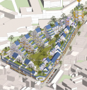
A certain degree of compactness is essential for the viability of 15-minute cities. This is due to the need for an economic threshold for facilities accessible by walking or cycling. A summary of 300 research projects by the OECD shows that compactness increases the efficiency of public services in all respects. But it also reveals disadvantages in terms of health and well-being due to pollution, traffic, and noise. The assumption is that there is an optimal density at which both pleasant living and the presence of everyday facilities - including schools - can be realised. At this point, 'densification' is not at the expense of quality of life but contributes to it. A lower density results in more car use and a higher density will reduce living and green space and the opportunity to create jobs.
The image above is a sketch of the 'Plan Papenvest' in Brussels. The density, 300 dwellings on an area of 1.13 hectares, is ten times that of an average neighbourhood. Urban planners often mention that the density of Dutch cities is much lower than in Paris and Barcelona, for example. Yet it is precisely in these cities that traffic is one of the main causes of air pollution, stress, and health problems. The benefits of compactness combined with a high quality of life can only be realised if the nuisances associated with increasing density are limited. This uncompromisingly means limiting car ownership and use.
Urban planners often seem to argue the other way round. They argue that building in the green areas around cities must be prevented at all costs to protect nature and that there is still enough space for building in the cities. The validity of this view is limited. In the first place, the scarce open space within cities can be better used for clean workshops and nature development in combination with water control. Secondly, much of the 'green' space outside cities is not valuable nature at all. Most of it is used to produce feed for livestock, especially cows. Using a few per cent of this space for housing does not harm nature at all. This housing must be concentrated near public transport. The worst idea is to add a road to the outskirts of every town and village. This will undoubtedly increase the use of cars.
Below you can link to my free downloadable e-book: 25 Building blocks to create better streets, neighborhoods and cities
Herman van den Bosch,
professor in management development
,
posted
The 15-minute city: from metaphor to planning concept (2/7)
Carlos Moreno, a professor at the Sorbonne University, helped Mayor Anne Hidalgo develop the idea of the 15-minute city. He said that six things made people happy: living, working, amenities, education, wellbeing, and recreation. The quality of the urban environment is enhanced when these functions are realized near each other. The monofunctional expansion of cities in the US, but also in the bidonvilles of Paris, is a thorn in his side, partly because this justifies owning a car.
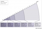
A more precise definition of the concept of the 15-minute city is needed before it can be implemented on a large scale. It is important to clarify which means of transport must be available to reach certain facilities in a given number of minutes. The list of facilities is usually very comprehensive, while the list of means of transport is usually only vaguely defined. But the distance you can travel in 15 minutes depends on the availability of certain modes of transport (see figure above).
Advocates of "new urbanism" have developed the tools to design 15-minute cities. They are based on three zones: the 5-minute walking zone, the 15-minute walking zone, which coincides with the 5-minute cycling zone, and finally the 15-minute cycling zone. These are not static concepts: In practice, the zones overlap and complement each other.
The 5-minute walking zone
This zone corresponds to the way in which most residential neighbourhoods functioned up until the 1960s, wherever you are in the world. Imagine a space with an average distance from the center to the edge of about 400 meters. In the center you will find a limited number of shops, a (small) supermarket, one or more cafes and a restaurant. The number of residents will vary between two and three thousand. Density will decrease from the centre and the main streets outwards. Green spaces, including a small neighbourhood park, will be distributed throughout the neighbourhood, as will workshops and offices.
In the case of new construction, it is essential that pedestrian areas have a dense network of paths without crossings at ground level with streets where car traffic is allowed. Some paths are wider and allow cycling within the 5- and 15-minute cycle zones. The streets provide access to concentrated parking facilities.
The 5-minute cycle zone and the 15-minute walking zone.
Here the distance from the center to the edge is about one kilometer. In this area, most of the facilities that residents need is available and can be distributed around the centers of the 5-minute walking zones. For example, a slightly larger supermarket may be located between two 5-minute walking zones. This zone will also contain one or more larger parks and some larger concentrations of employment.
This zone can be a large district of a city, but it can also be a small municipality or district of around 15 to 25,000 inhabitants. With such a population there will be little room for dogmatic design, especially when it comes to existing buildings. But even then, it is possible to separate traffic types by keeping cars off many streets and clustering car parks. The bottom line is that all destinations in this zone can be reached quickly by walking and cycling, and that car routes can be crossed safely.
The car will be used (occasionally) for several destinations. For example, for large shopping trips to the supermarket.
The 15-minute cycle zone.
This zone will be home to 100.00 or more residents. The large variation is due to the (accidental) presence of facilities for a larger catchment area, such as an industrial estate, a furniture boulevard or an IKEA, a university or a (regional) hospital. It is certainly not a sum of comparable 5-minute cycle zones. Nevertheless, the aim is to distribute functions over the whole area on as small a scale as possible. In practice, this zone is also crossed by several roads for car traffic. The network of cycle paths provides the most direct links between the 5-minute cycle zones and the wider area.
The main urban development objectives for this zone are good accessibility to urban facilities by public transport from all neighbourhoods, the prohibition of hypermarkets and a certain distribution of central functions throughout the area: Residents should be able to go out and have fun in a few places and not just in a central part of the city.
Below you can link to my free downloadable e-book: 25 Building blocks to create better streets, neighborhoods and cities.
Herman van den Bosch,
professor in management development
,
posted
When will robotaxi’s become commonplace? (8/8)
Until recently, optimists would say "in a few years." Nobody believes that anymore, except for Egon Musk. The number of - so far small - incidents involving robot taxis is increasing to such an extent that the cities where these taxis operate on a modest scale, San Francisco in particular, want to take action.
Europe vs USA
In any case, it will take a long time before robotaxis are commonplace in Europe. There are two major differences between the US and Europe when it comes to transportation policy.
In the US, each state can individually determine when autonomous vehicles can hit the road. In Europe, on the other hand, a General Safety Regulation has been in force since June 2022 that applies to all countries. This states, among other things, that a driver must maintain control of the vehicle at all times. Strict conditions apply to vehicles without a driver: separate lanes, short routes on traffic-calmed parts of the public road and always with a 'safety driver' on board.
The second difference is that in the US 45% of all residents do not have public transport available. In Europe you can get almost anywhere by public transport, although the frequency is low in remote areas. Governments say they want to further increase accessibility by public transport, even if this is at the expense of car traffic. To this end, they want an integrated transport policy, a word that is virtually unknown in the US.
Integrated transport policy
In essence, integrated transport policy is the offering of a series of transport options that together result in (1) the most efficient, safe and convenient satisfaction of transport needs, (2) reduction of the need to travel over long distances (including via the '15- minutes city') and (3) minimal adverse effects on the environment and the quality of life, especially in the large cities. In other words, transport is part of policy aimed at improving the quality of the living environment.
Integrated transport policy assesses the role of vehicle automation in terms of their contribution to these objectives. A distinction can be made between the automation of passenger cars (SAE level 1-3) and driverless vehicles (SEA level 4-5).
Automation of passenger cars
Systems such as automatic lane changes, monitoring distance and speed, and monitoring the behavior of other road users are seen as contributing to road safety. However, the driver always remains responsible and must therefore be able to take over steering at any time, even if the car does not emit a (disengagement) signal. Eyes on the road and hands on the wheel.
Driverless cars
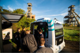
'Hail-riding' will result in growth of traffic in cities because the number of car kilometers per user increases significantly, at the expense of walking, cycling, public transport and to a much lesser extent the use of private cars. Sofar, the number of people who switch from their own car to 'hail-riding' is minimal. The only way to reverse this trend is to impose heavy taxes on car kilometers in urban areas. On the other hand, the use of robot shuttles is beneficial in low-traffic areas and on routes from residential areas to a station. Shuttles are also an excellent way to reduce car use locally. For example, in the extensive Terhills resort in Genk, Belgium, where people leave their cars in the parking lot and transfer to autonomous shuttles that connect the various destinations on the site with high frequency.
A few months ago (April 2023), I read that Qbus in the Netherlands wants to experiment with 18-meter-long autonomous buses, for the time being accompanied by a 'safety driver'. Routes on bus lanes outside the busiest parts of the city are being considered. Autonomous metros and trains have been running in various cities, including London, for years. It is this incremental approach that we will need in the coming years instead of dreaming about getting into an autonomous car, where a made bed awaits us and we wakes us rested 1000 kilometers away. Instead of overcrowded roads with moving beds, we are better off with a comfortable and well-functioning European network of fast (sleeper) trains on a more modern rail infrastructure and efficient and convenient pre- and post-transport.
Vasileios Milias,
PhD Candidate
at Delft University of Technology (TU Delft),
posted
CTstreets Map

🚶♀️ How walkable is Amsterdam? 🚶♂️
🏘️ Ever wondered how pedestrian-friendly is your neighbourhood?
Do you feel encouraged and safe to walk in your surroundings?
Do the streets have too much traffic 🚦 and not enough trees 🌳?
I am thrilled to introduce to you the newest sibling of CTwalk: CTstreets Map!
CTstreets is a web tool that highlights how walkable Amsterdam is 🚶♀️ 🚶♂️
It uses openly available data sources and provides information on how walkable neighborhoods, walksheds (5 and 15-minutes), and streets are.
CTstreets was developed through a participatory approach in three main steps:
📖 We studied the literature and made a list of all the factors that are most commonly found to impact walkability.
💬 We asked urban experts who work in Amsterdam to prioritize the identified walkability factors while considering the characteristics and citizens of Amsterdam.
💯 Based on our discussions with the experts we created overall walkability scores, and scores per theme (e.g., related to landscape or proximity) and visualized them.
👀 Explore the web tool here:
CTstreets Map
[currently does not support mobile phones or tablets]
🔍 Learn more about CTstreets Map:
Documentation
On a more personal note, it was wonderful collaborating with Matias Cardoso to develop this project. CTstreets draws significantly from Matia's MSc thesis "Amsterdam on foot," which is openly accessible and you can read here: https://lnkd.in/eyj3dpBZ
Disclaimer:
The estimated walkability scores are heavily based on the availability and quality of existing data sources. The reality is undoubtedly more complex. Walkability can be also personal and the presented scores might not reflect everyone’s point of view. Ctstreets is practically a tool aiming to enable the exploration of factors that impact walkability according to the experts in a simple, interactive, and fun way.
Vasileios Milias,
PhD Candidate
at Delft University of Technology (TU Delft),
posted
CTwalk Map
What opportunities for social cohesion do cities provide?
Is your neighbourhood park frequented by a homogenous or diverse mix of people? How many hashtag#amenities can you reach within a short hashtag#walking distance? And do you often encounter people from different walks of life?
I am very excited to introduce to you CTwalk Map, a web tool that seeks to highlight the social cohesion potential of neighbourhoods while also unmasking local access hashtag#inequities. CTwalk maps opportunities that different age groups can reach within a 5 or 15-minute walk.
🚶♀️🚶♂️ It uses granular population, location, and pedestrian network data from open sources to estimate how many children, adults, and elderly hashtag#citizens can reach various destinations in a city within a short walk.
🌐 It offers a simple and straightforward understanding of how the 5 and 15-minute walking environments are shaped by the street network.
➗ It estimates the degree of pedestrian co-accessibility of various hashtag#city destinations.
CTwalk Map is now available for the five largest cities in The Netherlands.
Take a look at the web tool:
https://miliasv.github.io/CTwalkMap/?city=amsterdam
... learn more about CTwalk Map at this link:
[currently does not support mobile phones or tablets]
...and let us know what you think!
Matias Cardoso,
Data, Sustainable Mobility, Architecture
,
posted
Walkability index for Amsterdam 🚶♀️

🚶♀️ How walkable is Amsterdam? 🚶♂️
🏘️ Ever wondered how pedestrian-friendly is your neighbourhood?
Do you feel encouraged and safe to walk in your surroundings?
Do the streets have too much traffic 🚦 and not enough trees 🌳?
Together with Vasileios Milias, we've developed CTstreets map, a new tool where you can check how your street scores in different walkability factors and what might be missing to make it more attractive for pedestrians.
👀 Explore the web tool here: https://miliasv.github.io/CTstreets/?city=amsterdam#15.18/52.371259/4.895385/0/45
🔍 Dive into the methodology and process on our info page: https://miliasv.github.io/CTstreets/info_page/
CTstreets is based on the results of my thesis "Amsterdam on Foot" where I developed a participatory approach to evaluate walkability in every street segment of Amsterdam using open data.
The categories available on the map are Overall walkability, Landscape, Crime Safety, Traffic Safety, Proximity and Infrastructure.
📍 With this tool, you can check how is the walkability per street, neighbourhood or walkshed (5 or 15 minutes) and switch between categories.
A disclaimer about the results presented: While based on the opinions of municipality workers, urban designers and advocates for pedestrian accessibility, this work might not reflect the opinion of everyone. After all, walkability is also influenced by personal factors. Furthermore, the data we used comes from open sources and it might not always be accurate / up to date. Ctstreets aims to enable the exploration of factors that impact walkability according to the experts in a simple, interactive, and fun way, and spark a conversation about how we think and design for pedestrians.
Herman van den Bosch,
professor in management development
,
posted
20. Facilities within walking and cycling distance
This is the 20th episode of a series 25 building blocks to create better streets, neighbourhoods, and cities. Its topic is to enable citizens having daily necessities in a walking and bicycling distance.
During the pandemic, lockdowns prevented people from leaving their homes or moving over a longer distance. Many citizens rediscovered their own neighbourhood. They visited the parks every day, the turnover of the local shops increased, and commuters suddenly had much more time. Despite all the concerns, the pandemic contributed to a revival of a village-like sociability.
Revival of the ‘whole neighbourhood’
Revival indeed, because until the 1960s, most residents of cities in Europe, the US, Canada, and Australia did not know better than their dally needs were available within a few minutes' walk. In the street where I was born, there were four butchers, four bakers, three greengrocers and four groceries, even though the street was not much longer than 500 meters. No single shop survived. My primary school was also on that street, and you had to be around the corner for the doctor. This type of quality of life went lost, in the USA in particular. However, urban planners never have forgotten this idea. In many cities, the pandemic has turned these memories into attainable goals, albeit still far removed from reality. Nevertheless, the idea of the 'whole neighborhood' gained traction in many cities. It fits into a more comprehensive planning concept, the 15-minute city.
Support for facilities
The idea is that residents can find all daily needs within an imaginary circle with an area of approximately 50 hectares. This implies a proportionate number of residents. A lower limit of 150 residents per hectare is often mentioned, considering a floor area of 40% for offices and small industry. The idea is further that most streets are car-free and provide plenty of opportunity for play and meeting.
Opportunity for social contacts
In a 'whole neighbourhood', residents find opportunity for shopping and meeting from morning to evening. There is a supermarket, a bakery, a butcher, a greengrocer's shop, a drugstore, a handful of cafes and restaurants, a fitness center, a primary school, a medical center, craft workshops, offices, green spaces and a wide variety of houses. Here, people who work at home drink their morning coffee, employees meet colleagues and freelancers work at a café table during the quiet hours. Housemen and women do their daily shopping or work out in the gym, have a chat, and drink a cup of tea. People meet for lunch, dinner and socializing on the terrace or in the cafes, until closing time. A good example is the Oostpoort in Amsterdam, albeit one of the larger ones with a station and a few tram lines.
Planning model
On the map above, the boundaries of the neighborhoods with an area of approximately 50 hectares are shown in the form of circles. The circular neighborhood is a model. This principle can already play a role on the drawing board in new neighborhoods to be built. In existing neighbourhoods, drawing circles is mainly a matter of considering local data. The center of the circle will then often be placed where there are already some shops. Shops outside the intended central area can be helped to move to this area. Spaces between existing homes can be reserved for small-scale businesses, schools, small parks, communal gardens and play facilities. Once the contours have been established, densification can be implemented by choosing housing designs that align to the character of the neighbourhood. Towards the outside of the imaginary circle, the building density will decrease, except at public transport stops or where circles border the water, often an ideal place for higher buildings.
If a thoroughfare passes through the center of the circle, this street can be developed into a city street, including a public transport route. Facilities are then realized around a small square in the center of the circle and the surrounding streets.
Incidentally, space between the circles can be used for through traffic, parks, and facilities that transcend districts, for instance a swimming pool or a sports hall or an underground parking garage. Mostly, neighborhoods will merge seamlessly into each other.
It will take time before this dream comes true.
Follow the link below to find an overview of all articles.
Herman van den Bosch,
professor in management development
,
posted
19. Safe living environment
This is the 19th episode of a series 25 building blocks to create better streets, neighbourhoods, and cities. This post is about increasing the independent mobility of children and the elderly, which is limited due to the dangers that traffic entails.
For safety reasons, most urban children under the age of ten are taken to school. The same goes for most other destinations nearby. It hampers children’s independent mobility, which is important for their development.
Car-free routes for pedestrians and cyclists
For security reasons, car-free connections between homes and schools, community centers, bus stops and other facilities are mandatory (photo’s top left and bottom right). Car routes, in their turn, head to neighborhood parking spaces or underground parking garages. Except for a limited number of parking spaces for disabled people.
Design rules
Model-wise, the design of a residential area consists of quadrants of approximately 200 x 200 meters in which connections are primarily intended for pedestrians and cyclists. There are routes for motorized traffic between the quadrants and there are parking facilities and bus stops at the edges. Inhabitants might decide that cars may enter the pedestrian area at walking pace to load and unload to disappear immediately afterwards. The routes for pedestrians and cyclists connect directly with the shops and other destinations in the neighborhood, based on the idea of the 15-minute city. Shops 'ideally' serve 9 to 16 quadrants. In practice, this mode will have many variations because of terrain characteristics, building types and aesthetic considerations.
Examples
The number of neighborhoods where cars can only park on the outskirts is growing. A classic example is 'ecological paradise' Vauban were 50 'Baugruppen' (housing cooperatives) have provided affordable housing (photo bottom middle ). Car-free too is the former site of the Gemeentelijk waterleidingbedrijf municipal water supply company in Amsterdam - (photo bottom left). Here almost all homes have a garden, roof terrace or spacious balcony. The Merwede district in Utrecht (top middle) will have 12,000 inhabitants and for only 30% room for parking is available, and even then only on the edge of the district. Shared cars, on the other hand, will be widely available. The space between the houses is intended for pedestrians, cyclists and children playing.
More emphasis on collective green
Due to the separation of traffic types and the absence of nuisance caused by car, there are no obligatory streets, but wide foot- and cycle paths. Instead there are large lawns for playing and picnicking, vegetable gardens and playgrounds. Further space savings will be achieved by limiting the depth of the front and back gardens. Instead, large collective space appears between the residential blocks; remember the Rivierenwijk in Utrecht that I mentioned in the former post (top right). Behind the buildings, there is room for small backyards, storage sheds and possibly parking space.
Follow the link below to find an overview of all articles.
Herman van den Bosch,
professor in management development
,
posted
18. Space for sporting and playing in a green environment
This is the 18th episode of a series 25 building blocks to create better streets, neighbourhoods, and cities. This message is about the limited possibilities for children to play in a green environment because of the sacrifices that are made to offer space for cars and private gardens
Almost all residential areas in the Netherlands offer too little opportunity for children to play. This post deals with this topic and also with changing the classic street pattern to make way for routes for pedestrians and cyclists.
Everything previously mentioned about the value of a green space applies to the living environment. The rule 3 : 30 : 300 is often used as an ideal: Three trees must be visible from every house, the canopy cover of the neighborhood is 30% and within an average distance of 300 meters there is a quarter of a hectare of green space, whether or not divided over a number of smaller parcels.
Functions of 'green' in neighbourhoods
The green space in the living environment must be more than a grass cover. Instead, it creates a park-like environment where people meet, it is accompanied by water features and can store water in case of superfluent rain, it limits the temperature and forms the basis for play areas for children.
Legally, communal, and private green areas are different entities; in practice, hybrid forms are becoming common. For example, a communal (inner) garden that can be closed off in the evening or public green that is cadastral property of the residents but intended for public use. In that case the residents live in a park-like environment which they might maintain and use together. Het Rivierdistrict in Utrecht is an example of this.
Play at the neighborhood level
Children want wide sidewalks and a place (at least 20 x 10 m2) close to home that is suitable for (fantasy) games and where there may also be attractive play equipment. The importance of playground equipment should not be overestimated. For many children, the ideal playground consists of heaps of coarse sand, water, climbing trees and pallets. To the local residents It undoubtedly looks messier than a field full of seesaw chickens. Good playground equipment is of course safe and encourages creative action. They can also be used for more than one purpose. You can climb on it, slide off it, play hide and seek and more. Of the simple devices, (saucer) swings and climbing frames are favorites.
A somewhat larger playground to play football and practice other sports is highly regarded. Such a space attracts many children from the surrounding streets and leads to the children playing with each other in varying combinations.
Squares
Most squares are large bare plains, which you prefer to walk around. Every neighborhood should have a square of considerable size as a place where various forms of play and exercise are concentrated. In the middle there is room for a multifunctional space - tastefully tiled or equipped with (artificial) grass - for ball games, events, music performances, markets and possibly movable benches. Ideally, the central part is somewhat lower, so that there is a slope to sit on, climb and slide down. On the edge there is room for countless activities, such as different forms of ball games, a rough part, with climbing trees, meeting places, spaces to hide, space to barbecue and walls to paint, but also catering and one or more terraces. Lighting is desirable in the evening, possibly (coloured) mood lighting. There is an opportunity for unexpected and unforeseen activities, such as a food car that comes by regularly, street musicians that come to visit, changing fairground attractions and a salsa band that comes to rehearse every week.
Such a square can possibly be integrated into a park that, apart from its value as a green space, already offers opportunities for children to play. Adding explicit game elements makes parks even more attractive.
Connecting car-free routes
Safe walking and cycling routes connect playgrounds, parks, and homes. They offer excellent opportunities to use bicycles, especially where they are connected to those of other neighbourhoods.
By seeing facilities for different age groups in conjunction, networks and nodes are created for distinctive target groups. The children's network mainly includes play areas close to home, connected via safe paths to playgrounds in the vicinity. Facilities especially for teenagers are best located somewhat secluded, but not isolated. Essentially, they want to fit in. The teenage network also includes places where there is something to eat, but also various facilities for sports and at a certain age it includes the entire municipality.
Follow the link below to find an overview of all articles.
Herman van den Bosch,
professor in management development
,
posted
16. A pleasant (family) home

This is the 16th episode of a series 25 building blocks to create better streets, neighbourhoods, and cities. This post is about one of the most important contributions to the quality of the living environment, a pleasant (family)home.
It is generally assumed that parents with children prefer a single-family home. New construction of this kind of dwelling units in urban areas will be limited due to the scarcity of land. Moreover, there are potentially enough ground-access homes in the Netherlands. Hundreds of thousands have been built in recent decades, while families with children, for whom this type of housing was intended, only use 25% of the available housing stock. In addition, many ground-access homes will become available in the coming years, if the elderly can move on to more suitable housing.
The stacked house of your dreams
It is expected that urban buildings will mainly be built in stacks. Stacked living in higher densities than is currently the case can contribute to the preservation of green space and create economic support for facilities at neighbourhood level. In view of the differing wishes of those who will be using stacked housing, a wide variation of the range is necessary. The main question that arises is what does a stacked house look like that is also attractive for families with children?
Area developer BPD (Bouwfonds Property Development) studied the housing needs of urban families based on desk research, surveys and group discussions with parents and children who already live in the city and formulated guidelines for the design of 'child-friendly' homes based on this.
Another source of ideas for attractive stacked construction was the competition to design the most child-friendly apartment in Rotterdam. The winning design would be realized. An analysis of the entries shows that flexible floor plans stand head and shoulders above other wishes. This wish was mentioned no less than 104×. Other remarkably common wishes are collective outdoor space [68×], each child their own place/play area [55×], bicycle shed [43×], roof garden [40×], vertical street [28×], peace and privacy [27× ], extra storage space [26×], excess [22×] and a spacious entrance [17×].
Flexible layout
One of the most expressed wishes is a flexible layout. Family circumstances change regularly and then residents want to be able to 'translate' to the layout without having to move. That is why a fixed 'wet unit' is often provided and wall and door systems as well as floor coverings are movable. It even happens that non-load-bearing partition walls between apartments can be moved.
Phased transition from public to private space
One of the objections to stacked living is the presence of anonymous spaces, such as galleries, stairwells, storerooms, and elevators. Sometimes children use these as a play area for lack of anything better. To put an end to this kind of no man's land, clusters of 10 – 15 residential units with a shared stairwell are created. This solution appeals to what Oscar Newman calls a defensible space, which mainly concerns social control, surveillance, territoriality, image, management, and sense of ownership. These 'neighborhoods' then form a transition zone between the own apartment, the rest of the building and the outside world, in which the residents feel familiar. Adults indicate that the use of shared cars should also be organized in these types of clusters.
Variation
Once, as the housing market becomes less overburdened, home seekers will have more options. These relate to the nature of the house (ground floor or stacked) and - related thereto - the price, the location (central or more peripheral) and the nature of the apartment itself. But also, on the presence of communal facilities in general and for children in particular.
Many families with children prefer that their neighbors are in the same phase of life and that the children are of a similar age. In addition, they prefer an apartment on the ground floor or lower floors that preferably consists of two floors.
Communal facilities
Communal facilities vary in nature and size. Such facilities contain much more than a stairwell, lift and bicycle storage. This includes washing and drying rooms, hobby rooms, opportunities for indoor and outdoor play, including a football cage on the roof and inner gardens. Houses intended for cohousing will also have a communal lounge area and even a catering facility.
However, the communal facilities lead to a considerable increase in costs. That is why motivated resident groups are looking for other solutions.
Building collectively or cooperatively
The need for new buildings will increasingly be met by cooperative or collective construction. Many municipalities encourage this, but these are complicated processes, the result of which is usually a home that better meets the needs at a relatively low price and where people have got to know the co-residents well in advance.
With cooperative construction, the intended residents own the entire building and rent a housing unit, which also makes this form of housing accessible to lower incomes. With collective building, there is an association of owners, and everyone owns their own apartment.
Indoor and outdoor space for each residential unit
Apartments must have sufficient indoor and outdoor space. The size of the interior space will differ depending on price, location and need and the nature of the shared facilities. If the latter are limited, it is usually assumed that 40 - 60 m2 for a single-person household, 60 - 100 m2 for two persons and 80 - 120 m2 for a three-person household. For each resident more about 15 to 20 m2 extra. Children over 8 have their own space. In addition, more and more requirements are being set for the presence, size, and safety of a balcony, preferably (partly) covered. The smallest children must be able to play there, and the family must be able to use it as a dining area. There must also be some protection against the wind.
Residents of family apartments also want their apartment to have a spacious hall, which can also be used as a play area, plenty of storage space and good sound insulation.
'The Babylon' in Rotterdam
De Babel is the winning entry of the competition mentioned before to design the ideal family-friendly stacked home (see title image). The building contains 24 family homes. All apartments are connected on the outside by stairs and wide galleries. As a result, there are opportunities for meeting and playing on all floors. The building is a kind of box construction that tapers from wide to narrow. The resulting terraces are a combination of communal and private spaces. Due to the stacked design, each house has its own shape and layout. The living areas vary between approximately 80 m2 and 155 m2 and a penthouse of 190 m2. Dimensions and layouts of the houses are flexible. Prices range from €400,000 – €1,145,000 including a parking space (price level 2021).
As promised, the building has now been completed, albeit in a considerably 'skimmed-down' form compared to the 'playful' design (left), no doubt for cost reasons. The enclosed stairs that were originally planned have been replaced by external steel structures that will not please everyone. Anyway, it is an attractive edifice.
Herman van den Bosch,
professor in management development
,
posted
7. Accessibility
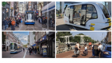
This is the 7th episode of a series 25 building blocks to create better streets, neighbourhoods, and cities. The question is whether motorized traffic must be banned from central parts of the city to improve the quality of the urban environment.
Most cities face a choice when it comes to accessibility of their central parts: Whether they renovate the road infrastructure or they face a growing and lasting conflict between car traffic and visitors, whose numbers will decrease further as a result of prioritizing cars. This post deals with the first option.
Changing priorities in the use of road space
The starting point for this renovation is choosing the best experience for both residents and visitors. Therefore, the use of road space in all parts of cities must be under scrutiny. This also applies the connecting roads between centers and the other parts of the city. The distribution of space between pedestrians, cyclists, cars, and public transport has to be reconsidered. A good example is the Ferdinand Bolstraat in Amsterdam. Cars have been banned, the sidewalks are widened, cyclists have their own lanes and the tram uses a switch track (photo below left), just as in Leidsestraat (photo above left).
Accessibility
The rule of thumb is that the larger a city and the better public transport is functioning, the more the accessibility by car of the central parts and the residential areas as well can be reduced. Visitors who rely on the use of a car then store their vehicle in a parking on the edge of the center, preferably near supermarkets or other places where voluminous purchases can be made. From these parking spaces they enter the central area on foot. Incidentally, it is worth considering opening the entire center to cars until 11 a.m. to pick up orders.
Cyclists can be allowed deeper penetration in the central urban area, but not unlimited. They leave their bicycles in (guarded) parking facilities too.
Public transport never stops more than 300 meters from the middle of the center, where comfortable waiting areas are offered, and information is available.
Separation of traffic flows
A separation of traffic flows is required for the entire urban area. The most central streets will be exclusively intended for pedestrians, emergency services and occasionally the tram. Bicycles are allowed in streets in the center, depending on their wideness.
Public transport has always priority at traffic lights. It ensures not only transfer-free accessibility of the urban center, but also connects the most important residential and work areas with a minimum number of transfer. The possible arrival of autonomous minibuses will radically improve the flexibility of public transport (photo above right).
Intra-urban walking and cycling routes
Pedestrians’ and cyclists’ safety and amenity are improved if the connections between the central and outlying parts of the city are accessible by separate routes too. In a city whose green space penetrates deep into the central area, these routes can partly run through nature. A good example is the cycle route from the center of Utrecht to Leidsche Rijn (photo bottom right). Pedestrians need an attractive route through the built-up area for reasons of social safety.
Follow the link below to find an overview of all articles.
Pelle Menke,
Communications and Programme officer Mobility
at Amsterdam InChange,
posted
Transition Day 2023: Mobility Justice - Power structures and engaging your target group
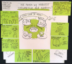
While our mobility system and its options are continuously expanding, there’s a growing number of people who feel excluded from the mobility system and experience a lack of access to services like public transport and shared mobility options. The concept of Mobility Poverty shows there are a variety of reasons for this exclusion, ranging from economic and geographical reasons, to falling behind on digital skills. If we want to move towards ‘Mobility Justice’, we would need a detailed image of the groups experiencing this exclusion and we would need a variety of actors to come up with -and implement- creative solutions to this emerging problem.
For the past months, Chris de Veer and I have been busy setting up a regional coalition and program on this subject. Because it’s becoming clear we’re discussing a problem we, a pool of mobility specialists, are not experiencing ourselves, we decided to critically look at what parties have a seat at the table. During the Amsterdam Smart City Transition Day on June 6th, we gathered input and reflections on the power structures in play and considerations when involving your target group in decision making.
Understanding power relations and structures when working on transitions
When designing solutions and innovative policies, it’s important to understand and be aware of the power structures in play. Our partner Kennisland is concerned with the topic and introduced this discussion within our network during on of our ‘Kennissessies’ earlier this year. Together with this session’s participants, we used their method to evaluate which parties have been involved in the initial phase of our Mobility Justice challenge.
It became clear that it had been mostly governmental parties which were involved in exploring the topic and initiating the design of a cooperation program. While this is of importance for practical matters like funding and political support, the group should have been diversified when we started exploring the problem and its solutions. The (target) group we’re talking about is currently lacking the power to help design both the collaboration process itself and the initiatives that should help fight Mobility Poverty.
Considerations when engaging with your target group
There was a general consensus in the group that we should now make more of an effort to engage with our target group. But how exactly? The group discussed different existing forms of involving a target group in decision making and advised us on matters to consider, namely;
- Decide in what stage(s) of the process collaboration or input is needed. Exploring the problem will require a completely different conversation and method compared to the stage of co-designing solutions.
- Be very clear about what you’ll use the outcomes for. If you decide to gather input from - and collaborate with your target group, you’ll need to actually incorporate the outcomes within your process. This is necessary to maintain the groups trust and validate their efforts.
- Besides defining problems and exploring its solutions, evaluation of the initiatives that follow will be equally important. Special efforts need to be put into place to keep the dialogue going with the target group during and after testing initiatives.
Next steps: Harnessing the power of community centres
When discussing potential next steps for the group, one of the session’s participants reminded us of the power of community centres. She mentioned an example in her own neighbourhood, where a group of neighbours initiated a sharing vehicle for elderly/disabled people. This example illustrated how local communities know best what specific problems or needs are at play, and how to set up solutions in a quick manner.
This conversation inspired us to now look for relevant local initiatives and community centres in the Amsterdam region. With their help, we hope to better understand problems related to Mobility Poverty and what specific solutions people need within their local context.
A call to the community
I’m now wondering if there is anyone in our Amsterdam Smart City community who could link us to local initiatives and community centres in the Amsterdam region? Mobility-related topics are a plus, but this is certainly not necessarily. Any advice or tips to share? Send me an email at pelle@amsterdamsmartcity.com. This summer, we’ll design the continuation of this project.
Pelle Menke,
Communications and Programme officer Mobility
at Amsterdam InChange,
posted
Demoday #19: Mobility as a Commons worksession
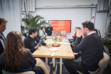
In the coming decades, urban population growth and a rising demand for mobility options will cause strain on our public spaces. The city of Amsterdam will counteract this trend by making private car ownership less attractive for its citizens, while making sure there are enough, well facilitated, alternative modes of transport. One could think of investments in (more) public transport, and the welcoming of shared mobility providers. Currently, some market players are making use of the latter and sharing cars and sharing mopeds are becoming part of the streetscape. Is this enough?
Mobility as a Commons
On the 23th of March, Diederik Basta and Jop Pék from the municipality of Amsterdam’s innovation department, hosted a working session on the concept of; Mobility as a Commons (MaaC). They introduced this concept by pointing out that currently, we’re not ‘sharing’ our modes of transport but we’re just ‘renting’ them from private companies. This raises a couple of concerns; these parties exist purely to maximize profits, they own and sell user data, their fleet of vehicles is not spread evenly throughout the city, and because it’s only available for those who can afford the service, it’s not inclusive for all.
The municipality is now exploring how to move away from these market mechanisms and facilitate car sharing solutions based in local ownership. This summer, they’ll experiment with pilots in which modes of transport are perceived as a ‘Commons’ and cooperatively owned and used by a group of local residents. Their goal is to gather insights on how to facilitate this form of locally organized mobility in the best way possible and pave the way for emerging initiatives.
Paradigm shifts
For this new alternative to succeed, drastic innovation is needed in which public authorities identify and alter their role. That’s why Diederik and Jop are also turning inwards and critically reflecting on the current premises from which they’re acting. Only then, you’ll be able to innovate in a way that you’re breaking free from your current paradigm and its effects. Because they are of such importance, I would like to quickly summarize the three relevant premises:
- People act out of self-interest; we assume mistrust. People need control and governance to reinforce the common good. Its effects: A government mistrusting its citizens and legal sealing of documents and procedures.
- The municipality owns public space. Public space should be designed and managed by experts to ensure quality, consistency and efficiency of functionalities. Its effects: Struggles with public participation and a focus on efficiency and functionality, instead of social interaction.
- The municipality is responsible for a well-functioning mobility system. Public space makes way, and more urban mobility makes people richer and happier. Its effects: Private parties push the mobility system and the government facilitates this, and traveling for work and other (social) activities is the norm.
Reactions from the participants
Next to inspiring the working session participants, Diederik and Job wanted to ignite an active conversation with the diverse group in front of them. They wanted to show the parties at the table how important it is to realise from what kind of premises and paradigm you’re currently ‘innovating’, but they were also curious what others thought of their upcoming project.
A big theme during the discussion was the fact that this ‘commons’ thinking is finding its way within different themes like the energy- and data transition. Energy cooperatives are emerging at a fast rate and this topic is receiving a lot of research and attention from energy companies at the moment. The same goes for cooperative ownership and use of data, as an alternative to protection and the commercial use of data. The different domains should be actively learning from each other, as learnings should be easily transferable. Furthermore, the group discussed the painful dilemma of the innovation department of the municipality. Their critical stance against their own policies is remarkable, but they need to find a balance where the pilot and its results will be refreshing and creative, as well as applicable in current policies as soon as possible. Finally, the group advised the presenters to; pay special attention to groups of citizens who have less time and resources available to organize themselves, write down in detail all administrative rules and obstructions that counteract these initiatives, and to not forget the power of private parties altogether; with a clear problem definition, they are able to organise and act at a fast rate.
What’s next?
In the coming months, the project’s final preparations and consideration will be implemented. Through the Horizon 2020 (GEMINI) project, The municipality of Amsterdam will cooperate with parties like Townmaking, Smart Innovation Norway, and our partner Cenex Nederland. Together they will guide and research local initiatives within Amsterdam (e.g. de Pijp, Tuindorp Oostzaan, Spaarndammerbuurt), activate a so called ‘Experimenteerregeling’ and create a plug and play system for future local initiatives. Diederik and Jop will incorporate the comments and discussions from this working session, and we’ll make sure to have them share their first learnings with the Amsterdam Smart City network later in 2023.
Do you want to know more about this topic, or would you like to get in contact with Diederik Basta or Jop Pék? You can contact me via pelle@amsterdamsmartcity.com, and I’ll connect you!
Stay up to date
Get notified about new updates, opportunities or events that match your interests.
Set up preferences

